PRINCIPLES
OF
GEOLOGY:
BEING
AN INQUIRY HOW FAR THE FORMER CHANGES OF
THE EARTH'S SURFACE
ARE REFERABLE TO CAUSES NOW IN OPERATION.
BY
CHARLES LYELL, ESQ. F.R.S.
PRESIDENT OF THE GEOLOGICAL SOCIETY OF LONDON.
"The inhabitants of the globe, like all the other parts of it, are subject to
change. It is not only the individual that perishes, but whole species."
"A change in the animal kingdom seems to be a part of the order of nature,
and is visible in instances to which human power cannot have extended."
PLAYFAIR, Illustrations of the Huttonian Theory, § 413.
IN FOUR VOLUMES.
VOL. II.
THE FOURTH EDITION
LONDON:
JOHN MURRAY, ALBEMARLE STREET.
1835.
PRINCIPLES OF GEOLOGY.
BOOK II.
AQUEOUS CAUSES—continued.
CHAPTER VI.
DESTROYING AND TRANSPORTING EFFECTS OF TIDES AND CURRENTS.
Differences in the rise of the tides—Rennell's Account of the Lagullas and Gulf currents—Velocity of currents—Causes of currents—Action of the sea on the British coast (p. 12.)—Shetland Islands—Large blocks removed—Effects of lightning—Isles reduced to clusters of rocks—Orkney Isles—East coast of Scotland (p. 19.)—East coast of England—Waste of the cliffs of Holderness, Norfolk, and Suffolk—Silting up of estuaries (p. 27.)—Origin of submarine forests—Yarmouth estuary—Suffolk coast—Dunwich (p. 31.)—Essex coast—Estuary of the Thames—Goodwin Sands—Coast of Kent—Formation of Straits of Dover (p. 39.)—South coast of England—Sussex—Hants—Dorset—Portland—Origin of the Chesil Bank (p. 47.)—Cornwall—Coast of Brittany.
ALTHOUGH the movements of great bodies of water, termed tides and currents, are in general due to very distinct causes, their effects cannot be studied separately; for they produce, by their joint action, those
VOL. II. B
changes which are objects of geological interest. These forces may be viewed in the same manner as we before considered rivers, first, as employed in destroying portions of the solid crust of the earth, and removing them to other places; secondly, as reproductive of new strata.
Tides.—It would be superfluous at the present day to offer any remarks on the cause of the tides. They are not perceptible in lakes, or in most inland seas; in the Mediterranean even, deep and extensive as is that sea, they are scarcely sensible to ordinary observation, their effects being quite subordinate to those of the winds and currents. In some places however, as in the Straits of Messina, there is an ebb and flow to the amount of two feet and upwards; at Naples and at the Euripus, of twelve or thirteen inches; and at Venice, according to Rennell, of five feet.* In the Syrtes, also, of the ancients, two wide shallow gulfs which penetrate very far within the northern coast of Africa, between Carthage and Cyrene, the rise is said to exceed five feet.†
In islands remote from any continent, the ebb and flow of the ocean is very slight, as at St. Helena, for example, where it is rarely above three feet.‡ In any given line of coast, the tides are greatest in narrow channels, bays, and estuaries, and least in the intervening tracts where the land is prominent. Thus, at the entrance of the estuary of the Thames and Medway, the rise of the spring-tides is eighteen feet; but when we follow our eastern coast from thence northward,
* Geography of Herodotus, vol. ii. p. 331.
† Ibid. p. 328.
‡ Romme, Vents et Courans, vol. ii. p. 2. Rev. F. Fallows, Quart. Journ. of Science, March, 1829.
towards Lowestoff and Yarmouth, we find a gradual diminution, until, at the places last mentioned, the highest rise is only seven or eight feet. From this point there begins again to be an increase, so that at Cromer, where the coast again retires towards the west, the rise is sixteen feet; and towards the extremity of the gulf called "the Wash," as at Lynn and in Boston deeps, it is from twenty-two to twenty-four feet, and in some extraordinary cases twenty-six feet. From thence again there is a decrease towards the north, the elevation at the Spurn Point being from nineteen to twenty feet, and at Flamborough Head and the Yorkshire coast from fourteen to sixteen feet.*
At Milford Haven in Pembrokeshire, at the mouth of the Bristol Channel, the tides rise thirty-six feet; and at King-Road near Bristol, forty-two feet. At Chepstow on the Wye, a small river which opens into the estuary of the Severn, they reach fifty feet, and sometimes sixty-nine, and even seventy-two feet.† A current which sets in on the French coast, to the west of Cape La Hague, becomes pent up by Guernsey, Jersey, and other islands, till the rise of the tide is from twenty to forty-five feet, which last height it attains at Jersey, and at St. Malo, a seaport of Brittany.
Currents.—The most extensive and best determined system of currents, is that which has its source in the Indian Ocean, under the influence of the trade winds; and which, after doubling the Cape of Good Hope, inclines to the northward, along the western coast of Africa, then crosses the Atlantic, near the equator, and is lost in the Caribbean Sea, yet seems to be again
* The heights of these tides are given on the authority Captain Hewett, R.N.
† On the authority of Captain Beaufort, R.N.
B 2
revived in the current which issues from the gulf of Mexico, by the straits of Bahama, and flows rapidly in a north-easterly direction by the bank of Newfoundland, towards the Azores.
We learn from the posthumous work of Rennell on this subject, that the Lagullas current, so called from the cape and bank of that name, is formed by the junction of two streams, flowing from the Indian Ocean; the one from the channel of Mozambique, down the south-east coast of Africa; the other, from the ocean at large. The collective stream is from ninety to one hundred miles in breadth, and runs at the rate of from two and a half to more than four miles per hour. It is at length turned westward by the Lagullas bank, which rises from a sea of great, depth to within one hundred fathoms of the surface. It must, therefore, be inferred, says Rennell, that the current here is more than one hundred fathoms deep, otherwise the main body of it would pass across the bank, instead of being deflected eastward, so as to flow round the Cape of Good Hope. From this cape it flows northward, along the western coast of Africa, taking the name of the South Atlantic current. It then enters the Bight, or Bay of Benin, and is turned westward, partly by the form of the coast there, and partly, perhaps, by the Guinea current, which runs from the north into the same great bay. From the centre of this bay proceeds the Equatorial current, holding a westerly direction across the Atlantic, which it traverses, from the coast of Guinea to that of Brazil, flowing afterwards by the shores of Guiana to the West Indies. The breadth of this current varies from 160 to 450 geographical miles, and its velocity is from twenty-five to seventy-nine
miles per day, the mean rate being about thirty miles. The length of its whole course is about 4000 miles. As it skirts the coast of Guinea, it is increased by the influx of the waters of the Amazon and Orinoco, and by their junction acquires accelerated velocity. After passing the island of Trinidad, it expands, and is almost lost in the Caribbean Sea; but there appears to be a general movement of that sea towards the Mexican gulf, which discharges the most powerful of all currents through the straits of Florida, where the waters run in the northern part with a velocity of five miles an hour, having a breadth of from thirty-five to fifty miles.
The temperature of the gulf of Mexico is 86°, in summer, or 6° higher than that of the ocean, in the same parallel (25° N. lat.), and a large proportion of this warmth is retained, even where the stream reaches the 43° N. lat. After issuing from the straits of Florida, the current runs in a northerly direction to Cape Hatteras, in North Carolina, about 35° N. lat., where it is more than seventy miles broad, and still moves at the rate of seventy-five miles per day. In about the 40° N. lat., it is turned more towards the Atlantic by the extensive banks of Nantucket, and St. George, which are from 200 to 300 feet beneath the surface of the sea; a clear proof that the current exceeds that depth. On arriving near the Azores, the stream widens, and overflows, as it were, forming a large expanse of warm water in the centre of the North Atlantic, over a space of 200 or 300 miles from north to south, and having a temperature of from 8° to 10° Fahr. above the surrounding ocean. The whole area, covered by the gulf water, is estimated by Rennell at 2000 miles in length, and, at a mean, 350 miles in breadth; an area
B 3
more extensive than that of the Mediterranean. The warm water has been sometimes known to reach the Bay of Biscay, still retaining five degrees of temperature above that of the adjoining ocean, and a branch of the gulf current occasionally drifts fruits, plants, and wood, the produce of America, and the West Indies, to the shores of Ireland, and the Hebrides.
The above statements prepare us to understand the description, given by Rennell, of the principal currents, which, he says, are oceanic rivers, from fifty to 250 miles in breadth, having a rapidity exceeding that of the largest navigable rivers of the continents, and so deep as to be sometimes obstructed, and occasionally turned aside, by banks which do not rise within forty or fifty fathoms of the surface of the sea.*
Greatest Velocity of Currents.—The ordinary velocity of the principal currents of the ocean is from one to three miles per hour; but when the boundary lands converge, large bodies of water are driven gradually into a narrower space, and then wanting lateral room are compelled to raise their level. Whenever this occurs, their velocity is much increased. The current which runs through the Race of Alderney, between the island of that name and the main land, has a velocity of above eight English miles an hour. Captain Hewett found that, in the Pentland Firth the stream, in ordinary spring tides, runs ten miles and a half an hour, and about thirteen miles during violent storms. The greatest velocity of the tidal current through the "Shoots," or New Passage, in the Bristol Channel, is fourteen English miles an hour; and Captain King observed, in his recent survey of the Straits of Magellan, that the tide ran at the same rate through the "First Narrows."
* Rennell on Currents, p. 58.
causes of Currents.—That movements of no inconsiderable magnitude should be impressed on an expansive ocean, by winds blowing for many months in one direction, may easily be conceived, when we observe the effects produced in our own seas by the temporary action of the same cause. It is well known that a strong south-west or north-west wind invariably raises the tides to an unusual height along the east coast of England and in the Channel; and that a north-west wind of any continuance causes the Baltic to rise two feet and upwards above its ordinary level. Smeaton ascertained by experiment that, in a canal four miles in length, the water was kept up four inches higher at one end than at the other, merely by the action of the wind along the canal; and Rennell informs us that a large piece of water, ten miles broad, and generally only three feet deep, has, by a strong wind, had its waters driven to one side, and sustained so as to become six feet deep, while the windward side was laid dry.*
As water, therefore, he observes, when pent up so that it cannot escape, acquires a higher level, so, in a place where it can escape, the same operation produces a current; and this current will extend to a greater or less distance, according to the force by which it is produced.
Currents flowing alternately in opposite directions are also occasioned by the rise and fall of the tides. The effect of this cause is, as before observed, most striking in estuaries and channels between islands.
A third cause of oceanic currents is evaporation by solar heat, of which the great current setting through the Straits of Gibraltar into the Mediter-
* Rennell on the Channel-current.
B 4
ranean is a remarkable example, and will be fully considered in the next chapter. A stream of colder water also flows from the Black Sea into the Mediterranean. It must happen in many other parts of the world that large quantities of water raised from one tract of the ocean by solar heat, are carried to some other where the vapour is condensed and falls in the shape of rain, and this in flowing back again to restore equilibrium, will cause sensible currents.
But there is another way in which heat and cold must occasion currents in the ocean. It is now ascertained that there is no maximum of density in salt water—no point, as in fresh water, at which an increase of cold causes the fluid to begin again to expand. Whenever, therefore, the temperature of the surface is lowered, condensation takes place, and the superficial water, having its specific gravity increased, falls to the bottom, upon which lighter water rises immediately and occupies its place. When this circulation of ascending and descending currents has gone on for a certain time in high latitudes, the inferior parts of the sea are made to consist of colder or heavier fluid than the corresponding depths of the ocean between the tropics. If there be a free communication, if no chain of submarine mountains divide the polar from the equatorial basins, a horizontal movement will arise by the flowing of colder water from the poles to the equator, and there will then be a reflux of warmer superficial water from the equator to the poles. A well-known experiment has been adduced to elucidate this mode of action in explanation of the "trade winds."* If a long
* See Capt. B. Hall's clear Explanation of the Theory of the Trade Winds, Fragments of Voyages, second series, vol. i. and his letter in the Appendix to Daniell's Meteorology.
trough, divided in the middle by a sluice or partition, have one end filled with water and the other with quicksilver, both fluids will remain quiet so long as they are divided; but when the sluice is drawn up, the heavier fluid will rush along the bottom of the trough, while the lighter, being displaced, will rise; and, flowing in an opposite direction, spread itself at the top. Hence it appears, that the expansion and contraction of sea-water by heat and cold have a tendency to set under-currents in motion from the poles to the equator, and to cause counter-currents at the surface which are impelled in a direction contrary to that of the prevailing trade winds. The circumstances being very complicated, we cannot expect to trace separately the movements due to each cause, but must be prepared for many anomalies, especially as the configuration of the bed of the ocean must often modify and interfere with the course of the inferior currents, as much as the position and form of continents and islands are found to alter the direction of those on the surface.
Each of the four causes above mentioned, the wind, the tides, evaporation, and expansion of water by heat, may be conceived to operate independently of the others, and although the influence of all the rest were annihilated. But there is another cause, the rotation of the earth on its axis, which can only come into play when the waters have already been set in motion by some one or all of the forces above described, and only when the direction of the current so raised happens to be from south to north, or from north to south.*
* In an interesting essay in the United Service Journal (Dec. 1833), an attempt is made to introduce the earth's rotation as a primary cause of currents. But the author appears to misconceive the mode in which alone this rotation could produce any effect, and reasons as if it would in all latitudes cause currents from east to west. He also seems never to have heard of Mr. Lloyd's level-lings across the Isthmus of Panama, by which the waters of the Gulf of Mexico are proved (if there be any difference) to be lower than the mean level of the Pacific, and he also assumes that the quantity of rain is greatly in excess in high instead of low latitudes.
B 5
The principle on which this cause operates is probably familiar to the reader, as it has long been recognized in the case of the trade winds. Without enlarging, therefore, on the theory, it will be sufficient to offer an example of the mode of action alluded to. When a current flows from the Cape of Good Hope towards the Gulf of Guinea, it consists of a mass of water, which, on doubling the Cape, in lat. 35°, has a rotatory velocity of about 800 miles an hour; but when it reaches the line, it arrives at a parallel where the surface of the earth is whirled round at the rate of 1000 miles an hour, or about 200 miles faster.* If this great mass of water was transferred suddenly from the higher to the lower latitude, the deficiency of its rotatory motion, relatively to the land and water with which it would come into juxtaposition would be such as to cause an apparent motion of the most rapid kind (of no less than 200 miles an hour) from east to west.
In the case of such a sudden transfer the eastern coast of America might be carried round so as to strike against a large body of water with tremendous violence, and a considerable part of the continent might be submerged. This disturbance does not occur, because the water of the stream, as it advances gra-
* See a table in Capt. Hall's work before cited.
dually into new zones of the sea which are moving more rapidly, acquires by friction an accelerated velocity. Yet as this motion is not imparted instantaneously, the fluid is unable to keep up with the full speed of the new surface over which it is successively brought. Hence, to borrow the language of Herschel, when he speaks of the trade winds, "it lags or hangs back, in a direction opposite to the earth's rotation, that is, from east to west*," and thus a current which would have run simply towards the north but for the rotation, may acquire a relative direction towards the west, or become a south-easterly current.
We may next consider a case where the circumstances are the converse of the above. The Gulf stream flowing from about lat. 20°, is at first impressed with a velocity of rotation of about 940 miles an hour, and runs to the lat. 40°, where the earth revolves only at the rate of 766 miles, or 174 miles slower. In this case a relative motion of an opposite kind may result; and the current may retain an excess of rotatory Velocity, tending continually to deflect it eastward.
Thus it will be seen that currents depend like the tides on no. temporary or accidental circumstances, but on the laws which preside over the motions of the heavenly bodies. But although the sum of their influence in altering the surface of the earth may be very constant throughout successive epochs, yet the points where these operations are displayed in fullest energy shift perpetually. The height to which the tides rise, and the violence and velocity of currents, depend in a great measure on the actual configuration of the land, the contour of a long line of continental or
* Treatise on Astronomy, chap. 3.
B 6
insular coast, the depth and breadth of channels, the peculiar form of the bottom of seas—in a word, on a combination of circumstances which are made to vary continually by many igneous and aqueous causes, and, among the rest, by the tides and currents themselves. Although these agents, therefore, of decay and reproduction are local in reference to periods of, short duration, such as those which history embraces, they are nevertheless universal, if we extend our views to a sufficient lapse of ages.
Action of the Sea on the British Coasts.—If we follow the eastern and southern shores of the British islands, from our Ultima Thule in Shetland to the Land's End in Cornwall, we shall find evidence of a series of changes since the historical era, very illustrative of the kind and degree of force exerted by tides and currents, co-operating with the waves of the sea. In this survey we shall have an opportunity of tracing their joint power on islands, promontories, bays, and estuaries; on bold, lofty cliffs, as well as on low shores; and on every description of rock and soil, from granite to blown sand.
Shetland Islands.—The northernmost group of the British islands, the Shetland, are composed of a great variety of rocks, including granite, gneiss, mica-slate, serpentine, greenstone, and many others, with some secondary rocks, chiefly sandstone and conglomerate. These islands are exposed continually to the uncontrolled violence of the Atlantic, for no land intervenes between their western shores and America. The prevalence, therefore, of strong westerly gales causes the waves to be sometimes driven with irresistible force upon the coast, while there is also a current setting from the north. The spray of the sea aids the decom-
position of the rocks, and prepares them to be breached by the mechanical force of the waves. Steep cliffs are hollowed out into deep caves and lofty arches; and almost every promontory ends in a cluster of rocks, imitating the forms of columns, pinnacles, and obelisks.
Drifting of large Masses of Rock.—Modern observations show that the reduction of continuous tracts to such insular masses is a process in which Nature is still actively engaged. "The Isle of Stenness," says Dr. Hibbert, "presents a scene of unequalled desolation. In stormy winters, huge blocks of stones are overturned or are removed from their native beds, and hurried up a slight acclivity to a distance almost incredible. In the winter of 1802, a tabular-shaped mass, eight feet two inches by seven feet, and five feet one inch thick, was dislodged from its bed, and removed to a distance of from eighty to ninety feet. I measured the recent bed from which a block had been carried away the preceding winter (A. D. 1818), and found it to be seventeen feet and a half by seven feet, and the depth two feet eight inches. The removed mass had been borne to a distance of thirty feet, when it was shivered into thirteen or more lesser fragments, some of which were carried still farther, from 30 to 120 feet. A block, nine feet two inches by six feet and a half, and four feet thick, was hurried up the acclivity to a distance of 150 feet."*
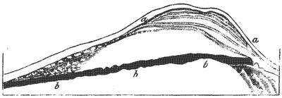
At Northmavine, also, angular blocks of stone have been removed in a similar manner to considerable distances by the waves of the sea, some of which are represented in the annexed figure.†
* Descrip. of Shetland Islands, p. 527. Edin. 1822.
† For this and the three following representations of rocks in the Shetland Isles, I am indebted to Dr. Hibbert's work before cited, which is rich in antiquarian and geological research.
Fig. 11.
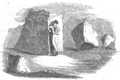
Stony fragments drifted by the sea. Northmavine, Shetland.
Effects of Lightning.—In addition to numerous examples of masses detached and driven by the waves, tides, and currents from their place, some remarkable effects of lightning are recorded in these isles. At Funzie, in Fetlar, about the middle of the last century, a rock of mica-schist, 105 feet long, ten feet broad, and in some places four feet thick, was in an instant torn by a flash of lightning from its bed, and broken into three large, and several smaller, fragments. One of these, twenty-six feet long, ten feet broad, and four feet thick, was simply turned over. The second, which was twenty-eight feet long, seventeen broad, and five feet in thickness, was hurled across a high point to the distance of fifty yards. Another broken mass, about forty feet long, was thrown still farther, but in the same direction, quite into the sea. There were also many smaller fragments scattered up and down.*
When we thus see electricity co-operating with the
* Dr. Hibbert, from MSS. of Rev. George Low, of Fetlar.
violent movements of the ocean in heaping up piles of shattered rocks on dry land, and beneath the waters, we cannot but admit that a region which shall be the theatre, for myriads of ages, of the action of such disturbing causes, might present, at some future period, if upraised far above the bosom of the deep, a scene of havoc and ruin that may compare with any now found by the geologist on the surface of our continents.
In some of the Shetland Isles, as on the west of Meikle Roe, dikes, or veins of soft granite, have mouldered away; while the matrix in which they were inclosed, being of the same substance, but of a firmer texture, has remained unaltered. Thus, long narrow ravines, sometimes twenty-feet wide, are laid open, and often give access to the waves. After describing some huge cavernous apertures into which the sea flows for 250 feet in Roeness, Dr. Hibbert enumerates other ravages of the ocean. "A mass of rock, the average dimensions of which may perhaps be rated at twelve or thirteen feet square, and four and a half or five in thickness, was first moved from its bed, about fifty years ago, to a distance of thirty feet, and has since been twice turned over."
Passage forced by the sea through porphyritic rocks.—"But the most sublime scene is where a mural pile of porphyry, escaping the process of disintegration that is devastating the coast, appears to have been left as a sort of rampart against the inroads of the ocean;—the Atlantic, when provoked by wintry gales, batters against it with all the force of real artillery—the waves having, in their repeated assaults, forced themselves an entrance. This breach, named the Grind of the Navir (Fig. 12.), is widened every winter by the overwhelming surge that, finding a passage through it,
Fig. 12.
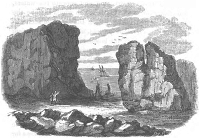
Grind of the Navir-Passage forced by the sea through rocks of hard porphyry.
separates large stones from its sides, and forces them to a distance of no less than 180 feet. In two or three spots, the fragments which have been detached are brought together in immense heaps, that appear as an accumulation of cubical masses, the product of some quarry."*
It is evident, from this example, that although the greater indestructibility of some rocks may enable them to withstand, for a longer time, the action of the elements, yet they cannot permanently resist. There are localities in Shetland, in which rocks of almost every variety of mineral composition are suffering disintegration; thus the sea makes great inroads on the clay slate of Fitfel Head, on the serpentine of the
* Hibbert, p. 528.
Vord Hill in Fetlar, and on the mica-schist of the Bay of Triesta, on the east coast of the same island, which decomposes into angular blocks. The quartz rock on the east of Walls, and the gneiss and mica-schist of Garthness, suffer the same fate.
Destruction of Islands.—Such devastation cannot be incessantly committed for thousands of years without dividing islands, until they become at last mere clusters of rocks, the last shreds of masses once continuous. To this state many appear to have been reduced, and innumerable fantastic forms are assumed by rocks adjoining these islands, to which the name of Drongs is applied, as it is to those of similar shape in Feroe.
The granitic rocks (Fig. 13.) between Papa Stour and Hillswick Ness afford an example. A still more singular cluster of rocks is seen to the south of Hillswick Ness (Fig. 14.), which presents a variety of forms as viewed from different points, and has often been
Fig. 13.
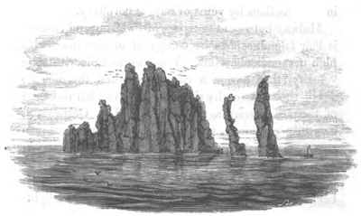
Granitic rocks named the Drongs, between Papa Stour and Hillswick Ness.
likened to a small fleet of vessels with spread sails.* We may imagine that in the course of time Hillswick
Fig. 14.
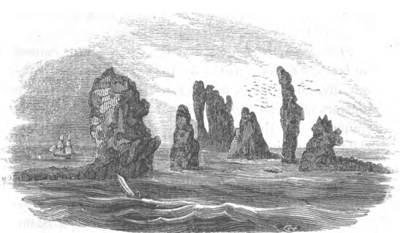
Granitic rocks to the south of Hillswick Ness, Shetland.
Ness itself may present a similar wreck, from the unequal decomposition of the rocks whereof it is composed, consisting of gneiss and mica-schist, traversed in all directions by veins of felspar porphyry.
Midway between the groups of Shetland and Orkney is Fair Island, said to be composed of sandstone with high perpendicular cliffs. The current runs with such velocity, that during a calm, and when there is no swell, the rocks on its shores are white with the foam of the sea driven against them. The Orkneys, if carefully examined, would probably illustrate our present topic as much as the Shetland group. The northeast promontory of Sanda, one of these islands, has been cut off in modern times by the sea, so that it became what is now called Start Island, where a light-
* Hibbert, p. 519.
house was erected in 1807, since, which time the new strait has grown broader.
East coast of Scotland.—To pass over to the main land of Scotland, we find that, in Inverness-shire, there have been inroads of the sea at Fort George, and others in Murrayshire, which have swept away the old town of Findhorn. On the coast of Kincardineshire, an illustration was afforded, at the close of the last century, of the effect of promontories in protecting a line of low-shore. The village of Mathers, two miles south of Johnshaven, was built on an ancient shingle beach, protected by a projecting ledge of limestone rock. This was quarried for lime to such an extent, that the sea broke through, and in 1795 carried away the whole village in one night, and penetrated 150 yards inland, where it has maintained its ground ever since, the new village having been built farther inland on the new shore. In the Bay of Montrose, we find the North Esk and the South Esk rivers pouring annually into the sea large quantities of sand and pebbles, yet they have formed no deltas; for the tides scour out the channels; and the current, setting across their mouths, sweeps away all the materials. Considerable beds of shingle, brought down by the North Esk, are seen along the beach.
Proceeding southwards, we find that at Arbroath, in Forfarshire, which stands on a rock of red sandstone, gardens and houses have been carried away within the last thirty years by encroachments of the sea. It has become necessary to remove the lighthouses at the mouth of the estuary of the Tay, in the same county, at Button Ness, which were built on a tract of blown sand, the sea having encroached for three quarters of a mile.
Force of Waves and Currents in Estuaries.—The combined power which waves and currents can exert in estuaries to considerable depths, was remarkably exhibited during the building of the Bell Rock Lighthouse, off the mouth of the Tay. The Bell Rock is a sunken reef, consisting of red sandstone, being from twelve to sixteen feet under the surface at high water, and about twelve miles from the mainland. At the distance of 100 yards, there is a depth, in all directions, of two or three fathoms at low water. In 1807, during the erection of the lighthouse, six large blocks of granite, which had been landed on the reef, were removed by the force of the sea, and thrown over a rising ledge to the distance of twelve or fifteen paces; and an anchor, weighing about 22 cwt., was thrown up upon the rock.* Mr. Stevenson informs us, moreover, that drift stones, measuring upwards of thirty cubic feet, or more than two tons weight, have, during storms, been often thrown upon the rock from the deep water.†
Submarine forests.—Among the proofs that the sea has encroached both on the estuaries of the Tay and Forth, may be mentioned the submarine forests which have been traced for several miles by Dr. Fleming, along the margins of those estuaries on the north and south shores of the county of Fife.‡ The alluvial tracts, however, on which such forests grow, generally occupy spaces which may be said to be in dispute between the river and the sea, and to be alternately lost and won. Estuaries (a term which we confine to inlets entered both by rivers and tides of the sea)
* Account of the Erection of the Bell Rock Lighthouse, p. 163.
† Ed. Phil. Journ., vol. iii. p. 54. 1820.
‡ Quarterly Journal of Science, &c., No. XIII. New Series, March, 1830.
have a tendency to become silted up in parts; but the same tracts, after remaining dry, perhaps, for thousands of years, are again liable to be overflowed, for they are always low, and, if inhabited, must generally be secured by artificial embankments. Meanwhile the sea devours, as it advances, the high as well as the low parts of the coast, breaking down, one after another, the rocky bulwarks which protect the mouths of estuaries. The changes of territory, therefore, within the general line of coast are all of a subordinate nature, in no way tending to arrest the march of the great ocean, nor to avert the destiny eventually awaiting the whole region: they are like. the petty wars and conquests of the independent states and republics of Greece, while the power of Macedon was steadily pressing on, and preparing to swallow up the whole.
On the coast of Fife, at St Andrew's, a tract of land which intervened between the castle of Cardinal Beaton and the sea, has been entirely swept away, as were the last remains of the Priory of Crail, in the same county, in 1803. On both sides of the Frith of Forth, land has been consumed; at North Berwick in particular, and at Newhaven, where an arsenal and dock, built in the reign of James IV., in the fifteenth century, has been overflowed.
East coast of England.—If we now proceed to the English coast, we find records of numerous lands having been destroyed in Northumberland, as those near Bamborough and Holy Island, and at Tynemouth castle, which now overhangs the sea, although formerly separated from it by a strip of land. At Hartlepool, and several other parts of the coast of Durham com-
posed of magnesian limestone, the sea has made considerable inroads.
Coast of Yorkshire.—Almost the whole coast of Yorkshire, from the mouth of the Tees to that of the Humber, is in a state of gradual dilapidation. That part of the cliffs which consists of lias, the oolite series, and chalk, decays slowly. They present abrupt and naked precipices, often 300 feet in height; and it is only at a few points that the grassy covering of the sloping talus marks a temporary relaxation of the erosive action of the sea. The chalk cliffs are washed into caves in the projecting headland of Flamborough, where they are decomposed by the salt vapours, and slowly crumble away. But the waste is most rapid between that promontory and Spurn Point, or the coast of Holderness, as it is called, a tract consisting of beds of clay, gravel, sand, and chalk rubble. The irregular intermixture of the argillaceous beds causes many springs to be thrown out, and this facilitates the undermining process, the waves beating against them, and a strong current setting chiefly from the north. The wasteful action is very conspicuous at Dimlington Height, the loftiest point in Holderness, where the beacon stands on a cliff 146 feet above high water, the whole being composed of clay, with pebbles scattered through it.*
In the old maps of Yorkshire, we find spots, now sand-banks in the sea, marked as the ancient sites of the towns and villages of Auburn, Hartburn, and Hyde. "Of Hyde," says Pennant, "only the tradition is left; and near the village of Hornsea, a street
* Phillips's Geology of Yorkshire, p. 61.
called Hornsea Beck has long since been swallowed."* Owthorne and its church have also been in great part destroyed, and the village of Kilnsea; but these places are now removed farther inland. The rate of encroachment at Owthorne, at present is about four yards a year.† Not unreasonable fears are entertained that at some future time the Spurn Point will become an island, and that the ocean, entering into the estuary of the Humber, will cause great devastation.‡ Pennant, after speaking of the silting up of some ancient ports in that estuary, observes, "But, in return, the sea has made most ample reprisals; the site, and even the very names of several places, once towns of note upon the Humber, are now only recorded in history; and Ravensper was at one time a rival to Hull (Madox, Ant. Exch. i., 422.), and a port so very considerable in 1332, that Edward Baliol and the confederated English Barons sailed from hence to invade Scotland; and Henry IV., in 1399, made choice of this port to land at, to effect the deposal of Richard II.; yet the whole of this has long since been devoured by the merciless ocean: extensive sands, dry at low water, are to be seen in their stead."§
Pennant describes Spurn Head as a promontory in the form of a sickle, and says the land, for some miles to the north, was "perpetually preyed on by the fury of the German Sea, which devours whole acres at a time, and exposes on the shores considerable quantities of beautiful amber."║
* Arctic Zoology, vol. i. p. 10. Introduction.
† For this information I am indebted to Mr. Phillips, of York.
‡ Phillips's Geology of Yorkshire, p. 60.
§ Arct. Zool. vol. i. p. 13. Introduction.
║ Ibid.
According to Bergmann, a strip of land, with several villages, was carried away near the mouth of the Humber in 1475.
Lincolnshire.—The maritime district of Lincolnshire consists chiefly of lands that lie below the level of the sea, being protected by embankments. Great parts of this fenny tract were, at some unknown period, a woody country, but were afterwards inundated, and are now again recovered from the sea. Some of the fens were embanked and drained by the Romans; but after their departure the sea returned, and large tracts were covered with beds of silt containing marine shells, now again converted into productive lands. Many dreadful catastrophes are recorded by incursions of the sea, whereby several parishes have been at different times overwhelmed.
Norfolk.—We come next to the cliffs of Norfolk and Suffolk, where the decay is in general incessant and rapid. At Hunstanton, on the north, the undermining of the lower arenaceous beds at the foot of the cliff causes masses of red and white chalk to be precipitated from above. Between Hunstanton and Weybourne, low hills, or dunes, of blown sand, are formed along the shore, from fifty to sixty feet high. They are composed of dry sand, bound in a compact mass by the long creeping roots of the plant called Marram (Arundo arenaria). Such is the present set of the tides, that the harbours of Clay, Wells, and other places, are securely defended by these barriers; affording a clear proof that it is not the strength of the material at particular points that determines whether the sea shall be progressive or stationary, but the general contour of the coast.
The waves constantly undermine the low chalk
cliffs, covered with sand and clay, between Weybourne and Sherringham, a certain portion of them being annually removed. At the latter town I ascertained, in 1829, some facts which throw light on the rate at which the sea gains upon the land. It was computed, when the present inn was built, in 1805, that it would require seventy years for the sea to reach the spot: the mean loss of land being calculated, from previous observations, to be somewhat less than one yard annually. The distance between the house and the sea was fifty yards; but no allowance was made for the slope of the ground being from the sea, in consequence of which, the waste was naturally accelerated every year, as the cliff grew lower, there being at each succeeding period less matter to remove when portions of equal area fell down. Between the years 1824 and 1829, no less than seventeen yards were swept away, and only a small garden was then left between the building and the sea. There is now a depth of twenty feet (sufficient to float a frigate) at one point in the harbour of that port, where, only forty-eight years ago, there stood a cliff fifty feet high, with houses upon it! If once in half a century an equal amount of change were produced suddenly by the momentary shock of an earthquake, history would be filled with records of such wonderful revolutions of the earth's surface; but, if the conversion of high land into deep sea be gradual, it excites only local attention. The flag-staff of the Preventive Service station, on the south side of this harbour, has, within the last fifteen years, been thrice removed inland, in consequence of the advance of the sea.
Farther to the south we find cliffs, composed, like those of Holderness before mentioned, of alternating
VOL. II. C
strata of blue clay, gravel, loam, and fine sand. Although they sometimes exceed 200 feet in height, the havoc made on the coast is most formidable. The whole site of ancient Cromer now forms part of the German Ocean, the inhabitants having gradually retreated inland to their present situation, from whence the sea still threatens to dislodge them. In the winter of 1825, a fallen mass was precipitated from near the lighthouse, which covered twelve acres, extending far into the sea, the cliffs being 250 feet in height.* The undermining by springs has sometimes caused large portions of the upper part of the cliffs, with houses still standing upon them, to give way, so that it is impossible, by erecting breakwaters at the base of the cliffs, permanently to ward off the danger.
On the same coast, the ancient villages of Shipden, Wimpwell, and Eccles, have disappeared; several manors and large portions of neighbouring parishes having, piece after piece, been swallowed up; nor has there been any intermission, from time immemorial in the ravages of the sea along a line of coast twenty miles in length, in which these places stood.† Hills of blown sand, between Eccles and Winterton, have barred up and excluded the tide for many hundred years from the mouths of several small estuaries; but there are records of nine breaches from 20 to 120 yards wide, having been made through these, by which immense damage was done to the low grounds in the interior. A few miles south of Happisburgh, also, are hills of blown sand, which extend to Yarmouth; and these are supposed to protect the coast, but in fact their formation proves that a temporary respite of the
* Taylor's Geology of East Norfolk, p. 32.
† Ibid.
incursions of the sea on this part is permitted by the present set of the tides and currents. Were it otherwise, the land, as we have seen, would give way, though made of solid rock.
Silting up of Estuaries.—At Yarmouth, the sea has not advanced upon the sands in the slightest degree since the reign of Elizabeth. In the time of the Saxons, a great estuary extended as far as Norwich, which city is represented, even in the thirteenth and fourteenth centuries, as "situated on the banks of an arm of the sea." The sands whereon Yarmouth is built first became firm and habitable ground about the year 1008, from which time a line of dunes has gradually increased in height and breadth, stretching across the whole entrance of the ancient estuary, and obstructing the ingress of the tides so completely, that they are only admitted by the narrow passage which the river keeps open, and which has gradually shifted several miles to the south. The ordinary tides at the river's mouth rise, at present, only to the height of three or four feet, the spring tides to about eight or nine.
By the exclusion of the sea, thousands of acres in the interior have become cultivated lands; and, exclusive of smaller pools, upwards of sixty fresh-water lakes have been formed, varying in depth from fifteen to thirty feet, and in extent from one acre to twelve hundred*. The Yare, and other rivers, frequently communicate with these sheets of water; and thus they are liable to be filled up gradually with lacustrine and fluviatile deposits, and to be converted into land covered with forests. When the sea at length returns (for as the whole coast gives way, this must inevitably happen sooner or later), these tracts will be again sub-
* Taylor's Geology of East Norfolk, p. 10.
C 2
merged, and submarine forests may then be found, as along the margins of many estuaries.*
Yarmouth does not project beyond the general line of coast which has been rounded off by the predominating current from the north-west. It must not be imagined, therefore, that the acquisition of new land fit for cultivation in Norfolk and Suffolk indicates any permanent growth of the eastern limits of our island, to compensate its reiterated losses. No delta can form on such a shore.
That great banks should be thrown across the estuary of the Yare, or any other estuary on our eastern coast, where there is not a large body of river-water to maintain an open channel, is perfectly intelligible, when we bear in mind that the marine current, sweeping along the coast, is charged with the materials of wasting cliffs, and ready to form a bar anywhere, the instant its course is interrupted or checked by any opposing stream. The mouth of the Yare has been, within the last five centuries, diverted about four miles to the south; so it is evident that at some remote period the river Alde, entered the sea at Aldborough, until its ancient outlet was barred up and at length transferred to a point no less than ten miles distant to the southwest. In this case ridges of sand and shingle like those of Lowestoff Ness, which will be described by-and-by, have been thrown up between the river and the sea; and an ancient sea-cliff is to be seen, now inland.
It may be asked why the rivers on our east coast are always deflected southwards, although the tidal current flows alternately from the south and north? The cause is to be found in the superior force of what
* For remarks on the origin of Submarine Forests, see Book III. chap. 16.
is commonly called "the flood tide from the north," a tidal wave derived from the Atlantic, a small part of which passes eastward up the English Channel, and through the Straits of Dover and then northwards, while the principal body of water, moving much more rapidly in a more open sea, first passes the Orkneys, and then turning flows down between Norway and Scotland, and sweeps with great velocity along our eastern coast. It is well known that the highest tides on this coast are occasioned by a powerful north-west wind which raises the eastern part of the Atlantic, and causes it to pour a greater volume of water into the German ocean. This circumstance of a violent offshore wind being attended with a rise of the waters, instead of a general retreat of the sea, naturally excites the wonder of the inhabitants of our coast. In many districts they look with confidence for a rich harvest of that valuable manure, the sea-weed, when the north-westerly gales prevail, and are rarely disappointed. The phenomenon is so well calculated to awaken curiosity, that I have heard the cause discussed by peasants aud fishermen; and more than once they have hazarded a theory of their own to account for it. The most ingenious idea which I heard suggested was this; a vast body of surface water, say they, is repelled by the wind from the shore, which afterwards returns, in order to restore the level of the sea; by this means a strong under-current is produced, which tears up the weed from the bed of the sea, and casts it ashore. The true explanation, however, of the phenomenon is doubtless that above mentioned.
Coast of Suffolk—The cliffs of Suffolk, to which we next proceed, are somewhat less elevated than those of Norfolk, but composed of similar alternations of clay,
C 3
sand, gravel. From Gorleston in Suffolk, to within a a few miles north of Lowestoff, the cliffs are slowly undermined. Near the last-mentioned town, there is an inland cliff about sixty feet high, the sloping talus of which is covered with turf and heath. Between the cliff and the sea is a low, flat tract of sand, called the Ness, nearly three miles long, and for the most part out of reach of the highest tides. The point of the Ness projects from the base of the original cliff to the distance of 660 yards. This accession of land, says Mr. Taylor, has been effected at distinct and distant intervals, by the influence of currents running between the land and a shoal about a mile off Lowestoff, called the Holm Sand. The lines of growth in the Ness are indicated by a series of concentric ridges or embankments inclosing limited areas, and several of these
Fig. 15.
Map of Lowestoff Ness, Suffolk.*
a, a. The dotted lines express a series of ridges of sand and shingle, forming the extremity of the triangular space called the Ness.
b, b, b. The dark line represents the inland cliff on which the town of Lowestoff stands, between which and the sea is the Ness.
* From Mr. R. C. Taylor's Mem., see below.
ridges have been formed within the observation of persons now living. A rampart of heavy materials is first thrown up to an unusual altitude by some extraordinary tide, attended with a violent gale. Subsequent tides extend the base of this high bank of shingle, and the interstices are then filled with sand blown from the beach. The Arundo and other marine plants by degrees obtain a footing; and creeping along the ridge, give solidity to the mass, and form in some cases a matted covering of turf. Meanwhile another mound is forming externally, which by the like process rises and gives protection to the first. If the sea forces its way through one of the external and incomplete mounds, the breach is soon repaired. After a while the marine plants within the areas inclosed by these embankments are succeeded by a better species of herbage, affording good pasturage, and the sands become sufficiently firm to support buildings.*
Destruction of Dunwich by the Sea.—The sea undermines the high cliffs near Corton, a few miles north of Lowestoff, as also two miles south of the same town, at Pakefield, a village which has been in part swept away during the present century. From thence to Dunwich the destruction is constant. At the distance of 250 yards from the wasting cliff at Pakefield, where we must suppose land to have existed at no remote period, the sea is sixteen feet deep at low water, and in the roadstead beyond, twenty-four feet. Of the gradual destruction of Dunwich, once the most considerable seaport on this coast, we have many authentic records. Gardner in his history of that borough, pub-
* The formation of the Ness is well described by Mr. R. C. Taylor, Phil. Mag. Oct. 1827. p. 297.
C 4
lished in 1754, shows, by reference to documents beginning with Doomsday Book, that the cliffs at Dunwich, Southwold, Eastern, and Pakefield, have been always subject to wear away. At Dunwich, in particular, two tracts of land which had been taxed in the eleventh century, in the time of King Edward the Confessor, are mentioned, in the Conqueror's survey, made but a few years afterwards, as having been devoured by the sea. The losses, at a subsequent period, of a monastery,—at another of several churches,—afterwards of the old port,—then of four hundred houses at once,—of the church of St. Leonard, the high road, town-hall, gaol, and many other buildings, are mentioned, with the dates when they perished. It is stated that, in the sixteenth century, not one quarter of the town was left standing; yet the inhabitants retreating inland, the name was preserved, as has been the case with many other ports, when their ancient site has been blotted out. There is, however, a church, of considerable antiquity, still standing, the last of twelve mentioned in some records. In 1740, the laying open of the churchyard of St. Nicholas and St. Francis, in the sea-cliffs, is well described by Gardner, with the coffins and skeletons exposed to view—some lying on the beach, and rocked—
"In cradle of the rude imperious surge."
Of these cemeteries no remains can now be seen. Ray also says, "that ancient writings make mention of a wood a mile and a half to the east of Dunwich, the site of which must at present be so far within the sea."* This city, once so flourishing and populous, is
* Consequences of the Deluge, Phys. Theol. Discourses.
now a small village, with about twenty houses, and one hundred inhabitants.
There is an old tradition, "that the tailors sat in their shops at Dunwich, and saw the ships in Yarmouth Bay:" but when we consider how far the coast at Lowestoff Ness projects between these places, we cannot give credit to the tale, which, nevertheless, proves how much the inroads of the sea in times of old had prompted men of lively imagination to indulge their taste for the marvellous.
Gardner's description of the cemeteries laid open by the waves reminds us of the scene which has been so well depicted by Bewick*, and of which numerous points on the same coast might have suggested the idea. On the verge of a cliff, which the sea has undermined, are represented the unshaken tower and western end of an abbey. The eastern aisle is gone, and the pillars of the cloister are soon to follow. The waves have almost isolated the promontory, and invaded the cemetery, where they have made sport with the mortal relics, and thrown up a skull upon the beach. In the foreground is seen a broken tombstone, erected, as its legend tells "to perpetuate the memory of one whose name is obliterated, as is that of the county for which he was "Custos Rotulorum." A cormorant is perched on the monument, defiling it, as if to remind some moraliser, like Hamlet, of "the base uses "to which things sacred may be turned. Had this excellent artist desired to satirise certain popular theories of geology, he might have inscribed the stone to the memory of some philosopher who taught "the permanency of
* History of British Birds, vol. ii. p. 220. Ed. 1821.
C 5
existing continents"—"the era of repose"—"the impotence of modern causes."
South of Dunwich are two cliffs, called Great and Little Cat Cliff. That which bears the name of Great has become the smaller of the two, and is only fifteen feet high, the more elevated portion of the hill having been carried away; on the other hand, the Lesser Cat Cliff has gained in importance, for the sea has here been cutting deeper into a hill which slopes towards it. But at no distant period, the ancient names will again become appropriate, for at Great Cliff the base of another hill will soon be reached, and at Little Cat Cliff the sea will, at about the same time, arrive at a valley.
The incursions of the sea at Aldborough were formerly very destructive, and this borough is known to have been once situated a quarter of a mile east of the present shore. The inhabitants continued to build farther inland, till they arrived at the extremity of their property, and then the town decayed greatly; but two sand-banks, thrown up at a short distance, now afford a temporary safeguard to the coast. Between these banks and the present shore, where the current now flows, the sea is twenty-four feet deep on the spot where the town formerly stood.
Continuing our survey of the Suffolk coast to the southward, we find that the cliffs of Bawdsey and Felixtow are foundering slowly, and that the point on which Landguard Fort is built suffers gradual decay. It appears that, within the memory of persons now living, the Orwell river continued its course in a more direct line to the sea, and entered to the north instead of the south of the low bank on which the fort last mentioned is built.
Essex.—Harwich, in Essex, stands on an isthmus, which will probably become an island in little more than half a century; for the sea will then have made a breach near Lower Dover Court, should it continue to advance as rapidly as it has done during the last fifty years. Within ten years, there was a considerable space between the battery at Harwich, built twenty-three years ago, and the sea; part of the fortification has already been swept away, and the rest overhangs the water. Since the year 1807, a field called the Vicar's Field, which belonged to the living of Harwich, has been totally annihilated.*
At Walton Naze, in the same county, the cliffs, composed of London clay, capped by the shelly sands of the crag, reach the height of about 100 feet, and are annually undermined by the waves. The old churchyard of Walton has been washed away, and the cliffs to the south are constantly disappearing.
Kent.—Isle of Sheppey.—On the coast bounding the estuary of the Thames, there are numerous examples both of the gain and loss of land. The Isle of Sheppey, which is now about six miles long by four in breadth, is composed of London clay. The cliffs on the north, which are from sixty to eighty feet high, decay rapidly, fifty acres having been lost within the last twenty years. The church at Minster, now near the coast, is said to have been in the middle of the island fifty years ago † and it has been conjectured that, at the present rate of destruction, the whole isle will be annihilated in about half a century. On the coast of the mainland to the east of Sheppey is Herne Bay; a place still retaining the name of a bay, although it is no longer
* On authority of Dr. Mitchell, F. G. S.
† For this information I am indebted to W. Gunnel, Esq.
C 6
appropriate, as the waves and currents have swept away the ancient headlands. There was formerly a small promontory in the line of the shoals where the present pier is built, by which the larger bay was divided into two, called the Upper and Lower.*
Still farther east stands the church of Reculver, upon a cliff composed of clay and sand, about twenty feet high. Reculver (Regulvium), was an important military station in the time of the Romans, and appears, from Leland's account, to have been, so late as Henry VIII.'s reign, nearly one mile distant from the sea. In the "Gentleman's Magazine", there is a view of it, taken in 1781, which still represents a considerable space as intervening between the north wall of the churchyard and the cliff. † Some time before the
Fig. 16.
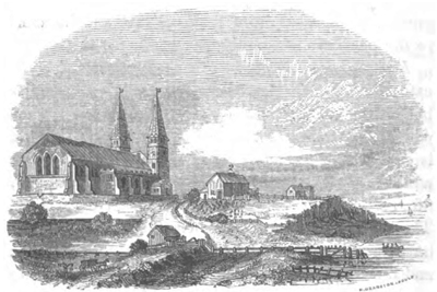
View of Reculver Church, taken in the year 1781.
1. Isle of Sheppey.
2. Ancient chapel now destroyed. The cottage between this chapel and the cliff was demolished by the sea, in 1782.
* On the authority of W. Richardson, Esq., F.G.S.
† Vol. ii. New Series, 1809, p. 801.
year 1780, the waves had reached the site of the ancient Roman camp, or fortification, the walls of which had continued for several years after they were undermined to overhang the sea, being firmly cemented into one mass. They were eighty yards nearer the sea than the church, and they are spoken of in the "Topographica Britannica" in the year 1780, as having recently fallen down.* In 1804, part of the churchyard with some adjoining houses was washed away, and the ancient church, with its two lofty spires, a well known land mark, was dismantled and abandoned as a place of worship. It is still standing (1834), but
Fig. 17.
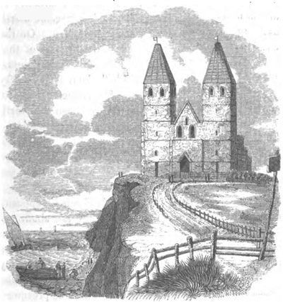
Reculver Church, in 1834.
* Dr. Mitchell, Proceedings or Geol. Sac. vol. ii. No. 1.
would probably have been annihilated ere this, had not the force of the waves been checked by an artificial causeway of stones and large wooden piles driven into the sands to break the force of the waves.*
Isle of Thanet.—The Isle of Thanet was, in the time of the Romans, separated from the rest of Kent by a navigable channel through which the Roman fleets sailed on their way to and from London. Bede describes this small estuary as being, in the beginning of the eighth century, three furlongs in breadth; and it is supposed that it began to grow shallow about the period of the Norman conquest. It was so far silted up in the year 1485, that an act was then obtained to build a bridge across it; and it has since become marsh land with small streams running through it. On the coast, Bedlam Farm, belonging to the hospital of that name, has lost eight acres in the last twenty years, the land being composed of chalk from forty to fifty feet above the level of the sea. It has been computed, that the average waste of the cliff between the North Foreland and the Reculvers, a distance of about eleven miles, is not less than two feet per annum. The chalk cliffs on the south of Thanet, between Ramsgate and Pegwell Bay, have on an average lost three feet per annum for the ten last years (preceding 1830).
Goodwin Sands.—The Goodwin Sands lie opposite this part of the Kentish coast. They are about ten miles in length, and are in some parts three, and in others seven miles distant from the shore; and, for a certain space, are laid bare at low water. That they are a remnant of land, and not "a mere accumulation of sea sand," as Rennell imagined †, may be presumed
* Dr. Mitchell, Proceedings of Geol. Soc. vol. ii. No. 1.
† Geog. of Herod, vol. ii. p. 326.
from the fact that, when the erection of a lighthouse on this shoal was in contemplation by the Trinity Board in the year 1817, it was found, by borings, that the bank consisted of fifteen feet of sand, resting on blue clay. An obscure tradition has come down to us, that the estates of Earl Goodwin, the father of Harold, who died in the year 1053, were situated here, and some have conjectured that they were overwhelmed by the flood mentioned in the Saxon chronicle, sub anno 1099. The last remains of an island, consisting, like Sheppey, of clay, may perhaps, have been carried away about that time.
There are other records of waste in the county of Kent, as at Deal; and at Dover, where Shakspeare's cliff, composed entirely of chalk, has suffered greatly, and continually diminishes in height, the slope of the hill being towards the land. About the year 1810 there was an immense land-slip from this cliff, by which Dover was shaken as if by an earthquake, and a still greater one in 1772.*
Straits of Dover.—In proceeding from the northern parts of the German Ocean towards the Straits of Dover, the water becomes gradually more shallow, so that in the distance of about two hundred leagues we pass from a depth of 120, to that of 58, 38, 24, and 18 fathoms. In the same manner the English Channel deepens progressively from Dover to its entrance, formed by the Land's End of England, and the Isle of Ushant on the Coast of France; so that the strait between Dover and Calais may be said to part two seas.†
* Dodsley's Ann. Regist. 1772.
† Stevenson on the Bed of the German Ocean.—Ed. Phil. Journ., No. v. p. 45.
Whether England was formerly united with France has often been a favourite subject of speculation; and in 1753 a society at Amiens proposed this as a subject of a prize essay, which was gained by the celebrated Desmarest, then a young man He founded his principal arguments on the identity of composition of the cliffs on the opposite sides of the channel, on a submarine chain extending from Boulogne to Folkestone, only fourteen feet under low water, and on the identity of the noxious animals in England and France, which could not have swum across the Straits, and would never have been introduced by man. He also attributed the rupture of the isthmus to the preponderating violence of the current from the north.* It will hardly be disputed that the ocean might have effected a breach through the land which, in all probability once united this country to the Continent in the same manner as it now gradually forces a passage through rocks of the same mineral composition, and often many hundred feet high, upon the coast.
Although the time required for such an operation was probably very great, yet we cannot estimate it by reference to the present rate of waste on both sides of the Channel; for when, in the thirteenth century the sea burst through the isthmus of Staveren, which formerly united Friesland with North Holland, it opened, in about one hundred years, a strait more than half as wide as that which divides England from France, after which the dimensions of the new channel remained almost stationary. The greatest depth of the straits between Dover and Calais is twenty-nine fathoms, which exceeds only by one fathom the
* Cuvier, Eloge de Desmarest.
greatest depth of the Mississippi at New Orleans. If the moving column of water in the great American river, which, as was before mentioned, does not flow rapidly, can maintain an open passage to that depth in its alluvial accumulations, still more might a channel of the same magnitude be excavated by the resistless force of the tides and currents of "the ocean stream,"
πоταμоιо μεγα σθενоς Ωхεανоιо
In framing these speculations, however, we must not overlook the great effects which particular combinations of causes might produce without violence. The chalk supposed in this instance to have been removed, was of itself a marine deposit, and must at some period have emerged from the deep. It may have been upraised gradually, as the coast of Sweden, with the bed of the adjacent ocean and Baltic sea, are now rising*; or there may have been oscillations of level in the lands once connecting France and England. In that case, and especially if the movements were slow, a great amount of excavation may have been produced by a comparatively feeble power exerted by waves and currents cutting through successive portions of the chalk as it emerged. And here I may mention, that strata of chalky rubble and sand found at the base of the cliffs near Dover and, Brighton, seem to indicate some changes in the relative level of sea and land since our coasts acquired a considerable part of their actual height and contour.†
At Folkestone, the sea undermines the chalk and subjacent strata. About the year 1716 there was a remarkable sinking of a track of land near the sea, so that houses became visible at points near the shore
* See Book ii. chap. 17.
† See Book iv. chap. 22.
from whence they could not be seen previously. In the description of this subsidence in the Philosophical Transactions, it is said, "that the land consisted of a solid stony mass (chalk), resting on wet clay (gault), so that it slid forwards towards the sea, just as a ship is launched on tallowed planks." It is also stated that, within the memory of persons then living, the cliff there had been washed away to the extent of ten rods.*
Encroachments of the sea at Hythe are also on record; but between this point and Rye there has been a gain of land within the times of history; the rich level tract called Romney Marsh, or Dungeness, about ten miles in width and five in breadth, and formed of silt, having received great accession. It has been necessary, however, to protect it from the sea, from the earliest periods, by a wall. These additions of land are exactly opposite that part of the English Channel where the conflicting tide-waves from the north and south meet; for, as that from the north is, for reasons already explained, the most powerful, they do not neutralize each other's force till they arrive at this distance from the straits of Dover. Rye, on the south of this tract, was once destroyed by the sea, but it is now two miles distant from it. The neighbouring town of Winchelsea was destroyed in the reign of Edward I., the mouth of the Rother stopped up, and the river diverted into another channel. In its old bed an ancient vessel, apparently a Dutch merchantman, was recently found. It was built entirely of oak, and much blackened.†
* Phil. Trans., 1716.
† Edin. Journ. of Sci., No. xix. p. 56.
South Coast of England.—To pass over some points near Hastings, where the cliffs have wasted at several periods, we arrive at the promontory of Beachy Head. Here a mass of chalk, three hundred feet in length, and from seventy to eighty in breadth, fell, in the year 1813, with a tremendous crash; and similar slips have since been frequent.*
Sussex.—About a mile to the west of the town of Newhaven the remains of an ancient entrenchment are seen, on the brow of Castle Hill. This earth-work, supposed to be Roman, was evidently once of considerable extent and of an oval form, but the greater part has been cut away. The cliffs, which are undermined here, are high; more than one hundred feet of chalk being covered by tertiary clay and sand, from sixty to seventy feet in thickness. In a few centuries the last vestiges of the plastic clay formation on the southern borders of the chalk of the South Downs on this coast will be annihilated, and future geologists will learn, from historical documents, the ancient geographical boundaries of this group of strata in that direction. On the opposite side of the estuary of the Ouse, on the east of Newhaven harbour, a bed of shingle, composed of chalk flints, derived from the waste of the adjoining cliffs, had accumulated at Sea-ford for several centuries. In the great storm of November, 1824, this bank was entirely swept away, and the town of Seaford inundated. Another great beach of shingle is now forming from fresh materials.
The whole coast of Sussex has been incessantly encroached upon by the sea from time immemorial; and, although sudden inundations only, which over-
* Webster, Geol. Trans., vol. ii. p. 192.
whelmed fertile or inhabited tracts are noticed in history, the records attest an extraordinary amount of loss. During a period of no more than eighty years, there are notices of about twenty inroads, in which tracts of land of from twenty to four hundred acres in extent were overwhelmed at once; the value of the tithes being mentioned by Nicholas, in his Taxatio Ecclesiastica.* In the reign of Elizabeth, the town of Brighton was situated on that tract where the chain pier now extends into the sea. In the year 1665, twenty-two tenements had been destroyed under the cliff. At that period there still remained under the cliff 113 tenements, the whole of which were overwhelmed in 1703 and 1705. No traces of the ancient town are now perceptible, yet there is evidence that the sea has merely resumed its ancient position at the base of the cliffs, the site of the old town having been merely a beach abandoned by the ocean for ages.
Hampshire—Isle of Wight.—It would be endless to allude to all the localities on the Sussex and Hampshire coasts where the land has given way; but I may point out the relation which the geological structure of the Isle of Wight bears to its present shape, as attesting that the coast owes its outline to the continued action of the sea. Through the middle of the island runs a high ridge of chalk strata, in a vertical position, and in a direction east and west. This chalk forms the projecting promontory of Culver Cliff on the east, and of the Needles on the west; while Sandown Bay on the one side, and Compton Bay on the other, have been hollowed out of the softer sands and argillaceous strata, which are inferior to the chalk.
* Mantell, Geology of Sussex, p. 293.
The same phenomena are repeated in the Isle of Purbeck, where the line of vertical chalk forms the projecting promontory of Handfast Point; and Swanage Bay marks the deep excavation made by the waves in the softer strata, corresponding to those of Sandown Bay.
Hurst-Castle Bank.—The entrance of the channel called the Solent is becoming broader by the waste of the cliffs in Colwell Bay; it is crossed for more than two thirds of its width by the shingle bank of Hurst Castle, which is about seventy yards broad and twelve feet high, presenting an inclined plane to the west. This singular bar consists of a bed of rounded chalk flints, resting on a submarine argillaceous base. The flints and a few other pebbles, intermixed, are exclusively derived from the waste of Hordwell, and other cliffs to the westward, where tertiary strata, capped with a covering of chalk flints, from five to fifty feet thick, are rapidly undermined.
Storm of Nov. 1824.—In the great storm of November, 1824, this bank of shingle was moved bodily forwards for forty yards towards the north-east; and certain piles which served to mark the boundaries of two manors were found, after the storm, on the opposite side of the bar. At the same time many acres of pasture land were covered by shingle, on the farm of Westover, near Lymington.
The cliffs between Hurst Shingle Bar and the mouth of the Stour and Avon are undermined continually. Within the memory of persons now living, it has been necessary thrice to remove the coast-road farther inland. The tradition, therefore, is probably true, that the church of Hordwell was once in the middle of that parish, although now very near the sea. The pro-
montory of Christ Church Head gives way slowly. It is the only point between Lymington and Poole Harbour, in Dorsetshire, where any hard stony masses occur in the cliffs. Five layers of large ferruginous concretions, somewhat like the septaria of the London day, have occasioned a resistance at this point, to which we may ascribe this headland. In the mean time, the waves have cut deeply into the soft sands and loam of Poole Bay; and, after severe frosts, great land-slips take place, which, by degrees, become enlarged into narrow ravines, or chines, as they are called, with vertical sides. One of these chines near Boscomb, has been deepened twenty feet within a few years. At the head of each there is a spring, the waters of which have been chiefly instrumental in producing these narrow excavations, which are sometimes from 100 to 150 feet deep.
Isle of Portland.—The peninsulas of Purbeck and Portland are continually wasting away. In the latter, the soft argillaceous substratum (Kimmeridge clay) hastens the dilapidation of the superincumbent mass of limestone.
In 1665 the cliffs adjoining the principal quarries in Portland gave way to the extent of one hundred yards, and fell into the sea; and in December, 1734, a slide to the extent of 150 yards occurred on the east side of the isle, by which several skeletons, buried between slabs of stone, were discovered. But a much more memorable occurrence of this nature, in 1792, occasioned probably by the undermining of the cliffs, is thus described in Hutchins's History of Dorsetshire: "Early in the morning the road was observed to crack: this continued increasing, and before two o'clock the ground had sunk several feet, and was in one con-
tinued motion, but attended with no other noise than what was occasioned by the separation of the roots and brambles, and now and then a falling rock. At night it seemed to stop a little, but soon moved again; and before morning, the ground, from the top of the cliff to the water-side, had sunk in some places fifty feet perpendicular. The extent of ground that moved was about a mile and a quarter from north to south, and six hundred yards from east to west."
Formation of the Chesil Bank.—Portland is connected with the main land by the Chesil Bank, a ridge of shingle about seventeen miles in length, and, in most places, nearly a quarter of a mile in breadth. The pebbles forming this immense barrier are chiefly of limestone; but there are many of quartz, jasper, chert, and other substances, all loosely thrown together. What is singular, they gradually diminish in size, from west to east—from the Portland end of the bank to that which attaches to the main land. The formation of this bar may probably be ascribed, like that of Hurst Castle, to a meeting of tides, or to a great eddy between the peninsula and the land. We have seen that slight obstructions in the course of the Ganges will cause, in the course of a man's life, slands many times larger than the whole of Portland, and which, in some cases, consist of a column of earth more than one hundred feet deep. In like manner we may expect the slightest impediment in the course of that tidal wave, which is sweeping away annually large tracts of our coast, to give rise to banks of sand and shingle many miles in length, if the transported materials be intercepted in their way to those submarine receptacles whither they are borne by the current. The gradual diminution in the size of the gravel as we proceed eastward might probably admit of expla-
nation, if the velocity of the tide or eddy at different points was ascertained; the rolled masses thrown up being largest where the motion of the water is most violent, or where they are deposited at the least distance from the rocks from which they were detached. The storm of 1824 burst over this bar with great fury, and the village of Chesilton, built upon the southern extremity of the bank, was overwhelmed, with many of the inhabitants. The fundamental rocks whereon the shingle rests are found at the depth of a few yards only below the level of the sea.
This same storm carried away part of the Break-water, at Plymouth, and huge masses of rock from two to five tons in weight, were lifted from the bottom of the weather side, and rolled fairly to the top of the pile. One block of limestone, weighing seven tons, was washed round the western extremity of the Breakwater, and carried 150 feet.* It was in the same month, and also during a spring-tide, that a great flood is mentioned on the coasts of England, in the year 1099. Florence of Worcester says, "On the third day of the nones of Nov. 1099, the sea came out upon the shore, and buried towns and men very many, and oxen and sheep innumerable." We also read in the Saxon Chronicle, already cited for the year 1099, "This year eke on St. Martin's mass day, the 11th of Novembre, sprung up so much of the sea flood, and so myckle harm did, as no man minded that it ever afore did, and there was the ylk day a new moon."
Dorsetshire—Devonshire—Cornwall.—At Lyme Regis, in Dorsetshire, the "Church Cliffs," as they are called, consisting of lias about one hundred feet in height, have gradually fallen away, at the rate of one
* De la Beche, Geol. Man. p. 82.
yard a year, since 1800.* The cliffs of Devonshire and Cornwall, which are chiefly composed of hard rocks, decay less rapidly. Near Penzance in Cornwall, there is a projecting tongue of land, called the "Green," formed of granitic sand, from which more than thirty acres of pasture land have been gradually swept away in the course of the last two or three centuries.† It is also said that St. Michael's Mount, now an insular rock, was formerly situated in a wood several miles from the sea; and its old Cornish name (Caraclowse in Cowse) signifies, according to Carew, the Hoare Rock in the Wood.‡ Between the Mount and Newlyn there is seen under the sand black vegetable mould, full of hazel nuts, and the branches, leaves, roots, and trunks of forest trees, all of indigenous species. This vegetable stratum has been traced seaward as far as the ebb permits, and seems to indicate some ancient estuary on that shore.
Tradition of loss of land in Cornwall.—The oldest historians mention a celebrated tradition in Cornwall, of the submersion of the Lionnesse, a country which formerly stretched from the Land's End to the Scilly Islands. The tract, if it existed, must have been thirty miles in length, and perhaps ten in breadth. The land now remaining on either side is from two hundred to three hundred feet high; the intervening sea about three hundred feet deep. Although there is no evidence for this romantic tale, it probably origin-
* This ground was measured by Dr. Carpenter of Lyme, In 1800, and again in 1829, as I am informed by Miss Mary Anning of Lyme, well known by her discoveries in fossil remains.
† Boase, Trans. Royal Geol. Soc. of Cornwall, vol. ii. p. 129.
‡ Ibid. p. 135.
VOL. II. D
ated in some catastrophe occasioned by former inroads of the Atlantic upon this exposed coast.*
West coast of England.—Having now brought together an ample body of proofs of the destructive operations of the waves, tides, and currents, on our eastern and southern shores it will be unnecessary to enter into details of changes on the western coast, for they present merely a repetition of the same phenomena, and in general on an inferior scale. On the borders of the estuary of the Severn the flats of Somersetshire and Gloucestershire have received enormous accessions, while, on the other hand, submarine forests on the coast of Cheshire and Lancashire indicate the overflowing of alluvial tracts. Since the year 1764, the coast of Cheshire between the rivers Mersey and Dee has lost many hundred yards, and some affirm more than half a mile, by the advance of the sea upon abrupt cliffs of red clay and marls. Within the period above mentioned several light-houses have been successively abandoned.† There are traditions in Pembrokeshire‡ and Cardiganshire§ of far greater losses of territory than that which the Lionnesse tale of Cornwall pretends to commemorate. They are all important, as demonstrating that the earliest inhabitants were familiar with the phenomenon of incursions of the sea.
Loss of land on the coast of France.—The French coast, particularly that of Brittany, where the tides rise to an extraordinary height, is the constant prey of
* Boase, Trans. Royal Geol. Soc. of Cornwall, vol. ii. p. 130.
† Stevenson, Jameson's Ed. new Phil. Journ. No. 8. p. 386.
‡ Camden, who cites Gyraldus, also Ray, "On the Deluge," Phys, Theol. p. 228.
§ Meyrick's Cardigan.
the waves. In the ninth century many villages and woods are reported to have been carried away, the coast undergoing great change whereby the hill of St. Michael was detached from the mainland. The parish of Bourgneuf, and several others in that neighbourhood, were overflowed in the year 1500. In 1735, during a great storm, the ruins of Palnel were seen uncovered in the sea.* A romantic tradition, more-over, has descended from the fabulous ages of the destruction of the south-western part of Brittany, whence we may probably infer some great inroad of the sea at a remote period.†
* Hoff, Geschichte, &c. vol. i. p. 49.
† Ibid. p. 48.
D 2
CHAPTER VII
ACTION OF TIDES AND CURRENTS—continued.
Action of tides and currents, continued—Inroads of the sea upon the delta of the Rhine in Holland—changes in the arms of the Rhine—Estuary of the Bies Bosch, formed in 1421—Zuyder Zee, in the 13th century—Islands destroyed—Delta of the Ems converted into a bay—Estuary of the Dollart formed (p. 58,)—Encroachment of the sea on the coast of Sleswick—On shores of North America—Tidal wave, called the Bore—Influence of tides and currents on the mean level of seas—Action of currents in inland lakes and seas—Baltic—Cimbrian deluge (p. 65.)—Straits of Gibraltar—No under-current there—Whether salt is precipitated in the Mediterranean—Waste of shores of Mediterranean.
Inroads of the sea at the mouths of the Rhine.—THE line of British coast considered in the preceding chapter offered no example of the conflict of two great antagonist forces; the entrance, on the one hand, of a river draining a large continent, and on the other, the flux and reflux of the tide, aided by a strong current. But when we pass over by the Straits of Dover to the Continent, and proceed northwards, we find an admirable illustration of such a contest, where the Rhine and the ocean are opposed to each other, each disputing the ground now occupied by Holland; the one striving to shape out an estuary, the other to form a delta. There was evidently a period when the river obtained the ascendency, when the shape of the
coast and set of the tides were probably very different; but for the last two thousand years, during which man has witnessed and actively participated in the struggle, the result has been in favour of the ocean; the area of the whole territory having become more and more circumscribed; natural and artificial barriers having given way, one after another; and many hundred thousand human beings having perished in the waves.
Changes in the arms of the Rhine.—The Rhine, after flowing from the Grison Alps, copiously charged with sediment, first purifies itself in the Lake of Constance, where a large delta is formed; then, swelled by the Aar and numerous other tributaries, it flows for more than six hundred miles towards the north: when, entering a low tract, it divides into two arms, north of Cleves, a little below the village of Pannerden—a point which must therefore be considered the head of its delta. In speaking of the delta I do not mean to assume that all that part of Holland which is comprised within the several arms of the Rhine can be called a delta in the strictest sense of the term; because some portion of the country thus circumscribed, as, for example, a part of Gelderland and Utrecht, consists of strata which may have been deposited in the sea before the Rhine existed. These older tracts may either have been raised like the Ullah Bund in Cutch, during the period when the sediment of the Rhine was converting a part of the sea into land, or they may have constituted islands previously.
When the river divides north of Cleves, the left arm takes the name of the Waal; and the right, retaining that of the Rhine, is connected, a little farther to the north, by an artificial canal with the river Yssel. Still lower down, the Rhine takes the name of the Leck, a
D 3
name which was given to distinguish it from another arm called the old Rhine, now sanded up, which passed by Utrecht and Leyden, to the sea at Catwyck. It is common, in all great deltas, that the principal channels of discharge should shift from time to time; but in Holland so many magnificent canals have been constructed, and have so diverted, from time to time, the course of the waters, that the geographical changes in this delta are endless, and their history, since the Roman era, forms a complicated topic of antiquarian research. The present head of the delta is about forty geographical miles from the nearest part of the gulf called the Zuyder Zee, and more than twice that distance from the general coast-line. The present head of the delta of the Nile is about eighty or ninety geographical miles from the sea; that of the Ganges, as we before stated, two hundred and twenty; and that of the Mississippi about one hundred and eighty, reckoning from the point where the Atchafalaya branches off, to the extremity of the new tongue of land in the Gulf of Mexico. But the comparative distance between the heads of deltas and the sea affords scarcely any data for estimating the relative magnitude of the alluvial tracts formed by their respective rivers. For the ramifications depend on many varying and temporary circumstances, and the area over which they extend does not hold any constant proportion to the volume of water in the river.
The Rhine therefore has at present three mouths. About two-thirds of its waters flow to the sea by the Waal, and the remainder is carried partly to the Zuyder Zee by the Yssel, and partly to the ocean by the Leck. As the whole coast to the south, as far as Ostend, and on the north, to the entrance of the Baltic
has, with few exceptions, from time immemorial, yielded to the force of the waves, it is evident that the delta of the Rhine, if it had advanced, would have become extremely prominent; and even if it had remained stationary, would long ere this have projected far beyond the rounded outline of the coast, like that strip of land already described, at the mouth of the Mississippi. But we find, on the contrary, that the islands which skirt the coast have not only lessened in size, but in number also, while great bays have been formed in the interior by incursions of the sea. I shall confine myself to the enumeration of some of the leading facts, in confirmation of these views, and begin with the southernmost part of the delta, where the Waal enters, which is at present united with the Meuse, in the same manner as an arm of the Po, before mentioned, has become confluent with the Adige. The Meuse itself had once a common embouchure with the Scheldt, by Sluys and Ostburg, but this channel was afterwards sanded up, as were many others between Walcheren, Beveland, and other islands, at the mouths of these rivers. The new accessions were almost all within the coast line, and were far more than counterbalanced by inroads of the sea, whereby large tracts of land, and dunes of blown sand, together with towns and villages, were swept away between the fourteenth and eighteenth centuries. Besides parts of Walcheren, Beveland, and several populous districts in Kadzand, the island Orisant was in the year 1658 entirely annihilated.
Inroads of the sea in Holland.—One of the most memorable irruptions occurred in 1421, where the tide, pouring into the mouth of the united Meuse and Waal, burst through a dam in the district named
D 4
Bergse-Veld, and overflowed seventy-two villages, forming a large sheet of water called the Bies Bosch. Thirty-five of the villages were irretrievably lost, and no vestige, even of their ruins, was afterwards seen. The rest were redeemed, and the site of the others, though still very generally represented on maps as an estuary, has in fact been gradually filled up by alluvial deposits, and is now, as I am informed by Professor Moll, an immense plain, yielding abundant crops of hay, though still uninhabited. To the north of the Meuse is a long line of shore covered with sand dunes, where great encroachments have taken place from time to time, in consequence chiefly of the prevalence of south-easterly winds which blow down the sands towards the sea. The church of Scheveningen, not far from the Hague, was once in the middle of the village, and now stands on the shore; half the place having been overwhelmed by the waves in 1570. Catwyck, once far from the sea, is now upon the shore; two of its streets having been overflowed, and land torn away to the extent of two hundred yards in 1719. It is only by aid of embankments, that Petten, and several other places farther north, have been defended against the sea.
Formation of the Zuyder Zee and Straits of Staveren.—Still more important are the changes which have taken place on the coast opposite the right arm of the Rhine, or the Yssel, where the ocean has burst through a large isthmus, and entered the inland lake Flevo, which, in ancient times, was, according to Pomponius Mela, formed by the overflowing of the Rhine over certain low lands. It appears that, in the time of Tacitus, there were several lakes in the present site of the Zuyder Zee, between Friesland and Holland. The
successive inroads by which these, and a great part of the adjoining territory, were transformed into a great gulf, began about the commencement, and were completed towards the close of the thirteenth century. Alting gives the following relation of the occurrence, drawn from manuscript documents of contemporary inhabitants of the neighbouring provinces. In the year 1205, the island now called Wieringen, to the south of the Texel, was still a part of the mainland, but during several high floods, of which the dates are given, ending in December, 1251, it was separated from the continent. By subsequent incursions, the sea consumed great parts of the rich and populous isthmus, a low tract which stretched on the north of Lake Flevo, between Staveren in Friesland, and Medemblick in Holland, till at length a breach was completed about the year 1282, and afterwards widened. Great destruction of land took place when the sea first broke in, and many towns were swept away; but there was afterwards a reaction to a certain extent, large tracts at first submerged having been gradually redeemed. The new straits south of Staveren are more than half the width of those of Dover, but are very shallow, the greatest depth not exceeding two or three fathoms. The new bay is of a somewhat circular form, and between thirty and forty miles in diameter. How much of this space may formerly have been occupied by Lake Flevo, is unknown.
Destruction of Islands.—A series of islands stretching from the Texel to the mouths of the Weser and Elbe, are evidently the last relics of a tract once continuous. They have greatly diminished in size, and have lost about a third of their number since the time
D 5
of Pliny; for that naturalist counted twenty-three islands between the Texel and Eider, whereas there are now only sixteen, including Heligoland and Neuwerk.* Heligoland, at the mouth of the Elbe, began in the year 800 to be much consumed by the waves. In the years 1300, 1500, and 1649, other parts were swept away, till at last only a rock of red marl (of the keuper formation of the Germans), about 200 feet high, and some low ground remained. Since 1770, a current has cut a passage no less than ten fathoms deep through this remaining portion, and has formed two islands, Heligoland and Sandy Island. The fact of the new channel being laid down in all the charts as sixty feet deep is important, as showing the excavating power of marine currents under favourable circumstances. On the other hand some few islands have extended their bounds in one direction, or become connected with others, by the sanding-up of channels; but even these, like Juist, have generally given way as much on the north towards the sea as. they have gained on the south, or land side.
The Dollart formed.—While the delta of the Rhine has suffered so materially from the movements of the ocean, it can hardly be supposed that minor rivers on the same coast should have been permitted to extend their deltas. It appears, that in the time of the Romans there was an alluvial plain of great fertility, where the Ems entered the sea by three arms. This low country stretched between Groningen and East Friesland, and sent out a peninsula to the north-east towards Emden. A flood, in 1277, first destroyed pact of the peninsula. Other inundations followed at differ-
* Hoff, vol. i. p. 364.
† Id. p. 57.
ent periods throughout the fifteenth century. In 1507, a part only of Torum, a considerable town, remained standing; and in spite of the erection of dams, the remainder of that place, together with market-towns, villages, and monasteries, to the number of fifty, were finally overwhelmed. The new gulf, which was called the Dollart, although small in comparison to the Zuyder Zee, occupied no less than six square miles at first; but part of this space was, in the course of the two following centuries, again redeemed from the sea. The small bay of Leybucht, farther north, was formed in a similar manner in the thirteenth century; and the bay of Harlbucht, in the middle of the sixteenth. Both of these have since been partially reconverted into dry land. Another new estuary, called the Gulf of Jahde, near the mouth of the Weser, scarcely inferior in size to the Dollart, has been gradually hollowed out since the year 1016, between which era and 1651 a space of about four square miles has been added to the sea. The rivulet which now enters this inlet is very small; but Arens conjectures, that an arm of the Weser had once an outlet in that direction.
Coast of Sleswick.—Farther north we find so many records of waste on the western coast of Sleswick, as to lead us to anticipate, that, at no distant period in the history of the physical geography of Europe, Jutland may become an island, and the ocean may obtain a more direct entrance into the Baltic. So late as 1825 the sea made a breach and entered the Lym-Fiord, so that the northern extremity of Jutland was converted for a time into an island; but the passage is now closed again.*
* Malte-Brun, vol. viii. part ii, p. 572.
D 6
Destruction of Northstrand by the sea.—Northstrand, up to the year 1240, was, with the islands Sylt and Föhr, so nearly connected with the mainland as to appear a peninsula, and was called North Friesland, a highly cultivated and populous district. It measured from nine to eleven geographical miles from north to south, and six to eight from east to west. In the above-mentioned year it was torn asunder from the continent, and in part overwhelmed. The Isle of Northstrand, thus formed, was, towards the end of the sixteenth century, only four geographical miles in circumference, and was still celebrated for its cultivation and numerous population. After many losses, it still contained nine thousand inhabitants. At last, in the year 1634, on the evening of the 11th of October, a flood passed over the whole island, whereby 1300 houses, with many churches, were lost; fifty thousand head of cattle perished, and above six thousand men. Three small islets, one of them still called Northstrand, alone remained, which are now continually wasting.
Inroads. of the sea on the eastern shores of North America.—After so many authentic details respecting the destruction of the coast in parts of Europe best known, it will be unnecessary to multiply examples of analogous changes in more distant regions of the world. It must not, however, be imagined that our own seas form any exception to the general rule. Thus, for example, if we pass over to the eastern coast of North America, where the tides rise to a great elevation, we find many facts attesting the incessant demolition of land. At Cape May, for example, on the north side of Delaware Bay, in the United States, the encroachment of the sea was shown by observ-
ations made consecutively for sixteen years, from 1804 to 1820, to average about nine feet a year *; and at Sullivan's Island, which lies on the north side of the entrance of the harbour of Charles town, in South Carolina, the sea carried away a quarter of a mile of land in three years, ending in 1786.†
Tidal wave called "the Bore"—Before concluding my remarks on the action of the tides, I must not omit to mention the wave called "the Bore," which is sometimes produced in a river where a large body of water is made to rise suddenly, in consequence of the contraction of the channel. This wave terminates abruptly on the inland side; because the quantity of water contained in it is so great, and its motion so rapid, that time is not allowed for the surface of the river to be immediately raised by means of transmitted pressure. A tide wave thus rendered abrupt has a close analogy, observes Mr. Whewell, to the waves which curl over and break on a shelving shore.‡
The Bore which enters the Severn, where the phenomenon is of almost daily occurrence, is sometimes nine feet high, and at spring tides rushes up the estuary with extraordinary rapidity. The same phenomenon is frequently witnessed in the principal branches of the Ganges, and in the Megna. "In the Hoogly, or Calcutta river," says Rennell, "the Bore commences at Hoogly Point, the place where the river first contracts itself, and is perceptible above Hoogly Town; and so quick is its motion, that it hardly employs four hours in travelling from one to the other, though the distance is nearly seventy miles.
* New Monthly Mag., vol. vi. p. 69.
† Hoff, vol. i. p. 96.
‡ Phil. Trans., 1833, p. 204.
At Calcutta It sometimes occasions an instantaneous rise of five feet; and both here, and in every other part of its track, the boats, on its approach, immediately quit the shore, and make for safety to the middle of the river. In the channels, between the islands in the mouth of the Megna, the height of the Bore is said to exceed twelve feet; and is so terrific in its appearance, and dangerous in its consequences, that no boat will venture to pass at spring tide."* These waves may sometimes cause inundations, undermine cliffs, and still more frequently sweep away trees and land animals from low shores, so that they may be carried down, and ultimately imbedded in fluviatile or submarine deposits.
Relative level of different seas.—There is another question, in regard to the effects of tides and currents, not yet fully determined—how far they may cause the mean level of the ocean to vary at particular places. According to the French observations in Egypt the waters of the Red Sea maintain a constant elevation of between four and five fathoms above the neighbouring waters of the Mediterranean, at all times of the tide. Some have attributed this to a current setting up the Red Sea and raising its level. But Rennell has suggested that the Mediterranean may be lower than the Red Sea; because its loss by evaporation may not be compensated, especially at its eastern end, by the current setting in through the Straits of Gibraltar. It has also been imagined that there is an equal, if not greater diversity, in the relative levels of the Atlantic and Pacific, on the opposite sides of the isthmus of Panama. But the levellings recently car-
* Rennell, Phil. Trans. 1781.
ried across that isthmus by Mr. Lloyd, to ascertain the relative height of the Pacific Ocean at Panama, and of the Atlantic at the mouth of the river Chagres, have shown, that the difference of mean level between those oceans is not considerable, and contrary to expectation the difference which does exist is in favour of the greater height of the Pacific. According to the result of this survey, on which great dependence may be placed, the mean height of the Pacific is three feet and a half, or 3.52 above the Atlantic, if we assume the mean level of a sea to coincide with the mean between the extremes of the elevation and depression of the tides; for between the extreme levels of the greatest tides in the Pacific, at Panama, there is a difference of 27.44 feet; and at the usual spring tides 21.22 feet: whereas at Chagres this difference is only 1.16 feet, and is the same at all seasons of the year.
The tides, in short, in the Caribbean Sea are scarcely perceptible, not equalling those in some parts of the Mediterranean, whereas the rise is very high in the Bay of Panama; so that the Pacific is at high tide lifted up several feet above the surface of the Gulf of Mexico, and then at low water let down as far below it.* But astronomers are agreed that, on mathematical principles, the rise of the tidal wave above the mean level of a particular sea must be greater than the fall below it; and although the difference has been hitherto supposed insufficient to cause an appreciable error, it is, nevertheless, worthy of observation, that the error, such as it may be, would tend to reduce the small difference, now inferred, from the observations of Mr. Lloyd, to exist between the levels of the two oceans.
* Phil. Trans., 1830, p. 59.
ACTION OF CURRENTS IN INLAND LAKES AND SEAS.
In such large bodies of water as the North American lakes, the continuance of a strong wind in one direction often causes the elevation of the water, and its accumulation on the leeward side; and while the equilibrium is restoring itself, powerful currents are occasioned. In October 1833, a strong current in Lake Erie, caused partly by the set of the waters towards the outlet of the lake, and partly by the prevailing wind, burst a passage through the sandy isthmus called Long Point Peninsula, and soon excavated a channel more than nine feet deep and nine hundred feet wide. Its width and breadth have since increased, and a new and costly pier has been erected; for it is hoped that the event will permanently improve the navigation of Lake Erie for steam-boats.* In the Black Sea, also, although free from tides, we learn from Pallas that there is a sufficiently strong current to undermine the cliffs in many parts, and particularly in the Crimea.
The redundancy of river water in the Baltic, especially during the melting of ice and snow in spring, causes in general an outward current through the channel called the Cattegat. But after a continuance of north-westerly gales, especially during the height of the spring tides, the Atlantic rises; and, pouring a flood of water into the Baltic, commits dreadful devastations on the isles of the Danish Archipelago. This current even acts, though with diminished force, as far eastward as the vicinity of Dantzic.† Accounts written during the last ten centuries attest the wearing down
* M.S. of Capt. Bayfield, R.N.
† See examples in Hoff, vol. i. p. 73., who cites Pisansky.
of promontories on the Danish coast, the deepening of gulfs, the severing of peninsulas from the main land, and the waste of islands, while in several cases marsh land, defended for centuries by dikes, has at last been overflowed, and thousands of the inhabitants whelmed in the waves.
Thus the island Barsoe, on the coast of Sleswick, has lost, year after year, an acre at a time. The island Alsen suffers in like manner. The peninsula Zingst was converted into an island in 1625. There is a tradition that the isle of Rugen was originally torn by a storm from the main land of Pomerania: and it is known, in later times, to have lost ground, as in the year 1625, when a tract of land was carried away. Some of these islands consist of ancient alluvial accumulations, containing blocks of granite, which are also spread over the neighbouring main land. The Marsh Islands are mere banks, like the lands formed of the "warp" in the Humber, protected by dikes. Some of them, after having been inhabited with security for more than ten centuries, have been suddenly over-whelmed. In this manner, in 1216, no less than ten thousand of the inhabitants of the Eyderstede and Ditmarsch perished; and on the 11th of October, 1634, the islands and the whole coast, as far as Jutland, suffered by a dreadful deluge.
Cimbrian Deluge.—I have before enumerated the ravages of the ocean on the western shores of Sleswick, and there are memorials of a series of like catastrophes on the eastern coast of that peninsula. Jutland was the Cimbrica Chersonesus of the ancients, and was then evidently the theatre of similar calamities; for Florus says, "Cimbri, Theutoni, atque Tigurini, ab extremis Galliæ profugi, cùm terras eorum inun-
dasset Oceanus, novas sedes toto orbe quærebant."* Some have wished to connect this "Cimbrian Deluge" with the bursting of the isthmus between England and France, and with other supposed convulsions; but when we consider the fate of Heligoland and Northstrand, and the other terrific inundations in Jutland and Holstein since the Christian era, wherein thousands have perished, we need not resort to any such extraordinary catastrophes to account for the historical relation. The wave which in 1634 devastated the whole coast of Jutland committed such havoc, that we must be cautious how we reject hastily the traditions of like events on the coasts of Kent, Cornwall, Pembrokeshire, and Cardigan; for, however sceptical we may be as to the amount of territory destroyed, it is very possible that former inroads of the sea may have been greater on those shores than any witnessed in modern times.
Straits of Gibraltar.—It is well known that a powerful current sets constantly from the Atlantic into the Mediterranean, and its influence extends along the whole southern borders of that sea, and even to the shores of Asia Minor. Captain Smyth found, during his survey, that the central current ran constantly at the rate of from three to six miles an hour eastward into the Mediterranean, the body of water being three miles and a half wide. But there are also two lateral currents—one on the European, and one on the African side; each of them about two miles and a half broad, and flowing at about the same rate as the central stream. These lateral currents ebb and flow with the tide, setting alternately into the Mediterranean
* Lib. iii. cap. 3.
and into the Atlantic. The excess of water constantly flowing in is very great, and there is only one cause to which this can be attributed, the loss of water in the Mediterranean by evaporation. That the level of this sea should be considerably depressed by this means is quite conceivable, since we know that the winds blowing from the shores of Africa are hot and dry; and hygrometrical experiments recently made in Malta and other places, show that the mean quantity of moisture in the air investing the Mediterranean, is equal only to one half of that in the astmosphere of England. The temperature also of the great inland sea is upon an average higher, as was before stated, by 3½° of Fahrenheit, than the western part of the Atlantic ocean, which must greatly promote its evaporation. The Black Sea being situated in a higher latitude, and being the receptacle of rivers flowing from the north, is much colder, and its expenditure far less; accordingly, it does not draw any supply from the Mediterranean, but, on the contrary, contributes to it by a current flowing outwards, for the most part of the year, through the Dardanelles. The discharge, however, at the Bosphorus is so small when compared to the volume of water carried in by rivers as to imply a great amount of evaporation even in the Black Sea.
Whether salt be precipitated in the Mediterranean.—It is, however, objected, that evaporation carries away only fresh water, and that the current from the Atlantic is continually bringing in salt water: why, then, do not the component parts of the waters of the Mediterranean vary? or how can they remain so nearly the same as those of the ocean? Some have imagined that the excess of salt might be carried away by an under-current running in a contrary direction to the
superior; and this hypothesis appeared to receive confirmation from a late discovery that the water taken up about fifty miles within the Straits, from a depth of 670 fathoms, contained a quantity of salt four times greater than the water of the surface. Dr. Wollaston*, who analysed this water obtained by Captain Smyth, truly inferred that an under-current of such denser water, flowing outward, if of equal breadth and depth with the current near the surface, would carry out as much salt below as is brought in above, although it moved with less than one fourth part of the velocity, and would thus prevent a perpetual increase of saltness in the Mediterranean beyond that existing in the Atlantic. It was also remarked by others, that the result would be the same if, the swiftness being equal, the inferior current had only one fourth of the volume of the superior. At the same time there appeared reason to conclude that this great specific gravity was only acquired by water at immense depths; for two specimens of the water, taken at the distance of some hundred miles from the Straits, and at depths of 400, and even 450 fathoms, were found by Dr. Wollaston not to exceed in density that of many ordinary samples of sea-water. Such being the case, we can now prove that the vast amount of salt brought into the Mediterranean does not pass out again by the Straits; for it appears by Captain Smyth's soundings, which Dr. Wollaston had not seen, that between the Capes of Trafalgar and Spartel, which are twenty-two miles apart, and where the Straits are shallowest, the deepest part, which is on the side of Cape Spartel, is only 220
* On the water of the Mediterranean, by W. H. Wollaston, M.D., F.R.S. Phil. Trans., 1829, part i. p. 29.
fathoms. It is therefore evident that if water sinks in certain parts of the Mediterranean, in consequence of the increase of its specific gravity, to greater depths than 220 fathoms, it can never flow out again into the Atlantic, since it must be stopped by the submarine barrier which crosses the shallowest part of the Straits of Gibraltar.
The idea of the existence of a counter-current, at a certain depth, first originated in the following circumstance:—M. De l'Aigle, commander of a privateer called the Phœnix, of Marseilles, gave chase to a Dutch merchant-ship, near Ceuta Point, and coming up with her in the middle of the gut, between Tariffa and Tangier, gave her one broadside, which directly sunk her. A few days after, the sunk ship, with her cargo of brandy and oil, was cast ashore near Tangier, which is at least four leagues to the westward of the place where she went down, and directly against the strength of the central current.* This fact, however, affords no evidence of an under-current, because the ship, when it approached the coast, would necessarily be within the influence of a lateral current, which, running westward twice every twenty-four hours, might have brought back the vessel to Tangier.
What, then, becomes of the excess of salt?—for this is an enquiry of the highest geological interest. The Rhone, the Po, and many hundred minor streams and springs, pour annually into the Mediterranean large quantities of carbonate of lime, together with iron, magnesia, silica, alumina, sulphur, and other mineral ingredients, in a state of chemical solution. To explain why the influx of this matter does not alter
* Phil. Trans., 1724.
the composition of this sea has never been regarded as a difficulty; for it is known that calcareous rocks are forming in the delta of the Rhone, in the Adriatic, on the coast of Asia Minor, and in other localities. Precipitation is acknowledged to be the means whereby the surplus mineral matter is disposed of, after the consumption of a certain portion in the secretions of testacea, zoophytes, and other marine animals. But before muriate of soda can, in like manner, be precipitated, the whole Mediterranean ought, it is said, to become as much saturated with salt as Lake Aral, the Dead Sea, or the brine-springs of Cheshire.
It is undoubtedly true, in regard to small bodies of water, that every particle must be fully saturated with muriate of soda before a single crystal of salt can be formed; such is probably the case in all natural salterns; such for example as those described by travellers as occurring on the western borders of the Black Sea, where extensive marshes are said to be covered by thin films of salt after a rapid evaporation of sea-water. The salt étangs of the Rhone, where salt has sometimes been precipitated in considerable abundance, have been already mentioned. But whether it be necessary that every part of a sea of enormous depth should be fully saturated before any precipitate can take place is a question of some difficulty. In the narrowest part of the Straits of Gibraltar, where they are about nine miles broad, between the Isle of Tariffa and Alcanzar Point, the depth varies from 160 to 500 fathoms: but between Gibraltar and Ceuta, Captain Smyth sounded to the enormous depth of 950 fathoms; where he found a gravelly bottom, with fragments of broken shells. Saussure sounded to the depth of two thousand feet, within a few yards of the shore, at Nice;
and M. Bérard has lately fathomed to the depth of more than six thousand feet in several places without reaching the bottom.*
The central abysses of this sea are, in all likelihood, at least as deep as the Alps are high; and, as at the depth of seven hundred fathoms only, water has been found to contain a proportion of salt four times greater than at the surface, we may presume that the excess of salt may be much greater at the depth of two or three miles. After evaporation, the surface water becomes impregnated with a slight excess of salt, and its specific gravity being thus increased, it instantly falls to the bottom, while lighter water rises to the top, or flows in laterally, being always supplied by rivers and the current from the Atlantic. The heavier fluid, when it arrives at the bottom, cannot stop if it can gain access to any lower part of the bed of the sea, not previously occupied by water of the same density. In this manner the bottom of the nethermost submarine abysses must annually receive new supplies of brine, while the water at the surface, being incessantly renewed by rivers and the current from the ocean, can never become saturated.
How far this accumulation of brine can extend before the inferior strata will part with any of their salt, and what difference in such a chemical process the immense pressure of the incumbent ocean might occasion, are questions which cannot be answered in the present state of science. There is also another curious topic of speculation; what changes may be effected by volcanic heat, so active in many parts of the bottom of the Mediterranean. A submarine hot-
* Bull. de la Soc. Géol. de France.—Résumé, p. 72. 1832.
spring or stufa would give rise to a new set of phenomena. Perhaps it may be said that their effect would only be to cause ascending and descending currents, and thereby to promote the intermixture of the upper and lower waters of the sea. A solfatara, or rent through which inflammable gases are continually escaping, might certainly convert sea-water into steam; and in this case salt would be precipitated in the space from which the steam was expelled. Additional supplies of water might then find their way into the fissure, being injected into every pore of the rock by the vast pressure of the incumbent ocean. If, by a repetition of this process, the cavity was filled with salt, other crystals of the same mineral would more easily be formed from a solution, and might then spread along the bottom of the sea. Yet even in this case it should seem that the fluid must first be fully saturated. It is certainly most difficult to explain on chemical principles how a deposit of salt may take place at the bottom of the Mediterranean, but it is nevertheles a fact that the waters of that sea, notwithstanding the constant influx of salt-water from the Atlantic, contain but a slight excess of muriate of soda above the ordinary waters of the ocean.
In regard to the probable origin of those continuous masses of rock-salt which we find in Poland, Hungary, Transylvania, and Spain, geologists have entertained very different opinions; but the theory which has obtained most favour in later times attributes them not to precipitation from an aqueous menstruum, but to sublimation from volcanic exhalations rising from below, which insinuate themselves into rents and vacuities, caused by the fracture and decomposition of rocks.
The straits of Gibraltar are said to become gradually wider by the wearing down of the cliffs on each side at many points; and the current sets along the coast of Africa so as to cause considerable inroads in various parts, particularly near Carthage. Near the Canopic mouth of the Nile, at Aboukir, the coast was greatly devastated in the year 1784, when a small island was nearly consumed. By a series of similar operations, the old site of the cities of Nicopolis, Taposiris, Parva, and Can opus, have become a sand-bank.*
Sand-Hills.—It frequently happens, where the sea is encroaching on a coast, that perpendicular cliffs of considerable height, composed of loose sand, supply, as they crumble away, large quantities of fine sand, which, being in mid-air when detached, are carried by the winds to great distances, covering the land or barring up the mouths of estuaries. This is exemplified in Poole Bay, in Hampshire, and in many points of the coast of Norfolk and Suffolk. But a violent wind will sometimes drift the sand of a sea beach, and carry it up with fragments of shells to great heights, as in the case of the sands of Barry, at the northern side of the estuary of the Tay, where hills of this origin attain the height of 140 feet.
On the coast of France and Holland long chains of these dunes have been formed in many parts, and often give rise to very important geological changes, by damming up the mouths of estuaries, and preventing the free ingress of the tides, or free efflux of river water.
* Clarke's Travels in Europe, Asia, and Africa, vol. Hi. pp. 340 and 363. 4th edition.
VOL. II. E
CHAPTER VIII.
REPRODUCTIVE EFFECTS OF TIDES AND CURRENTS.
Reproductive effects of tides and currents—Silting up of estuaries does not compensate the loss of land on the borders of the ocean—Bed of the German Ocean (p. 81.)—Composition and extent of its sand-banks—Strata deposited by currents on the southern and eastern shores of the Mediterranean—Transportation by currents of the sediment of the Amazon, Orinoco, and Mississippi (p. 84.)—Stratification.
FROM the facts enumerated in the last chapter, it appears that, on the borders of the ocean, currents and tides co-operating with the waves of the sea are most powerful instruments in the destruction and transportation of rocks; and as numerous tributaries discharge their alluvial burden into the channel of one great river, so we find that many rivers deliver their earthy contents to one marine current, to be borne by it to a distance, and deposited in some deep receptacle of the ocean. The current not only receives this tribute of sedimentary matter from streams draining the land, but acts also itself on the coast, as does a river on the cliffs which bound a valley. The course of currents on the British shores is ascertained to be as tortuous as that of ordinary rivers. Sometimes they run between sand-banks, which consist of matter thrown down at certain points where the velocity of the stream had been retarded; but it very frequently happens, that as
in a river one bank is made of low alluvial gravel, while the other is composed of some hard and lofty rock constantly undermined, so the current, in its bends, strikes here and there upon a coast, which then forms one bank, while a shoal under water forms the other. If the coast, be composed of solid materials, it yields slowly; so also if it be of great height, for in that case a large quantity of matter must be removed before the sea can penetrate to any distance. But the openings where rivers enter are generally the points of least resistance, and it is here, therefore, that the ocean makes the widest and deepest breaches.
A current alone cannot shape out and keep open an estuary, because it holds in suspension, like the river, during certain seasons of the year, a large quantity of sediment; and where the waters, flowing in opposite directions, meet, this matter subsides. For this reason, in inland seas, and even on the borders of the ocean, where the rise of the tide happens to be slight, it is scarcely possible to prevent a harbour from silting up; and it is often expedient to carry out a jetty beyond the point where the marine current and the river neutralize each other's force; for beyond this point a free channel is maintained by the superior strength of the current.
Estuaries, how formed.—The formation and keeping open of large estuaries are due to the combined influence of the tidal currents and rivers; for when the tide rises, a large body of water suddenly enters the mouth of the river, where, becoming confined within narrower bounds, while its momentum is not destroyed, it is urged on, and, having to pass through a contracted channel, rises and runs with increased velocity, just as a stream, when it reaches the arch of a bridge scarcely
E 2
large enough to give passage to its waters, rushes with a steep fall through the arch. During the ascent of the tide, a body of fresh water, flowing down from the higher country, is arrested in its course for several hours; and thus a large lake of brackish water is accumulated, which, when the sea ebbs, is let loose, as on the removal of an artificial sluice or dam. By the force of this retiring water, the alluvial sediment both of the river and of the sea is swept away, and transported to such a distance from the mouth of the estuary, that a small part only can return with the next tide.
It sometimes happens, that during a violent storm a large bar of sand is suddenly made to shift its position, so as to prevent the free influx of the tides, or efflux of river water. Thus about the year 1500 the sands at Bayonne were suddenly thrown across the mouth of the Adour. That river, flowing back upon itself, soon forced a passage to the northward, along the sandy plain of Capbreton, till at last it reached the sea at Boucau, at. the distance of seven leagues from the point where it had formerly entered. It was not till the year 1579 that the celebrated architect, Louis de Foix, undertook, at the request of Henry III., to re-open the ancient channel, which he at last effected with great difficulty.*
Tides in Estuaries.—In the estuary of the Thames at London, and in the Gironde, the tide flows five hours and ebbs seven, and in all estuaries the water requires a longer time to run down than up; so that the preponderating force is always in the direction
* Nouvelle Chronique de la Ville de Bayonne, pp. 113. 139 27.
which tends to keep open a deep and broad passage. But as both the river and the tidal current are ready to part with their sediment whenever their velocity is checked, there is naturally a tendency in all estuaries to silt up partially, since eddies, and backwaters, and points where opposing streams meet, are very numerous, and constantly change their position.
Silting up of estuaries does not compensate for loss of coasts.—Many writers have declared that the gain on our eastern coast, since the earliest periods of history, has more than counterbalanced the loss; but they have been at no pains to calculate the amount of loss, and have often forgotten that, while the new acquisitions are manifest, there are rarely any natural monuments to attest the former existence of the land that has been carried away. They have also taken into their account those tracts artificially recovered, which are often of great agricultural importance, and may remain secure, perhaps, for thousands of years, but which are only a few feet above the mean level of the sea, and are therefore exposed to be overflowed again by a small proportion of the force required to remove cliffs of considerable height on our shores. If it were true that the area of land annually abandoned by the sea in estuaries were equal to that invaded by it, there would still be no compensation in kind.
It will seem, at first sight, somewhat paradoxical, but it is nevertheless true, that the greater number of estuaries, although peculiarly exposed to the invasion of the sea, are usually contracting in size, even where the whole line of coast is giving way. But the fact is, that the inroads made by the ocean upon estuaries, although extremely great, are completed during periods of comparatively short duration; and in the intervals
E 3
between these irruptions, the mouths of rivers, like Other parts of the coast, usually enjoy a more or less perfect respite. All the estuaries, taken together, Constitute but a small part of a great line of coast; it is, therefore, most probable, that if our observations extend to a few centuries only, we shall not see any, and very rarely all, of this small part exposed to the fury of the ocean. The coast of Holland and Fries-land, if studied for several consecutive centuries since the Roman era, would generally have led to the conclusion that the land was encroaching fast upon the sea, and that the aggrandizement within the estuaries far more than compensated the losses on the open coast. But when our retrospect embraces the whole period, an opposite inference is drawn: and we find that the Zuyder Zee, the Bies Bosch, Dollart, and Yahde, are modern gulfs and bays, and that these points have been the principal theatres of the retreat, instead of the advance, of the land. If we possessed records of the changes on our coast for several thousand years, they would probably present us with similar results; and although we have hitherto seen our estuaries, for the most part, become partially converted into dry land, and bold cliffs intervening between the mouths of rivers consumed by the sea, this has merely arisen from the accidental set of the currents and tides during a brief period.
The current which flows round from the north-west, and bears against the eastern coast of England, transports, as we have seen, materials of various kinds. It undermines and sweeps away the granite, gneiss, trap rocks, and sandstone of Shetland, and removes the gravel and loam of the cliffs of Holderness, Norfolk, and Suffolk, which are between fifty and two hundred
feet in height, and which waste at the rate of from one to six yards annually. It bears away the strata of London clay on the coast of Essex and Sheppey—consumes the chalk with its flints for many miles continuously on the shores of Kent and Sussex—commits annual ravages on the fresh-water beds, capped by a thick covering of chalk flints, in Hampshire, and continually saps the foundations of the Portland limestone. It receives, besides, during the rainy months, large supplies of pebbles, sand, and mud, which numerous streams from the Grampians, Cheviots, and other chains, send down to the sea. To what regions, then, is all this matter consigned? It is not retained in mechanical suspension by the waters of the sea, nor does it mix with them in a state of chemical solution,—it is deposited somewhere, yet certainly not in the immediate neighbourhood of our shores; for, in that case, there would soon be a cessation of the encroachment of the sea, and large tracts of low land, like Romney Marsh, would almost every where encircle our island.
As there is now a depth of water, exceeding thirty feet, in some spots where cities flourished but a few centuries ago, it is clear that the current not only carries far away the materials of the wasted cliffs, but removes also the ruins of many of the regular strata at the bottom of the sea.
So great is the quantity of matter held in suspension by the tidal current on our shores, that the waters are in some places artificially introduced into certain lands below the level of the sea; and by repeating this operation, which is called "warping," for two or three years, considerable tracts have been raised, in
E 4
the estuary of the Humber, to the height of about six feet. If a current, charged with such materials, meets with deep depressions in the bed of the ocean, it must often fill them up; just as a river, when it meets with a lake in its course, fills it gradually with sediment. But in the one case, the sheet of water is converted into land; whereas, in the other, a shoal only is raised, overflowed at high water, or at least by spring tides. The only records which we at present possess of the gradual shallowing of seas are confined, as might be expected, to estuaries, havens, and certain channels of no great depth; and to some inland seas, as the Baltic, Adriatic, and Arabian Gulf. It is only of late years, that accurate surveys and soundings have afforded data of comparison in very deep seas, of which future geologists will avail themselves.
An extraordinary gain of land is described to have taken place at the head of the Red Sea, the Isthmus of Suez having doubled in breadth since the age of Herodotus. In his time, and down to that of Arrian, Heroopolis was on the coast; now it is as far distant from the Red Sea as from the Mediterranean.* Suez in 1541 received into its harbour the fleet of Solyman II.; but it is now changed into a sand-bank. The country called Tehama on the Arabian side of the Gulf has increased from three to six miles since the Christian era. Inland from the present ports are the ruins of more ancient towns, which were once on the sea-shore, and bore the same names. It is said that the blown sand from the deserts supplies some
* Danville, Mém. sur l'Egypte, p. 108.—Von Hoff, vol. i. p. 390.
part of the materials of this new land, and that the rest is composed of shells and corals, of which the growth is very rapid.
Filling up of the German Ocean.—The German Ocean is deepest on the Norwegian side, where the soundings give 190 fathoms; but the mean depth of the whole basin may be stated at no more than thirty-one fathoms.* The bed of this sea is traversed by several enormous banks, one of which, occupying a central position, trends from the Frith of Forth, in a north-easterly direction, to a distance of 110 miles; others run from Denmark and Jutland upwards of 105 miles to the north-west; while the greatest of all, the Dogger Bank, extends for upwards of 354 miles from north to south. The whole superficies of these enormous shoals is equal to about one fifth of the whole area of the German Ocean, or to about one third of the whole extent of England and Scotland.† The average height of the banks measures, according to Mr. Stevenson, about seventy-eight feet; the upper portion of them consisting of fine and coarse siliceous sand, mixed with comminuted corals and shells.‡
It has been supposed by some writers, that these vast submarine hills are made up bodily of drift sand, and other loose materials, principally supplied from the waste of the English, Dutch, and other coasts. But the late survey of the North Sea, conducted by Captain Hewett, affords ground for suspecting that this opinion is very erroneous. If such immense mounds of sand and mud had been accumulated under
* Stevenson on the Bed of the German Ocean, or North Sea.—Ed. Phil. Journ. No. V. p. 44. 1820.
† Ibid., p. 47.
‡ Ibid.
E 5
the influence of currents, the same causes ought nearly to have reduced to a level the entire bottom of the German Ocean; instead of which some long narrow ravines are found to intersect the banks. One of these varies from seventeen to forty-four fathoms in depth, and has very precipitous sides: in one part, called the "Inner Silver Pits," it is fifty-five fathoms deep. The shallowest parts of the Doggerbank were found to be forty-two feet under water, except in one place, where the wreck of a ship had caused a shoal; so that we may suppose the currents, which vary in their velocity from a mile to two miles and a half per hour, to have power to prevent the accumulation of drift matter in places of less depth. It seems, then, that the great banks above alluded to, and the ravines which intersect them, cannot be due to the tides and currents now existing in this sea. They may, however, have been caused in great part by the movements of the ocean at some former period, when the bed of this sea, and the surface of the land adjoining, assumed its actual configuration.
Strata deposited by currents.—It appears extraordinary, that in some tracts of the sea, adjoining the coast of England, where we know that currents are not only sweeping along rocky masses, thrown down, from time to time, from the high cliffs, but also occasionally scooping out channels in the regular strata, there should exist fragile shells and tender zoophytes in abundance, which live uninjured by these violent movements. The ocean, however, is in this respect a counterpart of the land; and as, on the continents, rivers may undermine their banks, uproot trees, and roll along sand and gravel, while their waters are inhabited by testacea and fish, and their alluvial plains are
adorned with rich vegetation and forests, so the sea may be traversed by rapid currents, and its bed may here and there suffer great local derangement, without any interruption of the general order and tranquillity.
One important character in the formations produced by currents, is, the immense extent over which they may be the means of diffusing homogeneous mixtures for these are often co-extensive with a great line coast, and, by comparison with their deposits, the deltas of rivers must shrink into insignificance. In the Mediterranean, the same current which is rapidly destroying many parts of the African coast, between the Straits of Gibraltar and the Nile, preys also upon the delta of the Nile, and drifts the sediment of that great river to the eastward. To this source may be attributed the rapid accretions of land on parts of the Syrian shores where rivers do not enter.
It is the opinion of M. Girard, one of the scientific men who accompanied Napoleon's expedition to Egypt, and who were employed on the survey of the ancient canal of Amron, communicating between the Nile and the Red Sea, that the isthmus of Suez itself is merely a bar formed by the deposition of this current and of the Nile, and that the two seas were formerly united.* It is certain, as before stated, that the isthmus is daily gaining in width by the accession of fresh deposits on the shores of the Mediterranean.†
The ruins of ancient Tyre are now far inland, and those of ancient Sidon are two miles distant from the
* Description de l'Egypte, Mémoires, tom. i. p. 33.
† Quarterly Review, No. lxxxvi. p. 445.
E 6
coast, the modern town having been removed towards the sea.* But the south coast of Asia Minor affords far more striking examples of advances of the land upon the sea, where small streams co-operate with the current before mentioned. Captain Beaufort, in his Survey of that coast, has pointed out the great alterations effected on these shores since the time of Strabo, where havens are filled up, islands joined to the mainland, and where the whole continent has increased many miles in extent. Strabo himself, on comparing the outline of the coast in his time with its ancient state, was convinced, like our countryman, that it had gained very considerably upon the sea. The new-formed strata of Asia Minor consist of stone, not of loose, incoherent materials. Almost all the streamlets and rivers, like many of those in Tuscany and the south of Italy, hold abundance of carbonate of lime in solution, and precipitate travertin, or sometimes bind together the sand and gravel into solid sandstones and conglomerates: every delta and sand-bar thus acquires solidity, which often prevents streams from forcing their way through them, so that their mouths are constantly changing their position.†
Distribution of the sediment of the Amazon by currents.—Among the greatest deposits now in progress, and of which the distribution is chiefly determined by currents, we may class those between the mouths of the Amazon and the southern coast of North America. It has been before stated that a great current flows
* Hoff, vol. i. p. 253.
† Karamania, or a brief Description of the Coast of Asia Minor, &c. London, 1817.
along the coast of Africa, from the south, which, when it reaches the bead of the Gulf of Guinea, and is opposed by the waters brought to the same spot by the Guinea current, streams off in a westerly direction, and pursues its rapid course quite across the Atlantic to the continent of South America. Here one portion proceeds along the northern coast of Brazil to the Caribbean Sea and the Gulf of Mexico. Captain Sabine found that this current was running with the astonishing rapidity of four miles an hour where it crosses the stream of the Amazon, which river preserves part of its original impulse, and has its waters not wholly mingled with those of the ocean at the distance of three hundred miles from its mouth.* The sediment of the Amazon is thus constantly carried to the north-west as far as to the mouths of the Orinoco, and an immense tract of swamp is formed along the coast of Guiana, with a long range of muddy shoals bordering the marshes, and becoming converted into land.† The sediment of the Orinoco is partly detained, and settles near its mouth, causing the shores of Trinidad to extend rapidly, and is partly swept away into the Caribbean Sea by the Guinea current. According to Humboldt, much sediment is carried again out of the Caribbean Sea into the Gulf of Mexico. The rivers, also, which descend from the high platform of Mexico, between the mouths of the Norte and Tampico, when they arrive, swollen by tropical rains, at the edge of that platform, bear down an enormous quantity of rock and mud to the sea; but the
* Experiments to determine the Figure of the Earth, &c. p. 445.
† Lochead's Observations on the Nat. Hist. of Guiana. Edin. Trans., vol. iv.
current, setting across their mouths, prevents the growth of deltas, and preserves an almost uniform curve in that line of coast.* It must, therefore, exert a great transporting power, and it cannot fail to sweep away part of the matter which is discharged from the mouths of the Norte and the Mississippi.
Area over which strata may be formed by currents.—In regard to the distribution of sediment by currents, it may be observed, that the rate of subsidence of the finer mud carried down by every great river into the ocean, must be extremely slow; for the more minute the separate particles of mud, the slower will they sink to the bottom, and the sooner will they acquire what is called their terminal velocity. It is well known that a solid body, descending through a resisting medium, falls by the force of gravity, which is constant, but its motion is resisted by the medium more and more as its velocity increases, until the resistance becomes sufficient to counteract the further increase of velocity. For example, a leaden ball, one inch diameter, falling through air of density as at the earth's surface, will never acquire greater velocity than 260 feet per second, and, in water, its greatest velocity will be 8 feet 6 inches per second. If the diameter of the ball were 1/100 of an inch, the terminal velocities in air would be 26 feet, and in water 86 of a foot per second.
Now, every chemist is familiar with the fact, that minute particles descend with extreme slowness through water, the extent of their surface being very great in proportion to their weight; and the resistance of the fluid depending on the amount of surface. A pre-
* This coast has been recently examined by Captain Vetch.—See also Bauza's new chart of the Gulf of Mexico.
cipitate of sulphate of baryta, for example, will sometimes require more than five or six hours to subside one inch*; while oxalate and phosphate of lime require nearly an hour to subside about an inch and a half and two inches respectively †, so exceedingly small are the particles of which these substances consist.
When we recollect that the depth of the ocean is supposed frequently to exceed three miles, and that currents run through different parts of that ocean at the rate of four miles an hour, and when at the same time we consider that some fine mud carried down by rivers, as Well as the impalpable powder showered down by volcanos, may subside at the rate of only an inch per hour, we shall be prepared to find examples of the transportation of sediment over areas of indefinite extent.
It is not uncommon for the emery powder used in polishing glass to take more than an hour to sink one foot. Suppose mud, composed of particles twice as coarse, to fall at the rate of two feet per hour, and these to be discharged into that part of the Gulf Stream which preserves a mean velocity of three miles an hour for a distance of two thousand miles; in twenty-eight days these particles will be carried 2016 miles, and will have fallen only to a depth of 224 fathoms.
In this example, however, it is assumed that the current retains its superficial velocity at the depth of 224 fathoms, for which we have as yet no data. Experiments should be made to ascertain the rate of currents at considerable distances from the surface,
* On the authority of Mr. Faraday.
† On the authority of Mr. R. Phillips.
and the time taken by the finest river sediment to settle in sea-water of a given depth, and then the geologist may determine the area over which homogeneous mixtures may be simultaneously distributed in certain seas.
Stratification.—In regard to the internal arrangement of formations deposited in the deep sea by currents far from the land, we may infer that in them, as in deltas, there is usually a division into strata; for, in both cases, the accumulations are successive, and, for the most part, interrupted. The waste of cliffs on the British coast is almost entirely confined to the winter months; so that running waters in the sea, like those on the land, are periodically charged with sediment, and again become pure.
CHAPTER IX.
IGNEOUS CAUSES.
Changes of the inorganic world, continued—Igneous causes—Division of the subject—Distinct volcanic regions—Region of the Andes—System of volcanos extending from the Aleutian isles to the Moluccas (p. 99.)—Polynesian archipelago—Volcanic region extending from the Caspian Sea to the Azores—Former connection of the Caspian, Lake Aral, and Sea of Azof—Tradition of deluges on the shores of the Bosphorus, Hellespont, and Grecian isles (p. 104.)—Periodical alternation of earthquakes in Syria and Southern Italy—Western limits of the European region (p. 111.)—Earthquakes rarer and more feeble as we recede from the centres of volcanic action—Extinct volcanos not to be included in lines of active vents.
WE have hitherto considered the changes wrought, since the times of history and tradition, by the continued action of aqueous causes on the earth's surface; and we have next to examine those resulting from igneous agency. As the rivers and springs on the land, and the tides and currents in the sea, have, with some slight modifications, been fixed and constant to certain localities from the earliest periods of which we have any records, so the volcano and the earthquake have, with few exceptions, continued, during the same lapse of time, to disturb the same regions. But as there are signs, on almost every part of our continent, of great
power having been exerted by running water on the surface of the land, and by waves, tides, and currents on cliffs bordering the sea, where, in modern times, no rivers have excavated, and no waves or tidal currents undermined—so we find signs of volcanic vents and violent subterranean movements in places where the action of fire has long been dormant. We can explain why the intensity of the force of aqueous causes should be developed in succession in different districts. Currents, for example, tides, and the waves of the sea, cannot destroy coasts, shape out or silt up estuaries, break through isthmuses, and annihilate islands, form shoals in one place and remove them from another, without the direction and position of their destroying and transporting power becoming transferred to new localities. Neither can the relative levels of the earth's crust, above and beneath the waters, vary from time to time, as they are admitted to have varied at former periods, and as it will be demonstrated that they still do, without the continents being, in the course of ages, modified, and even entirely altered, in their external configuration. Such events must clearly be accompanied by a complete change in the volume, velocity, and direction of the streams and land floods to which certain regions give passage. That we should find, therefore, cliffs where the sea once committed ravages, and from which it has now retired—estuaries where high tides once rose, but which are now dried up—valleys hollowed out by water, where no streams now flow, is no more than we should expect;—these and similar phenomena are the necessary consequences of physical causes now in operation; and, if there be no instability in the laws of nature, similar fluctuations must recur again and again in time to come.
But, however natural it may be that the force of running water in numerous valleys, and of tides and currents in many tracts of the sea, should now be spent, it is by no means so easy to explain why the violence of the earthquake and the fire of the volcano should also have become locally extinct, at successive periods. We can look back to the time when the marine strata, whereon the great mass of Etna rests, had no existence; and that time is extremely modern in the earth's history. This alone affords ground for anticipating that the eruptions of Etna will one day cease.
Nec quæ sulfureis ardet fornacibus Ætna
Ignea semper erit, neque enim fuit ignea semper,
are the memorable words which are put into the mouth of Pythagoras by the Roman poet, and they are followed by speculations as to the cause of volcanic vents shifting their positions. Whatever doubts the philosopher expresses as to the nature of these causes, it is assumed, as incontrovertible, that the points of eruption will hereafter vary, because they have formerly done so.
I have endeavoured to show, in former chapters, that this principle of reasoning has been too much set at naught by some modern schools of geology, which not only refuse to conclude that great revolutions in the earth's surface are now in progress, or that they will take place hereafter, because they have often been repeated in former ages, but even assume the improbability of such a conclusion, and throw the whole weight of proof on those by whom that doctrine is embraced.
Division of the subject.—Humboldt has defined
volcanic action to be "the influence exerted by the interior of a planet on its external covering during the different stages of refrigeration." If we adopt the first part of this definition, without connecting it with the theory of secular refrigeration, or the cooling down of an original heated and fluid nucleus, we may then class under a general head all the subterranean phenomena, whether of volcanos, earthquakes, or those insensible movements of the land, by which, as will afterwards appear, large districts may be depressed or elevated, without convulsions. According to this view, I shall consider, first, the volcano; secondly, the earthquake; thirdly, the rising or sinking of land in countries where there are no volcanos or earthquakes; fourthly, the probable causes of the changes which result from subterranean agency.
It is a very general opinion, that earthquakes and volcanos have a common origin; for both are confined to certain regions, although the subterranean movements are least violent in the immediate proximity of volcanic vents, especially where the discharge of aëriform fluids and melted rock is made constantly from the same crater. But as there are particular regions, to which both the points of eruption and the movements of great earthquakes are confined, I shall begin by tracing out the geographical boundaries of some of these, that the reader may be aware of the magnificent scale on which the agency of subterranean fire is now simultaneously developed. Over the whole of the vast tracts alluded to, active volcanic vents are distributed at intervals, and most commonly arranged in a linear direction. Throughout the intermediate spaces there is abundant evidence that the subterranean fire is at work continuously, for the
ground is convulsed from time to time by earthquakes; gaseous vapours, especially carbonic acid gas, are disengaged plentifully from the soil; springs often issue at a very high temperature, and their waters are usually impregnated with the same mineral matters as are discharged by volcanos during eruptions.
DISTINCT REGIONS OF SUBTERRANEAN DISTURBANCE.
Region of the Andes.—Of these great regions, that of the Andes is one of the best defined. Respecting its southern extremity, we are still in need of more accurate information, doubts being entertained by some whether it extends into Tierra del Fuego. Captain Hall, however, had a distant view from his ship, in 1822, of appearances which seem clearly to indicate an eruption of a volcano placed near the Beagle Channel (50° 48′ S. lat., 68° W. long.). Several volcanos are said to exist in the Andes of Patagonia, and no less than nineteen points of eruption are well known in Chili, situated in a continuous line from south to north, and forming lofty mountains. The number may hereafter be greatly augmented when the country has been more carefully examined, and throughout a longer period. How long an interval of rest may entitle us to consider a volcano as extinct, is not easily determined; but we know that, in Ischia, there intervened, between two consecutive eruptions, a pause of seventeen centuries; and a much longer period, perhaps, elapsed between the eruptions of Vesuvius before the earliest Greek colonies settled in Campania, and the renewal of its activity in the reign of Titus. It will be necessary, therefore, to
wait for at least six times as many centuries as have elapsed since the discovery of America, before any one of the dormant craters of the Andes can he presumed to be entirely spent, unless where there are some geological proofs that the latest eruptions must have belonged to a remote era.
From the observations of Humboldt it appears, that all the volcanos of the Andes, whether extinct or active, have burst through basalts and trachytes, or through some igneous rocks of a porphyritic structure. All the loftiest summits of the range are composed of trachyte, with which abundance of obsidian is occasionally associated, and large accumulations of pumice and tuff, the latter formed of fragments of lava and cinders agglutinated together.
Villarica, in lat. 39° 8′ S., one of the principal of the Chilian volcanos, continues burning without intermission, and is so high that it may be distinguished at the distance of 150 miles. A year never passes in this province without some slight shocks of earthquakes; and about once in a century, or oftener, tremendous convulsions occur, by which, as will be afterwards seen, the land has been shaken from one extremity to the other; and continuous tracts, including part of the bed of the Pacific, have been permanently raised from one to twenty feet or more above their former level. Hot springs are numerous in this district, as well as springs of naphtha and petroleum, and mineral waters of various kinds.
If we pursue our course northwards, we find in Peru only one active volcano as yet known; but the province is so subject to earthquakes, that scarcely a week happens without a shock, and many of these
have been so considerable as to create great changes of the surface.
Proceeding farther north, we find the most considerable volcanos of the Andes situated in the province of Quito, where that chain attains its highest elevation. These volcanos, occurring between the second degree of south and the third degree of north lat., are, Cayambe, Cotopaxi, Pichincba, Antisana, L'Altar, and Tunguragua. The form of Cayambe, whose summit is crossed by the line of the equator, is that of a truncated cone, which rises to the immense height of 19,625 feet. The Indians of Lican have a tradition that the mountain called L'Altar, or Capac Urcu, which means "the chief," was once the highest of those near the equator, being higher than Chimborazo, but in the reign of Ouainia Abomatha, before the discovery of America, a prodigious eruption took place, which lasted eight years, and broke it down. The fragments of trachyte, says M. Boussingault, which once formed the conical summit of this celebrated mountain, are at this day spread over the plain.* Cotopaxi is the most lofty of all the South American volcanos which have been in a state of activity in modern times, its height being 18,858 feet; and its eruptions have been more frequent and destructive than those of any other mountain. It is a perfect cone, usually covered with an enormous bed of snow, which has, however, been sometimes melted suddenly during an eruption; as in Jan. 1803, for example, when the snows were dissolved in one night.
Deluges are often caused in the Andes by the liquefaction of great masses of snow, and sometimes by the
* Bull. de la Soc. Géol., tom. vi. p. 55.
rending open, during earthquakes, of subterranean cavities filled with water. In these inundations, fine volcanic sand, loose stones, and other materials which the water meets with in its descent are swept away, and a vast quantity of mud, called "moya," is thus formed and carried down into the lower regions. Mud derived from this source descended, in 1797, from the sides of Tunguragua, and filled valleys a thousand feet wide to the depth of six hundred feet, forming barriers by which rivers were dammed up, and lakes occasioned. In these currents and lakes of moya thousands of small fish are sometimes enveloped which, according to Humboldt, have lived and multiplied in subterranean cavities. So great a quantity of these fish were ejected from the volcano of Imbaburu in 1691, that fevers, which prevailed at the period, were attributed to the effluvia arising from the putrid animal matter.
In Quito, many important revolutions in the physical features of the country are said to have resulted, within the memory of man, from the earthquakes by which it has been convulsed. M. Boussingault declares his belief, that if a full register had been kept of all the convulsions experienced here and in other populous districts of the Andes, it would be found that the trembling of the earth had been incessant. The frequency of the movement, he thinks, is not due to volcanic explosions, but to the continual falling in of masses of rock which have been fractured and up-heaved in a solid form at a comparatively recent epoch. According to the same author, the height of several mountains of the Andes has diminished in modern times.*
* Bull. de la Soc. Géol. de France, tom. vi. p. 56.
If we continue our investigations still farther to the north, we find in the same line three volcanos in the province of Pasto, and three others in that of Popayan. In the provinces of Guatimala and Nicaragua, which lie between the isthmus of Panama and Mexico, there are no less than twenty-one active volcanos, all of them contained between the tenth and fifteenth degrees of north latitude.
The great volcanic chain, after having thus pursued its course for several thousand miles from south to north, turns off in a side direction in Mexico, in the parallel of the city of that name, and is prolonged in a great platform, between the eighteenth and twenty-second degrees of north latitude. This high table land is said to owe its present form to the circumstance of an ancient system of valleys, in a chain of granitic mountains, having been filled up to the depth of many thousand feet, with various volcanic products. Five active volcanos traverse Mexico from west to east—Tuxtla, Orizaba, Popocatepetl, Jorullo, and Colima. Jorullo, which is in the centre of the great platform, is no less than 120 miles from the nearest ocean—an important circumstance, as showing that the proximity of the sea is not a necessary condition, although certainly a very general characteristic, of the position of active volcanos. The extraordinary eruption of this mountain, in 1759, will be described in the sequel. If the line which connects these five vents be prolonged, in a westerly direction, it cuts the volcanic group of islands, called the Isles of Revillagigedo.
To the north of Mexico there are three, or according to some five, volcanos, in the peninsula of California, but of these we have at present no detailed account. I have before mentioned the violent earthquakes which
VOL. II. F
in 1812 convulsed the valley of the Mississippi at New Madrid, for the space of three hundred miles in length. As this happened exactly at the same time as the great earthquake of Caraccas, it is probable that these two points are parts of one continuous volcanic region; for the whole circumference of the intervening Caribbean Sea must be considered as a theatre of earthquakes and volcanos. On the north lies the island of Jamaica, which, with a tract of the contiguous sea, has often experienced tremendous shocks; and these are frequent along a line extending from Jamaica to St. Domingo, and Porto Rico. On the south of the same basin the shores and mountains of Colombia are perpetually convulsed. On the west, is the volcanic chain of Guatimala and Mexico, before traced out; and on the east the west India isles, where, in St. Vincent's and Guadaloupe, are active vents.
Thus it will be seen that volcanos and earthquakes occur uninterruptedly, from Chili to the north of Mexico; and it seems probable, that they will hereafter be found to extend from Cape Horn to California, or even to New Madrid, in the United States—a distance upon the whole as great as from the pole to the equator. In regard to the western limits of the region, they lie deep beneath the waves of the Pacific, and must continue unknown to us. On the east they are not prolonged, except where they include the West Indian islands, to a great distance; for there seem to be no indications of volcanic disturbances in Guiana, Brazil, and Buenos Ayres.
Canada.—Although no volcanos have been discovered in the northern regions of the new continent, we have authentic accounts of frequent earthquakes in Canada, and some of considerable violence have

occurred, as that of 1663, hereafter to be described. A large part of the estuary of the St. Lawrence and the surrounding country has been shaken from time to time; and we learn from Captain Bayfield's Memoirs, that along the shores of the estuary and Gulf of St. Lawrence horizontal banks of recent shells appear at various heights, from ten to one hundred feet above high water mark, and inland beaches of sand and single with similar shells, as also elevated limestone rocks scooped out by the waves, and showing lines of Lithodomous perforations, facts which indicate most clearly the successive upheaving of the land since the sea was inhabited by the existing species of testacea.*
Volcanic region from the Aleutian Isles to the Moluccas.—On a scale, which equals, or surpasses, that of the Indes, is another continuous line of volcanic action, which commences, on the north, with the Aleutian Isles Russian America, and extends, first in an easterly direction for nearly two hundred geographical miles, and then southwards, without interruption, throughout space of between 60° and 70° of latitude to the Moluccas, where it branches off in different directions both towards the east and north-west.† The northern extremity of this volcanic region is the Peninsula of Alaska in about the fifty-fifth degree of latitude. From hence the line is continued through the Aleutian or Fox Islands, to Kamtschatka. In that archipelago eruptions are frequent; and a new island rose in 1814, which, according to some reports, is three thousand
* Proceedings of Geol; Soc. No. i. vol. ii. and Trans, of Lit Soc. of Quebec, vols. i. ii.
† See map of volcanic lines which I have reduced and corrected from Von Buch's work on the Canaries.
F 2
feet high and four miles round.* Langsdorf also mentions a rock of equal height, consisting of trachyte, said to have made its appearance at once from the bottom of the sea in the year 1795.† Earthquakes of the most terrific description agitate and alter the bed of the sea and surface of the land throughout this tract. The line is continued in the southern extremity of the peninsula of Kamtschatka, where there are seven active volcanos, which, in some eruptions, have scattered ashes to immense distances. The Kurile chain of islands constitutes the prolongation of the range, where a train of volcanic mountains, nine of which are known to have been in eruption, trends in a southerly direction. In these, and in the bed of the adjoining sea, alterations of level have resulted from earthquakes since the middle of the last century. The line is then continued to the south-west in the great island of Jesso, where there are active volcanic vents, as also in Nipon, the principal of the Japanese group, where, the number of burning mountains is very great; slight shocks of earthquakes being almost incessant, and violent ones experienced at distant intervals. Between the Japanese and Philippine Islands, the communication is preserved by several small insular vents. Sulphur Island, in the Loo Choo archipelago, emits sulphureous vapour; and Formosa suffers greatly from earthquakes. In Luzon, the most northern and largest of the Philippines, are three active volcanos; Mindanao also was in eruption in 1764. The line is then prolonged through Sanguir and the north-eastern extremity of Celebes, by Ternate and Tidore, to the Moluc-
* Von Hoff, vol. ii. p. 414.
† Referred to by Daubeny, Encycl. Metr. Part. 38. p. 725.
cas, and, amongst the rest, Sumbawa. Here a great transverse line may be said to run from east to west. On the west it passes through the whole of Java, where there are thirty-eight large volcanic mountains, many of which continually discharge smoke and sulphureous vapours. In the volcanos of Sumatra, the same linear arrangement is preserved; but the line inclines gradually to the north-west in such a manner as to point to the active volcano in Barren Island, in the Bay of Bengal, in about the twelfth degree of north latitude. (See Plate of volcanic band of Molucca and Sunda Islands, p. 99.) In another direction the volcanic range is prolonged through Borneo, Celebes, Banda, and New Guinea; and farther eastward in New Britain, New Ireland, and various parts of the Polynesian archipelago. The Pacific Ocean, indeed, seems, in equatorial latitudes, to be one vast theatre of igneous action; and its innumerable archipelagos, such as the New Hebrides, Friendly and Georgian Islands, are all composed either of coralline limestones, or volcanic rocks, with active vents here and there interspersed. The abundant production of carbonate of lime in solution, would alone raise a strong presumption of the volcanic constitution of these tracts, even if there were not more positive proofs of igneous agency.
Volcanic region from the Caspian to the Azores.—If we now turn our attention to the principal region in the Old World, which, from time immemorial, has been agitated by earthquakes, and has given vent, at certain points, to subterranean fires, we find that it possesses the same general characters. This region extends from east to west for the distance of about one thousand geographical miles, from the Caspian Sea to the Azores; including within its limits the greater part of
F 3
the Mediterranean, and its most prominent peninsulas. From south to north, it reaches from about the thirty-fifth to the forty-fifth degree of latitude. Its northern boundaries are Caucasus, the Black Sea, the mountains of Thrace, Transylvania, and Hungary—the Austrian, Tyrolian, and Swiss Alps—the Cevennes and Pyrenees, with the mountains which branch off from the Pyrenees westward, to the north side of the Tagus. Its western limits are the ocean, but it is impossible to determine how far it may be prolonged in that direction; neither can we assign with precision its extreme eastern limit, since the country beyond the Caspian and the Sea of Aral is little known. Capt. A. Burnes, in his recent expedition through the valley of the Oxus, found that the whole basin of that river had a few weeks before he passed through it been convulsed by a tremendous earthquake, which had thrown down buildings and obstructed the courses of rivers.
The great steppe of Tartary is unexplored; and we are almost equally ignorant of the physical constitution of China, in which country many violent earthquakes have been felt. The southern boundaries of the region include the most northern parts of Africa, and part of the Desert of Arabia.* We may trace, through the whole area comprehended within these extensive limits, numerous points of volcanic eruptions, hot springs, gaseous emanations, and other signs of igneous agency; while few tracts, of any extent, have been entirely exempt from earthquakes throughout the last three thousand years.
Borders of the Caspian.—To begin on the Asiatic side, we find that, on the western shores of the Cas-
* Von Hoff, vol. ii. p. 99.
pian, in the country round Baku, there is a tract called the Field of Fire, which continually emits inflammable gas, while springs of naphtha and petroleum occur in the same vicinity, as also mud volcanos. In the chain of Elburs, to the south of this sea, is a lofty mountain, which, according to Morier, sometimes emits smoke, and at the base of which are several small craters, where sulphur and saltpetre are procured in sufficient abundance to be used in commerce. Violent subterranean commotions have been experienced along the borders of the Caspian; and it is reported that, since 1556, the waters of that sea have encroached on the Russian territory to the north; but the fact, as Malte-Brun observes, requires confirmation. According to Engelhard and Parrot, the depth of the water has increased in places, while the general surface has been lowered; and they say that the bottom of the sea has, in modern times, varied in form; and that, near the south coast, the Isle of Idak, north from Astrabat, formerly high land, has now become very low.* Any indications of a change in the relative levels of the land in this part of Asia, are of more than ordinary interest; because a succession of similar variations would account for many prominent features in the physical geography of the district between the salt lake Aral and the western shores of the Black Sea—a district well known to have been always subject to great earthquakes.
Steppes of the Caspian.—The level of the Caspian is lower than that of the Black Sea, by about 350 feet A low and level tract, called the Steppe, abound-
* Travels in the Crimea and Caucasus, in 1815, vol. i. pp. 257, 264.—Von Hoff, vol. i. p. 137.
F 4
ing in saline plants, and composed of tertiary strata containing many shells of species now common in the adjoining sea, skirts the north-western shores of the Caspian. This plain often terminates abruptly by a line of inland cliffs, at the base of which runs a kind of beach, consisting of fragments of limestone and sand, cemented together into a conglomerate. Pallas has endeavoured to show that there is an old line of sandy country, which indicates the ancient bed of a strait, by which the Caspian was once united to the sea of Azof. On similar grounds, it is inferred that the salt lake Aral was formerly connected with the Caspian.
Tradition of deluges on the shores of the Bosphorus, &c.—The convulsions which have produced the phenomena of the steppes may be very modern in the earth's history, and yet a small portion of them only may have happened in the last twenty or thirty centuries. Remote traditions have come down to use of inundations, in which the waters of the Euxine were forced through the Thracian Bosphorus, and through the Hellespont, into the Ægean; and in the deluge of Samothrace, it appears that that small island, and the adjoining coast of Asia, were inundated. In the Ogygian also, which happened at a different time, Bœotia and Attica were overflowed. Notwithstanding the mixture of fable, and the love of the marvellous, in those rude ages, and the subsequent inventions of Greek poets and historians, it may be distinctly perceived that the floods alluded to were local and transient, and that they happened in succession near the borders of that chain of inland seas. They may, perhaps, have been nothing more than great waves, which, about fifteen centuries before our era, devastated the
borders of the Black Sea, the Sea of Marmora, the Archipelago, and neighbouring coasts, in the same manner: as the western shores of Portugal, Spain, and Northern Africa were inundated, during the great earthquake at Lisbon, by a wave which rose, in some places, to the height of fifty or sixty feet; or as happened in Peru, in 1746, where two hundred violent shocks followed each other in the space of twenty-four, hours, and the ocean broke with impetuous force upon the land, destroying the town of Callao, and four other seaports, and permanently converted a considerable tract of inhabited country, which had perhaps sunk down below its former level, into a bay. Diodorus Siculus, in his account of the Samothracian deluge, informs us that the inhabitants had time to take refuge in the mountains, and save themselves by flight; he also relates that, long after the event, the fishermen of the island drew up in their nets the capitals of columns, which, he says, were the remains of cities submerged by that terrible catastrophe.* These statements scarcely leave any doubt that the event consisted of a subsidence of the coast, accompanied by a series of earthquakes, and successive inroads of the sea.
In the country between the Caspian and the Black Seas, and in the chain of Caucasus, numerous earthquakes have, in modern times, caused fissures and subsidences of the soil, especially at Tiflis.† The Caucasian territories abound in hot-springs and mineral waters. So late as 1814, a new island was raised by volcanic explosions, in the Sea of Azof; and Pallas
* Book v. chap. 46. See letter of M. Virlet, Bulletin de la Soc. Géol. de France, vol. ii. p. 341.
† Von Hoff, vol. ii. p. 210.
F 5
mentions. that, in the same locality, opposite old Tem, ruk, a submarine eruption took place in 1799 accompanied with dreadful thundering, emission of fire and smoke, and the throwing up of mire and stones. Violent earthquakes were felt at the same time at great distances from Temruk. The country around Erzerum exhibits similar phenomena, as does that around Tauris and the lake of Urmia, in which latter we have already remarked the rapid formation of travertin. The lake of Urmia, which is about 280 English miles in circumference, resembles the Dead Sea, in having no outlet, and in being more salt than the ocean. Between the Tigris and Euphrates, also, there are numerous springs of naptha, and frequent earthquakes agitate the country.
Syria and Palestine abound in volcanic appearances, and very extensive areas have been shaken, at different periods, with great destruction of cities and loss of lives. Continual mention is made in history of the ravages committed by earthquakes in Sidon, Tyre, Berytus, Laodicea, and Antioch, and in the island of Cyprus. The country around the Dead Sea appears evidently, from the accounts of modern travellers, to be volcanic. A district near Smyrna, in Asia Minor, was termed by the Greeks Catacocaumene, or the burnt, where there is a large arid territory, without trees, and with a cindery soil.*
Periodical alternation of Earthquakes in Syria and Southern Italy.—It has been remarked by Von Hoff, that from the commencement of the thirteenth to the latter half of the seventeenth century, there was an almost entire cessation of earthquakes in Syria and
* Strabo, Ed. Fal., p. 900.
Judea; and, during this interval of quiescence, the Archipelago, together with part of the adjacent coast of Lesser Asia, as also Southern Italy and Sicily, suffered greatly from earthquakes; while volcanic eruptions were unusually frequent in the same regions. A more extended comparison, also, of the history of the subterranean convulsions of these tracts seems to confirm the opinion, that a violent crisis of commotion never visits both at the same time. It is impossible for us to declare, as yet, whether this phenomenon is constant in this and other regions, because we can rarely trace back a connected series of events farther than a few centuries; but it is well known that, where numerous vents are clustered together within a small area, as in many archipelagos for instance, two of them are never in violent eruption at once. If the action of one becomes very great for a century or more, the others assume the appearance of spent volcanos. It is, therefore, not improbable that separate provinces of the same great range of volcanic fires may hold a relation to one deep-seated focus, analogous to that which the apertures of a small group bear to some more superficial rent or cavity. Thus, for example, we may conjecture that, at a comparatively small distance from the surface, Ischia and Vesuvius mutually communicate with certain fissures, and that each affords relief alternately to elastic fluids and lava there generated. So we may suppose Southern Italy and Syria to be connected, at a much greater depth, with a lower part of the very same system of fissures; in which case any obstruction occurring in one duct may have the effect of causing almost all the vapour and melted matter to be forced up the other, and if they cannot get vent, they may be the cause of violent earthquakes.
F 6
Grecian Archipelago.—Proceeding westwards, we reach the Grecian Archipelago, where Santorin, afterwards to be described, is the grand centre of volcanic action. To the north-west of Santorin is another volcano in the island of Milo, of recent aspect, having a very active solfatara in its central crater, and many sources of boiling water and steam. Continuing the same line, we arrive at that part of the Morea, where we learn, from ancient writers, that Helice and Bura were, in the year 373 B. C., submerged beneath the sea by an earthquake; and the walls, according to Ovid, were to be seen beneath the waters. Near the same spot, in our times (1817), Vostizza was laid in ruins by a subterranean convulsion.* At Methone, also (now Modon), in Messenia, about three centuries before our era, an eruption threw up a great volcanic mountain, which is represented by Strabo as being nearly four thousand feet in height; but the magnitude of the hill requires confirmation. Some suppose that the accounts of the formation of a hill near, Trœzene, of which the date is unknown, may refer to the same event.
It was Von Buch's opinion that the volcanos of Greece were arranged in a line running N. N. W. and S. S. E., as represented in the map, Pl. 3.; and that they afforded the only example in Europe of active volcanos having a linear direction.† But observations made during the late French expedition to the Morea have by no means confirmed this view. On the contrary, M. Virlet announces as the result of his investigations, that there is no one determinate line of direc-
* Von Hoff, vol. ii. p. 172.
† See plate of volcanic bands, p. 99.
tion for the volcanic phenomena in Greece, whether we follow the points of eruptions, or the earthquakes, or any other signs of igneous agency.
Macedonia, Thrace, and Epirus, have always been subject to earthquakes, and the Ionian Isles are continually convulsed. Respecting Southern Italy, Sicily, and the Lipari Isles, it is unnecessary to enlarge here, as the existence of volcanos in that region is known to all, and I shall have occasion again to allude to them.
The north-eastern portion of Africa, including Egypt, which lies six or seven degrees south of the volcanic line already traced, has been almost always exempt from earthquakes; but the north-western portion, especially Fez and Morocco, which fall within the line suffer greatly from time to time. The southern part of Spain, also, and Portugal, have generally been exposed to the same scourge simultaneously with Northern Africa. The provinces of Malaga, Murcia, and Granada, and in Portugal, the country round Lisbon, are recorded at several periods to have been devastated by great earthquakes. It will be seen, from Michell's account of the great Lisbon shock in 1755, that the first movement proceeded from the bed of the ocean ten or fifteen leagues from the coast. So late as February 2.1816, when Lisbon was vehemently shaken, two ships felt a shock in the ocean west from Lisbon; one of them at the distance of 120, and the other 262 French leagues from the coast*—a fact which is the more interesting, because a line drawn through the Grecian archipelago, the volcanic region of Southern Italy, Sicily, Southern Spain, and Portu-
* Verneur, Journal des Voyages, vol. iv. p. 111. Von Hoff, vol. ii. p. 275.
gal, will, if prolonged westward through the ocean, strike the volcanic group of the Azores, which has, therefore, in all probability, a submarine connection with the European line. How far the island of Madeira, which has been subject to violent earthquakes, and the Canary Islands, in which volcanic eruptions have been frequent, may communicate beneath the waters with the same great region, must for the present be mere matter of conjecture.
Besides the continuous spaces of subterranean disturbance, of which we have merely sketched the outline, there are other disconnected volcanic groups, of which the geographical extent is as yet very imperfectly known. Among these may be mentioned Iceland, which belongs, perhaps, to the same region as the volcano in Jan Mayen's Island, situated 5° to the north-east. With these, also, part of the nearest coast of Greenland, which is sometimes shaken by earthquakes, may be connected.
In another hemisphere the island of Bourbon belongs to a theatre of volcanic action, of which Madagascar probably forms a part, if the alleged existence of burning volcanos in that island shall, on further examination, be substantiated. In following round the borders of the Indian Ocean to the north, we find the volcano of Gabel Tor, within the entrance of the Arabian Gulf. In the province of Cutch earthquakes are frequent, and at Mhurr, twenty-five miles from Luckput, there is an active volcano, or at least a solfatara.* In Malwa, as also in Chittagong, in Bengal, there have been violent earthquakes within the historical period.
* On the authority of Capt. A. Burnes.
Volcanic regions of Southern Europe.—Respecting the volcanic system of Southern Europe, it may be observed, that there is a central tract where the greatest earthquakes prevail, in which rocks are shattered, mountains rent, the surface elevated or depressed, and cities laid in ruins. On each side of this line of greatest commotion there are parallel bands of country, where the shocks are less violent. At a still greater distance (as in Northern Italy, for example, extending to the foot of the Alps), there are spaces where the shocks are much rarer and more feeble, yet possibly of sufficient force to cause, by continued repetition, some appreciable alteration in the external form of the earth's crust. Beyond these limits, again, all countries are liable to slight tremors at distant intervals of time, when some great crisis of subterranean movement agitates an adjoining volcanic region; but these may he considered as mere vibrations, propagated mechanically through the external covering of the globe, as sounds travel almost to indefinite distances through the air. Shocks of this kind have been felt in England, Scotland, Northern France, and Germany—particularly during the Lisbon earthquake. But these countries cannot, on this account, be supposed to constitute parts of the southern volcanic region, any more than the Shetland and Orkney Islands can be considered as belonging to the Icelandic circle, because the sands ejected from Hecla have been wafted thither by the winds.
Lines of active and extinct Volcanos not to he confounded.—We must also be careful to distinguish between lines of extinct and active volcanos, even where they appear to run in the same direction; for ancient and modern systems may cross and interfere
with each other. Already, indeed, we have proof that this is the case; so that it is not by geographical position, but by reference to the species of organic beings alone, whether aquatic or terrestrial, whose remains occur in beds interstratified with lavas, that we can clearly distinguish the relative age of volcanos of which no eruptions are recorded. Had Southern Italy been known to civilized nations for as short a period as America, we should have had no record of eruptions in Ischia; yet we might have assured ourselves that the lavas of that isle had flowed since the Mediterranean was inhabited by the species of testacea now living in the Neapolitan seas.* With this assurance it would not have been rash to include the numerous vents of that island in the modern volcanic group of Campania.
On similar grounds we may infer, without much hesitation, that the eruptions of Etna and the modern earthquakes of Calabria, are a continuation of that action, which, at a somewhat earlier period, produced the submarine lavas of the Val di Noto in Sicily.† But the lavas of the Euganean hills and the Vicentin, although not wholly beyond the range of earthquakes in Northern Italy, must not be confounded with any existing volcanic system; for when they flowed, the seas were inhabited by animals almost all of them distinct from those now known to live, whether in the Mediterranean or other parts of the globe. But an examination of these topics would carry us to events anterior to the times of. history; we must therefore defer their consideration to the 4th Book.
* See account of Ischia, book iv. chap. 10.
† Book iv. ch. 6.
CHAPTER X.
VOLCANIC DISTRICT OP NAPLES.
History of the volcanic eruptions in the district round Naples—Early convulsions in the island of Ischia—Numerous cones thrown, up there—Epomeo not an habitual volcano—Lake Avernus—The Solfatara—Renewal of the eruptions of Vesuvius, A. D. 79—Pliny's description of the phenomena, (p. 119).—Remarks on his silence respecting the destruction of Herculaneum and Pompeii—Subsequent history of Vesuvius—Lava discharged in Ischia in 1302—Pause in the eruptions of Vesuvius—Monte Nuovo thrown up, (p. 124).—Uniformity of the volcanic operations of Vesuvius and the Phlegræan Fields in ancient and modern times.
I SHALL next give a sketch of the history of some of the volcanic vents dispersed throughout the great regions before described, and consider the composition and arrangement of their lavas and ejected matter. The only volcanic region known to the ancients was that of which the Mediterranean forms a part; and even of this they have transmitted to us very imperfect records relating to the eruptions of the three principal districts, namely, that round Naples, that of Sicily and its isles, and that of the Grecian Archipelago. By far the most connected series of records throughout a long period relates to the first of these provinces; and these cannot be too attentively considered, as much historical information is indispensable
in order to enable us to obtain a clear view of the connection and alternate mode of action of the different vents in a single volcanic group.
Early convulsions in the Island of Ischia.—The Neapolitan volcanos extend from Vesuvius, through the Phlegræan Fields, to Procida and Ischia, in a somewhat linear arrangement, ranging from the north-east to the south-west, as will be seen in the annexed map of the volcanic district of Naples, (plate 4.) Within the space above limited, the volcanic force is sometimes developed in single eruptions from a considerable number of irregularly scattered points; but a great part of its action has been confined to one principal and habitual vent, Vesuvius or Somma. Before the Christian era, from the remotest periods of which we have any tradition, this principal vent was in a state of inactivity. But terrific convulsions then took place from time to time in Ischia (Pithecusa), and seem to have extended to the neighbouring isle of Procida (Prochyta); for Strabo* mentions a story of Procida having been torn asunder from Ischia; and Pliny† derives its name from its having been poured forth by an eruption from Ischia.
The present circumference of Ischia along the water's edge is eighteen miles, its length from west to east about five, and its breadth from north to south three miles. Several Greek colonies which settled there before the Christian era were compelled to abandon it in consequence of the violence of the eruptions. First the Erythræans, and afterwards the Chalcidians, are mentioned as having been driven out by earthquakes and igneous exhalations, A colony was after-
* Lib. v.
† Nat. Hist., lib. iii. c. 6.
wards established by Hiero, king of Syracuse, about 380 years before the Christian era; but when they had built a fortress, they were compelled by an eruption to fly, and never again returned. Strabo tells us that Timæus recorded a tradition, that, a little before his time, Epomeus, the principal mountain in the centre of the island, vomited fire during great earthquakes; that the land between it and the coast had ejected much fiery matter, which flowed into the sea, and that the sea receded for the distance of three stadia, and then returning, overflowed the island. This eruption is supposed by some to have been that which formed the crater of Monte Corvo on one of the higher flanks of Epomeo, above Foria, the lava-current of which may still be traced, by aid of the scoriæ on its surface, from the crater to the sea.
To one of the subsequent eruptions in the lower parts of the isle, which caused the expulsion of the first Greek colony, Monte Rotaro has been attributed, and it bears every mark of recent origin. The cone is remarkably perfect, and has a crater on its summit precisely resembling that of Monte Nuovo; but the hill is larger, and resembles some of the more considerable cones of single eruption near Clermont in Auvergne, and, like some of them, it has given vent to a lava-stream at its base, instead of its summit. A small ravine swept out by a torrent exposes the structure of the cone, which is composed of innumerable inclined and slightly undulating layers of pumice, scoriæ, white lapilli, and enormous angular blocks of trachyte. These last have evidently been thrown out by violent explosions, like those which in 1822 launched from Vesuvius a mass of pyroxenic lava, of many tons
weight, to the distance of three miles, which fell in the garden of Prince Ottajano. The cone of Rotaro is covered with the arbutus, and other beautiful evergreens. Such is the strength of the virgin soil, that the shrubs have become almost arborescent; and the growth of some of the smaller wild plants has been so vigorous, that botanists have scarcely been able to recognize the species.
The eruption which dislodged the Syracusan colony is supposed to have given rise to that mighty current which forms the promontory of Zaro and Caruso. The surface of these lavas is still very arid and bristling; and is covered with black scoriæ; so that it is not without great labour that human industry has redeemed some small spots, and converted them into vineyards. Upon the produce of these vineyards the population of the island is almost entirely supported. It amounts at present to about twenty-five thousand, and is on the increase.
From the date of the great eruption last alluded to, down to our own time; Ischia has enjoyed tranquillity, with the exception of one emission of lava hereafter to be described, which, although it occasioned much local damage, does not appear to have devastated the whole country, in the manner of more ancient explosions. There are, upon the whole, on different parts of Epomeo, or scattered through the lower tracts of Ischia, twelve considerable volcanic cones, which have been thrown up since the island was raised above the surface of the deep; and many streams of lava may have flowed, like that of 'Arso' in 1302, without cones having been produced; so that this island may, for ages before the period of the remotest traditions,
have served as a safety-valve to the whole Terra di Lavoro, while the fires of Vesuvius were dormant.*
Lake Avernus.—It seems also clear, that Avernus, a circular lake near Puzzuoli, about half a mile in diameter, which is now a salubrious and cheerful spot, once exhaled mephitic vapours, such as are often emitted by craters after eruptions. There is no reason for discrediting the account of Lucretius, that birds could not fly over it without being stifled, although they may now frequent it uninjured.† There must have been a time when this crater was in action; and for many centuries afterwards it may have deserved the appellation of "atri janua Ditis," emitting, perhaps, gases as destructive of animal life as those suffocating vapours given out by Lake Quilotoa, in Quito, in 1797, by which whole herds of cattle on its shores were killed ‡, or as those deleterious emanations which annihilated all the cattle in the island of Lancerote, one of the Canaries, in 1730.§ Bory St. Vincent mentions, that in the same isle birds fell lifeless to the ground; and Sir William Hamilton informs us that he picked up dead birds on Vesuvius during an eruption.
Solfatara.—The Solfatara, near Puzzuoli, which may be considered as a nearly extinguished crater, appears, by the accounts of Strabo and others, to have been before the Christian era in very much the same
* For an account of the geology of Ischia, see book iv., ch. 10.
† De Rerum Nat, vi 740.—Mr. Forbes on the Bay of Naples, Edin. Journ. of Science, No. iii. new series, p. 87. Jan. 1830.
‡ Humboldt, Voy., p. 317.
§ Von Buch, Uber einen vulcanischen Ausbruch auf der Insel Lanzerote.
state as at present, giving tent continually to aqueous vapour, together with sulphureous and muriatic acid gases, like those evolved by Vesuvius.
Ancient history of Vesuvius.—Such, then, were the points where the subterranean fires obtained vent, iron the earliest period to which tradition reaches back, down to the first century of the Christian era; but we then arrive at a crisis in the volcanic action of this district—one of the most interesting events witnessed by man during the brief period throughout which he hat observed the physical changes on the earth's surface. From the first colonization of Southern Italy by the Greeks, Vesuvius afforded no other indications of its volcanic character than such as the naturalist might infer, from the analogy of its structure to other volcanos. These were recognized by Strabo, but Pliny did not include the mountain in his list of active vents. The ancient cone was of a very regular form, terminating, not as at present, in two peaks, but with a flattish summit, where the remains of an ancient crater, nearly filled up, had left a slight depression, covered in its interior by wild vines, and with a sterile plain at the bottom. On the exterior, the flanks of the mountains were clothed with fertile fields richly cultivated, and at its base were the populous cities of Herculaneum and Pompeii, But the scene of repose was at length doomed to cease, and the volcanic fire was recalled to the main channel, which, at some former unknown period, had given passage to repeated streams of melted lava, sand, and scoriæ.
Renewal of its eruptions.—The first symptom of the revival of the energies of this volcano was the occurrence of an earthquake in the year 63 after Christ, which did considerable injury to the cities in its
vicinity. From that time to the year 79 slight shocks were frequent; and in the month of August of that year they became more numerous and violent, till they ended at length in an eruption. The elder Pliny, who commanded the Roman fleet, was then stationed at Misenum; and in his anxiety to obtain a near view of the phenomena, he lost his life, being suffocated by sulphureous vapours. His nephew, the younger Pliny, remained at Misenum, and has given us, in his Letters, a lively description of the awful scene. A dense column of vapour was first seen rising vertically from Vesuvius, and then spreading itself out laterally, so that its upper portion resembled the head, and its lower the trunk of the pine which characterizes the Italian landscape. This black cloud was pierced occasionally by flashes of fire as vivid as lightning, succeeded by darkness more profound than night. Ashes fell even upon the ships at Misenum, and caused a shoal in one part of the sea—the ground rocked, and the sea receded from the shores, so that many marine animals were seen on the dry sand. The appearances above described agree perfectly with those witnessed in more recent eruptions, especially those of Monte Nuovo in 1538, and of Vesuvius in 1822.
Silence of Pliny respecting the destruction of Herculaneum and Pompeii.—In all times and countries, indeed, there is a striking uniformity in the volcanic phenomena; but it is most singular that Pliny, although giving a circumstantial detail of so many physical facts, and describing the eruption, earthquake, and shower of ashes which fell at Stabiæ, makes no allusion to the sudden overwhelming of two large and populous cities, Herculaneum and Pompeii. All naturalists who have searched into the memorials of the past for records
of physical events, must have been surprised at the indifference with which the most memorable occurrences are often passed by, in the works of writers of enlightened periods; as also of the extraordinary exaggeration which usually displays itself in the traditions of similar events, in ignorant and superstitious ages. But no omission is more remarkable than that now under consideration: nor has the circumstance, we think, been at all explained by the suggestion that the chief object of the younger Pliny was to give Tacitus a full account of the particulars of his uncle's death. We have no hesitation in saying, that had the buried cities never been discovered, the accounts transmitted to us of their tragical end would have been discredited by the majority, so vague and general are the narratives, or so long subsequent to the event Tacitus, the friend and contemporary of Pliny, when adverting in general terms to the convulsions, says merely that "cities were consumed or buried."*
Suetonius, although he alludes to the eruption incidentally, is silent as to the cities. They are mentioned by Martial, in an epigram, as immersed in cinders; but the first historian who alludes to them by name is Dion Cassius†, who flourished about a century and a half after Pliny. He appears to have derived his information from the traditions of the inhabitants, and to have recorded, without discrimination, all the facts and fables which he could collect. He tells us, "that during the eruption a multitude of men of superhuman stature, resembling giants, appeared, sometimes on the mountain, and sometimes in
* Haustæ aut obrutæ urbes.—Hist., lib. i.
† Hist. Rom., lib. lxvi.
the environs—that stones and smoke were thrown out, the sun was hidden, and then the giants seemed to rise again, while the sounds of trumpets were heard, &c. &c.: and finally," he relates, "two entire cities, Herculaneum and Pompeii, were buried under showers of ashes, while all the people were sitting in the theatre." That many of these circumstances were invented would have been obvious, even without the aid of Pliny's letters; and the examination of Herculaneum and Pompeii enables us to prove, that none of the people were destroyed in the theatres, and, indeed, that there were very few of the inhabitants who did not escape from both cities. Yet some lives were lost, and there was ample foundation for the tale in its most essential particulars.
This case may often serve as a caution to the geologist, who has frequent occasion to weigh, in like manner, negative evidence derived from the silence of eminent writers, against the obscure but positive testimony of popular traditions. Some authors, for example, would have us call in question the reality of the Ogygian deluge, because Homer and Hesiod say nothing of it. But they were poets, not historians, and they lived many centuries after the latest date assigned to the catastrophe. Had they even lived at the time of that flood, we might still contend that their silence ought, no more than Pliny's, to avail against the authority of tradition, however much exaggeration we may impute to the traditional narrative of the event.
It does not appear that in the year 79 any lava flowed from Vesuvius; the ejected substances, perhaps, consisted entirely of lapilli, sand, and fragments of older lava, as when Monte Nuovo was thrown up in
VOL. II. G
1538. The first era at which we have authentic accounts of the flowing of a stream of lava, is the year 1036, which is the seventh eruption from the revival of the fires of the volcano. A few years afterwards, in 1049, another eruption is mentioned, and another in 1138 (or 1139), after which a great pause ensued of 168 years. During this long interval of repose, two minor vents opened at distant points. First, it is on tradition that an eruption took place from the Solfatara in the year 1198, during the reign of Frederic II., Emperor of Germany; and although no circumstantial detail of the event has reached us from those dark ages, we may receive the fact without hesitation.* Nothing more, however, can be attributed to this eruption, as Mr. Scrope observes, than the discharge of a light and scoriform trachytic lava, of recent aspect, resting upon the strata of loose tuff which covers the principal mass of trachyte.†
Volcanic eruption in Ischia, 1302.—The other occurrence is well authenticated,—the eruption, in the year 1302, of a lava-stream from a new vent on the south-east side of the Island of Ischia. During part of 1301, earthquakes had succeeded one another with fearful rapidity; and they terminated at last with the discharge of a lava-stream from a point named the Campo del Arso, not far from the town of Ischia. This lava ran quite down to the sea—a distance of about two miles; in colour it varies from iron grey to reddish black, and is remarkable for the glassy felspar
* The earliest authority, says Mr. Forbes, given for this fact, appears to be Capaccio, quoted in the Terra Tremante of Bonito.—Edin. Journ. of Sci. &c. No. I., new series, p. 127. July, 1829.
† Geol. Trans., vol. ii. part iii. p. 346. second series.
which it contains. Its surface is almost as sterile, after a period of five centuries, as if it had cooled down yesterday. A few scantlings of wild thyme, and two or three other dwarfish plants, alone appear in the interstices of the scoriæ, while the Vesuvian lava of 1767 is already covered with a luxuriant vegetation. Pontanus, whose country-house was burnt and overwhelmed, describes the dreadful scene as having lasted two months.* Many houses were swallowed up, and a partial emigration of the inhabitants followed. This eruption produced no cone, but only a slight depression, hardly deserving the name of a crater, where heaps of black and red scoriae lie scattered around. Until this eruption, Ischia is generally believed to have enjoyed an interval of rest for about seventeen centuries; but Julius Obsequens†, who flourished A.D. 214, refers to some volcanic convulsions in the years 662 after the building of Rome (91 B.C.). As Pliny, who lived a century before Obsequens, does not enumerate this among other volcanic eruptions, the statement of the latter author is supposed to have been erroneous; but it would be more consistent, for reasons before stated, to disregard the silence of Pliny, and to conclude that some kind of subterranean commotion, probably of no great violence, happened at the period alluded to.
History of Vesuvius after 1138.—To return to Vesuvius:—the next eruption occurred in 1306; between which era and 1631 there was only one other (in 1500), and that a slight one. It has been remarked, that throughout this period Etna was in a
* Lib. vi. de Bello Neap. in Grævii Thesaur.
† Prodig. libell., c. cxiv.
G 2
state of such unusual activity as to lend countenance to the idea that the great Sicilian volcano may sometimes serve as a channel of discharge to elastic fluids and lava that would otherwise rise to the vents in Campania.
Formation of Monte Nuovo, 1538.—The great pause was also marked by a memorable event in the Phlegræan Fields—the sudden formation of a new mountain in 1538, of which we have received authentic accounts from contemporary writers. Frequent earthquakes, for two years preceding, disturbed the neighbourhood of Puzzuoli; but it was not until the 27th and 28th of September, 1538, that they became alarming, when not less than twenty shocks were experienced in twenty-four hours. At length, on the night of the 29th, two hours after sunset, a gulf opened between the little town of Tripergola, which once existed on the site of the Monte Nuovo, and the baths in its suburbs, which were much frequented. This watering-place contained an hospital for those who resorted thither for the benefit of the thermal springs, and it appears that there were no fewer than three inns in the principal street. A large fissure approached the town with a tremendous noise, and with the emission of flame; and began to discharge pumice-stones, blocks of unmelted lava, and ashes mixed with water. The ashes, by which the town was entirely overwhelmed, fell in immense quantities, even at Naples; while the neighbouring Puzzuoli was deserted by its inhabitants. The sea retired suddenly for two hundred yards, and a portion of its bed was left dry. The whole coast, from Monte Nuovo to beyond Puzzuoli, was at that time upraised to the height of many feet above the bed of the Mediterranean, and has ever since
remained permanently elevated. The proofs of this remarkable event will be considered at length when the phenomena of the Temple of Serapis are described.* On the 3d of October the eruption ceased, so that the hill (1. fig. 18.), the great mass of which was thrown up in a day and a night, was accessible; and those who ascended reported that they found a funnel-shaped crater on its summit. (2. fig. 18.)
The height of Monte Nuovo has recently been determined, by the Italian mineralogist Pini, to be 440 English feet above the level of the bay; its base is about eight thousand feet, or nearly a mile and a half, in circumference. According to Pini, the depth of the crater is 421 English feet from the summit of the hill,
Fig. 18.
Monte Nuovo, formed in the Bay of Baiæ, Sept. 29th, 1538.
1. Cone of Monte Nuovo.
2. Brim of crater of ditto,
3. Thermal spring, called Baths of Nero, or Stufe di Tritoli.
* See chap. xvi.
G 3
so that its bottom is only nineteen feet above the level of the sea. No lava flowed from this cavity, but the ejected matter consisted of pumiceous scoriæ and masses of trachyte, many of them schistose, and resembling clinkstone. The Monte Nuovo is declared, by the best authorities, to stand partly on the site of the Lucrine Lake (4. fig. 19.*), which was nothing more than the crater of a pre-existent volcano, and was almost entirely filled during the explosion of 1538. Nothing now remains but a shallow pool, separated from the sea by an elevated beach, raised artificially.
Fig. 19.
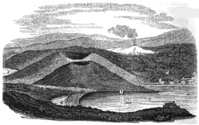
The Phlegræan Fields.
1. Monte Nuovo.
2. Monte Barbaro.
3. Lake Avernus.
4. Lucrine Lake.
5. The Solfatara.
6. Puzzuoli.
7. Bay of Baiæ.
* This representation of the Phlegræan Fields is reduced from part of Plate xxxi. of Sir William Hamilton's great work, "Campi Phlegræi." The faithfulness of his coloured delineations of the scenery of that country cannot be too highly praised.
Volcanos of the Phlegræan Fields.—Immediately adjoining Monte Nuovo is the larger volcanic cone of Monte Barbaro (2. fig. 19.), the Gaurus inanis of Juvenal—an appellation given to it probably from its deep circular crater, which is about a mile in diameter. Large as is this cone, it was probably produced by a single eruption; and it does not, perhaps, exceed in magnitude some of the largest of those formed in Ischia, within the historical era. It is composed chiefly of indurated tufa, like Monte Nuovo, stratified conformably to its conical surface. This hill was once very celebrated for its wines, and is still covered with vineyards; but when the vine is not in leaf it has a sterile appearance, and, late in the year, when seen from the beautiful bay of Baiæ, it often contrasts so strongly in verdure with Monte Nuovo, which is always clothed with arbutus, myrtle, and other wild evergreens, that a stranger might well imagine the cone of older date to be that thrown up in the sixteenth century.*
There is nothing, indeed, so calculated to instruct the geologist as the striking manner in which the recent volcanic hills of Ischia, and that now under consideration, blend with the surrounding landscape. Nothing seems wanting or redundant; every part of the picture is in such perfect harmony with the rest, that the whole has the appearance of having been called into existence by a single effort of creative power. Yet what other result could we have anticipated, if Nature has ever been governed by the same
* Hamilton (writing in 1770) says, "The new mountain produces as yet but a very slender vegetation."—Campi Phlegræi, p. 69. This remark was no longer applicable when I saw it, in 1828.
G 4
laws? Each new mountain thrown up—each new tract of land raised or depressed by earthquakes—should be in perfect accordance with those previously formed, if the entire configuration of the surface has been due to a long series of similar disturbances. Were it true that the greater part of the dry land originated simultaneously in its present state, at some era of paroxysmal convulsion, and that additions were afterwards made slowly and successively during a period of comparative repose; then, indeed, there might be reason to expect a strong line of demarcation between the signs of ancient and modern changes. But the very continuity of the plan, and the perfect identity of the causes, are to many a source of deception; since, by producing a unity of effect, they lead them to exaggerate the energy of the agents which operated in the earlier ages. In the absence of all historical information, they are as unable to separate the dates of the origin of different portions of our continents, as the stranger is to determine, by their physical features alone, the distinct ages of Monte Nuovo, Monte Barbaro, Astroni, and the Solfatara.
The vast scale and violence of the volcanic operations in Campania, in the olden time, has been a theme of declamation, and has been contrasted with the comparative state of quiescence of this delightful region in the modern era. Instead of inferring, from analogy, that the ancient Vesuvius was always at rest when the craters of the Phlegræan Fields were burning,—that each cone rose in succession,—and that many years, and often centuries, of repose intervened between different eruptions,—geologists seem to have generally conjectured that the whole group sprung up from the ground at once, like the soldiers of Cadmus when he
sowed the dragon's teeth. As well might they endeavour to persuade us that on these Phlegræan Fields, as the poets feigned, the giants warred with Jove, ere yet the puny race of mortals were in being.
Modern Eruptions of Vesuvius.—For nearly a century after the birth of Monte Nuovo, Vesuvius continued in a state of tranquillity. There had then been no violent eruption for 492 years; and it appears that the crater was then exactly in the condition of the present extinct volcano of Astroni, near Naples. Bracini, who visited Vesuvius not long before the eruption of 1631, gives the following interesting description of the interior:—"The crater was five miles in circumference, and about a thousand paces deep; its sides were covered with brushwood, and at the bottom there was a plain on which cattle grazed. In the woody parts wild boars frequently harboured. In one part of the plain, covered with ashes, were three small pools, one filled with hot and bitter water, another salter than the sea, and a third hot, but tasteless."* But at length these forests and grassy plains were consumed, being suddenly blown into the air, and their ashes scattered to the winds. In December, 1631, seven streams of lava poured at once from the crater, and overflowed several villages on the flanks and at the foot of the mountain. Resina, partly built over the ancient site of Herculaneum, was consumed by the fiery torrent. Great floods of mud were as destructive as the lava itself,—no uncommon occurrence during these catastrophes; for such is the violence of rains produced by the evolution of aqueous
* Hamilton's Campi Phlegræi, folio, vol. i. p. 62.; and Brieslak, Campanie, tome i. p. 186.
G 5
vapour, that torrents of water descend the cone, and, becoming charged with impalpable volcanic dust, and rolling along loose ashes, acquire sufficient consistency to deserve their ordinary appellation of "aqueous lavas."
A brief period of repose ensued, which lasted only until the year 1666, from which time to the present there has been a constant series of eruptions, with rarely an interval of rest exceeding ten years. During these three centuries no irregular volcanic agency has convulsed other points in this district. Brieslak remarked, that such irregular convulsions had occurred in the Bay of Naples in every second century; as, for example, the eruption of the Solfatara in the twelfth, of the lava of Arso, in Ischia, in the fourteenth, and of Monte Nuovo in the sixteenth: but the eighteenth has formed an exception to this rule, and this seems accounted for by the unprecedented number of eruptions of Vesuvius during that period; whereas, when the new vents opened, there had always been, as we have seen, a long intermittance of activity in the principal volcano.
CHAPTER XI.
VOLCANIC DISTRICT OF NAPLES—continued.
Volcanic District of Naples, continued—Dimensions and structure of the cone of Vesuvius—Dikes in the recent cone (p. 137.)—Section through Vesuvius and Somma—Vesuvian lavas and minerals (p. 141.)—Effects of decomposition of lavas—Alluviums called "aqueous lavas"—Origin and composition of the matter enveloping Herculaneum and Pompeii—Controversies on the subject—Condition and contents of the buried cities (p. 152.)—Small number of Skeletons—State of preservation of animal and vegetable substances—Rolls of Papyrus—Probability of future discoveries of MSS.—Stabiæ (p. 158.)—Torre del Greco—Concluding remarks on the Campanian volcanos.
Structure of the cone of Vesuvius.—BETWEEN the end of the eighteenth century and the year 1822, the great crater of Vesuvius has been gradually filled by lava boiling up from below, and by scoriæ falling from the explosions of minor mouths which were formed at intervals on its bottom and sides. In place of a regular cavity, therefore, there was a rough and rocky plain, covered with blocks of lava and scoriæ, and cut by numerous fissures, from which clouds of vapour were evolved. But this state of things was totally changed by the eruption of October, 1822, when violent explosions, during the space of more than twenty days, broke up and threw out all this accumulated mass, so as to leave an immense gulf or chasm, of an irregular,
G 6
but somewhat elliptical shape, about three miles in circumference when measured along the very sinuous and irregular line of its extreme margin, but somewhat less than three quarters of a mile in its longest diameter, which was directed from N. E. to S. W.* The depth of this tremendous abyss has been variously estimated; for from the hour of its formation it decreased daily by the dilapidation of its sides. It measured, at first, according to the account of some authors, two thousand feet in depth from the extreme part of the existing summit †; but Mr. Scrope, when he saw it, soon after the eruption, estimated its depth at less than half that quantity. More than eight hundred feet of the cone was carried away by the explosions, so that the mountain was reduced in height from about 4200 to 3400 feet. ‡
As we ascend the sloping sides, the volcano appears a mass of loose materials—a mere heap of rubbish, thrown together without the slightest order; but on arriving at the brim of the crater, and obtaining a view of the interior, we are agreeably surprised to discover that the conformation of the whole displays in every part the most perfect symmetry and arrangement. The materials are disposed in regular strata, slightly undulating, appearing, when viewed in front, to be disposed in horizontal planes. But, as we make the circuit of the edge of the crater, and observe the cliffs by which it is encircled projecting or receding in salient or retiring angles, we behold transverse sections
* Account of the Eruption of Vesuvius in October, 1822, by G. P. Scrope, Esq., Journ. of Sci., &c. vol. xv. p. 175.
† Mr. Forbes, Account of Mount Vesuvius, Edin. Journ. of Sci., No. xviii. p. 195. Oct. 1828.
‡ Ibid., p. 194.
of the currents of lava and beds of sand and scoriæ, and recognize their true dip. We then discover that they incline outwards from the axis of the cone, at angles varying from 30° to 45°. The whole cone, in fact, is composed of a number of concentric coatings of alternating lavas, sand, and scoriæ. Every shower of ashes which has fallen from above, and every stream of Java descending from the lips of the crater, have conformed to the outward surface of the hill, so that one conical envelope may be said to have been sucessively folded round another, until the aggregation of the whole mountain was completed. The marked separation into distinct beds results from the different colours and degrees of coarseness in the sands, scoriæ, and lava, and the alternation of these with each other. The greatest difficulty, on the first view, is to conceive how so much regularity can be produced, notwithstanding the unequal distribution of sand and scoriæ, driven by prevailing winds in particular eruptions, and the small breadth of each sheet of lava as it first flows out from the crater.
But on a closer examination, we find that the appearance of extreme uniformity is delusive, for when a number of beds thin out gradually, and at different points, the eye does not without difficulty recognize the termination of any one stratum, but usually supposes it continuous with some other, which at a short distance may lie precisely in the same plane. The slight undulations, moreover, produced by inequalities on the sides of the hill on which the successive layers were moulded, assist the deception. As countless beds of sand and scoriæ constitute the greater part of the whole mass, these may sometimes mantle continuously round the whole cone; and even lava-streams
may be of considerable breadth when first they overflow, and, since in some eruptions a considerable part of the upper portion of the cone breaks down at once, may form a sheet extending as far as the space which the eye usually takes in in a single section.
The high inclination of some of the beds, and the firm union of the particles even where there is evidently no cement, is another striking feature in the volcanic tuffs and breccias, which seems at first not very easy of explanation. But the last great eruption afforded ample illustration of the manner in which these strata are formed. Fragments of lava, scoriæ, pumice, and sand, when they fall at slight distances from the summit, are only half cooled down from a state of fusion, and are afterwards acted upon by the heat from within, and by fumeroles or small crevices in the cone through which hot vapours are disengaged. Thus heated, the ejected fragments cohere together strongly; and the whole mass acquires such consistency in a few days, that fragments cannot be detached without a smart blow of the hammer. At the same time sand and scoriæ, ejected to a greater distance, remain incoherent.*
Sir William Hamilton, in his description of the eruption of 1779, says, that jets of liquid lava, mixed with stones and scoriæ, were thrown up to the height of at least ten thousand feet, having the appearance of a column of fire.† Some of these were directed by the winds towards Ottaiano, and some of them, falling almost perpendicularly, still red-hot and liquid, on Vesuvius, covered its whole cone, part of
* Monticelli and Covelli, Storia di Fenon. del Vesuv., en 1821-2-3.
† Campi Phlegræi.
the mountain of Somma, and the valley between them. The falling matter being nearly as vividly inflamed as that which was continually issuing fresh from the crater, formed with it one complete body of fire, which could not be less than two miles and a half in breadth, and of the extraordinary height above mentioned, casting a heat to the distance of at least six miles around it. Dr. Clarke, also, in his account of the eruption of 1793, says that millions of red-hot stones were shot into the air full half the height of the cone itself, and then bending, fell all round in a fine arch. On another occasion he says that, as they fell, they covered nearly half the cone with fire.
The same author has also described the different appearance of the lava at its source, and at some distance from it, when it had descended into the plains below. At the point where it issued, in 1793, from an arched chasm in the side of the mountain, the vivid torrent rushed with the velocity of a flood. It was in perfect fusion, unattended with any scoriæ on its surface, or any gross materials not in a state of complete solution. It flowed with the translucency of honey, "in regular channels, cut finer than art can imitate, and glowing with all the splendour of the sun."—"Sir William Hamilton," he continues, "had conceived that no stones thrown upon a current of lava would make any impression. I was soon convinced of the contrary. Light bodies, indeed, of five, ten, and fifteen pounds weight made little or no impression even at the source; but bodies of sixty, seventy, and eighty pounds were seen to form a kind of bed on the surface of the lava, and float away with it. A stone of three hundred weight, that had been thrown out by the crater, lay near the source of the
current of lava: I raised it upon one end, and then let it fall in upon the liquid lava; when it gradually sunk beneath the surface, and disappeared. If I wished to describe the manner in which it acted upon the lava, I should say that it was like a loaf of bread thrown into a bowl of very thick honey, which gradually involves itself in the heavy liquid, and then slowly sinks to the bottom.
"The lava, at a small distance from its source, acquires a darker tint upon its surface, is less easily acted upon, and, as the stream widens, the surface, having lost its state of perfect solution, grows harder and harder, and cracks into innumerable fragments of very porous matter, to which they give the name of scoriæ, and the appearance of which has led many to suppose that it proceeded thus from the mountain. There is, however, no truth in this. All lava, at its first exit from its native volcano, flows out in a liquid state, and all equally in fusion. The appearance of the scoriæ is to be attributed only to the action of the external air, and not to any difference in the materials which compose it, since any lava whatever, separated from its channel, and exposed to the action of the external air, immediately cracks, becomes porous, and alters its form. As we proceeded downward, this became more and more evident; and the same lava which at its original source flowed in perfect solution, undivided, and free from encumbrances of any kind, a little farther down had its surface loaded with scoriæ in such a manner, that, upon its arrival at the bottom of the mountain, the whole current resembled nothing so much as a heap of unconnected cinders from an iron-foundry." In another place he says, that "the rivers of lava in the plain resembled a vast heap of cinders, or the scoriæ of an iron-foundry, rolling
slowly along, and falling with a rattling noise over one another."*
It appears that the intensity of the light and heat of the lava varies considerably at different periods of the same eruption, as in that of Vesuvius in 1819 and 1820, when Sir H. Davy remarked different degrees of vividness in the white heat at the point where the lava originated.†
When the expressions "flame" and "smoke" are used in describing volcanic appearances, they must generally be understood in a figurative sense. The clouds of apparent smoke consist usually of aqueous and other vapours, or of that impalpable dust which is formed of finely comminuted volcanic scoriæ. The columns of flame are very rarely if ever derived from inflammable gases, but consist of showers of incandescent or red-hot fragments of lava, illuminated by that vivid light which is emitted from the crater below, where the lava is said to glow with the splendour of the sun.
Dikes in the recent cone, how formed.—The inclined strata, before mentioned, which dip outwards in all directions from the axis of the cone of Vesuvius, are intersected by veins or dikes of compact lava, for the most part in a vertical position. ‡ In 1828 these were seen to be about seven in number, some of them not less than four or five hundred feet in height, and thinning out before they reached the uppermost part of the cone. Being harder than the beds through which they pass, they have decomposed less rapidly, and therefore stand out in relief. §
* Otter's Life of Dr. Clarke.
† Phil. Trans., 1828, p. 241.
‡ See Book 4. chap. 10.
§ When I visited Vesuvius, in Nov. 1828, I was prevented from descending into the crater by the constant ejections then thrown out. I only got sight of three of the dikes; but Signor Monticelli had previously had drawings made of the whole, which he showed me. The veins which I saw were on that side of the cone which is encircled by Somma. In March of the year before mentioned, an eruption began at the bottom of the deep gulf formed in 1822. The ejected matter had filled up nearly one third of the original abyss in November, and the same operation was still in progress, a single black cone being seen at the bottom in almost continual activity. I found the lava of 1822 not yet cool on the north side of the cone, and evolving much beat and vapour from crevices. It was then upwards of six years since it flowed out.
There can be no doubt that these dikes have been produced by the filling up of open fissures with liquid lava; but of the date of their formation we know nothing further than that they are all subsequent to the year 79, and, relatively speaking, that they are more modern than all the lavas and scoriæ which they intersect. A considerable number of the upper strata, not traversed by them, must have been due to later eruptions, if the dikes were filled from below, and if lava rose in them to the surface. That the earthquakes, which almost invariably precede eruptions, occasion rents in the mass is well known; and, in 1822, three months before the lava flowed out, open fissures, evolving hot vapours, were numerous. It is clear that such rents must be injected with melted matter when the column of lava rises, so that the origin of the dikes is easily explained, as also the great solidity and crystalline nature of the rock composing them, which has been-formed by lava cooling slowly under great pressure.
Section through Vesuvius and Somma.—In the annexed diagram (Fig. 20.) it will be seen that, on the side of Vesuvius opposite to that where a portion of
the ancient cone of Somma (a) still remains, is a projection (b) called the Pedamentina, which some have supposed to be part of the circumference of the ancient crater broken down towards the sea, and over the edge of which the lavas of the modern Vesuvius have poured; the axis of the present cone of Vesuvius being, according to Visconti, precisely equidistant from the escarpment of Somma and the Pedamentina. But it has been objected (and not without reason) to this hypothesis, that, if the Pedamentina and the escarp-
Fig. 20.
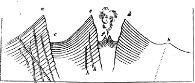
Supposed section of Vesuvius and Somma.
a. Monte Somma, or the remains of the ancient cone of Vesuvius.
b. The Pedamentina, a terrace-like projection, encircling the base of the recent cone of Vesuvius, on the south side.
c. Atrio del Cavallo.*
d, e. Crater left by eruption of 1822.
f. Small cone thrown up in 1828, at the bottom of the great crater.
g, g. Dikes intersecting Somma.
h, h. Dikes intersecting the recent cone of Vesuvius.
* So called from travellers leaving their hones and mules there when they prepare to ascend the cone on foot.
ment of Somma were the remains of the original crater, that crater must have been many miles in diameter, and more enormous than almost any one known on the globe. It is therefore more probable that the ancient mountain was higher than Vesuvius (which, comparatively speaking, is a volcano of no great height), and that the explosions of the year 79 caused it not merely to disgorge the contents of its crater, which had long been choked up, but blew up a great part of the cone itself: so that the wall of Somma, and the ridge or terrace of the Pedamentina, were never the margin of a crater of eruption, but are the relics of a ruined and truncated cone.
It will be seen in the diagram that the slanting beds of the cone of Vesuvius become horizontal in the Atrio del Cavallo (at c), where the base of the new cone meets the precipitous escarpment of Somma; for when the lava flows down to this point, as happened in 1822, its desending course is arrested, and it then runs in another direction along this small valley, circling round the base of the cone. Sand and scoriæ, also, blown by the winds, collect at the base of the cone, and are then swept away by torrents; so that there is always here a flattish plain, as represented. In the same manner the small interior cone (f) must be composed of sloping beds, terminating in a horizontal plain; for, while this monticule was gradually gaining height by successive ejections of lava and scoriæ, in 1828, it was always surrounded by a flat pool of semi-fluid lava, into which scoriæ and sand were thrown.
The escarpment of Somma exhibits a structure precisely similar to that of the cone of Vesuvius, but the beds are intersected by a much greater number of dikes. The formation of this older cone does not be-
long to the historical era, and must not, therefore, be enlarged upon in this place; but I shall have occasion presently to revert to the subject, when speaking of a favourite doctrine of some modern geologists, concerning "craters of elevation" (Erhebungs Crater), whereby, in defiance of analogy, the origin of the identical disposition of the strata and dikes in Vesuvius and Somma has been referred to a mode of operation extremely dissimilar.
Vesuvian Lavas.—The modern lavas of Vesuvius are characterized by a large proportion of augite (or pyroxene.) When they are composed of this mineral and felspar, they may be said to differ in no way in composition from many of the ancient volcanic rocks of Scotland. They are often porphyritic, containing disseminated crystals of augite, leucite, or some other mineral, imbedded in a more earthy base. These porphyritic lavas are often extremely compact, especially in the dikes of Vesuvius and Somma, which, in hardness and specific gravity, are by no means inferior to ordinary veins of trap, and, like them, often preserve a remarkable parallelism in their two opposite faces for considerable distances.*
In regard to the structure of the Vesuvian lavas on a great scale, there are no natural sections of sufficient depth to enable us to draw fair comparisons between them and the products of extinct volcanos. At the fortress near Torre del Greco a section is exposed, fifteen feet in height, of a current which ran into the sea; and it evinces, especially in the lower part, a decided tendency to divide into rude columns. A still more striking example may be seen to the west of Torre
* See Book 4. chap. 10.
del Annunziata, near Forte Scassato, where the mass is laid open by the sea to the depth of twenty feet. In both these cases, however, the rock may rather be said to be divided into numerous perpendicular fissures, than to be prismatic, although the same picturesque effect is produced. In the lava-currents of Central France (those of the Vivarais, in particular), the uppermost portion, often forty feet or more in thickness, is an amorphous mass passing downwards into lava irregularly prismatic; and under this, there is a foundation of regular and vertical columns, but these lavas are often one hundred feet or more in thickness. We can scarcely expect to discover the same phenomenon in the shallow currents of Vesuvius, where the lowest part has cooled more rapidly, although it may be looked for in modern streams in Iceland, which exceed even those of ancient France in volume.
Mr. Scrope mentions that, in the cliffs encircling the modern crater of Vesuvius, he saw many currents offering a columnar division, and some almost as regularly prismatic as any ranges of the older basalts; and he adds, that in some the spheroidal concretionary structure, on a large scale, was equally conspicuous.* Brieslak † also informs us that, in the siliceous lava of 1737, which contains augite, leucite, and crystals of felspar, he found very regular prisms in a quarry near Torre del Greco; an observation confirmed by modern authorities.‡
Effects of decomposition on lavas.—The decomposition of some of the felspathic lavas, either by simple
* Journ. of Sci., vol. xv. p. 177.
† Voy. dans la Campanie, tome i. p. 201.
‡ Mr. Forbes on Mount Vesuvius, Edin. Journ. of Sci., No. xviii., Oct. 1828.
weathering, or by gaseous emanations, converts them from a hard to a soft clayey state, so that they no longer retain the smallest resemblance to rocks cooled down from a state of fusion. The exhalations of sulphuretted hydrogen and muriatic acid, which are disengaged continually from the Solfatara, also produce curious changes on the trachyte of that nearly extinct volcano: the rock is bleached and becomes porous, fissile, and honeycombed, till at length it crumbles into a white siliceous powder.* Numerous globular concretions, composed of concentric laminæ, are also formed by the same vapours in this decomposed rock.†
They who have visited the Phlegræan Fields and the volcanic regions of Sicily, and who are aware of the many problematical appearances which igneous rocks of the most modern origin assume, especially after decomposition, cannot but be astonished at the confidence with which the contending Neptunists and Vulcanists in the last century dogmatized on the origin of certain rocks of remote antiquity. Instead of having laboured to acquire an accurate acquaintance with the aspect of known volcanic rocks, and the transmutations which they undergo subsequently to their first consolidation, the adherents of both parties seem either to have considered themselves born with an intuitive knowledge of the effects of volcanic operations, or to have assumed that they required no other analogies than those which a laboratory or furnace might supply.
Vesuvian Minerals.—A great variety of minerals
* Daubeny on Volcanos, p. 169.
† Scrope, Geol. Trans., second series, vol. ii. p. 346.
are found in the lavas of Vesuvius and Somma; for so many are common to both, that it is unnecessary to separate them. Augite, leucite, felspar, mica, olivine, and sulphur, are most abundant. It is an extraordinary fact, that, in an area of three square miles round Vesuvius, a greater number of simple minerals have been found than in any spot of the same dimensions on the surface of the globe. Häuy enumerated only 380 species of simple minerals as known to him; and no less than eighty-two had been found on Vesuvius before the end of the year 1828.* Many of these are peculiar to that locality. Some mineralogists have conjectured that the greater part of these were not of Vesuvian origin, but thrown up in fragments from some older formation, through which the gaseous explosions burst. But none of the older rocks in Italy, or elsewhere, contain such an assemblage of mineral products; and the hypothesis seems to have been prompted by a disinclination to admit that, in times so recent in the earth's history, the laboratory of Nature could have been so prolific in the creation of new and rare compounds. Had Vesuvius been a volcano of high antiquity, formed when Nature
Wanton'd as in her prime, and played at will
Her virgin fancies,
it would have been readily admitted that these, or a much greater variety of substances, had been sublimed in the crevices of lava, just as several new earthy and metallic compounds are known to have been produced by fumeroles, since the eruption of 1822. But a violent hypothesis appears to have been resorted to,
* Monticelli and Covelli, Prodom. della Mineral. Vesuv.
in order to explain away facts which would imply the unimpaired energy of reproductive causes in our own times.
Formation of Tuffs.—The above remarks apply simply to the structure of the cone; but a small part only of the ejected matter remains so near to the volcanic orifice. A large portion of sand and scoriæ is borne by the winds and scattered over the surrounding plains: part falls into the sea; and still more is swept down by torrents into the deep, during the intervals, often protracted for many centuries, between eruptions. In this case horizontal deposits of tufaceous matter become intermixed with other kinds of sediment, and with shells and corals, so that rocks of a mixed character are formed, such as tuffs, peperinos, and volcanic conglomerates.
Flowing of lava under water.—Some of the lavas, also, of Vesuvius reach the sea, as do those of almost all volcanos; since they are generally in islands, or bordering the coast. Here they find a bottom, often levelled by operations analogous to those which form deltas; so that instead of being highly inclined, as around the cone, or in narrow bands, as in a valley, they may spread out in broad horizontal sheets. It is not improbable, as Dr. Daubeny has suggested, that they retain their fluidity for a considerable time longer beneath the sea than in the open air; for the rapidity with which heated bodies are cooled by being plunged into water arises chiefly from the conversion of the lower portions of water into steam, which steam absorbing much heat immediately ascends, and is reconverted into water. But under the pressure of an ocean sufficiently deep to prevent the formation of steam, the heat of the lava would be carried off more slowly, and
VOL. II. H
only by the circulation of ascending and descending currents of water, those portions nearest the source of heat becoming specifically lighter, and consequently displacing the water above. This kind of circulation would take place with much less rapidity than in the atmosphere, inasmuch as the expansion of water by equal increments of heat is less considerable than that of air.*
Volcanic alluviums.—In addition to the ejections which fall on the cone, and that much greater mass which finds its way gradually to the neighbouring sea, there is a third portion, often of no inconsiderable thickness, composed of alluviums, spread over the valleys and plains at small distances from the volcano. Aqueous vapours are evolved copiously from a crater during eruptions, and often for a long time subsequently to the discharge of scoriæ and lava: these vapours are condensed in the cold atmosphere surrounding the high volcanic peak, and heavy rains are thus caused in countries where, at the same season and under ordinary circumstances, such a phenomenon is entirely unknown. The floods thus occasioned sweep along the impalpable dust and light scoriæ, till a current of mud is produced, which is called, in Campania, "lava d' acqua," and is often more dreaded than an igneous stream (lava di fuoco), from the greater velocity with which it moves. So late as the 27th of October, 1822, one of these alluviums descended the cone of Vesuvius, and, after overspreading much cultivated soil, flowed suddenly into the villages of St. Sebastian and Massa, where, filling the streets and interior of some of the houses, it suffocated seven persons. It will therefore happen very frequently, that,
* See Daubeny's Volcanos, p. 400.
towards the base of a volcanic cone, alternations will be found of lava, alluvium, and showers of ashes.
Mass enveloping Herculaneum and Pompeii.—To which of these two latter divisions the mass enveloping Herculaneum and Pompeii should be referred, has been a question of the keenest controversy; but the discussion might have been shortened, if the combatants had reflected that, whether volcanic sand and ashes were conveyed to the towns by running water, or through the air, during an eruption, the interior of buildings, so long as the roofs remain entire, together with all underground vaults and cellars, could be filled only by an alluvium. We learn from history, that a heavy shower of sand, pumice, and lapilli, sufficiently great to render Pompeii and Herculaneum uninhabitable, fell for eight successive days and nights in the year 79, accompanied by violent rains. We ought, therefore, to find a very close resemblance between the strata covering these towns, and those composing the minor cones of the Phlegræan Fields, accumulated rapidly, like Monte Nuovo, during a continued shower of ejected matter; with this difference however, that the strata incumbent on the cities would be horizontal, whereas those in the cones are highly inclined, and that large angular fragments of rock, which are thrown out near the vent, would be wanting at a distance, where small lapilli only can be found. Accordingly, with these exceptions, no identity can be more perfect than the form and distribution of the matter at the base of Monte Nuovo, as laid open by the encroaching sea, and the appearance of the beds superimposed on Pompeii. That city is covered with numerous alternations of different horizontal beds of tuff and lapilli,
H 2
for the most part thin, and subdivided into very fine layers. I observed the following section near the Amphitheatre, in November, 1828—(descending series).
| Feet. | Inches. | ||
| 1. | Black sparkling sand from the eruption of 1822, containing minute regularly formed crystals of augite and tourmaline, from | 2 to 3* | |
| 2. | Vegetable mould | 3 | 0 |
| 3. | Brown incoherent tuff, full of pisolitic globules in layers, from half an inch to three inches in thickness | 1 | 6 |
| 4. | Small scoriæ and white lapilli | 0 | 3 |
| 5. | Brown earthy tuff, with numerous pisolitic globules | 0 | 9 |
| 6. | Brown earthy tuff, with lapilli divided into layers | 4 | 0 |
| 7. | Layer of whitish lapilli | 0 | 1 |
| 8. | Grey solid tuff | 0 | 3 |
| 9. | Pumice and white lapilli | 0 | 3 |
| 10 | 4 | ||
Many of the ashes in these beds are vitrified and harsh to the touch. Crystals of leucite, both fresh and farinaceous, have been found intermixed.† The depth of the bed of ashes above the houses is variable,
* The last great eruption, in 1822, caused a covering only a few inches thick on Pompeii. Several feet are mentioned by Mr. Forbes.—Ed. Journ. of Science, No. xix. p. 131. Jan. 1829. But he must have measured in spots where it had drifted. The dust and ashes were five feet thick at the top of the crater, and decreased gradually to ten inches at Torre del Annunziata. The size and weight of the ejected fragments diminished very regularly in the same continuous stratum, as the distance from the centre of projection was greater.
† Forbes, ibid. p. 130.
but seldom exceeds twelve or fourteen feet, and it is said that the higher part of the Amphitheatre always projected above the surface; though, if this were the case, it seems inexplicable that the city should never have been discovered till the year 1750. It will be observed, in the above section, that two of the brown half-consolidated tuffs are filled with small pisolitic globules. It is surprising that this circumstance is not alluded to in the animated controversy which the Royal Academy of Naples maintained with one of their members, Signor Lippi, as to the origin of the strata incumbent on Pompeii. The mode of aggregation of these globules has been fully explained by Mr. Scrope, who saw them formed in great numbers, in 1822, by rain falling during the eruption on fine volcanic sand, and sometimes, also, produced like hail in the air, by the mutual attraction of the minutest particles of fine damp sand. Their occurrence, therefore, agrees remarkably well with the account of heavy rain, and showers of sand and ashes, recorded in history, and is opposed to the theory of an alluvium brought from a distance by a flood of water.
Lippi entitled his work, "Fù il fuoco o l' acqua che sotterrò Pompei ed Ercolano?"* and he contended that neither were the two cities destroyed in the year 79, nor by a volcanic eruption, but purely by the agency of water charged with transported matter. His Letters, wherein he endeavoured to dispense, as far as possible, with igneous agency, even at the foot of the volcano, were dedicated, with great propriety, to Werner, and afford an amusing illustration of the polemic style in which geological writers of that day
* Napoli, 1816.
H 3
indulged themselves. His arguments were partly of an historical nature, derived from the silence of contemporary historians, respecting the fate of the cities which, as we have already stated, is most remarkable, and partly drawn from physical proofs. He pointed out with great clearness the resemblance of the tufaceous matter in the vaults and cellars at Herculaneum and Pompeii to aqueous alluviums, and its distinctness from ejections which had fallen through the air. Nothing, he observed, but moist pasty matter could have received the impression of a woman's breast, which was found in a vault at Pompeii, or have given the cast of a statue discovered in the theatre at Herculaneum. It was objected to him, that the heat of the tuff in Herculaneum and Pompeii was proved by the carbonization of the timber, corn, papyrus-rolls, and other vegetable substances there discovered: but Lippi replied with truth, that the papyri would have been burnt up, if they had come in contact with fire, and that their being only carbonized was a clear demonstration of their having been enveloped, like fossil wood, in a sediment deposited from water. The Academicians, in their report on his pamphlet, assert, that when the Amphitheatre was first cleared out, the matter was arranged, on the steps, in a succession of concave layers, accommodating themselves to the interior form of the building, just as snow would lie if it had fallen there. This observation is highly interesting, and points to the difference between the stratification of ashes in an open building, and of mud derived from the same in the interior of edifices and cellars. Nor ought we to call the allegation in question, because it could not be substantiated at the time of the controversy, after the matter had been all removed;
although Lippi took advantage of this removal, and met the argument of his antagonists by requiring them to prove the fact.
Pompeii not destroyed by lava.—There is decisive evidence that no stream of lava has ever reached Pompeii since it was first built, although the foundations of the town stand upon the old leucitic lava of Somma; several streams of which, with tuff interposed, have been cut through in excavations. At Herculaneum the case is different, although the substance which fills the interior of the houses and the vaults must have been introduced in a state of mud, like that found in similar situations in Pompeii; yet the superincumbent mass differs wholly in composition and thickness. Herculaneum was situated several miles nearer to the volcano, and has, therefore, been always more exposed to be covered, not only by showers of ashes, but by alluviums and streams of lava. Accordingly, masses of both have accumulated on each other above the city, to a depth of nowhere less than 70, and in many places of 112 feet.*
The tuff which envelopes the buildings consists of comminuted volcanic ashes, mixed with pumice. A mask imbedded in this matrix has left a cast, the sharpness of which was compared by Hamilton to those in plaster of Paris; nor was the mask in the least degree scorched, as if it had been imbedded in heated matter. This tuff is porous; and, when first excavated, is soft and easily worked, but acquires a considerable degree of induration on exposure to the air. Above this lowest stratum is placed, according to
* Hamilton's Observations on Mount Vesuvius, p. 94. London, 1774.
H 4
Hamilton, "the matter of six eruptions," each separated from the other by veins of good soil. In these soils Lippi states that he collected a considerable number of land shells—an observation which is no doubt correct; for many snails burrow in soft soils, and some Italian species descend, when they hybernate, to the depth of five feet and more from the surface. Della Torre also informs us that there is in one part of this superimposed mass a bed of true siliceous lava (lava di pietra dura); and, as no such current is believed to have flowed till near one thousand years after the destruction of Herculaneum, we must conclude, that the origin of a large part of the covering of Herculaneum was long subsequent to the first inhumation of the place. That city, as well as Pompeii, was a seaport. Herculaneum is still very near the shore, but a tract of land, a mile in length, intervenes between the borders of the Bay of Naples and Pompeii. In both cases the gain of land is due to the filling up of the bed of the sea with volcanic matter, and not to elevation by earthquakes, for there has been no change in the relative level of land and sea. Pompeii stood on a slight eminence composed of the lavas of the ancient Vesuvius, and flights of steps led down to the water's edge. The lowermost of these steps are said to be still on an exact level with the sea.
Condition and contents of the buried cities.—After these observations on the nature of the strata enveloping and surrounding the cities, we may proceed to consider their internal condition and contents, so far at least as they offer facts of geological interest. Notwithstanding the much greater depth at which Herculaneum was buried, it was discovered before Pompeii, by the accidental circumstance of a well being sunk,
in 1713, which came right down upon the theatre, where the statues of Hercules and Cleopatra were soon found. Whether this city or Pompeii, both of them founded by Greek colonies, was the most considerable, is not yet determined; but both are mentioned by ancient authors as among the seven most flourishing cities in Campania. The walls of Pompeii were three miles in circumference; but we have, as yet, no certain knowledge of the dimensions of Herculaneum. In the latter place the theatre alone is open for inspection; the Forum, Temple of Jupiter, and other buildings, having been filled up with rubbish as the workmen proceeded, owing to the difficulty of removing it from so great a depth below ground. Even the theatre is only seen by torchlight, and the most interesting information, perhaps, which the geologist obtains there, is the continual formation of stalactite in the galleries cut through the tuff; for there is a constant percolation of water charged with carbonate of lime mixed with a small portion of magnesia. Such mineral waters must, in the course of time, create great changes in many rocks; especially in lavas, the pores of which they may fill with calcareous spar, so as to convert them into amygdaloids. Some geologists, therefore, are unreasonable when they expect that volcanic rocks of remote eras should accord precisely with those of modern date; since it is obvious that many of those produced in our own time will not long retain the same aspect and internal composition.
Both at Herculaneum and Pompeii, temples have been found with inscriptions commemorating the rebuilding of the edifices after they had been thrown
H 5
down by an earthquake.* This earthquake happened hi the reign of Nero, sixteen years before the cities were overwhelmed. In Pompeii, one fourth of which is now laid Open to the day, both the public and private buildings bear testimony to the catastrophe. The walls are rent, and in many places traversed by fissures still open. Columns are lying on the ground only half hewn from huge blocks of travertin, and the temple for which they were designed is seen half repaired. In some few places the pavement had sunk in, but in general it was undisturbed, consisting of large irregular flags of lava joined neatly together, in which the carriage wheels have often worn ruts an inch and a half deep. In the wider streets, the ruts are numerous and irregular; in the narrower, there are only two, one on each side, which are very conspicuous. It is impossible not to look with some interest even on these ruts, which were worn by chariot wheels more than seventeen centuries ago; and, independently of their antiquity, it is remarkable to see such deep incisions so continuous in a stone of great hardness. We observe nothing of the kind in the oldest pavements of modern cities.
Small number of skeletons.— A very small number of skeletons have been discovered in either city; and it is clear that most of the inhabitants not only found time to escape, but also to carry with them the principal part of their valuable effects. In the barracks at Pompeii were the skeletons of two soldiers chained to the stocks, and in the vaults of a country-house in the suburbs were the skeletons of seventeen persons, who
* Swinburne and Lalande. Paderni, Phil. Trans. 1758, vol. 1. p. 619.
appear to have fled there to escape from the shower of ashes. They were found inclosed in an indurated tuff, and in this matrix was preserved a perfect cast of a woman, perhaps the mistress of the house, with an infant in her arms. Although her form was imprinted on the rock, nothing but the bones remained. To these a chain of gold was suspended, and on the fingers of the skeleton were rings with jewels. Against the sides of the same vault was ranged a long line of earthen amphoræ.
The writings scribbled by the soldiers on the walls of their barracks, and the names of the owners of each house written over the doors, are still perfectly legible. The colours of fresco paintings on the stuccoed walls in the interior of buildings are almost as vivid as if they were just finished. There are public fountains decorated with shells laid out in patterns in the same fashion as those now seen in the town of Naples; and in the room of a painter, who was perhaps a naturalist, a large collection of shells was found, comprising a great variety of Mediterranean species, in as good a state of preservation as if they had remained for the same number of years in a museum. A comparison of these remains with those found so generally in a fossil state would not assist us in obtaining the least insight into the time required to produce a certain degree of decomposition or mineralization; for, although, under favourable circumstances, much greater alteration might doubtless have been brought about in a shorter period, yet the example before us shows that an inhumation of seventeen centuries may sometimes effect nothing towards the reduction of shells to the state in which fossils are usually found.
The wooden beams in the houses at Herculaneum
H 6
are black on the exterior, but when cleft open they appear to be almost in the state of ordinary wood, and the progress made by the whole mass towards the state of lignite is scarcely appreciable. Some animal and vegetable substances of more perishable kinds have of course suffered much change and decay, yet the state of conservation of these is truly remarkable. Fishing-nets are very abundant in both cities, often quite entire; and their number at Pompeii is the more interesting from the sea being now, as we stated, a mile distant. Linen has been found at Herculaneum, with the texture well defined; and in a fruiterer's shop in that city were discovered vessels full of almonds, chestnuts, walnuts, and fruit of the "carubiere," all distinctly recognizable from their shape. A loaf, also, still retaining its form, was found in a baker's shop, with his name stamped upon it. On the counter of an apothecary was a box of pills converted into a fine earthy substance; and by the side of it a small cylindrical roll, evidently prepared to be cut into pills. By the side of these was a jar containing medicinal herbs. In 1827, moist olives were found in a square glass case, and "caviare," or roe of a fish, in a state of wonderful preservation. An examination of these curious condiments has been published by Covelli, of Naples, and they are preserved hermetically sealed in the museum there.*
Papyri.—There is a marked difference in the condition and appearance of the animal and vegetable substances found in Pompeii and Herculaneum; those of Pompeii being penetrated by a grey pulverulent tuff, those in Herculaneum seeming to have been first
* Mr. Forbes, Edin, Journ. of Sci., No. xix. p. 130, Jan. 1829.
enveloped by a paste which consolidated round them, and then allowed them to become slowly carbonized. Some of the rolls of papyrus at Pompeii still retain their form; but the writing, and indeed almost all the vegetable matter, appear to have vanished, and to have been replaced by volcanic tuff some what pulverulent. At Herculaneum the earthy matter has scarcely ever penetrated; and the vegetable substance of the papyrus has become a thin friable black matter, almost resembling in appearance the tinder which remains when stiff paper has been burnt, in which the letters may still be sometimes traced. The small bundles of papyri, composed of five or six rolls tied up together, had sometimes lain horizontally, and were pressed in that direction, but sometimes they had been placed in a vertical position. Small tickets were attached to each bundle, on which the title of the work was inscribed. In one case only have the sheets been found with writing on both sides of the pages. So numerous are the obliterations and corrections, that many must have been original manuscripts. The variety of handwritings is quite extraordinary: nearly all are written in Greek, but there are a few in Latin. They were almost all found in a suburban villa in the library of one private individual; and the titles of four hundred of those least injured, which have been read, are found to be unimportant works, but all entirely new, chiefly relating to music, rhetoric, and cookery. There are two volumes of Epicurus "On Nature," and the others are mostly by writers of the same school, only one fragment having been discovered, by an opponent of the Epicurean system, Chrysippus.*
* In one of the manuscripts which was in the hands of the interpreters when I visited the museum, the author indulges in the speculation that all the Homeric personages were allegorical—that Agamemnon, was the ether, Achilles the sun, Helen the earth, Paris the air, Hector the moon, &c.
Probability of future discoveries of MSS.—In the Opinion of some antiquaries, not one-hundreth part of the city has yet been explored; and the quarters hitherto cleared out, at a great expense, are those where there was the least probability of discovering manuscripts. As Italy could already boast her splendid Roman amphitheatres and Greek temples, it was a matter of secondary interest to add to their number those in the dark and dripping galleries of Herculaneum; and having so many of the masterpieces of ancient art, we could have dispensed with the inferior busts and statues which could alone have been expected to reward our researches in the ruins of a provincial town. But from the moment that it was ascertained that rolls of papyrus preserved in this city could still be deciphered, every exertion ought to have been steadily and exclusively directed towards the discovery of other libraries. Private dwellings should have been searched, before so much labour and expense were consumed in examining public edifices. A small portion of that zeal and enlightened spirit which prompted the late French and Tuscan expedition to Egypt might, long ere this, in a country nearer home, have snatched from oblivion some of the lost works of the Augustan age, or of eminent Greek historians and philosophers. A single roll of papyrus might have disclosed more matter of intense interest than all that was ever written in hieroglyphics.*
* During my stay at Naples, in 1828, the Neapolitan government, after having discontinued operations for many years, cleared out a small portion of Herculaneum, near the sea, where the covering was least thick. After this expense had been incurred, it was discovered that the whale of the ground had been previously examined, near a century before, by the French Prince d'Elbœuf, who had removed every thing of value! Such is the want of system with which operations have always been, and still are, carried on here, that we may expect similar blunders to be made continually.
Stabiæ—Besides the cities already mentioned, Stabiæ, a small town about six miles from Vesuvius, and near the site of the modern Castel-a-Mare (see map of volcanic district of Naples), was overwhelmed during the eruption Of 79. Pliny mentions that, when his uncle was there, he was obliged to make his escape, so great was the quantity of falling stones and ashes. In the ruins of this place, a few skeletons have been found buried in volcanic ejections, together with some antiquities of no great value, and rolls of papyrus, which, like those of Pompeii, were illegible.
Torre del Greco overflowed by lava.—Of the towns hitherto mentioned, Herculaneum alone has been overflowed by a stream of melted matter; but this did not, as we have seen, enter or injure the buildings which were previously enveloped or covered over with tuff. But burning torrents have often taken their course through the streets of Torre del Greco, and consumed or inclosed a large portion of the town in solid rock. It seems probable that the destruction of three thousand of its inhabitants, in 1631, which some accounts attribute to boiling water, was principally due to one of those alluvial floods which we before mentioned: but, in 1737, the lava itself flowed through the eastern side of the town, and afterwards reached the sea; and, in
1794, another current, rolling over the western side, filled the streets and houses, and killed more than four hundred persons. The main street is now quarried through this lava, which supplied building-stones for new houses erected where others had been annihilated The church was half buried in a rocky mass, but the upper portion served as the foundation of a new edifice.
The number of the population at present is estimated at fifteen thousand; and a satisfactory answer may readily be returned to those who inquire how the inhabitants can be so "inattentive to the voice of time and the warnings of Nature*," as to rebuild their dwellings on a spot so often devastated. No neighbouring site unoccupied by a town, or which would not be equally insecure, combines the same advantages of proximity to the capital, to the sea, and to the rich lands on the flanks of Vesuvius. If the present population were exiled, they would immediately be replaced by another, for the same reason that the Maremma of Tuscany and the Campagna di Roma will never be depopulated, although the malaria fever commits more havoc in a few years than the Vesuvian lavas in as many centuries. The district around Naples supplies one, amongst innumerable examples, that those regions where the surface is most frequently renewed, and where the renovation is accompanied, at different intervals of time, by partial destruction of animal and vegetable life, may nevertheless be amongst the most habitable and delightful on our globe.
I have already made a similar remark when speaking of tracts where aqueous causes are now most active; and the observation applies as well to parts
* Sir H. Davy, Consolations in Travel, p. 66.
of the surface which are the abode of aquatic animals, as to those which support terrestrial species. The sloping sides of Vesuvius give nourishment to a vigorous and healthy population of about eighty thousand souls; and the surrounding hills and plains, together with several of the adjoining isles, owe the fertility of their soil to matter ejected by prior eruptions. Had the fundamental limestone of the Apennines remained uncovered throughout the whole area, the country could not have sustained a twentieth part of its present inhabitants. This will be apparent to every geologist who has marked the change in the agricultural character of the soil the moment he has passed the utmost boundary of the volcanic ejections, as when, for example, at the distance of about seven miles from Vesuvius, he leaves the plain and ascends the declivity of the Sorrentine Hills.
Concluding remarks.—Yet favoured as this region has been by Nature from time immemorial, the signs of the changes imprinted on it during the period that it has served as the habitation of man may appear in after-ages to indicate a series of unparalleled disasters. Let us suppose that at some future time the Mediterranean should form a gulf of the great ocean, and that the tidal current should encroach on the shores of Campania, as it now advances upon the eastern coast of England; the geologist will then behold the towns already buried, and many more which will evidently be entombed hereafter, laid open in the steep cliffs, where he will discover buildings superimposed above each other, with thick intervening strata of tuff or lava—some unscathed by fire, like those of Herculaneum and Pompeii; others half melted down, as in Torre del Greco; and many shattered and thrown
about in strange confusion, as in Tripergola. Among the ruins will be seen skeletons of men, and impressions of the human form stamped in solid rocks of tuff. Nor will the signs of earthquakes be wanting. The pavement of part of the Domitian Way, and the Temple of the Nymphs, submerged at high tide, will be uncovered at low water, the columns remaining erect and uninjured. Other temples which had once sunk down, like that of Serapis, will be found to have been upraised again by subsequent movements. If they who study these phenomena, and speculate on their causes, assume that there were periods when the laws of Nature differed from those established in their own time, they will scarcely hesitate to refer the wonderful monuments in question to those primeval ages When they consider the numerous proofs of reiterated catastrophes to which the region was subject, they may, perhaps, commiserate the unhappy fate of beings condemned to inhabit a planet during its nascent and chaotic state, and feel grateful that their favoured race has escaped such scenes of anarchy and misrule.
Yet what was the real condition of Campania during those years of dire convulsion? "A climate where heaven's breath smells sweet and wooingly—a vigorous and luxuriant nature unparalleled in its productions—a coast which was once the fairy land of poets, and the favourite retreat of great men. Even the tyrants of the creation loved this alluring region, spared it, adorned it, lived in it, died in it."* The inhabitants, indeed, have enjoyed no immunity from the calamities which are the lot of mankind; but the principal evils which they have suffered must be attributed to moral, not to physical, causes—to disastrous events over
* Forsyth's Italy, vol. ii.
which man might have exercised a control, rather than to the inevitable catastrophes which result from subterranean agency. When Spartacus encamped his army of ten thousand gladiators in the old extinct crater of Vesuvius, the volcano was more justly a subject of terror to Campania, than it has ever been since the rekindling of its fires.
CHAPTER XII.
ETNA—SKAPTAR JOKUL—JORULLO.
External physiognomy of Etna—Lateral cones—Their successive obliteration—Early eruptions of Etna—Monti Rossi in 1669—Great Fissure of S. Lio—Towns overflowed by lava—Part of Catania destroyed (p. 171.)—Mode of advance of a current of lava—Excavation of a church under lava—Subterranean caverns—Linear direction of cones formed in 1811 and 1819—Flood produced in 1755 by the melting of snow during an eruption—A glacier covered by lava on Etna—Volcanic eruptions in Iceland (p. 179.)—New island thrown up in 1783—Lava currents of Skaptár Jokul in same year—Their immense volume—Eruption of Jorullo in Mexico (p. 186.)—Humboldt's Theory of the convexity of the Plain of Malpais.
External physiognomy of the cone.—HAVING entered into a detailed historical account of the changes in the volcanic district round Naples, I shall allude in a more cursory manner to some of the circumstances of principal interest in the history of other volcanic mountains. After Vesuvius, our most authentic records relate to Etna, which rises near the sea in solitary grandeur to the height of nearly eleven thousand feet,*
* In 1815, Captain Smyth ascertained, trigonometrically, that the height of Etna was 10,874 feet. The Catanians, disappointed that their mountain had lost nearly 2000 feet of the height assigned to it by Recupero, refused to acquiesce in the decision. Afterwards, in 1824, Sir J. Herschel, not being aware of Captain Smyth's conclusions, determined, by careful barometrical measurement, that the height was 10,872½ feet. This singular agreement of results so differently obtained was spoken of by Herschel as "a happy accident;" but Dr. Wollaston remarked that "it was one of those accidents which would not have happened to two fools."
the mass being chiefly composed of volcanic matter ejected above the surface of the water. The base of the cone is almost circular, and eighty-seven English miles in circumference; but if we include the whole district over which its lavas extend, the circuit is probably twice that extent.
Divided into three regions.—The cone is divided by nature into three distinct zones, called the fertile, the woody, and the desert regions. The first of these, comprising the delightful country around the skirts of the mountain, is well cultivated, thickly inhabited, and covered with olives, vines, corn, fruit-trees, and aromatic herbs. Higher up, the woody region encircles the mountain—an extensive forest, six or seven miles in width, affording pasturage for numerous flocks. The trees are of various species, the chestnut, oak, and pine being most luxuriant; while in some tracts are groves of cork and beech. Above the forest is the desert region, a waste of black lava and scoriæ; where, on a kind of plain, rises the cone to the height of about eleven hundred feet, from which sulphureous vapours are continually evolved. The most grand and original feature in the physiognomy of Etna is the multitude of minor cones which are distributed over its flanks, and which are most abundant in the woody region. These, although they appear but trifling irregularities when viewed from a distance as subordinate parts of so imposing and colossal a mountain,
would, nevertheless, he deemed hills considerable altitude in almost any other region.
Cones produced by lateral eruptions.—Without enumerating numerous monticules of ashes thrown out at different points, there are about eighty of these secondary volcanos, of considerable dimensions; fifty-two on the west and north, and twenty-seven on the east side of Etna. One of the largest, called Monte Minardo, near Bronte, is upwards of 700 feet in height, and a double hill near Nicolosi, called Monti Rossi, formed in 1669, is 450 feet high, and the base two miles in circumference; so that it somewhat exceeds in size Monte Nuovo, before described. Yet it rank only as a cone of the second magnitude amongst those produced by the lateral eruptions of Etna. On looking down from the lower borders of the desert region, these volcanos present us with one of the most delightful and characteristic scenes in Europe. They afford every variety of height and size, and are arranged in beautiful and picturesque groups. However uniform they may appear when seen from the sea, or the plains below, nothing can be more diversified than their shape when we look from above into their craters, one side of which is generally broken down. There are, indeed, few objects in nature more picturesque than a wooded volcanic crater. The cones situated in the higher parts of the forest zone are chiefly clothed with lofty pines; while those at a lower elevation are adorned with chestnuts, oak, beech, and holm.
Successive obliteration of these cones.—The history of the eruptions of Etna, imperfect and interrupted as it is, affords, nevertheless, a full insight into the manner in which the whole mountain has successively attained its present magnitude and internal structure. The
principal cone has more than once fallen in and been reproduced. In 1444 it was 320 feet high, and fell in after the earthquakes of 1537. In the year 1693, when a violent earthquake shook the whole of Sicily, and killed sixty thousand persons, the cone lost so much of its height, says Boccone, that it could not be seen from several places in Valdemone, from which it was before visible. The greater number of eruptions happen either from the great crater, or from lateral openings in the desert region. When hills are thrown up in the middle zone, and project beyond the general level, they gradually lose their height during subsequent eruptions; for when lava runs down from the upper parts of the mountain, and encounters any of these hills, the stream is divided, and flows round them so as to elevate the gently sloping grounds from which they rise. In this manner a deduction is often made at once of twenty or thirty feet, or even more, from their height. Thus, one of the minor cones, called Monte Peluso, was diminished in altitude by a great lava stream which encircled it in 1444; and another current has recently taken the same course—yet this hill still remains four or five hundred feet high.
There is a cone called Monte Nucilla, near Nicolosi, round the base of which several successive currents have flowed, and showers of ashes have fallen, since the time of history, till at last, during an eruption in 1536, the surrounding plain was so raised, that the top of the cone alone was left projecting above the general level. Monte Nero, situated above the Grotta dell' Capre, was in 1766 almost submerged by a current; and Monte Capreolo afforded, in the year 1669, a curious example of one of the last stages of obliteration: for a lava stream, descending on a high ridge
which had been built up by the continued superposition of successive lavas, flowed directly into the crater, and nearly filled it. The lava, therefore, of each new lateral cone tends to detract from the relative height of lower cones above their base: so that the flanks of Etna, sloping with a gentle inclination, envelop in succession a great multitude of minor volcanos, while new ones spring up from time to time; and this has given to the older parts of the mountain, as seen in some sections two or three thousand feet perpendicular, a complex and highly interesting internal structure.
Early eruptions of Etna.—Etna appears to have been in activity from the earliest times of tradition; for Diodorus Siculus mentions an eruption which caused a district to be deserted by the Sicani before the Trojan war. Thucydides informs us*, that in the sixth year of the Peloponnesian war, or in the spring of the year 425 B.C., a lava stream ravaged the environs of Catania, and this, he says, was the third eruption which had happened in Sicily since the colonization of that island by the Greeks. The second of the three eruptions alluded to by the historian took place in the year 475 B.C., and was that so poetically described by Pindar, two years afterwards, in his first Pythian ode:—
κιων
Δ'оυρανια συνεхει
Nιфоεσσ' Aillegτνα,
πανετεѕ
Xιоνоѕ ỏειαѕ τιθηνα.
In these and the seven verses which follow, a graphic description is given of Etna, such as it appeared five centuries before the Christian era, and such as it
* Book iii., at the end.
has been seen when in eruption in modern times. The poet is only making a passing allusion to the Sicilian volcano, as the mountain under which Typhœus lay buried, yet by a few touches of his master hand every striking feature of the scene has been faithfully pourtrayed. We are told of "the snowy Etna, the pillar of heaven,—the nurse of everlasting frost, in whose deep caverns lie concealed the fountains of unapproachable fire—a stream of eddying smoke by day—a bright and ruddy flame by night; and burning rocks rolled down with loud uproar into the sea."
Eruption of 1669—Monti Rossi formed.—The great eruption which happened in the year 1669 is the first which claims particular attention. An earthquake had levelled to the ground all the houses in Nicolosi, a town situated near the lower margin of the woody region, about twenty miles from the summit of Etna, and ten from the sea at Catania. Two gulphs then opened near that town, from whence sand and scoriæ were thrown up in such quantity, that, in the course of three or four months, a double cone was formed, called Monti Rossi, about 450 feet high. But the most extraordinary phenomenon occurred at the commencement of the convulsion in the, plain of S. Lio. A fissure six feet broad, and of unknown depth, opened with a loud crash, and ran in a somewhat tortuous course to within a mile of the summit of Etna. Its direction was from north to south, and its length twelve miles. It emitted a most vivid light. Five other parallel fissures of considerable length afterwards opened one after the other, and emitted smoke, and gave out bellowing sounds which were heard at the distance of
VOL. II. I
Fig. 21.
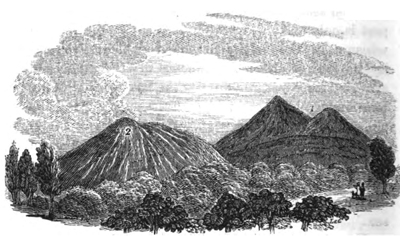
Minor cones on the flanks of Etna.
1. Monti Rossi, near Nicolosi, formed in 1669.
2. Vampeluso?*
forty miles. This case seems to present the geologist with an illustration of the manner in which those continuous dikes of vertical porphyry were formed which are seen to traverse some of the older lavas of Etna; for the light emitted from the great rent of S. Lio appears to indicate that the fissure was filled to a certain height with incandescent lava, probably to the height of an orifice not far distant from Monti Rossi, which at that time opened and poured out a lava current. When the melted matter in such a rent has cooled, it must become a solid wall or dike, intersecting the older rocks of which the mountain is composed.
The lava current above alluded to soon reached in its
* The hill which I have here introduced was called by my guide Vampolara, but the name given in the text is the nearest to this which I find in Gemmellaro's Catalogue of Minor Cones.
course a minor cone called Mompiliere, at the base of which it entered a subterranean grotto, communicating with a suite of those caverns which are so common in the lavas of Etna. Here it appears to have melted down some of the vaulted foundations of the hill, so that the whole of that cone became slightly depressed and traversed by numerous open fissures.
Part of Catania destroyed.—The lava, after overflowing fourteen towns and villages, some having a population of between three and four thousand inhabitants, arrived at length at the walls of Catania. These had been purposely raised to protect the city; but the burning flood accumulated till it rose to the top of the rampart, which was sixty feet in height, and then it fell in a fiery cascade and overwhelmed part of the city. The wall, however, was not thrown down, but was discovered long afterwards, by excavations made in the rock by the Prince of Biscari; so that the traveller may now see the solid lava curling over the top of the rampart as if still in the very act of falling.
This great current had performed a course of fifteen miles before it entered the sea, where it was still six hundred yards broad, and forty feet deep. It covered some territories in the environs of Catania, which had never before been visited by the lavas of Etna. While moving on, its surface was in general a mass of solid rock; and its mode of advancing, as is usual with lava streams, was by the occasional fissuring of the solid walls. A gentleman of Catania, named Pappalardo, desiring to secure the city from the approach of the threatening torrent, went out with a party of fifty men whom he had dressed in skins to protect them from the heat, and armed with iron crows and hooks. They broke open one of the solid walls which flanked
I 2
the current near Belpasso, and immediately forth issued a rivulet of melted matter which took the direction of Paternò; but the inhabitants of that town, being alarmed for their safety, took up arms and put a stop to farther operations.*
As another illustration of the solidity of the walls of an advancing lava stream, I may mention an adventure related by Recupero, who, in 1766, had ascended a small hill formed of ancient volcanic matter, to behold the slow and gradual approach of a fiery current, two miles and a half broad; when suddenly two small threads of liquid matter issuing from a crevice detached themselves from the main stream, and ran rapidly towards the hill. He and his guide had just time to escape, when they saw the hill, which was fifty feet in height, surrounded, and in a quarter of an hour melted down into the burning mass, so as to flow on with it.
But it must not be supposed that this complete fusion of rocky matter coming in contact with lava is of universal, or even common, occurrence. It probably happens when fresh portions of incandescent matter come successively in contact with fusible materials. In many of the dikes which intersect the tuffs and lavas ef Etna, there is scarcely any perceptible alteration effected by heat on the edges of the horizontal beds, in contact with the vertical and more crystalline mass. On the site of Mompiliere, one of the towns overflowed in the great eruption above described, an excavation was made in 1704; and by immense labour the workmen reached, at the depth of thirty-five feet, the gate of the principal church, where there were three statues, held in high veneration. One of these, together with
* Ferrara, Descriz. dell' Etna, p. 108.
a bell, some money, and other articles, were extracted in a good state of preservation from beneath a great arch formed by the lava. It seems very extraordinary that any works of art, not encased with tuff, like those in Herculaneum, should have escaped fusion in hollow spaces left open in this lava current, which was so hot at Catania eight years after it entered the town, that it was impossible to hold the hand in some of the crevices.
Subterranean caverns on Etna.—Mention was made of the entrance of a lava stream into a subterranean grotto, whereby the foundations of a hill were partially undermined. Such underground passages are among the most curious features on Etna, and appear to have been produced by the hardening of the lava, during the escape of great volumes of elastic fluids, which are often discharged for many days in succession, after the crisis of the eruption is over. Near Nicolosi, not far from Monti Rossi, one of these great openings may be seen, called the Fossa della Palomba, 625 feet in circumference at its mouth, and seventy-eight deep. After reaching the bottom of this, we enter another dark cavity, and then others in succession, sometimes descending precipices by means of ladders. At length the vaults terminate in a great gallery ninety feet long, and from fifteen to fifty broad, beyond which there is still a passage, never yet explored; so that the extent of these caverns remains unknown.* The walls and roofs of these great vaults are composed of rough and bristling scoriæ, of the most fantastic forms.
Eruption of 1811.—I shall now proceed to offer some observations on the two last eruptions in 1811
* Ferrara, Descriz. dell' Etna. Palermo, 1818.
I 3
and 1819.* It appears, from the relation of Signor Gemmellaro, who witnessed the phenomena, that the great crater in 1811 first testified, by its loud detonations, that the lava had ascended to near the summit of the mountain. A violent shock was then felt, and a stream broke out from the side of the cone, at no great distance from its apex. Shortly after this had ceased to flow, a second stream burst forth at another opening, considerably below the first; then a third still lower, and so on till seven different issues had been thus successively formed, all lying upon the same straight line. It has been supposed that this line was a perpendicular rent in the internal framework of the mountain, which rent was probably not produced at one shock, but prolonged successively downwards, by the lateral pressure and intense heat of the internal column of lava, as it subsided by gradual discharge through each vent.†
Eruption of 1819.—In 1819 three large mouths or caverns opened very near those which were formed in the eruptions of 1811, from which flames, red-hot cinders, and sand, were thrown up with loud explosions. A few minutes afterwards another mouth opened below, from which flames and smoke issued; and finally a fifth, lower still, whence a torrent of lava flowed, which spread itself with great velocity over the deep and broad valley called "Val del Bove." This stream flowed two miles in the first twenty-four hours, and nearly as far in the succeeding day and night.
* Since this was written for the 1st edition of this work, another eruption has occurred. In 1832, the lava flowed down on the west side of Etna to within two miles of Bronte.
† Scrope on Volcanos, p. 153.
The three original mouths at length united into one large crater, and sent forth lava, as did the inferior apertures, so that an enormous torrent poured down the "Val del Bove." When it arrived at a vast and almost perpendicular precipice, at the head of the valley of Calanna, it poured over in a cascade, and, being hardened in its descent, made an inconceivable crash as it was dashed against the bottom. So immense was the column of dust raised by the abrasion of the tufaceous hill over which the hardened mass descended, that the Catanians were in great alarm, supposing a new eruption to have burst out in the woody region, exceeding in violence that near the summit of Etna.
Mode of advance of the lava.— Of the cones thrown up during this eruption, not more than two are of sufficient magnitude to be numbered among those eighty which were before described as adorning the flanks of Etna. The surface of the lava which deluged the "Val del Bove" consists of rocky and angular blocks, tossed together in the utmost disorder. Nothing can be more rugged, or more unlike the smooth and even superficies which those who are unacquainted with volcanic countries may have pictured to themselves, in a mass of matter which had consolidated from a liquid state. Mr. Scrope observed this current in the year 1819, slowly advancing down a considerable slope, at the rate of about a yard an hour, nine months after its first emission. The lower stratum being arrested by the resistance of the ground, the upper or central part gradually protruded itself, and being unsupported fell down. This in its turn was covered by a mass of more liquid lava, which swelled over it from above. The current had all the appearance of a huge heap of
I 4
rough and large cinders rolling over and over upon itself by the effect of an extremely slow propulsion from behind. The contraction of the crust as it solidified, and the friction of the scoriform cakes against one another, produced a crackling sound. Within the crevices a dull red heat might be seen by night, and vapour issuing in considerable quantity was visible by day.*
Flood produced by the melting of snow by lava.—The erosive and transporting power of running water is rarely exerted on Etna with great force, the rain which falls being immediately imbibed by the porous lavas; so that, vast as is the extent of the mountain, it feeds only a few small rivulets, and these, even, are dry throughout the greater portion of the year. The enormous rounded boulders, therefore, of trachyte and basalt, a line of which can be traced from the sea, from near Giardini, by Mascali, and Zafarana, to the "Val del Bove," would offer a perplexing problem to the geologist, if history had not preserved the memorials of a tremendous flood which happened in this district in the year 1755. It appears that two streams of lava flowed in that year, on the 2nd of March, from the highest crater: they were immediately precipitated upon an enormous mass of snow, which then covered the whole mountain, and was extremely deep near the summit. The sudden melting of this frozen mass, by a fiery torrent three miles in length, produced a frightful inundation, which devastated the sides of the mountain for eight miles in length, and afterwards covered the lower flanks of Etna, where they were less steep, together with the plains near the sea, with great deposits of sand, scoriæ, and blocks of lava.
* Scrope on Volcanos, p. 102.
Many absurd stories circulated in Sicily respecting this event, such as that the water was boiling, and that it was vomited from the highest crater; that it was as salt as the sea, and full of marine shells; but these were mere inventions, to which Recupero, although he relates them as tales of the mountaineers, seems to have attached rather too much importance.
Floods of considerable violence have also been produced on Etna by the fall of heavy rains, aided, probably, by the melting of snow. By this cause alone, in 1761, sixty of the inhabitants of Acicatena were killed, and many of their houses swept away.*
Glacier covered by a lava stream.—A remarkable discovery has lately been made on Etna of a great mass of ice, preserved for many years, perhaps for centuries, from melting, by the singular accident of a current of red-hot lava having flowed over it. The following are the facts in attestation of a phenomenon which must at first sight appear of so paradoxical a character. The extraordinary heat experienced in the South of Europe, during the summer and autumn of 1828, caused the supplies of snow and ice which had been preserved in the spring of that year, for the use of Catania and the adjoining parts of Sicily and the island of Malta, to fail entirely. Great distress was consequently felt for want of a commodity regarded in those countries as one of the necessaries of life rather than an article of luxury, and the abundance of which contributes in some of the larger cities to the salubrity of the water and the general health of the community. The magistrates of Catania applied to Signor M. Gemmellaro, in the hope that his local
* Ferrara. Descriz. dell' Etna, p. 116.
I 5
knowledge of Etna might enable him to point out some crevice or natural grotto on the mountain, where drift snow was still preserved. Nor were they disappointed; for he had long suspected that a small mass of perennial ice at the foot of the highest cone was part of a large and continuous glacier covered by a lava current. Having procured a large body of workmen he quarried into this ice, and proved the superposition of the lava for several hundred yards, so as completely to satisfy himself that nothing but the subsequent flowing of the lava over the ice could account for the position of the glacier. Unfortunately for the geologist, the ice was so extremely hard, and the excavation so expensive, that there is no probability of the operations being renewed.
On the first of December, 1828, I visited this spot, which is on the south-east side of the cone, and not far above the Casa Inglese; but the fresh snow had already nearly filled up the new opening, so that it had only the appearance of the mouth of a grotto. I do not, however, question the accuracy of the conclusion of Signor Gemmellaro, who being well acquainted with all the appearances of drift snow in the fissures and cavities of Etna, had recognized, even before the late excavations, the peculiarity of the position of the ice in this locality. We may suppose that at the commencement of the eruption, a deep mass of drift snow had been covered by volcanic sand showered down upon it before the descent of the lava. A dense stratum of this fine dust mixed with scoriæ is well known to be an extremely bad conductor of heat; and the shepherds in the higher regions of Etna are accustomed to provide water for their flocks during summer, by strewing a layer of volcanic sand a few inches
thick over the snow, which effectually prevents the heat of the sun from penetrating.
Suppose the mass of snow to have been preserved from liquefaction until the lower part of the lava had consolidated, we may then readily conceive that a glacier thus protected, at the height of ten thousand feet above the level of the sea, would endure as long as the snows of Mont Blanc, unless melted by volcanic heat from below. When I visited the great crater in the beginning of winter, (December 1st, 1828,) I found the crevices in the interior encrusted with thick ice, and in some cases hot vapours were actually streaming out between masses of ice and the rugged and steep walls of the crater.
After the discovery of Signor Gemmellaro, it would not be surprising to find in the cones of the Icelandic volcanos, which are covered for the most part with perpetual snow, repeated alternations of lava streams and glaciers.
Volcanic eruptions in Iceland.—With the exception of Etna and Vesuvius, the most complete chronological records of a series of eruptions are those of Iceland; for their history reaches as far back as the ninth century of our era; and, from the beginning of the twelfth century, there is clear evidence that, during the whole period, there has never been an interval of more than forty, and very rarely one of twenty years, without either an eruption or a great earthquake. So intense is the energy of the volcanic action in this region, that some eruptions of Hecla have lasted six years without ceasing. Earthquakes have often shaken the whole island at once, causing great changes in the interior, such as the sinking down of hills, the rending of mountains, the desertion by rivers of their channels,
I 6
and the appearance of new lakes.* New islands have often been thrown up near the coast, some of which still exist; while others have disappeared, either by subsidences or the action of the waves.
In the interval between eruptions, innumerable hot springs afford vent to subterranean heat, and solfataras discharge copious streams of inflammable matter. The volcanos in different parts of this island are observed, like those of the Phlegræan Fields, to be in activity by turns, one vent often serving for a time as a safety-valve to the rest. Many cones are often thrown up in one eruption, and in this case they take a linear direction, running generally from north-east to south-west, from the north-eastern part of the island, where the volcano Krabla lies, to the promontory Reykianas.
New island thrown up in 1783.—The convulsions of the year 1783 appear to have been more tremendous than any recorded in the modern annals of Iceland; and the original Danish narrative of the catastrophe, drawn up in great detail, has since been substantiated by several English travellers, particularly in regard to the prodigious extent of country laid waste, and the volume of lava produced.† About a month previous
* Von Hoff, vol. ii. p. 393.
† The first narrative of the eruption was drawn up by Stephensen, then Chief Justice in Iceland, appointed Commissioner by the King of Denmark, for estimating the damage done to the country, that relief might be afforded to the sufferers. Henderson was enabled to correct some of the measurements given by Stephensen, of the depth, width, and length of the lava currents, by reference to the MS. of Mr. Paulson, who visited the tract in 1794, and examined the lava with attention. (Journal of a Residence in Iceland, &c. p. 229.) Some of the principal facts are also corroborated by Dr. Hooker, in his "Tour in Iceland," vol. ii. p. 128.
to the eruption on the main land, a submarine volcano burst forth in the sea in lat. 63° 25′ N. long. 23° 44′ W. at a distance of thirty miles in a south-west direction from Cape Reykianas, and ejected so much pumice, that the ocean was covered with that substance to the distance of 150 miles, and ships were considerably impeded in their course. A new island was thrown up, consisting of high cliffs, within which fire, smoke, and pumice were emitted from two or three different points. This island was claimed by his Danish Majesty, who denominated it Nyöe, or the New Island; but before a year had elapsed, the sea resumed its ancient domain, and nothing was left but a reef of rocks from five to thirty fathoms under water.
Great eruption of Skaptár Jokul.—Earthquakes, which had long been felt in Iceland, became violent on the 11th of June, when Skaptár Jokul, distant nearly two hundred miles from Nyöe, threw out a torrent of lava which flowed down into the river Skaptâ, and completely dried it up. The channel of the river was between high rocks, in many places from four hundred to six hundred feet in depth, and near two hundred in breadth. Not only did the lava fill up this great defile to the brink, but it overflowed the adjacent fields to a considerable extent. The burning flood, on issuing from the confined rocky gorge, was then arrested for some time by a deep lake, which formerly existed in the course of the river, between Skaptardal and Aa, which it entirely filled. The current then advanced again, and reaching some ancient lava full of subterraneous caverns, penetrated and melted down part of it; and in some places, where the steam could not gain vent, it blew up the rock, throwing fragments to the height of more than 150 feet. On the 18th of
June, another ejection of liquid lava rushed from the volcano, which flowed down with amazing velocity over the surface of the first stream. By the damming up of the mouths of some of the tributaries of the Skaptâ, many villages were completely overflowed with water, and thus great destruction of property was caused The lava, after flowing for several days, was precipitated down a tremendous cataract called Stapafoss, where it filled a profound abyss, which that great waterfall had been hollowing out for ages, and, after this the fiery current again continued its course.
On the 3rd of August, fresh floods of lava still pouring from the volcano, a new branch was sent off in a different direction; for the channel of the Skaptâ was not so entirely choked up, and every opening to the west and north so obstructed, that the melted matter was forced to take a new course, so that it ran in a southeast direction, and discharged itself into the bed of the river Hverfisfliot, where a scene of destruction scarcely inferior to the former was occasioned. These Icelandic lavas (like the ancient streams which are met with in Auvergne, and other provinces of Central France,) are stated by Stephensen to have accumulated to a prodigious depth in narrow rocky gorges; but when they came to wide alluvial plains, they spread themselves out into broad burning lakes, sometimes from twelve to fifteen miles wide, and one hundred feet deep. When the "fiery lake" which filled up the lower portion of the valley of the Skaptâ had been augmented by new supplies, the lava flowed up the course of the river to the foot of the hills from whence the Skaptâ takes its rise. This affords a parallel case to one which can be shown to have happened at a remote era in the volcanic region of the Vivarais in France, where lava
issued from the cone of Thueyts, and while one branch ran down, another more powerful stream flowed up the channel of the river Ardêche.
The sides of the valley of the Skaptâ present superb ranges of basaltic columns of older lavas, resembling those which are laid open in the valleys descending from Mont Dor in Auvergne, where more modern lava currents, on a scale very inferior in magnitude to those of Iceland, have also usurped the beds of the existing rivers. The eruption of Skaptár Jokul did not entirely cease till the end of two years; and when Mr. Paulson visited the tract eleven years afterwards, in 1794, he found columns of smoke still rising from parts of the lava, and several rents filled with hot water.*
Although the population of Iceland was very much scattered, and did not exceed fifty thousand, no less than twenty villages were destroyed, besides those inundated by water; and more than nine thousand human beings perished, together with an immense number of cattle, partly by the depredations of the lava, partly by the noxious vapours which impregnated the air, and, in part, by the famine caused by showers of ashes throughout the island, and the desertion of the coasts by the fish.
Immense volume of the lava.—But the extraordinary volume of melted matter produced in this eruption deserves the particular attention of the geologist. Of the two branches, which flowed in nearly opposite directions, the greatest was fifty, and the lesser forty miles in length. The extreme breadth which the Skaptâ branch attained in the low countries was from
* Henderson's Journal, &c. p. 228.
twelve to fifteen miles, that of the other about seven. The ordinary height of both currents was one hundred feet, but in narrow defiles it sometimes amounted to six hundred. A more correct idea will be formed of the dimensions of the two streams, if we consider how striking a feature they would now form in the geology of England, had they been poured out on the bottom of the sea after the deposition, and before the elevation of our secondary and tertiary rocks. The same causes which have excavated valleys through parts of our marine strata, once continuous, might have acted with equal force on the igneous rocks, leaving, at the same time, a sufficient portion undestroyed to enable us to discover their former extent. Let us, then, imagine the termination of the Skaptâ branch of lava to rest on the escarpment of the inferior and middle oolite, where it commands the vale of Gloucester. The great platform might be one hundred feet thick, and from ten to fifteen miles broad, exceeding any which can be found in Central France. We may also suppose great tabular masses to occur at intervals, capping the summit of the Cotswold Hills between Gloucester and Oxford, by Northleach, Burford, and other towns. The wide valley of the Oxford clay would then occasion an interruption for many miles; but the same rocks might recur on the summit of Cumnor and Shot-over Hills, and all the other oolitic eminences of that district. On the chalk of Berkshire, extensive plateaus, six or seven miles wide, would again be formed; and, lastly, crowning the highest sands of Highgate and Hampstead, we might behold some remnants of the current five or six hundred feet in thickness, causing those hills to rival, or even to surpass, in height, Salisbury Craigs and Arthur's Seat.
The distance between the extreme points here indicated would not exceed ninety miles in a direct line; and we might then add, at the distance of nearly two hundred miles from London, along the coast of Dorset-shire and Devonshire for example, a great mass of igneous rocks, to represent those of contemporary origin, which were produced beneath the level of the sea, where the island of Nyöe rose up.
Volume of ancient and modern flows of lava compared.—Yet, gigantic as must appear the scale of these modern volcanic operations, we must be content to regard them as perfectly insignificant in comparison to currents of the primeval ages, if we embrace the theoretical views of some geologists of great celebrity. Thus, we are informed by Professor Brongniart, in his last work, that "aux époques géognostiques anciennes, tous les phénomènes géologiques se passoient dans des dimensions centuples de celles qu'ils présentent aujourd'hui."* Had Skaptár Jokul therefore been a volcano of the olden time, it would have poured forth lavas at a single eruption, a hundred times more voluminous than those which were witnessed by the present generation in 1783. But this can never have been intended by M. Brongniart; for were we to multiply the two currents before described by a hundred, and first assume that their height and breadth remain the same, they would stretch out to the length of nine thousand miles, or about half as far again as from the pole to the equator. If, on the other hand, we suppose their length and breadth to remain the same, and multiply their height in an equal proportion, the mean
* Tableau des Terrains qui composent l'Écorce duGlobe, p. 52. Paris, 1829.
elevation of the volcanic mass becomes ten thousand feet, and its greatest more than double that of the Himalaya mountains. It will immediately be granted that, among the older formations, no igneous rock of such colossal magnitude has yet been met with; nay, it would be most difficult to point out a mass of ancient date distinctly referrible to a single eruption, which should even rival in volume the matter poured out from Skaptár Jokul in 1783.
Eruption of Jorullo in 1759.—As another example of the stupendous scale of modern volcanic eruptions, I may mention that of Jorullo in Mexico, in 1759. The great region to which this mountain belongs has already been described. The plain of Malpais forms part of an elevated platform, between two and three thousand feet above the level of the sea, and is bounded by hills composed of basalt, trachyte, and volcanic tuff, clearly indicating that the country had previously, though probably at a remote period, been the theatre of igneous action. From the era of the discovery of the New World to the middle of the last century, the district had remained undisturbed, and the space, now the site of the volcano, which is thirty-six leagues distant from the nearest sea, was occupied by fertile fields of sugar-cane and indigo, and watered by the two brooks Cuitimba and San Pedro. In the month of June, 1759, hollow sounds of an alarming nature were heard, and earthquakes succeeded each other for two months, until, in September, flames issued from the ground, and fragments of burning rocks were thrown to prodigious heights. Six volcanic cones, composed of scoriæ and fragmentary lava, were formed on the line of a chasm which ran in the direction from N.N.E. to S.S. W. The least of these cones was 300
feet in height; and Jorullo, the central volcano, was elevated 1600 feet above the level of the plain. It sent forth great streams of basaltic lava, containing included fragments of granitic rocks, and its ejections did not cease till the month of February, 1760.
Humboldt visited the country more than 40 years after this occurrence, and was informed by the Indians, that when they returned, long after the catastrophe, to the plain, they found the ground uninhabitable from the excessive heat. When he himself visited the place, there appeared, around the base of the cones, and spreading from them, as from a centre, over an extent of four square miles, a mass of matter 550 feet in height, in a convex form, gradually sloping in all directions towards the plain. This mass was still in a heated state, the temperature in the fissures being on the decrease from year to year, but in 1780 it was still sufficient to light a cigar at the depth of a few inches. On this convex protuberance were thousands of flattish conical mounds, from six to nine feet high, which, as well as large fissures traversing the plain, acted as fumeroles, giving out clouds of sulphuric acid and hot aqueous vapour. The two small rivers before mentioned disappeared during the eruption, losing themselves below the eastern extremity of the plain, and reappearing as hot springs at its western limit.
Cause of the convexity of the plain of Malpais.—Humboldt attributed the convexity of the plain to inflation from below; supposing the ground, for four square miles in extent, to have risen up in the shape of a bladder to the elevation of 550 feet above the plain in the highest part. But this theory is by no means borne out by the facts described; and it is the more necessary to scrutinize closely the proofs relied
on, because the opinion of Humboldt appears to have been received as if founded on direct observation, and has been made the groundwork of other bold and extraordinary theories. Mr. Scrope has suggested that the phenomena may be accounted for far more naturally, by supposing that lava flowing simultaneously from the different orifices, and principally from Jorullo, united into a sort of pool or lake. As they were poured forth on a surface previously flat, they would, if their liquidity was not very great, remain thickest and deepest near their source, and diminish in bulk from thence towards the limits of the space which they covered. Fresh supplies were probably emitted successively during the course of an eruption which lasted a year; and some of these, resting on those first emitted, might only spread to a small distance from the foot of the cone, where they would necessarily accumulate to a great height.
The showers, also, of loose and pulverulent matter from the six craters, and principally from Jorullo, would be composed of heavier and more bulky particles near the cones, and would raise the ground at their base, where, mixing with rain, they might have given rise to the stratum of black clay which is described as covering the lava. The small conical mounds (called "hornitos," or little ovens) may resemble those five or six small hillocks which existed in 1823 on the Vesuvian lava, and sent forth columns of vapour, having been produced by the disengagement of elastic fluids heaving up small dome-shaped masses of lava. The fissures mentioned by Humboldt as of frequent occurrence, are such as might naturally accompany the consolidation of a thick bed of lava, contracting as it congeals; and the disappearance of
rivers is the usual result of the occupation of the lower part of a valley or plain by lava, of which there are many beautiful examples in the old lava-currents of Auvergne. The heat of the "hornitos" is stated to have diminished from the first; and Mr. Bullock, Who visited the spot many years after Humboldt, found the temperature of the hot spring very low,—a fact which seems clearly to indicate the gradual congelation of a subjacent bed of lava, which from its immense thickness may have been enabled to retain its heat for half a century. The reader may be reminded, that when we thus suppose the lava near the volcano to have been, together with the ejected ashes, more than five hundred feet in depth, we merely assign a thickness which the current of Skaptár Jokul attained in some places in 1783.
Hollow sound of the plain when struck.—Another argument adduced in support of the theory of inflation from below, was, the hollow sound made by the steps of a horse upon the plain; which, however, proves nothing more than that the materials of which the convex mass is composed are light and porous. The sound called "rimbombo" by the Italians is very commonly returned by made ground when struck sharply; and has been observed not only on the sides of Vesuvius and other volcanic cones where there is a cavity below, but in plains such as the Campagna di Roma, composed in a great measure of tuff and porous volcanic rocks. The reverberation, however, may perhaps be assisted by grottos and caverns, for these may be as numerous in the lavas of Jorullo as in many of those of Etna; but their existence would lend no countenance to the hypothesis of a great arched
cavity, four square miles in extent, and in the centre 550 feet high.*
No recent eruptions of Jorullo.—In a former edition I stated that I had been informed by Captain Vetch, that in 1819 a tower at Guadalaxara was thrown down by an earthquake, and that ashes, supposed to have come from Jorullo, fell at the same time at Guanaxuato, a town situated 140 English miles from the volcano. There appears, however, to have been a mistake in the statement; for Mr. Burkart, a German director of mines, who examined Jorullo in 1827, ascertained that there had been no eruption there since Humboldt's visit in 1803. He went to the bottom of the crater, and observed a slight evolution of sulphurous acid vapours, but the "hornitos" had entirely ceased to send forth steam. During the twenty-four years intervening between his visit and that of Humboldt, vegetation had made great progress on the flanks of the new hills, the rich soil of the surrounding country was once more covered with luxuriant crops of sugar-cane and indigo, and there was an abundant growth of natural underwood on all the uncultivated tracts.†
* See Scrope on Volcanos, p. 267.
† Leonhard and Bronn's Neues Jahrbuch, 1835, p. 36.
CHAPTER XIII.
Volcanic archipelagos—The Canaries—Eruptions in Teneriffe—Cones thrown up in Lancerote in 1730-36—Pretended distinction between ancient and modern lavas—Recent oolitic travertin in Lancerote—Submarine volcanos (p. 198.)—Graham Island formed in 1831—Von Buch's Theory of "Elevation Craters" considered (p. 205.)—Santorin and its contiguous isles—Isle of Palma, a supposed "Crater of Elevation" (p. 213.)—Barren Island in the Bay of Bengal—Mineral composition of volcanic products (p. 223.)—Speculations respecting igneous rocks produced at great depths by modern volcanic eruptions.
Volcanic archipelagos.—IN our chronological sketch of the changes which have happened within the traditionary and historical period in the volcanic district round Naples, we described the renewal of the fires of a central and habitual crater, and the almost entire cessation of a series of irregular eruptions from minor and independent vents. Some volcanic archipelagos offer interesting examples of the converse of this phenomenon; the great habitual vent having become almost sealed up, and eruptions of great violence now proceeding, either from different points in the bed of the ocean, or from adjoining islands, where, as formerly in Ischia, new cones and craters are formed from time to time. Of this state of things the Canary Islands now afford an example.
Peak of Teneriffe.—The highest crater of the Peak of Teneriffe has been in the state of a solfatara ever since it has been known to Europeans; but several
eruptions have taken place from the sides of the mountain; one in the year 1430, which formed a small hill, and another in 1704 and the two following years, accompanied with great earthquakes, when the lava overflowed a town and harbour. Another eruption happened in June, 1798, not far from the summit of the peak. But these lateral emissions of lava, at distant intervals, may be considered as of a subordinate kind, and subsidiary to the great discharge which has taken place in the contiguous isles of Palma and Lancerote; and the occasional activity of the peak may be compared to the irregular eruptions before mentioned, of the Solfatara, of Arso in Ischia, and of Monte Nuovo, which have broken out since the renewal of the Vesuvian fires in 79.
Eruption in Lancerote, 1730 to 1736.—The effects of one of these insular eruptions in the Canaries, which happened in Lancerote, between; the years 1730 and 1736, were very remarkable; and a detailed description has been published by Von Buch, who had an opportunity, when he visited that island in 1815, of comparing the accounts transmitted to us of the event, with the present state and geological appearances of the country.* On the 1st of September, 1730, the earth split open on a sudden two leagues from Yaira. In one night a considerable hill of ejected matter was thrown up; and a few days later, another vent opened, and gave out a lava-stream, which overran Chinanfaya and other villages. It flowed first rapidly, like water, but became afterwards
* This account was principally derived by Von Buch from the MS. of Don Andrea Lorenzo Curbeto, Curate of Yaira, the point where the eruption began.—Ueber einen vulcanischen Ausbruch auf der Insel Lanzerote.
heavy and slow, like honey. On the 7th of September an immense rock was protruded from the bottom of the lava, with a noise like thunder, and the stream was forced to change its course from N. to N. W., so that St. Catalina and other villages were overflowed.
Whether this mass was protruded by an earthquake, or was a mass of ancient lava, blown up like that before mentioned in 1783 in Iceland, is not explained.
On the 11th of September more lava flowed out, and covered the village of Maso entirely, and, for the space of eight days, precipitated itself with a horrible roar into the sea. Dead fish floated on the waters in indescribable multitudes, or were thrown dying on the shore. After a brief interval of repose, three new openings broke forth immediately from the site of the consumed St. Catalina, and sent out an enormous quantity of lapilli, sand, and ashes. On the 28th of October, the cattle throughout the whole country dropped lifeless to the ground, suffocated by putrid vapours, which condensed and fell down in drops. On the 1st of December a lava stream reached the sea, and formed an island, round which dead fish were strewed.
Number of cones thrown up.—It is unnecessary here to give the details of the overwhelming of other places by fiery torrents, or of a storm which was equally new and terrifying to the inhabitants, as they had never known one in their country before. On the 10th of January, 1731, a high hill was thrown up, which, on the same day, precipitated itself back again into its own crater; fiery brooks of lava flowed from it to the sea. On the 3rd of February a new cone arose. Others were thrown up in March, and poured forth lava-streams. Numerous other volcanic cones were
VOL. II. K
subsequently formed in succession, till at last their number amounted to about thirty. In June, 1731, during a renewal of the eruptions, all the banks and shores in the western part of the island were covered with dying fish, of different species, some of which had never before been seen. Smoke and flame arose from the sea, with loud detonations. These dreadful commotions lasted without interruption for five successive years, so that a great emigration of the inhabitants became necessary.
Their linear direction.—As to the height of the new cones, Von Buch was assured that the formerly great and flourishing St. Catalina lay buried under hills 400 feet in height; and he observes that the most elevated cone of the series rose 600 feet above its base, and 1378 feet above the sea, and that several others were nearly as high. The new vents were all arranged in one line, about two geographical miles long, and in a direction nearly east and west. If we admit the probability of Von Buch's conjecture, that these vents opened along the line of a cleft, it seems necessary to suppose that this subterranean fissure was only prolonged upwards to the surface by degrees, and that the rent was narrow at first, as is usually the case with fissures caused by earthquakes. Lava and elastic fluids might escape from some point on the rent where there was least resistance, till, the first aperture becoming obstructed by ejections and the consolidation of lava, other orifices burst open in succession, along the line of the original fissure. Von Buch found that each crater was lowest on that side on which lava had issued; but some craters were not breached, and were without any lava-streams. In one of these were open fissures, out of which hot vapours rose, which in 1815
raised the thermometer to 145° Fahrenheit, and was probably at the boiling point lower down. The exhalations seemed to consist of aqueous vapour; yet they could not be pure steam, for the crevices were encrusted on either side by siliceous sinter (an opal-like hydrate of silica of a white colour), which extended almost to the middle. This important fact attests the length of time during which chemical processes continue after eruptions, and how open fissures may be filled up laterally by mineral matter, sublimed from volcanic exhalations. The lavas of this eruption covered nearly a third of the whole island, often forming on slightly inclined planes great horizontal sheets several square leagues in area, resembling very much the basaltic plateaus of Auvergne.
Pretended distinction between ancient and modern lavas.—One of the new lavas was observed to contain masses of olivine of an olive-green colour, resembling those which occur in one of the lavas of the Vivarais. Von Buch supposes the great crystals of olivine to have been derived from a previously existing basalt melted up by the new volcanos; but he gives no sufficient data to bear out such a conjecture. The older rocks of the island consist, in a great measure, of that kind of basaltic lava called dolerite, sometimes columnar, and partly of common basalt and amygdaloid. Some recent lavas assumed, on entering the sea, a prismatic form, and so much resembled the older lavas of the Canaries, that the only geological distinction which Von Buch appears to have been able to draw between them was, that they did not alternate with conglomerates, like the ancient basalts. Some modern writers have endeavoured to discover, in the abundance
K 2
of these conglomerates, a proof of the dissimilarity of the volcanic action in ancient and modern times; but this character is more probably attributable to the difference between submarine operations and those on the land. All the blocks and imperfectly rounded fragments of lava, transported, during the intervals of eruption, by rivers and torrents, into the adjoining sea, or torn by the continued action of the waves from cliffs which are undermined, must accumulate in stratified breccias and conglomerates, and be covered again and again by other lavas. This is now taking place on the shores of Sicily, between Catania and Trezza, where the sea breaks down and covers the shore with blocks and pebbles of the modern lavas of Etna; and on parts of the coast of Ischia, where numerous currents of trachyte are in like manner undermined in lofty precipices. So often then as an island is raised in a volcanic archipelago by earthquakes from the deep, the fundamental and (relatively to all above) the oldest lavas will often be distinguishable from those formed by subsequent eruptions on dry land, by their alternation with beds of sandstone and fragmentary rocks.
The supposed want of identity then between the volcanic phenomena of different epochs resolves itself into the marked difference between the operations simultaneously in progress, above and below the waters. Such, indeed, is the source, as was before stated in the First Book (Chap. V.), of many of our strongest theoretical prejudices in geology. No sooner do we study and endeavour to explain submarine appearances, than we feel, to use a common expression, out of our element; and, unwilling to concede that our
extreme ignorance of processes now continually going on can be the cause of our perplexity, we take refuge in a "pre-existent order of nature."
Recent formation of oolitic travertin in Lancerote.—Throughout a considerable part of Lancerote, the old lavas are covered by a thin stratum of limestone, from an inch to two feet in thickness. It is of a hard stalactitic nature, sometimes oolitic, like the Jura limestone, and contains fragments of lava and terrestrial shells, chiefly helices and spiral bulimi. Von Buch imagines, that this remarkable superstratum has been produced by the furious north-west storms, which in winter drive the spray of the sea in clouds over the whole island; from whence calcareous particles may be deposited stalactitically. If this explanation be correct, and it seems highly probable, the fact is interesting, as attesting the quantity of matter held in solution by the sea-water, and ready to precipitate itself in the form of solid rock. At the bottom of such a sea, impregnated, as in the neighbourhood of all active volcanos, with mineral matter in solution, lavas must be converted into calcareous amygdaloids, a form in which the igneous rocks so frequently appear in the older European formations. I may mention that recent crevices in the rocks of Trezza, one of the Cyclopian isles at the foot of Etna, are filled with a kind of travertin, as high as the spray of the sea reaches; and included in this hard veinstone I have seen fragments, and even entire specimens, of recent shells thrown up by the waves.
Recent eruption in Lancerote.—From the year 1736 to 1815, when Von Buch visited Lancerote, there had been no eruption; but, in August, 1824, a crater
K 3
opened near the port of Rescif, and formed, by its ejections, in the space of twenty-four hours, a considerable hill. Violent earthquakes preceded and accompanied this eruption.*
Submarine volcanos.—Although we have every reason to believe that volcanic eruptions as well as earthquakes are common in the bed of the sea, it was not to be expected that many opportunities would occur to scientific observers of witnessing the phenomena. The crews of vessels have sometimes reported that they have seen in different places sulphureous smoke, flame, jets of water, and steam, rising up from the sea, or they have observed the waters greatly discoloured, and in a state of violent agitation as if boiling. New shoals have also been encountered, or a reef of rocks just emerging above the surface, where previously there was always supposed to have been deep water. On some few occasions the gradual formation of an island by a submarine eruption has been observed, as that of Sabrina, in the year 1811, off St. Michael's, in the Azores. The throwing up of ashes in that case, and the formation of a cone about three hundred feet in height, with a crater in the centre, closely resembled the phenomena usually accompanying a volcanic eruption on land. Sabrina was soon washed away by the waves. Previous eruptions in the same part of the sea were recorded to have happened in 1691 and 1720. The rise of Nyöe, also, a small island off the coast of Iceland, in 1783, has
* Férussac, Bulletin des Sci. Nat., tome v. p. 45. 1825. The volcano was still burning when the account here cited was written.
already been alluded to, and another volcanic isle was produced by an eruption near Reikiavig, on the same coast, in June, 1830.*
Graham Island†, 1831.—We have still more recent and minute information respecting the appearance, in 1831, of a new volcanic island in the Mediterranean, between the S. W. coast of Sicily and that projecting part of the African coast where ancient Carthage stood. The site of the island was not any part of the great shoal, or bank, called "Nerita," as was first asserted, but a spot where Captain W. H. Smyth had found, in his survey a few years before, a depth of more than one hundred fathoms' water. ‡
The position of the island (lat. 37° 8′ 30″ N., long. 12° 42′ 15″ E.) was about thirty miles S.W. of Sciacca in Sicily, and thirty-three miles N.E. of Pantellaria.§ On the 28th of June, about a fortnight before the eruption was visible, Sir Pulteney Malcolm, in passing over the spot in his ship, felt the shocks of an earthquake, as if he had struck on a sand-bank; and the same shocks were felt on the west coast of Sicily, in a direction from S.W. to N.E. About the 10th of July, John Corrao, the captain of a Sicilian vessel,
* Journ. de Géol., tome i.
† In a former edition, I selected the name of Sciacca out of seven which had been proposed; but the Royal and Geographical Societies have now adopted Graham Island; a name given by Captain Senhouse, R.N., the first who succeeded in landing on it. The seven rival names are, Nerita, Ferdinanda, Hotham, Graham, Corrao, Sciacca, Julia. As the isle was visible for only about three months, this is an instance of a wanton multiplication of synonyms which has scarcely ever been outdone even in the annals of zoology and botany.
‡ Phil. Trans. 1832, p. 255.
§ Journ. of Roy. Geograph. Soc. 1830-31.
K 4
reported that, as he passed near the place, he saw a column of water like a water-spout, sixty feet high, and eight hundred yards in circumference, rising from the sea, and soon afterwards a dense steam in its place, which ascended to the height of 1800 feet. The same Corrao, on his return from Gergenti, on the 18th of July, found a small island, twelve feet high, with a crater in its centre, ejecting volcanic matter, and immense columns of vapour; the sea around being covered with floating cinders and dead fish. The scoriæ were of a chocolate colour, and the water which boiled in the circular basin was of a dingy red. The eruption continued with great violence to the end of the same month; at which time the island was visited by several persons, and, among others, by Captain Swinburne, R. N., and M. Hoffmann, the Prussian geologist. It was then from fifty to ninety feet in height, and three quarters of a mile in circumference. By the 4th of August it became, according
Fig. 22.
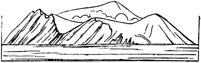
Form of the cliffs of Graham Island, as seen from S. S. E., distant one mile, 7th August, 1831.*
to some accounts, above 200 feet high, and three miles in circumference; after which it began to diminish in size by the action of the waves, and was only two
* Phil. Trans., part ii., 1832, reduced from drawings by Captain Wodehouse, R.N.
miles round on the 25th of August; and on the 3d of September, when it was carefully examined by Captain Wodehouse, only three-fifths of a mile in circumference, its greatest height being then 107 feet. At this time the crater was about 780 feet in circumference. On the 29th of September, when it was visited by Mons. C. Prevost, its circumference was reduced to about seven hundred yards. It was com-
Fig. 23.
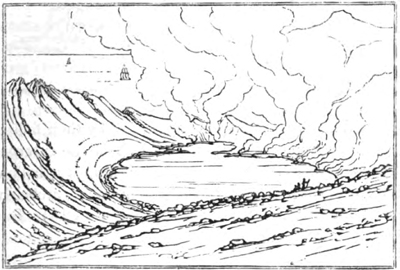
View of the interior of Graham Island, 99th Sept. 1831.
posed entirely of incoherent ejected matter, scoriæ, pumice, lapilli, and cinders, forming regular strata, some of which are described as having been parallel to the steep inward slope of the crater, while the rest were inclined outwards, like those of Vesuvius. In the annexed sketch, however (fig. 24.), drawn by M. Joinville, who accompanied M. C. Prevost, all the beds are represented as sloping towards the axis of the crater; and, if the view be correct, we must suppose that the last remnant only of the cone was then preserved, namely, that central part where the beds
K 5
have all an inward dip.* When the arrangement of the
Fig. 24.
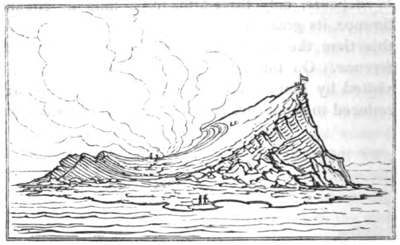
Graham Island, 19th Sept. 1831.
ejected materials has been determined by their falling continually on two steep slopes, that of the external cone and that of the crater, which is always a hollow inverted cone, a transverse section would probably resemble that given in the annexed figure (25.) But
Fig.25.
when I visited Vesuvius, in 1828, I saw no beds of scoriæ inclined towards the axis of the cone (see fig. 20. p. 139.) Such may have existed; but the explosions, or subsidences, or whatever causes produced the great crater of 1822, had possibly destroyed them.
Few of the pieces of stone thrown out from Graham Island exceeded a foot in diameter. Some fragments of dolomitic limestone were intermixed; but these were the only non-volcanic substances. During the
* See memoir by M. C. Prevost, Ann. des Sci. Nat., tom.xxiv.
month of August, there occurred on the S. W. side of the new island a violent ebullition and agitation of the sea, accompanied by the constant ascension of a column of dense white steam, indicating the existence of a second vent at no great depth from the surface. Towards the close of October, no vestige of the crater remained, and the island was nearly levelled with the surface of the ocean, with the exception, at one point, of a small monticule of sand and scoriæ. It was reported that, at the commencement of the year following (1832), there was ft a depth of 150 feet where the island had been: but this account was quite erroneous; for in the early part of that year Captain Swinburne found a shoal and discoloured water there, and towards the end of 1833 a dangerous reef existed, of an oval figure, about three fifths of a mile in extent. In the centre was a black rock, of the diameter of about twenty-six fathoms, from nine to eleven feet under water; and round this rock are banks of black volcanic stones and loose sand. At the distance of sixty fathoms from this central mass, the depth increased rapidly. There was also a second shoal at the distance of 450 feet S. W. of the great reef, with fifteen feet water over it, also composed of rock surrounded by deep sea. We can scarcely doubt that the rock in the middle of the larger reef is solid lava which rose up in the principal crater, and that the second shoal marks the site of the submarine eruption observed in August, 1831, to the S.W. of the island.
From the whole of the facts above detailed, it appears that a hill eight hundred feet or more in height wad formed by a submarine volcanic vent, of which the upper part (only about two hundred feet high) emerged
K 6
above the waters, so as to form an island. This cone must have been equal in size to one of the largest of the lateral volcanos on the flanks of Etna, and about half the height of the mountain Jorullo in Mexico, which was formed in the course of nine months, in 1759. In the centre of the new volcano a large cavity was kept open by gaseous discharges, which threw out scoriæ; and fluid lava probably rose up in this cavity. It is not uncommon for small subsidiary craters to open near the summit of a cone, and one of these may have been formed in the case of Graham Island; a vent perhaps, connected with the main channel of discharge which gave passage in that direction to elastic fluids scoriæ, and melted lava. It does not appear that either from this duct, or from the principal vent, there was any overflowing of lava; but melted rock may have flowed from the flanks or base of the cone (a common occurrence on land), and may have spread in a broad sheet over the bottom of the sea.
Fig. 26.
The dotted lines in the annexed figure are an imaginary restoration of the upper part of the cone, now removed by the waves: the strong lines represent the part of the volcano which is still under water. In the centre is a great column, or dike, of solid lava, two hundred feet in diameter, supposed to fill the space by
which the gaseous fluids rose; and on each side of the dike is a stratified mass of scoriæ and fragmentary lava. The solid nucleus of the reef where the black rock is now found withstands the movements of the sea; while the surrounding loose tuffs are cut away to a somewhat lower level. In this manner the lava, which was the lowest part of the island, or to speak more correctly, which scarcely ever rose above the level of the sea when the island existed, has now become the highest point in the reef.
No appearances observed, either during the eruption or since the island disappeared, give the least support to the opinion promulgated by some writers, that part of the ancient bed of the sea had been lifted up bodily.
The solid products, says Dr. John Davy, whether they consisted of sand, light cinders, or vesicular lava, differed more in form than in composition. The lava contained augite; and the specific gravity was 2·07 and 2·70. When the light spongy cinder, which floated on the sea, was reduced to fine powder by trituration, and the greater part of the entangled air got rid of, it was found to be of the specific gravity 2·64; and that of some of the sand which fell in the eruption was 2·75*; so that the materials equalled ordinary granites in weight and solidity. The only gas evolved in any considerable quantity was carbonic acid.†
Theory of Elevation Craters. ‡—Before quitting the subject of submarine volcanos, it will be necessary to
* Phil. Trans. 1832, p. 243.
† Ibid. 249.
‡ The view which I now give of the theory of elevation craters is the same which I published in the first edition, printed in 1829, after I had examined Vesuvius and Etna, and compared them with the Mont Dor and the Plomb du Cantal. But I have now incorporated with the illustrations and arguments then advanced, some information derived from the subsequent observations of M. Virlet and others. Neither that gentleman, in his memoir cited below, nor M. Hoffmann, in his letter on the subject addressed to the Geological Society of France, nor M. Cordier, in his paper on the Cantal, have referred to my previous sketch of the controversy, and were, probably, not aware of what Mr. Scrope and myself had written on the subject; but ft is satisfactory and important to observe, that they have followed the same line of argument and illustration.
say something of an opinion which has been promulgated by Leopold Von Buch, respecting what he has termed Erhebungs crater (Cratères de Soulèvement). He has attempted to explain, by a novel hypothesis, the origin of certain large cavities, and the peculiar disposition of the masses of volcanic matter which surround them. We shall first consider the island of Santorin in the Grecian archipelago,—one of the examples of this mode of formation instanced by Von Buch.
The three islands of Santorin, Therasia, and Aspronisi surround an almost circular gulf of about two leagues in diameter from south to north, and a league and a half from east to west. The island of Santorin itself forms more than two thirds of the circuit, and is composed entirely of volcanic matter, with the exception of its southern part, which rises to three times the height of the igneous rocks in the island, and is formed of granular limestone and argillaceous schist.* This mountainous part is the original and fundamental nucleus of the isle; and, according to M. Bory de St. Vincent, its strata have the same direction as those of the other isles of the Grecian archipelago, from N.N.W.
* Virlet Bull de la Soc. Géol. de French, tom. iii. p.103.
to S.S.E. Their inclination and fractures have no relation to the position of the newer volcanic rocks, of
Fig. 27.
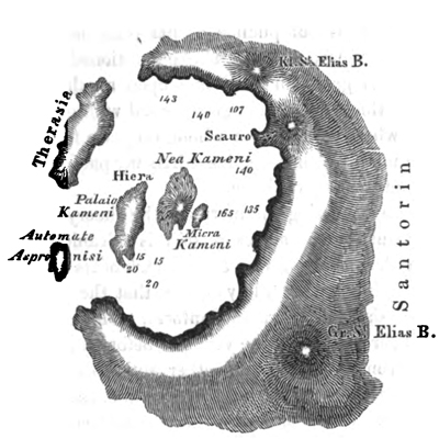
Chart and section of Santorin and the contiguous islands in the Grecian Archipelago.
which the remainder of the group of islands is exclusively composed. The volcanic mass, which must be considered as quite an independent formation, consists of alternating beds of trachytic lava, tuff, and conglomerate, which dip on every side from the centre of the gulf to the circumference. Towards the gulf they present uniformly a high and steep escarpment, the precipices in Santorin rising to the height of more than eight hundred feet, and plunging at once into a sea
from eight hundred to a thousand feet deep. Each of the islands is capped by an enormous mass of white tufaceous conglomerate, from forty to fifty feet in thickness; which is not pumice, as has often been stated. The beds of lava and tuff, above mentioned, are accumulated in great numbers one upon another, and of unequal thickness: although disposed with great regularity, when viewed as a whole, they are found to be discontinuous, as in Vesuvius, when any particular mass is traced to some distance.
Before discussing the merits of the theory proposed to account for the structure of this volcanic group, it will be desirable to give a brief sketch of its history, so far as it is known. Pliny relates that the separation of Therasia from Thera, or Santorin, took place after a violent earthquake, in the year 233 before the Christian era. From his work, and other authorities, we also learn that the year 196 B.C. gave birth, in the middle of the gulf, to Hiera, or the Sacred Isle, still called Hiera-Nisos, or sometimes Palaia Kameni (Old Burnt Island). There seems to have been no eruption then, but simply an upheaving of solid lava. In the year 19 of our era, Thia (the Divine) made its appearance above the surface of the waters. This small island has no longer a separate existence, having been joined to Hiera, from which it was only 250 paces distant: Hiera itself increased in size in 726 and in 1427. In 1573, the small island of Micra-Kameni appeared, a small cone and crater, one hundred feet high, raised by successive ejections.
On the 27th of September, 1650, there was an eruption three or four miles north of Santorin, altogether outside of the gulf, immediately after violent earthquakes. It gave rise to no new islet, but greatly
elevated the bottom of the sea on the spot. The eruption lasted three months: many houses on Santorin were destroyed; and the vapours of sulphur and hydrogen killed more than fifty persons, and more than one thousand domesticated animals. A wave fifty feet high broke upon the rocks of the Isle of Nio, about four leagues distant, and advanced 350 yards into the interior of the island of Sikino, which is seven leagues off. The sea also broke upon Santorin, overthrew two churches, and exposed to view a village on each side of the mountain of St. Stephen, both of which must have been overwhelmed by showers of volcanic matter during some former eruption.*
Lastly, in 1707 and 1709, Nea Kameni was produced between Palaia and Micra (old and lesser) Kamenis. This isle was composed originally of two distinct parts, the first which rose was called the White Island—a mass of pumice, extremely porous. Goree the Jesuit, who was then in Santorin, says that the rock "cut like bread," and that, when the inhabitants landed on it, they found a multitude of full-grown fresh oysters adhering to it, which they eat.† This island was afterwards covered, in great part, by the matter ejected from the crater of the second island, produced at the same time, called "Black Island," being composed partly of brown trachyte. This volcano, now named Nea (or New) Kameni, continued in eruption, at intervals, during 1711 and 1712, and formed a cone 330 feet above the level of the sea: there are now, therefore, two channels of direct communication
* Virlet, Bull. de la Soc. Géol de France, tom. iii. p. 103.
† Phil. Trans., No. 332.
between the atmosphere and volcanic foci beneath the group of Santorin; namely, the craters of New and Little Kameni.
A curious fact is mentioned by M. Virlet, respecting the supposed slow and progressive rise of a solid ridge at the bottom of the sea. Twenty years ago there was a depth of fifteen fathom water between the lesser Kameni and the port of Phira in Santorin. In 1830, when MM. Virlet and Bory visited the spot, there was only a depth of between three and four fathoms; and they found that the bottom consisted of a hard rock, probably trachyte, measuring about eight hundred yards from E. to W. and five hundred only from N. to S. Beyond this the sea deepens rapidly on all sides. From these facts, and from information obtained on the spot, M. Virlet infers that the bed of the sea is rising gradually, and that, in all probability, a new island may one day appear without commotion above the surface. He suggests that the solid crust of rock now slowly rising may resemble a cork carried up by the fermentation of the liquor on which it floats.*
After the explanation which I before offered † of the mode in which the semicircular escarpment of Somma must have originated, it is almost needless to say that I regard the three islands which encircle the gulf of Santorin as nothing more than the ruins of a great volcanic cone, the summit of which, like that of the ancient Vesuvius, has been destroyed; and as to the small volcanic islets thrown up since the historical era, in the centre of the gulf, they may be compared
* See M. Virlet's Memoir, before cited.
† Above, p. 139.
to the modern cone, or rather cones, of Vesuvius. But Von Buch's hypothesis suggests a very different origin for Santorin, and other islands and gulfs of a similar configuration. He supposes that the different masses of tuff, conglomerate, and whatever else may be associated, were first horizontally disposed along the floor of the ocean. An expansive force from below then burst an opening through them, and, acting from a central point, raised symmetrically on every side whatever resisted its action; so that the uplifted strata were made to dip on all sides from the centre, as is usual in volcanic cones; while a deep hollow was left in the middle, resembling in all essential particulars an ordinary volcanic crater.
It was never pretended that this theory was founded on the actual observation, in any part of the globe, of analogous effects produced by the elevating force of earthquakes, or the escape of elastic fluids; for the inflation, from below, of the rocks in the plain of Malpais, during the eruption of Jorullo, was, as before stated, an hypothesis proposed, long after that eruption, to account for appearances which admit of a different explanation. Besides, in that case, there was no great hollow formed in the centre of the whole mass of lava, although there is an eruption-crater on the summit of Jorullo itself.
It is naturally objected by M. Virlet, that if a mass like Santorin, which, including its submarine foundations, must be from 1700 to 2000 feet in thickness, was suddenly and violently heaved up from a horizontal position, we might expect to find the rocks furrowed every where with rents which would diverge from the principal centre of movement to the circumference of
the circular area. But these rents are wanting, as are all signs of the shattering and dislocation of the mass. At the same time he adduces a fact which must surely prove conclusive against the notion of the island's having been formed in any other mode than that by which an ordinary cone is accumulated. In examining the various currents of lava (the existence of which was unknown to Von Buch, who had not visited Santorin), it was found that the vesicles, or pores which abound in them, are lengthened in the several directions in which they would naturally be drawn out, if the melted matter had flowed towards different points of the compass from the summit of a conical mountain, of which the present islands were the base. The force of this argument will be appreciated by those who are aware that bubbles of confined gas in a fluid in motion assume an oval form, and that the direction of the longer axis coincides always with that of the stream. It is also observed by M. Virlet, that the deep stratum of white tufaceous conglomerate by which all the islands are uniformly covered, may well be supposed to have resulted from heavy showers of ejected matter which fell during that paroxysmal explosion by which the great cone was originally blown up, truncated, and emptied in its interior.
The manner in which the external walls were separated into three distinct islands is easily conceived. The principal breaches are to the N. W., the quarter most exposed to the waves and currents. On this side, the earthquake of 233 B.C., mentioned by Pliny, may have caused a fissure, which allowed the waves and currents to penetrate and sweep away the incoherent tuffs and conglomerates, just as they washed
away Graham Island; and if there happened to be little or no lava at certain points, the waves would in such places readily force a passage.*
Isle of Palma.—The next example which may claim our attention is Palma, one of the Canary Islands; and, when controverting Von Buch's theoretical opinions, we must not forget how much geology is indebted to his talents and zeal for his faithful description of this interesting group of islands.
In the centre of Palma is an immense circular cavity, called the Caldera, which forms the hollow axis of the entire island. A lofty mountain ridge runs
Fig. 28.
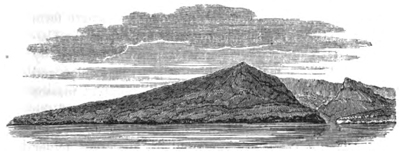
View of the Isle of Palma, and of the Caldera in its centre.
round this axis, and presents in all directions, towards the Caldera, a perpendicular precipice of no less than four thousand feet in height: while on the outside the slope is gentle towards the sea. The middle of the Caldera is more than two thousand feet above the level of the ocean; the surrounding borders (or "cumbre," as they are termed,) are of various heights, attaining at one point an elevation of 7234 feet. The diameter of the Caldera is about six miles;
* Virlet, ibid.
and so steep are the cliffs by which it is environed, that there is not a single pathway down the rocks; and the only entrance is by the ravine, or "baranco," which runs from the great circus down to the sea, intersecting all the rocks of which the island is composed. In this section are exposed strata of tuff, alternating with beds of basalt; and below are conglomerates, composed of fragments of granite, quartz, syenite, and other hypogene rocks, some of which appear in one place in situ. Volcanic dikes, or veins, cutting through all these formations, increase in number as the traveller passes through the baranco, or gorge, and, receding farther from the sea, approaches nearer to the Caldera. The veins in the precipice on each side often cross one another, and at length form a perfect net-work. In the cliffs encircling the Caldera itself are various volcanic rocks, traversed by basaltic dikes, most of which are perpendicular, and appear to hold together the more incoherent masses through which they cut. The sloping sides of the island, which has much the appearance of a flattened and hollow cone, are furrowed by numerous minor ravines, deepening as they approach the sea, in which beds of red and yellow scoriæ are exposed to view.
From this description I find it impossible to draw any other inference than that we have here the remains of a great volcanic mountain, formed by successive eruptions, the first of which burst through granitic rocks. A great cone having, in the course of ages, been built up, the higher parts of it were afterwards destroyed, and an immense hollow occasioned by gaseous explosions; at the same time that a falling in, or engulphment, of large masses may have taken place. But, according to the theory of "erhebungs crater," we
are called upon to suppose, that a series of horizontal beds of volcanic matter were first accumulated over each other, to the enormous depth of more than four thousand feet,—an hypothesis which alone implies the proximity of a vent, from which immense quantities of igneous rocks had proceeded: next, that, after the aggregation of the mass, the expansive force was directed on a given point with such extraordinary energy, as to lift up bodily the whole mass, so that it should rise in some parts to the height of seven thousand feet above the sea, leaving a great gulf or cavity in the middle. Yet, notwithstanding this prodigious effort of gaseous explosions, concentrated on so small a point, the beds, instead of being shattered, contorted, and thrown into the utmost disorder, have acquired that regular and symmetrical arrangement which characterize the flanks of a large cone of eruption like Etna! It will readily be admitted, that earthquakes, when they act on extensive tracts of country, may elevate and depress them without deranging considerably the relative position of hills, valleys, and ravines. But if the aeriform fluids should break through a mere point, as it were, of the earth's crust, and that, too, where the beds were not composed of soft yielding clay, or incoherent sand, but in great part of solid trachyte and basalt, thousands of feet thick, is it possible to conceive that such masses of rock could be heaved up, so as to attain the height of seven thousand feet, or more, without being thrown into a vertical, and often into a reversed position? Would they not be fissured and fractured in every direction, and, instead of forming a mountain of regular form and structure, would they not be reduced to a mere confused and chaotic heap?
The dimensions of the Gulf of Santorin, or the Caldera of the Isle of Palma, are not greater than we may suppose to result from the truncation and evacuation of ordinary volcanic cones. We shall afterwards see that Papandayang, formerly one of the loftiest volcanos in Java, lost, in 1772, about four thousand feet of its former height.* During an eruption in 1444, accompanied by a tremendous earthquake, the summit of Etna was destroyed, and an enormous crater was left, from which lava flowed. The segment of that crater may still be seen near the Casa Inglese, and, when complete, it must have measured several miles in diameter. The cone was afterwards repaired; but this might not so easily have happened, had the summit of Etna, like Stromboli or Santorin, been placed in a deep sea; for in that case the vent might have become choked up with strata of sand and conglomerate, swept in by waves and currents; and these obstructions, by augmenting the repressive force, would have increased the violence of subsequent explosions. There is, unquestionably, a much greater probability when the volcanic vent communicates with the atmosphere that a channel will be kept open by elastic fluids, whereby currents of lava may escape without resistance, and without causing any violent commotion. Let us suppose the large Etnean crater of 1444 to have been choked up, and again truncated down to the upper margin of the woody region; a circular basin would thus have been formed, thirty Italian miles in circumference, exceeding by five or six miles the circuit of the Gulf of Santorin. Yet we know, by numerous sections, that the strata of
* See chap. xvi.
trachyte, basalt, and trachytic breccia, would, in that part of the great cone of Etna, dip on all sides off from the centre, at a gentle angle, to every point of the compass, except where irregularities were occasioned, at certain points, by the occurrence of the small buried cones before mentioned. If this gulf were, then, again choked up, and the vent obstructed, so that new explosions of great violence should truncate the cone once more down to the inferior border of the forest zone of Etna, the circumference of the gulf would be fifty Italian miles.* Yet even then the ruins of the cone of Etna might form a circular island, entirely composed of volcanic rocks, sloping gently outwards on all sides, at a very slight angle; and this island might be between seventy and eighty English miles in its exterior circuit, rivalling Palma in fertility; while the circular bay within might be between forty and fifty miles round.
If a difference in size alone were a sufficient reason for seeking a difference in origin, we should then be called upon to refer the innermost cone of Vesuvius, thrown up in 1828, to a mode of action distinct from that by which the larger cone of the year 79 was formed; and the shape and structure of this, again, might be attributed to a series of operations distinct from those to which the outermost cone and escarpment of Somma were due. It is extraordinary that, after the identity of the form and structure of Vesuvius and Somma had been so clearly demonstrated by M. Necker†, one of these cones should actually have
* For the measurements of different parts of the cone of Etna, Trattato dei Boschi del' Etna, Scuderi, Acti dell' Acad. Gion. de Catan., vol. i.
† Mémoire sur le Mont Somma, Mém. de la Soc. de Phys. et. d'Hist. Nat. de Génève, tom. ii. part i. p. 155.
VOL. II. L
been considered by some of the followers of Von Buch as an "erhebungs crater," and the other as a cone of eruption. (See fig. 20. p. 139.)
Great Canary.—The form of the Great Canary is very analogous to that of Palma, there being here also a caldera and a principal ravine leading out of it, on the south side. The rocks are tuff, conglomerate, basalt, and trachyte. In some of the borders of the island are marls and conglomerates containing recent marine shells, from three to four hundred feet above the level of the sea, and presenting an appearance, says Von Buch, as if the level of the ocean had subsided at successive periods. These are doubtless the effects of elevation, and at the base of Etna marine strata are in like manner discoverable; but their occurrence does not prove an upheaving of that kind, from which cones and craters would result.
Teneriffe.—The Peak of Teneriffe rises out of a valley surrounded by precipitous cliffs, which vary in height from 1000 to 1800 feet, and which are given as an exemplification of the "Erhebungs crater." The Peak stands, says Von Buch, like a tower encircled by its fosse and bastion. The volcanic rocks resemble, in general, those found in the other Canary Islands.
Barren Island.—Barren Island, in the Bay of Bengal, is also proposed as a striking illustration of the erhebungs crater; and here, it is said, we have the advantage of being able to contrast the ancient crater of elevation with a cone and crater of eruption in its centre. When seen from the ocean, this island presents, on almost all sides, a surface of bare rocks, rising, with a moderate acclivity, towards the interior; but at one point there is a cleft, by which we can penetrate into the centre, and there discover that it is
occupied by a great circular basin, filled by the waters
Fig. 29.
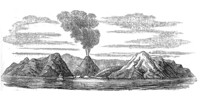
Cone and crater of Barren Island, in the Bay of Bengal.
of the sea, and bordered all around by steep rocks, in the midst of which rises a volcanic cone, very frequently in eruption. The summit of this cone is 1690 French feet in height, corresponding to that of the circular border which incloses the basin; so that it can be seen from the sea only through the ravine, which precisely resembles the deep gorge of the caldera of the Isle of Palma, and of which an equivalent, more or less decided in its characters, is said to occur in all elevation craters. It is most probable that the exterior inclosure of Barren Island, c, d, (Fig. 30.) is nothing more than the remains of a truncated cone, c, a, b, d, a great portion of which has been carried away, partly by the action of the waves, and partly by explosions which preceded the formation of the new interior cone, f, e, g.
Fig. 30.
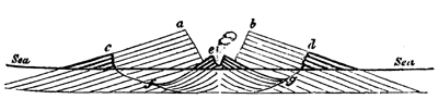
Supposed section of Barren Island, is the Bay of Bengal.
L 2
Had there been any foundation for the theory, that violent explosions of gas could exert the power of raising up horizontal strata symmetrically round a central cavity, numerous examples would, ere this, have been adduced of strata other than volcanic elevated in this way round some active volcano. But where do we find an instance of inner craters like those of Vesuvius, Santorin, Barren Island, and others, encircled by precipices of rocks exclusively of lacustrine or marine origin, and in which the strata have the quaqua-versal dip, characteristic of all cones of eruption? If such could be pointed out, we might undoubtedly be forced to concede, that the cone and crater-like configuration may be the result of two distinct modes of formation. It is not pretended that, on the whole face of the globe, a single example of this kind can be pointed out. Are we then called upon to believe that, whenever elastic fluids generated in the subterranean regions burst through horizontal strata, so as to upheave them in the peculiar manner before adverted to, they always select, as if from choice, those spots of comparatively insignificant area where a certain quantity of volcanic matter happens to lie; while they carefully avoid purely lacustrine and marine strata, although they often lie immediately contiguous? Why, on the southern borders of the Limagne d'Auvergne, where several eruptions burst through, and elevated the horizontal marls and limestones, did these fresh-water beds never acquire, in any instance, a conical and crateriform disposition? We have no hesitation, therefore, in adhering to the opinion, that all the cavities palled elevation craters by Von Buch, are simply craters of paroxysmal explosion, as they have been very properly termed by Mr. Scrope. This class of
craters, or cup-shaped hollows, have not merely been formed where the earth's crust happened to be composed of volcanic matter; but repeated explosions of elastic fluids have sometimes burst through rents in other rocks, and have shattered them for a certain space, and blown their contents into the air. Thus in the volcanic region of the Eifel, explosions, sometimes unaccompanied by the emission of lava, have excavated craters in strata of sandstone and shale; but they have not raised the strata all round the central cavity. The distinctness of these phenomena from those appealed to in corroboration of the "erhebungs crater" will be pointed out in the fourth book.
An attempt has been made to adduce the ancient volcanos of Central France, the Mont Dor, and the Plomb du Cantal, conical mountains without craters, or any central cavities, as illustrations of the "Erhebungs crater;" but how little their form and structure confirm this theory will be seen when they are described.* The marine shelly deposits, interstratified with basalt, through which the great cone of Etna rises, are also said to have constituted an ancient crater of elevation; but in my account of the geology of Sicily, it will appear that the strata in question do not dip so as to countenance such an hypothesis. Nor will it be difficult to show, when treating of "Valleys of Elevation," as they have been termed, that no confirmation of the views of Von Buch can be derived from the analogy of their configuration.†
Origin of the deep lateral gorge in Elevation Craters.—In regard to the deep channel of communication which appears always to connect the central cavity of the so called "Elevation Craters" with the sea, it may,
* Book iv.
† Ibid.
L 3
perhaps, be ascribed, in some cases, to the action of the tides, during the gradual and successive upheaving of a volcanic isle. But to this subject I shall more particularly advert when inquiring into the causes of the configuration of coral islands.
The mountains in the moon have been pointed out, by M. Elie de Beaumont, as resembling the caldera of the isle of Palma, and other Erhebungs crater*; but an astronomer of high authority has ventured upon a very different speculation respecting these lunar mountains. "The generality of them," says Sir John Herschel, "present a striking uniformity and singularity of aspect. They are wonderfully numerous, occupying by far the larger portion of the surface, and almost universally of an exactly circular or cup-shaped form, foreshortened, however, into ellipses towards the limb; but the larger have, for the most part, flat bottoms Within, from which rises centrally a small, steep, conical hill. They offer, in short, in its highest perfection, the true volcanic character, as it may be seen in the crater of Vesuvius, and in a map of the Volcanic districts of the Campi Phlegræi, or the Puy de Dome. And in some of the principal ones, decisive marks of volcanic stratification, arising from successive deposits of ejected matter, may be clearly traced with powerful telescopes." †
M. Hoffmann set out on his travels through Italy and Sicily, in 1829, with a strong expectation of finding every where the clearest illustrations of the "Erhebungs crater; "but when he had explored the Lake Albano, near Rome, as well as Vesuvius, Etna, Strom-
* Ann. des Sci. Nat., Jan. 1831.
† Herschel, Treatise on Astronomy, p. 229.
boli, and the other Lipari Islands, he was compelled reluctantly to abandon the doctrine.* An examination of the same countries led M. C. Prevost, as it had done Mr. Scrope and myself, to similar conclusions.
Mineral Composition of Volcanic Products.—The mineral called felspar forms in general more than half of the mass of modern lavas. When it is in great excess, lavas are called trachytic; they consist generally of a base of compact felspar in which crystals of glassy felspar are disseminated.† When augite (or pyroxene) predominates, lavas are termed basaltic. But others of an intermediate composition occur, which from their colour have been called gray-stones. The abundance of quartz, forming distinct crystals or concretions, characterizes the granitic and other ancient rocks, now generally considered by geologists as of igneous origin: whereas that mineral is rarely exhibited in a separate form in recent lavas, although flint enters largely into their composition. Hornblende, so common in hypogene rocks, or those commonly called "primary," is rare in modern lava; nor does it enter largely into rocks of any age in which augite abounds. It should, however, be stated, that the experiments of M. Gustavus Rose have made it very questionable, whether the minerals called hornblende and augite can be separated as distinct species, as their different varieties seem to pass into each other, whether we consider the characters derived from their angles of crystallization, their chemical composition, or their specific gravity. The difference in form of the two substances may be explained by the different circumstances under which they have been produced; the
* Bulletin de la Soc. Géol. de France, tom. iii. p. 170.
† See Glossary.
L 4
form of hornblende being the result of slower cooling. Crystals of augite have been met with in the scoriæ of furnaces, but never those of hornblende; and crystals of augite have been obtained by melting hornblende in a platina crucible, but hornblende itself has not been formed artificially.* Mica occurs plentifully in some recent trachytes, but is rarely present where augite is in excess.
Frequency of eruptions, and nature of subterranean igneous rocks.—When we speak of the igneous rocks of our own times, we mean that small portion which, in violent eruptions, is forced up by elastic fluids to the surface of the earth,—the sand, scoriæ, and lava, which cool in the open air. But we cannot obtain access to that which is congealed far beneath the surface under great pressure equal to that of many hundred, or many thousand atmospheres.
During the last century, about fifty eruptions are recorded of the five European volcanic districts, of Vesuvius, Etna, Volcano, Santorin, and Iceland; but many beneath the sea in the Grecian Archipelago and near Iceland may doubtless have passed unnoticed. If some of them produced no lava, others, on the contrary, like that of Skaptár Jokul in 1783, poured out melted matter for five or six years consecutively; which cases, being reckoned as single eruptions, will compensate for those of inferior strength. Now, if we consider the active volcanos of Europe to constitute about a fortieth part of those already known on the globe, and calculate that, one with another, they are about equal in activity to the burning mountains in Other districts, we may then compute that there hap-
* Bulletin de la Soc. Géol. de France, tom. ii. p. 206.
pen on the earth about two thousand eruptions in the course of a century, or about twenty every year.
However inconsiderable, therefore, may be the superficial rocks which the operations of fire produce on the surface, we must suppose the subterranean changes now constantly in progress to be on the grandest scale. The loftiest volcanic cones must be as insignificant, when contrasted to the products of fire in the nether regions, as are the deposits formed in shallow estuaries when compared to submarine formations accumulating in the abysses of the ocean. In regard to the characters of these volcanic rocks, formed in our own times in the bowels of the earth, whether in rents and caverns, or by the cooling of lakes of melted lava, we may safely infer that the rocks are heavier and less porous than ordinary lavas, and more crystalline, although composed of the same mineral ingredients. As the hardest crystals produced artificially in the laboratory require the longest time for their formation; so we must suppose that where the cooling down of melted matter takes place by insensible degrees, in the course of ages, a variety of minerals will be produced far harder than any formed by natural processes within the short period of human observation.
These subterranean volcanic rocks, moreover, cannot be stratified in the same manner as sedimentary deposits from water, although it is evident that when great masses consolidate from a state of fusion, they may separate into natural divisions; for this is seen to be the case in many lava currents. We may also expect that the rocks in question will often be rent by earthquakes, since these are common in volcanic regions; and the fissures will be often injected with similar matter, so that dikes of crystalline rock will
L 5
traverse masses of similar composition. It is also clear, that no organic remains can be included in such masses, as also that these deep-seated igneous formations considered in mass must underlie all the strata containing organic remains, because the heat proceeds from below upwards, and the intensity required to reduce the mineral ingredients to a fluid state must destroy all organic bodies in rocks either subjacent or included in the midst of them.
If, by a continued series of elevatory movements, such masses shall hereafter be brought up to the surface, in the same manner as sedimentary marine strata have, in the course of ages, been upheaved to the summit of the loftiest mountains, it is not difficult to foresee what perplexing problems may be presented to the geologist. He may then, perhaps, study in some mountain chain the very rocks produced at the depth of several miles beneath the Andes, Iceland, or Java, in the time of Leibnitz, and draw from them the same conclusion which that philosopher derived from certain igneous products of high antiquity; for he conceived our globe to have been, for an indefinite period, in the state of a comet, without an ocean, and uninhabitable alike by aquatic or terrestrial animals.
CHAPTER XIV.
EARTHQUAKES AND THEIR EFFECTS.
Earthquakes and their effects—Deficiency of ancient accounts Ordinary atmospheric phenomena—Changes produced by earthquakes in modern times considered in chronological order—Earthquakes in Murcia, Ischia, &c.—Chili in 1822—Extent of country elevated (p. 234.)—Aleppo and Ionian Isles—Earthquake of Cutch in 1819—Subsidence in the delta of the Indus (p. 237.)—Island of Sumbawa in 1815—Town of Tomboro submerged—Earthquake of Caraccas in 1812—South Carolina in 1811—Changes in the valley of the Mississippi (p. 246.)—Aleutian Islands in 1806—Reflections on the earthquakes of the nineteenth century—Earthquake in Quito, Quebec, &c.—Java, 1786—Sinking down of large tracts—Japan Isles, 1783.
IN the sketch before given of the geographical boundaries of volcanic regions, I stated, that although the points of eruption are but thinly scattered, constituting mere spots on the surface of those vast districts, yet the subterranean movements extend simultaneously over immense areas. We may now proceed to consider the changes which these movements produce on the surface, and in the internal structure of the earth's crust.
Deficiency of ancient accounts.—It is only within the last century and a half, since Hooke first promulgated his views respecting the connexion between geological phenomena and earthquakes, that the per-
L 6
manent changes effected by these convulsions have excited attention. Before that time, the narrative of the historian was almost exclusively confined to the number of human beings who perished, the number of cities laid in ruins, the value of property destroyed, or certain atmospheric appearances which dazzled or terrified the observers. The creation of a new lake, the engulphing of a city, or the raising of a new island, are sometimes, it is true, adverted to, as being too obvious, or of too much geographical interest, to be passed over in silence. But no researches were made expressly with a view of ascertaining the amount of depression or elevation of the ground, or any particular alterations in the relative position of sea and land; and very little distinction was made between the raising of soil by volcanic ejections, and the upheaving of it by forces acting from below. The same remark applies to a very large proportion of modern accounts; and how much reason we have to regret this deficiency of information appears from this, that in every instance where a spirit of scientific inquiry has animated the eye-witnesses of these events, facts calculated to throw light on former modifications of the earth's structure are recorded.
Phenomena attending earthquakes.—As I shall confine myself almost entirely, in the following notice of earthquakes, to the changes brought about by them in the configuration of the earth's crust, I may mention, generally, some accompaniments of these terrible events which are almost uniformly commemorated in history, that it may be unnecessary to advert to them again. Irregularities in the seasons preceding or following the shocks; sudden gusts of wind, interrupted by dead calms; violent rains at unusual seasons,
or in countries where such phenomena are almost unknown; a reddening of the sun's disk, and a haziness in the air, often continued for months; an evolution of electric matter, or of inflammable gas from the soil, with sulphureous and mephitic vapours; noises underground, like the running of carriages, or the discharge of artillery, or distant thunder; animals uttering cries of distress, and evincing extraordinary alarm, being more sensitive than men of the slightest movement; a sensation like sea-sickness, and a dizziness in the head, experienced by men:—these, and other phenomena, which are still more remotely connected with our present subject as geologists, have recurred again and again at distant ages, and in all parts of the globe.
I shall now begin the enumeration of earthquakes with the latest authentic narratives, and so carry back the survey retrospectively, that I may bring before the reader, in the first place, the minute and circumstantial details of modern times, and thus enable him, by observing the extraordinary amount of change within the last 150 years, to perceive how great must be the deficiency in the meagre annals of earlier eras.
EARTHQUAKES OF THE NINETEENTH CENTURY.*
Murcia, 1829.—An earthquake happened near Alicant, in the south of Spain, on the 21st of March,
* Since the publication of the former editions of this work, numerous accounts of recent earthquakes have been published; but as they do not illustrate any new principle, I cannot insert them, as they would enlarge too much the size of my work. Among the most violent may be mentioned those of Sept. 1827, at Lahore, East Indies—of Jan. 15,1832, which destroyed Foligno, in Italy,—June 24, 1830, in China, in Tayming, North of Houan—March 9, 1830, in the Caucasus at Kislier—April 1833, Manilla—1833, Isle of Lissa in Adriatic, and Opus. Von Hoff has published, from time to time, in Poggendorf's Annalen, lists of the earthquakes which have happened since 1821; and, by consulting these, the reader will perceive that every month is signalized by one or many convulsions in some part of the globe.
1829, which violently agitated a small district about four square miles in area, being the basin of the river Segura, between Orihuela and the sea. All the villages in this tract were thrown down by a vertical movement, the soil being traversed by innumerable crevices four or five inches broad. In the alluvial plain, especially that part near the sea, small circular apertures were formed, out of which black mud, salt water, and marine shells were vomited; and in other places fine, yellowish-green, micaceous sand, like that on the beach at Alicant, was thrown Up in jets.*
Ischia, 1828.—On the 2d of February the whole island of Ischia was shaken by an earthquake, and in the October following I found all the houses in Casamicciol still without their roofs. On the sides of a ravine between that town and Forio, I saw masses of greenish tuff, which had been thrown down. The hot-spring of Rita, which was nearest the centre of the movement, was ascertained by M. Covelli to have increased in temperature, showing, as he observes, that the explosion took place below the reservoirs which heat the thermal waters.†
Bogota, 1827.—On the 16th of November, 1827, the plain of Bogota was convulsed by an earthquake, and a great number of towns were thrown down.
* Férussac, Bulletin des Sci. Nat., Nov. 1829, p. 203.
† Biblioth. Univ., Oct. 1828, p. 157.; and Férussac, Bulletin &c., tome xi. p. 297.
Torrents of rain swelled the Magdalena, sweeping along vast quantities of mud and other substances, which emitted a sulphureous vapour and destroyed the fish. Popayan, which is distant two hundred geographical miles S. S. W. of Bogota, suffered greatly. Wide crevices appeared in the road of Guanacas, leaving no doubt that the whole of the Cordilleras sustained a powerful shock. Other fissures opened near Costa, in the plains of Bogota, into which the river Tunza immediately began to flow.* It is worthy of remark, that in all such cases the ancient gravel bed of a river is deserted, and a new one formed at a lower level; so that a want of relation in the position of alluvial beds to the existing water-courses may be no test of the high antiquity of such deposits, at least in countries habitually convulsed by earthquakes. Extraordinary rains accompanied the shocks before mentioned; and two volcanos are said to have been in eruption in the mountain-chain nearest to Bogota.
Chili, 1822.—On the 19th of November, 1822, the coast of Chili was visited by a most destructive earthquake. The shock was felt simultaneously throughout a space of 1200 miles from north to south. St. Jago, Valparaiso, and some other places, were greatly injured. When the district round Valparaiso was examined on the morning after the shock, it was found that the whole line of coast, for the distance of above one hundred miles, was raised above its former level.† At Valparaiso the elevation was three feet, and at Quintero about four feet. Part of the bed of the sea, says Mrs. Graham, remained bare and dry at high water, "with
* Phil. Mag., July 1828, p. 37.
† See Geol. Trans., vol. i., second series; and also Journ. of Sci., 1824, vol. xvii. p. 40.
beds of oysters, muscles, and other shells, adhering to the rocks on which they grew, the fish being all dead, and exhaling most offensive effluvia."*
I have been informed by Mr. Cruckshanks, an English botanist, who resided in the country during the earthquake, that, for several days after the event, fishermen dug out certain burrowing shells from sands above low-water mark, which previously they had only procured below that level. The same gentleman found that some rocks of greenstone at Quintero, a few hundred yards from the beach, which had always been under water till the shock of 1822, have since been uncovered when the tide is at half-ebb; and he states that, after the earthquake, it was the general belief of the fishermen and inhabitants of the Chilian coast, that the ocean had permanently retreated, not that the land had risen.
An old wreck of a ship, says Mrs. Graham, which before could not be approached, became accessible from the land, although its distance from the original sea-shore had not altered.† It was observed, that the water-course of a mill, at the distance of about a mile from the sea, gained a fall of fourteen inches, in little more than one hundred yards; and from this fact it is inferred that the rise in some parts of the inland country was far more considerable than on the borders of the ocean.‡ Part of the coast thus elevated consisted of granite, in which parallel fissures were caused, some of which were traced for a mile and a half inland. Cones of earth, about four feet high, were thrown up in several districts, by the forcing up of water mixed with sand through funnel-shaped hollows,—a pheno-
* Geol. Trans., vol. i., second series, p. 415.
† Ibid.
‡ Journ. of Sci., vol. xvii. p. 42.
menon very common in Calabria, and the explanation of which will hereafter be considered. Those houses in Chili of which the foundations were on rock were less damaged than such as were built on alluvial soil.
Dr. Meyen, a Prussian traveller, who visited Valparaiso in 1831, says that on examining the rocks both north and south of the town, he found appearances corroborating Mrs. Graham's statements.* According to him, the whole coast of central Chili was raised about four feet, and banks of marine shells were laid dry on many parts of the coast. He observed similar banks, elevated at unknown periods, in several places, especially at Copiapo, where the species all agree with those now living in the ocean. Mr. Fryer also, who resided some years in South America, relates, that being at Valparaiso, after the earthquake of 1822, he saw a shelly beach to the east of the town, above the reach of the tides, and rocks were pointed out to him as being now less under water than they were before the convulsion.†
On the other hand, Mr. Cuming, a gentleman well known by his numerous discoveries in conchology, and who resided at Valparaiso before the earthquake, and was there during and after the convulsion, could detect no proofs of the rise of the land, although his attention had been called to the fact by Mrs. Graham's statements. He tells me, that he had frequently collected shells from the rocks on the shore, north and south of the town, previous to and after the event, but he saw no signs of any change of level; but, on the contrary, remarked, that the water at spring tides rose after the earthquake to the same point on a wall near
* Reise um die erde.
† Geol. Soc. Proceedings, 1835.
his house, which it had reached before the shocks. He imagines that the marine shells alluded to were thrown up by the sea during the commotion, and that the idea of the coast having been raised would not have been so generally received, had there not been a rapid gain of land opposite to Valparaiso, immediately after the earthquake in 1822. This accession was caused by the continual influx of granitic sand and gravel, washed down by numerous torrents from the interior, and cast up again by the waves of the Pacific. During the nine years intervening between 1822 and 1831, the population of Valparaiso was multiplied in an extraordinary manner, and increased from 6,000 to 34,000 inhabitants; in consequence of which every effort was made to preverve the newly acquired sand-banks, and in some places no less than two entire streets have been erected where there was sea before.
I have stated these objections, trusting that they will prompt the scientific traveller and resident in Chili, to institute more minute inquiries; in the mean time I consider the testimony of the many witnesses, whose opinion was formed before any of the new additions of land had taken place, to be sufficient to establish the fact, although the change of level may perhaps be found to have been less uniform in different places than some have assumed.
Extent of country elevated.—The area over which this permanent alteration of level is conjectured to have extended is 100,000 square miles.* The whole country, from the foot of the Andes to a great distance under the sea, is supposed to have been raised, the greatest rise being at the distance of about two miles from the shore. "The rise upon the coast was from two to four feet:—at the distance of a mile
* Journ. of Sci., vol. xvii.
inland it must have been from five to six, or seven feet."* The soundings in the harbour of Valparaiso have been materially changed by this shock, and the bottom has become shallower. The shocks continued up to the end of September, 1823; even then, forty-eight hours seldom passed without one, and sometimes two or three were felt during twenty-four hours. Mrs. Graham observed, after the earthquake of 1822, that, besides the beach newly raised above high-water mark, there were several older elevated lines of beach one above the other, consisting of shingle mixed with shells, extending in a parallel direction to the shore, to the height of fifty feet above the sea.†
In order to give some idea of the enormous amount of change which this single convulsion may have occasioned, let us assume that the extent of country moved was correctly estimated at 100,000 square miles,—an extent just equal to half the area of France, or about five-sixths of the area of Great Britain and Ireland. If we suppose the elevation to have been only three feet on an average, it will be seen that the mass of rock added to the continent of America by the movement, or, in other words, the mass previously below the level of the sea, and after the shocks permanently above it, must have contained fifty-seven cubic miles in bulk; which would be sufficient to form a conical mountain two miles high (or about as high as Etna), with a circumference at the base of nearly thirty-three miles. We may take the mean specific gravity of the rock at 2·655,—a fair average, and a convenient one
* Journ. of Sci., vol. xvii., pp. 40. 45.
† Geol. Trans., vol. i., second series, p. 415.
in such computations, because at such a rate a cubic yard weighs two tons. Then, assuming the great pyramid of Egypt, if solid, to weigh, in accordance with an estimate before given, six million tons, we may state the rock added to the continent by the Chilian earthquake to have more than equalled 100,000 pyramids.
But it must always be borne in mind that the weight of rock here alluded to constituted but an insignificant part of the whole amount which the volcanic forces had to overcome. The whole thickness of rock between the surface of Chili and the subterranean foci of volcanic action, may be many miles or leagues deep. Say that the thickness was only two miles, even then the mass which changed place and rose three feet being 200,000 cubic miles in volume, must have exceeded in weight 363 million pyramids.
It may be useful to consider these results in connection with others already obtained from a different source, and to compare the working of two antagonist forces—the levelling power of running water, and the expansive energy of subterranean heat. How long, it may be asked, would the Ganges require, according to data before explained, to transport to the sea a quantity of solid matter equal to that added to the land by the Chilian earthquake? The discharge of mud in one year by the Ganges equalled the weight of sixty pyramids. In that case it would require seventeen centuries and a half before the river could bear down from the continent into the sea a mass equal to that gained by the Chilian earthquake. In about half that number of centuries, perhaps, the united waters of the Ganges and Burrampooter might accomplish the operation.
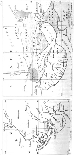
Aleppo, 1822.—Ionian Isles, 1820.—When Aleppo was destroyed by an earthquake in 1822, two rocks are reported to have risen from the sea near the island of Cyprus*; and a new rocky island was observed in 1820 not far from the coast of Santa Maura, one of the Ionian Islands, after violent earthquakes.†
Cutch, 1819.— A violent earthquake occurred at Cutch, in the delta of the Indus, on the 16th of June, 1819. (See map, plate 5.) The principal town, Bhooj, was converted into a heap of ruins, and its stone buildings were thrown down. The shock extended to Ahmedabad, where it was very destructive; and at Poonah, four hundred miles farther, it was feebly felt. At the former city, the great mosque erected by Sultan Ahmed nearly 450 years before, fell to the ground, attesting how long a period had elapsed since a shock of similar violence had visited that point. At Anjar, the fort, with its tower and guns, were hurled to the ground in one common mass of ruin. The shocks continued some days until the 20th; when, thirty miles from Bhooj, a volcano is said to have burst out in eruption, and the convulsions ceased.
Subsidence in the Delta of the Indus.—Although the ruin of towns was great, the face of Nature in the inland country, says Captain Macmurdo, was not visibly altered. In the hills some large masses only of rock and soil were detached from the precipices; but the eastern and almost deserted channel of the Indus; which bounds the province of Cutch, was greatly changed. This estuary, or inlet of the sea, was, before the earthquake, fordable at Luckput, being only about
* Journ. of Sci., vol. xiv. p. 450.
† Von Hoff., vol. ii. p. 180.
a foot deep when the tide was at ebb, and at flood tide never more than six feet; but it was deepened at the fort of Luckput, after the shock, to more than eighteen feet at low water.* On sounding other parts of the channel, it was found, that where previously the depth of the water at flood never exceeded one or two feet, it had become from four to ten feet deep. By these and other remarkable changes of level, a part of the inland navigation of that country, which had been closed for centuries, become again practicable.
Fort and village submerged.† —The fort and village of Sindree, on the eastern arm of the Indus, above Luckput, are stated by the same writer to have been overflowed; and, after the shock, the tops of the houses and wall were alone to be seen above the water, for the houses, although submerged, were not cast down. Had they been situated, therefore, in the interior, where so many forts were levelled to the ground, their site would, perhaps, have been regarded as having remained comparatively unmoved. Hence we may suspect that great permanent upheavings and depressions of soil may be the result of earthquakes, without the inhabitants being in the least degree conscious of any change of level.
A more recent survey of Cutch by Capt. A. Burnes, who was not in communication with Capt. Macmurdo, confirms the facts above enumerated, and adds many important details.‡ That officer examined the delta
* Macmurdo, Ed. Phil. Journ., vol. iv. p. 106.
† I am indebted to Captain Burnes for the accompanying engraving, (Pl. VI.) of the Fort of Sindree, as it appeared eleven years before the earthquake.
‡ This Memoir is now in the Library of the Royal Asiatic Society of London.
of the Indus in 1826 and 1828, and from his account it appears that, when Sindree subsided in June, 1819, the sea flowed in by the eastern mouth of the Indus, and in a few hours converted a tract of land, 2000 square miles in area, into an inland sea, or lagoon. Neither the rush of the sea into this néw depression, nor the movement of the earthquake, threw down entirely the small fort of Sindree, one of the four towers, the north-western, still continuing to stand; and the day after the earthquake, the inhabitants, who had ascended to the top of this tower, saved themselves in boats.*
Elevation of the Ullah Bund.—Immediately after the shock, the inhabitants of Sindree saw, at the distance of five miles and a half from their village, a long elevated mound, where previously there had been a low and perfectly level plain. (See Map, Pl. 5.) To this uplifted tract they gave the name of "Ullah Bund," or the "Mound of God," to distinguish it from several artificial dams previously thrown across the eastern arm of the Indus.
Extent of country raised.—It has been already ascertained that this new-raised country is upwards of fifty miles in length from east to west, running parallel to that line of subsidence before mentioned which caused the grounds around Sindree to be flooded. The range of this elevation extends from Puchum island towards Gharee; its breadth from north to south is conjectured to be in some parts sixteen miles, and its greatest ascertained height above the original level of the delta
* I have been enabled, from personal communication with Captain Burnes, to add several particulars to my former account of this earthquake.
is ten feet,—an elevation which appears to the eye to be very uniform throughout.
For several years after the convulsion of 1819, the course of the Indus was very unsettled, and at length, in 1826, the river threw a vast body of water into its eastern arm, that called the Phurraun, above Sinde; and forcing its way in a more direct course to the sea, burst through all the artificial dams which had been thrown across its channel, and at length cut right through the "Ullah Bund," whereby a natural section was obtained. In the perpendicular cliffs thus laid open, Captain Burnes found that the upraised lands consisted of clay filled with shells. The new channel of the river where it intersected the "bund" was eighteen feet deep, and during the swells in 1826, it was two or three hundred yards in width; but in 1828 the channel was still further enlarged. The Indus, when it first opened this new passage, threw such a body of water into the new meer, or salt lagoon, of Sindree, that it became fresh for many months; but it had recovered its saltness in 1828, when the supply of river water was less copious, and finally it became more salt than the sea, in consequence, as the natives suggested to Captain Burnes, of the saline particles with which the "Runn of Cutch" is impregnated.
In 1828 Captain Burnes went in a boat to the ruins of Sindree, where a single remaining tower was seen in the midst of a wide expanse of sea. The tops of the ruined walls still rose two or three feet above the level of the water; and standing on one of these, he could behold nothing in the horizon but water, except in one direction, where a blue streak of land to the north indicated the Ullah Bund. This scene presents to the imagination a lively picture of the revolutions
now in progress on the earth—a waste of waters where a few years before all was land, and the only land visible consisting of ground uplifted by a recent earthquake.
The Runn of Cutch, above alluded to, is a flat region of a very peculiar character, and no less than 7000 square miles in area; a greater superficial extent than Yorkshire, or about one fourth the area of Ireland. It is not a desert of moving sand, nor a marsh, but evidently the dried-up bed of an inland sea, which for a great part of every year has a hard and dry bottom uncovered by weeds or grass, and only supporting here and there a few tamarisks. But during the monsoons, when the sea runs high, the salt water driven up from the Gulf of Cutch and the creeks at Luckput overflows a large part of the Runn, especially after rains, when the soaked ground permits the sea-water to spread rapidly. The Runn is also liable to be overflowed occasionally in some parts by river-water; and it is remarkable that the only portion which was ever highly cultivated (that anciently called Sayra) is now permanently submerged. The surface of the Runn is sometimes encrusted with salt about an inch in depth, in consequence of the evaporation of the sea-water. Islands rise up in some parts of the waste, and the boundary lands form bays and promontories.
The natives have a tradition that, about three centuries ago, the countries of Cutch and Sinde were separated by the sea, thus giving rise to the district called the Runn. Towns far inland are still pointed out as having once been ancient ports; and it is said that ships were wrecked and engulphed by the great catastrophe. In confirmation of this account it was
VOL. II. M
observed, in 1819, that, in the jets of black muddy water thrown out of fissures in that region, there were cast up numerous pieces of wrought iron and ship nails.* Cones of sand six or eight feet in height are said to have been thrown up on these lands.†
We must not conclude without alluding to a moral phenomenon connected with this tremendous catastrophe, which we regard as highly deserving the attention of geologists. It is stated by Captain Burnes, that "these wonderful events passed unheeded by the inhabitants of Cutch;" for the region convulsed, though once fertile, had for a long period been reduced to sterility by want of irrigation, so that the natives were indifferent as to its fate. Now it is to this profound apathy which all but highly civilized nations feel, in regard to physical events not having an immediate influence on their worldly fortunes, that we must ascribe the extraordinary dearth of historical information concerning changes of the earth's surface, which modern observations show to be by no means of rare occurrence in the ordinary course of nature.
To the east of the line of this earthquake lies Oojain (called Ozene in the Peryplus Maris Erythr.). Ruins of an ancient city are there found, a mile north of the present, buried in the earth to the depth of from fifteen to sixteen feet, which inhumation is known to have been the consequence of a tremendous catastrophe in the time of the Rajah Vicramaditya.‡
Island of Sumbawa, 1815.—In April, 1815, one of
* Captain Burnes's Account
† Captain Macmurdo's Memoir, Ed. Phil. Journ., vol. iv. p.106.
‡ Von Huff, vol. ii. p. 454.; for further particulars, see book 3. chap. xiv.
the most frightful eruptions recorded in history occurred in the mountain Tomboro, in the island of Sumbawa. It began on the 5th of April, and was most violent on the 11th and 12th, and did not entirely cease till July. The sound of the explosions was heard in Sumatra, at the distance of 970 geographical miles in a direct line; and at Ternate, in an opposite direction, at the distance of 720 miles. Out of a (population of twelve thousand, only twenty-six individuals survived on the island. Violent whirlwinds carried up men, horses, cattle, and whatever else came within their influence, into the air, tore up the largest trees by the roots, and covered the whole sea with floating timber.* Great tracts of land were covered by lava, several streams of which, issuing from the crater of the Tomboro mountain, reached the sea. So heavy was the fall of ashes, that they broke into the Resident's house at Bima, forty miles east of the volcano, and rendered it, as well as many other dwellings in the town, uninhabitable. On the side of Java the ashes were carried to the distance of 300 miles, and 217 towards Celebes, in sufficient quantity to darken the air. The floating cinders to the westward of Sumatra formed, on the 12th of April, a mass two feet thick, and several miles in extent, through which, ships with difficulty forced their way.
The darkness occasioned in the daytime by the ashes in Java, was so profound, that nothing equal to it was ever witnessed in the darkest night. Although this volcanic dust when it fell was an impalpable, pow-
* Raffles's Java, vol. i. p. 28.
M 2
der, it was of considerable weight when compressed, a pint of it weighing twelve ounces and three-quarters. Along the sea-coast of Sumbawa, and the adjacent isles, the sea rose suddenly to the height of from two to twelve feet, a great wave rushing up the estuaries, and then suddenly subsiding. Although the wind at Bima was still during the whole time, the sea rolled in upon the shore, and filled the lower parts of the houses with water a foot deep. Every prow and boat was forced from the anchorage, and driven on shore.
"On the 19th of April," says one of Raffles's correspondents, "we grounded on the bank of Bima town. The anchorage at Bima must have altered considerably, as where we grounded the Ternate cruiser lay at anchor in six fathoms a few months before." Unfortunately, no facts are stated by which we may judge with certainty whether this shoal, implying a change of depth of more than thirty feet, was caused by an accumulation of ashes, or by an upheaving of the bottom of the sea. It is stated, however, that the surrounding country was covered with ashes. On the other hand, the town called Tomboro, on the west side of the volcano, was overflowed by the sea, which encroached upon the shore at the foot of the volcano, so that the water remained permanently eighteen feet deep in places where there was land before. Here we may observe, that the amount of subsidence of land was apparent, in spite of the ashes, which would naturally have caused the limits of the coast to be extended.
The area over which tremulous noises and other volcanic effects extended, was one thousand English miles in circumference, including the whole of the Molucca islands, Java, ·a considerable portion of Ce-
lebes, Sumatra, and Borneo. In the island of Amboyna; in the same month and year, the ground opened, threw out water, and then closed again.*
In conclusion, I may remind the reader, that but for the accidental presence of Sir Stamford Raffles, then governor of Java, we should scarcely have heard in Europe of this tremendous catastrophe. He required all the residents in the various districts under his authority to send in a statement of the circumstances which occurred within their own knowledge; but, valuable as were their communications, they are often calculated to excite rather than to satisfy the curiosity of the geologist. They mention, that similar effects, though in a less degree, had, about seven years before, accompanied an eruption of Carang Assam, a volcano in the island of Bali, west of Sumatra; but no particulars of that great catastrophe are recorded.†
Caraccas, 1812.—On the 26th of March, 1812, several violent shocks of an earthquake were felt in Caraccas. The surface undulated like a boiling liquid, and terrific sounds were heard underground. The whole city with its splendid churches was in an instant a heap of ruins, under which ten thousand of the inhabitants were buried. On the 5th of April, enormous rocks were detached from the mountains. It was believed that the mountain Silla lost from 300 to 360 feet of its height by subsidence; but this was an opinion not founded on any measurement. On the 27th of April, a volcano in St. Vincent's threw out ashes; and on the 30th, lava flowed from its crater into the sea,
* Raffles's Hist. of Java, vol. i. p. 25.—Ed. Phil. Journ., vol. iii. p. 389.
† Life and Services of Sir Stamford Raffles, p. 241. London, 1830.
M 3
while its explosions were heard at a distance equal to that between Vesuvius and Switzerland, the sound being transmitted, as Humboldt supposes, through the ground. During the earthquake which destroyed Caraccas, an immense quantity of water was thrown out at Valecille, near Valencia, as also at Porto Cabelle, through openings in the earth; and in the Lake Mara caybo the water sank.*
Although the great change of level in the mountain Silla was not distinctly proved, the opinion of the inhabitants deserves attention, because I shall afterwards have to mention some well-authenticated alterations in the same district during preceding earthquakes. Humboldt observed that the Cordilleras, composed of gneiss and mica slate, and the country immediately at their foot, were more violently shaken than the plains.
South Carolina, 1811.—New Madrid.—Previous to the destruction of La Guayra and Caraccas, in 1812, South Carolina was convulsed by earthquakes; and the shocks continued till those cities were destroyed. The valley also of the Mississippi, from the village of New Madrid to the mouth of the Ohio in one direction, and to the St. Francis in another, was convulsed to such a degree as to create lakes and islands. Flint, the geographer, who visited the country seven years after the event, informs us, that a tract of many miles in extent, near the Little Prairie, became covered with water three or four feet deep; and when the water disappeared, a stratum of sand was left in its place. Large lakes of twenty miles in extent were formed in the course of an hour, and others were drained. The
* Humboldt's Pers. Nar., vol. iv. p. 12.; and Ed. Phil. Journ., vol. i. p. 272. 1819.
grave-yard at New Madrid was precipitated into the bed of the Mississippi; and it is stated that the ground whereon the town is built, and the river bank for fifteen miles above, sank eight feet below their former level.* The neighbouring forest presented for some years afterwards "a singular scene of confusion; the trees standing inclined in every direction, and many having their trunks and branches broken."†
The inhabitants relate that the earth rose in great undulations; and when, these reached a certain fearful height, the soil burst, and vast volumes of water, sand, and pit-coal were discharged as high as the tops of the trees. Flint saw hundreds of these deep chasms remaining in an alluvial soil, seven years after. The people in the country, although inexperienced in such convulsions, had remarked that the chasms in the earth were in a direction from S.W. to N.E.; and they accordingly felled the tallest trees; and laying them at right angles to the chasms, stationed themselves upon them. By this invention, when chasms opened more than once under these trees several persons were prevented from being swallowed up.‡ At one period during this earthquake, the ground not far below New Madrid swelled up so as to arrest the Mississippi in its course, and to cause a temporary reflux of its waves. The motion of some of the shocks was horizontal, and of others perpendicular; and the vertical movement is said to have been much less desolating than the horizontal. If this be often the case, those shocks which injure cities least may produce the greatest alteration of level.
* Cramer's Navigator, p. 243. Pittsburgh, 1821.
† Long's Exped. to the Rocky Mountains, iii. p. 184.
‡ Silliman's Journ., Jan. 1829.
M 4
Aleutian Islands,1806.—In the year 1806, a new island, in the form of a peak, with some low conical hills upon it, rose from the sea among the Aleutian Islands, north of Kamtschatka. According to Langsdorf *, it was four geographical miles in circumference; and Von Buch infers, from its magnitude, and from its not having again subsided below the level of the sea, that it did not consist merely of ejected matter, like Monte Nuovo, but of a solid rock of trachyte upheaved.† Another extraordinary eruption happened in the spring of the year 1814, in the sea near Unalaschka, in the same archipelago. A new isle was then produced of considerable size, and with a peak three thousand feet high, which remained standing for a year afterwards, though with somewhat diminished height.
Although it is not improbable that the earthquake accompanying the tremendous eruptions above mentioned may have heaved up part of the bed of the sea, yet we must wait for fuller information before we assume this as a fact. The circumstance of these islands not having disappeared like Sabrina, may have arisen from the emission of lava. If Jorullo, for example, in 1759, had risen from a shallow sea to the height of 1600 feet, instead of attaining that elevation above the Mexican plateau, the massive current of basaltic lava which poured out from its crater would have enabled it to withstand, for a long period, the action of a turbulent sea.
Reflections on the Earthquakes of the nineteenth century.—We are now about to pass on to the events of
* Bernerkungen auf einer Reise um die Welt., bd. ii. s. 209.
† Neue Allgem. Geogr. Ephemer., bd. iii. s. 348.
the eighteenth century; but, before we leave the consideration of those already enumerated, let us pause for a moment, and reflect how many remarkable facts of geological interest are afforded by the earthquakes above described, though they constitute but a small part of the convulsions even of the last thirty years. New rocks have risen from the waters; the temperature of a thermal spring has been raised; the coast of Chili for one hundred miles has been permanently elevated; a considerable tract in the delta of the Indus has sunk down, and some of its shallow channels have become navigable; an adjoining part of the same district, upwards of fifty miles in length and sixteen in breadth, has been raised about ten feet above its former level; the town of Tomboro has been submerged, and twelve thousand of the inhabitants of Sumbawa have been destroyed. Yet, with a knowledge of these terrific catastrophes, witnessed during so brief a period by the present generation, will the geologist declare with perfect composure that the earth has at length settled into a state of repose? Will he continue to assert that the changes of relative level of land and sea, so common in former ages of the world, have now ceased? If, in the face of so many striking facts, he persists in maintaining this favourite dogma, it is in vain to hope that, by accumulating the proofs of similar convulsions during a series of antecedent ages, we shall shake his tenacity of purpose:—
Si fractus illabatur orbis,
Impavidum ferient ruinæ.
M 5
EARTHQUAKES OF THE EIGHTEENTH CENTURY.
Quito, 1797.—On the morning of February 4th, 1797, the volcano of Tunguragua in Quito; and the surrounding district, for forty leagues from south to north, and twenty leagues from west to east, experienced an undulating movement, which lasted four minutes. The same shock was felt over a tract of 170 leagues from south to north, from Piura to Popayan; and 140 from west to east, from the sea to the river Napo. In the smaller district first mentioned, where the movement was more intense, every town was levelled to the ground; and Riobamba, Quero, and other places, were buried under masses detached from the mountains. At the foot of Tunguragua the earth was rent open in several places; and streams of water and fetid mud, called "moya," poured out, overflowing and wasting every thing. In valleys one thousand feet broad, the water of these floods reached to the height of six hundred feet; and the mud deposit barred up the course of the river, so as to form lakes, which in some places continued for more than eighty days. Flames and suffocating vapours escaped from the lake Quilotoa, and killed all the cattle On its shores. The shocks continued all February and March; and on the 5th of April they recurred with almost as much violence as at first. We are told that the form of the surface in the district most shaken was entirely altered, but no exact measurements are given whereby we may estimate the degree of elevation or subsidence.* Indeed it would be difficult, except in the immediate neigh-
* Cavanilles, Journ. de Phys., tome xlix. p. 230. Gilberts, Annalen, bd. vi. p. 67. Humboldt's Voy., p. 317.
bourhood of the sea, to obtain any certain standard of comparison, if the levels were really as much altered as the narrations imply.
Cumana, 1797.—In the same year, on the 14th of December, the small Antilles experienced subterranean movements, and four fifths of the town of Cumana was shaken down by a vertical shock. The form of the shoal of Mornerouge, at the mouth of the river Bourdones, was changed by an upheaving of the ground.*
Quebec, 1791.—We learn from Captain Bayfield's memoirs, that earthquakes are very frequent on the shore of the estuary of the St. Lawrence, of force sufficient at times to split walls and throw down chimneys. Such were the effects experienced in December, 1791, in St. Paul's Bay, about fifty miles N.E. from Quebec; and the inhabitants say, that about every twenty-five years a violent earthquake returns, which lasts forty days. In the history of Canada, it is stated that, in 1663, a tremendous convulsion lasted six months, extending from Quebec to Tadeausac,— a distance of about 130 miles. The ice on the river was broken up and many landslips caused.†
Caraccas, 1790.—In the Caraccas, near where the Caura joins the Orinoco, between the towns San Pedro de Alcantara and San Francisco de Aripao, an earth quake, on St. Matthew's day, 1790, caused a sinking in of the granitic soil, and left a lake eight hundred yards in diameter, and from eighty to one hundred in depth. It was a portion of the forest of Aripao which sub-
* Humboldt's Voy., Relat. Hist, part i. p. 309.
† Macgregor's Travels in America.
M 6
sided, and the trees remained green for several months under water.*
Sicily, 1790.—On the 18th of March in the same year, at S. Maria di Niscemi, some miles from Terranuova, near the south coast of Sicily, the ground gradually sunk down for a circumference of three Italian miles, during seven shocks; and, in one place, to the depth of thirty feet. It continued to subside to the end of the month. Several fissures sent forth sulphur, petroleum, steam, and hot water; and a stream of mud, which flowed for two hours, and covered a space sixty feet long, and thirty broad. This happened far from both the ancient and modern volcanic district, in a group of strata consisting chiefly of blue clay.†
Java, 1786.—About the year 1786, an earthquake was felt at intervals, for the period of four months, in the neighbourhood of Batur, in Java, and an eruption followed. Various rents were formed, which emitted a sulphureous vapour; separate tracts sunk away, and were swallowed by the earth. Into one of these the rivulet Dotog entered, and afterwards continued to follow a subterraneous course. The village of Jampang was buried in the ground, with thirty-eight of its inhabitants, who had not time to escape. We are indebted to Dr. Horsfield for having verified the above-mentioned facts. ‡
Japan Isles, 1783.—In the province of Sinano, in the Isle of Nifou, the volcanic mountain of Asamayama, situated north-east of the town of Komoro, was in violent eruption August 1. 1783. The eruption
* Humboldt's Voy., Relat Hist, part ii. p. 632.
† Ferrara, Camp. fl., p. 51.
‡ Batav. Trans., vol viii. p. 141.
was preceded by a frightful earthquake; gulphs are said to have opened every where, and many towns to have been swallowed up, while others were subsequently buried by lava.*
* Humboldt, Fragmens Asiatiques, &c., tom. i. p. 229.
CHAPTER XV.
EARTHQUAKE IN CALABRIA, 1783.
Earthquake in Calabria, February 5. 1783—Shocks continued to the end of the year 1786—Authorities—Area convulsed— Geological structure of the district—Difficulty of ascertaining changes of level (p. 261.)—Subsidence of the quay at Messina—Shift or fault in the Round Tower of Terranuova—Movement in the stones of two obelisks—Opening and closing of fissures—Large edifices engulphed—Dimensions of new caverns and fissures (p. 268.)—Gradual closing in of rents—Bounding of detached masses into the air—Landslips—Buildings transported entire to great distances (p. 275.)—New lakes—Currents of mud—Funnel-shaped hollows in alluvial plains—Fall of cliffs, and shore near Scilla inundated—State of Stromboli and Etna during the shocks—How earthquakes contribute to the formation of valleys (p. 281.)—Concluding remarks.
Duration of the shocks.—OF the numerous earthquakes which have occurred in different parts of the globe, during the last hundred years, that of Calabria, in 1783, is almost the only one of which the geologist can be said to have such a circumstantial account as to enable him fully to appreciate the changes which this cause is capable of producing in the lapse of ages. The shocks began in February, 1783, and lasted for nearly four years, to the end of 1786. Neither in duration, nor in violence, nor in the extent of territory moved, was this convulsion remarkable, when contrasted with many experienced in other countries,
both during the last and present century; nor were the alterations which it occasioned in the relative level of hill and valley, land and sea, so great as those effected by some subterranean movements in South America, in later times. The importance of the earthquake in question arises from the circumstance, that Calabria is the only spot hitherto visited, both during and after the convulsions, by men possessing sufficient leisure, zeal, and scientific information, to enable them to collect and describe with accuracy the physical facts which throw light on geological questions.
Authorities.—Among the numerous authorities, Vivenzio, physician to the King of Naples, transmitted to the court a regular statement of his observations during the continuance of the shocks; and his narrative is drawn up with care and clearness.* Francesco Antonio Grimaldi, then secretary of war, visited the different provinces at the king's command, and published a most detailed description of the permanent changes m the surface.† He measured the length, breadth, and depth of the different fissures and gulphs which opened, and ascertained their number in many provinces. His comments, moreover, on the reports of the inhabitants, and his explanations of their relations, are judicious and instructive. Pignataro, a physician residing at Monteleone, a town placed in the very centre of the convulsions, kept a register of the shocks, distinguishing them into four classes, according to their degree of violence. From his work, it appears that, in the year 1783, the number was 949.
* Istoria de' Tremuoti della Calabria del 1783.
† Descriz. de' Tremuoti Accad. nelle Calabria nel 1783. Napoli, 1784.
of which 501 were shocks of the first degree of force; and in the following year there were 151, of which 98 were of the first magnitude.
Count Ippolito, also, and many others, wrote descriptions of the earthquake; and the Royal Academy of Naples, not satisfied with these and other observations, sent a deputation from their own body into Calabria, before the shocks had ceased, who were accompanied by artists instructed to illustrate by drawings the physical changes of the district, and the state of ruined towns and edifices. Unfortunately these artists were not very successful in their representations of the condition of the country, particularly when they attempted to express, on a large scale, the extraordinary revolutions which many of the great and minor river-courses underwent. But many of the plates published by the Academy are valuable; and as they are little known, I shall frequently avail myself of them to illustrate the facts about to be described.*
In addition to these Neapolitan sources of information, our countryman, Sir William Hamilton, surveyed the district, not without some personal risk, before the shocks had ceased; and his sketch, published in the Philosophical Transactions, supplies many, facts that would otherwise have been lost. He has explained in a rational manner many events which, as related in the language of some eye-witnesses, appeared marvellous and incredible. Dolomieu also examined Calabria during the catastrophe, and wrote an account of the earthquake, correcting a mistake
* Istoria de' Fenomeni del Tremoto, &c. nell' An. 1783, posta in luce dalla Real. Accad., &c. di Nap. Napoli, 1784. fol.
into which Hamilton had fallen, who supposed that a part of the tract shaken had consisted of volcanic tuff. It is, indeed, a circumstance which enhances the geological interest of the commotions which so often modify the surface of Calabria, that they are confined to a country where there are neither ancient nor modern rocks of volcanic or trappean origin; so that at some future time, when the era of disturbance shall have passed by, the cause of former revolutions will be as latent as in parts of Great Britain now occupied exclusively by ancient marine formations.
Extent of the area convulsed.—The convulsion of the earth, sea, and air extended over the whole of Calabria Ultra, the south-east part of Calabria Citra, and across the sea to Messina and its environs; a district lying between the 33th and 39th degrees of latitude. The concussion was perceptible over a great part of Sicily, and as far north as Naples; but the surface over which the shocks acted so forcibly as to excite intense alarm did not generally exceed five hundred square miles in area. The soil of that part of Calabria is composed chiefly, like the southern part of Sicily, of calcareo-argillaceous strata of great thickness, containing marine shells. This clay is sometimes. associated with beds of sand and limestone. For the, most part these formations resemble in appearance and, consistency the Subapennine marls, with their accompanying sands and sandstones; and the whole group bears considerable resemblance, in the yielding nature of its materials, to most of our tertiary deposits in France and England. Chronologically considered, however, the Calabrian formations are comparatively of very modern date, and abound in fossil shells referrible to species now living in the Mediterranean.
We learn from Vivenzio that, on the 20th and 26th of March, 1783, earthquakes occurred in the islands of Zante, Cephalonia, and St. Maura; and in the last-mentioned island several public edifices and private houses were overthrown, and many people destroyed. It has been already shown that the Ioman Islands fall within the line of the same great volcanic region as Calabria; so that both earthquakes were probably derived from a common source, and it is not improbable that the bed of the whole intermediate sea was convulsed.
If the city of Oppido, in Calabria, be taken as a centre, and round that centre a circle be described, with a radius of twenty-two miles, this space will comprehend the surface of the country which suffered the greatest alteration, and where all the towns and villages were destroyed. The first shock, of February 5th, 1783, threw down, in two minutes, the greater part of the houses in all the cities, towns, and villages, from the western flanks of the Apennines in Calabria Ultra to Messina in Sicily, and convulsed the whole surface of the country. Another occurred on the 28th of March, with almost equal violence. The granitic chain which passes through Calabria from north to south, and attains the height of many thousand feet, was shaken but slightly by the first shock, but more rudely by some which followed.
Some writers have asserted that the wavelike movements which were propagated through the recent strata, from west to east, became very violent when they reached the point of junction with the granite, as if a reaction war produced where the undulatory movement of the soft strata was suddenly arrested by the more solid rocks. But the statement of Dolomieu
on this subject is most interesting, and, perhaps, in a geological point of view, the most important of all the observations which are recorded.*
The Apennines, he says, which consist in great part of hard and solid granite, with some micaceous and argillaceous schists, form bare mountains with steep sides, and exhibit marks of great degradation. At their base newer strata are seen of sand and clay, mingled with shells; a marine deposit containing such ingredients as would result from the decomposition of granite. The surface of this newer (tertiary) formation constitutes what is called the plain of Calabria—a platform which is flat and level, except where intersected by narrow valleys or ravines, which rivers and torrents have excavated sometimes to the depth of six hundred feet. The sides of these ravines are almost perpendicular; for the superior stratum, being bound together by the roots of trees, prevents the formation of a sloping bank. The usual effect of the earthquake, he continues, was to disconnect all those masses which either had not sufficient bases for their bulk, or which were supported only by lateral adherence. Hence it follows that throughout almost the whole length of the chain the soil which· adhered to the granite at the base of the mountains Caulone, Esope, Sagra, and Aspramonte, slid over the solid and steeply inclined nucleus, and· descended somewhat lower, leaving almost uninterruptedly from St. George to beyond St. Christina, a distance of from nine to ten miles, a chasm between the solid granitic nucleus and the sandy soil Many lands slipping thus were carried to at considerable distance from their former position, so as entirely to cover
* Dissertation on the Calabrian Earthquake, &c., translated in Pinkerton's Voyages and Travels, vol. v.
others; and disputes arose as to whom the property which had thus shifted its place should belong.
From this account of Dolomieu we might anticipate, as the result of a continuance of such earthquakes, first, a longitudinal valley following the line of junction of the older and newer rocks; secondly, greater disturbance in the newer strata near the point of contact than at a greater distance from the mountains; phenomena very common in other parts of Italy at the junction of the Apennine and Subapennine formations.
The surface of the country often heaved, like the billows of a swelling sea, which produced a swimming in the head, like sea-sickness. It is particularly stated, in almost all the accounts, that just before each shock the clouds appeared motionless; and, although no explanation is offered of this phenomenon, it is obviously the same as that observed in a ship at sea when it pitches violently. The clouds seem arrested in their career as often as the vessel rises in a direction contrary to their course; so that the Calabrians must have experienced precisely the same motion on the land.
Trees, supported by their trunks, sometimes bent during the shocks to the earth, and touched it with their tops. This is mentioned as a well-known fact by Dolomieu; and he assures us that he was always on his guard against the spirit of exaggeration in which the vulgar are ever ready to indulge when relating these wonderful occurrences.
I shall now consider, in the first place, that class of physical changes produced by the earthquake which are connected with alterations in the relative level of the different parts of the land; and afterwards describe those which are more immediately connected with the derangement of the regular drainage of the
country, and where the force of running water cooperated with that of the earthquake.
Difficulty of ascertaining changes of level.—In regard to alterations of relative level, none of the accounts establish that they were on a considerable scale; but it must always be remembered that, in proportion to the area moved is the difficulty of proving that the general level has undergone any change, unless the sea-coast happens to have participated in the principal movement. Even then it is often impossible to determine whether an elevation or depression even of several feet has occurred, because there is nothing to attract notice in a band of shingle and sand of unequal breadth above the level of the sea running parallel to a, coast; such bands generally marking the point reached by the waves during spring tides, or the most violent tempests. The scientific investigator has not sufficient topographical knowledge to discover whether the extent of beach has diminished or increased; and he who has the necessary local information scarcely ever feels any interest in ascertaining the amount of the rise or fall of the ground. Add to this the great difficulty of making correct observations, in consequence of the enormous waves which roll in upon a coast during an earthquake, and efface every landmark near the shore.
Subsidence of the Quay at Messina.—It is evidently in seaports alone that we can look tor very accurate indications of slight changes of level; and when we find them, we may presume that they would not be rare at other points, if equal facilities of comparing relative altitudes were afforded. Grimaldi states (and his account is confirmed by Hamilton and others), that at Messina, in Sicily, the shore was rent; and the soil
along the port, which before the shock was perfectly level, was found afterwards to be inclined towards the sea,—the sea itself near the "Banchina" becoming deeper, and its bottom in several places disordered. The quay also sunk down about fourteen inches below the level of the sea, and the houses in its vicinity were much fissured. (Phil. Trans. 1783.)
Among various proofs of partial elevation and depression in the interior, the Academicians mention, in their Survey, that the ground was sometimes on the same level on both sides of new ravines and fissures, but sometimes there had been a considerable shifting, either by the upheaving of one side, or the subsidence of the other. Thus, on the sides of long rents in the territory of Soriano, the stratified masses had altered their relative position to the extent of from eight to fourteen palms (six to ten and a half feet).
Polistena—Similar shifts in the strata are alluded
Fig. 31.
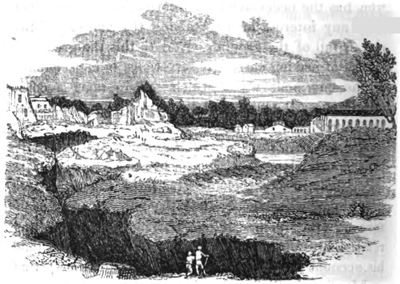
Deep fissure near Polistena, caused by the earthquake of 1783.
to in the territory of Polistena, where there appeared innumerable fissures in the earth. One of these was of great length and depth; and in parts the level of the corresponding sides was greatly changed. (See Fig. 31.)
Terranuova.—In the town of Terranuova some houses were seen uplifted above the common level, and others adjoining sunk down into the earth. In several streets the soil appeared thrust up, and abutted against the walls of houses; a large circular tower of solid masonry, part of which had withstood the general destruction, was divided by a vertical rent, and one side was upraised, and the foundations heaved out of the ground. It was compared by the Academicians to a great tooth half extracted from the alveolus, with the upper part of the fangs exposed. (See Fig. 32.)
Fig. 32.
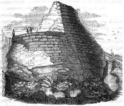
Shift or "fault" in the round tower of Terranuova in Calabria, occasioned by the earthquake of 1783.
Along the line of this shift, or "fault," as it would be termed technically by miners, the walls were found to adhere firmly to each other, and to fit so well, that the only signs of their having been disunited was the want of correspondence in the courses of stone on either side of the rent.
Dolomieu saw a stone well in the convent of the Augustins at Terranuova, which had the appearance of having been driven out of the earth. It resembled a small tower eight or nine feet in height, and a little inclined. This effect, he says, was produced by the consolidation and consequent sinking of the sandy soil in which the well was dug.
In some walls which had been thrown down, or violently shaken, in Monteleone, the separate stones were parted from the mortar, so as to leave an exact mould where they had rested; whereas in other cases the mortar was ground to dust between the stones.
It appears that the wave-like motions, and those which are called vorticose or whirling in a vortex, often produced effects of the most capricious kind. Thus, in some streets of Monteleone, every house was thrown down but one; in others, all but two; and the buildings which were spared were often scarcely in the least degree injured.
In many cities of Calabria, all the most solid buildings were thrown down, while those which were slightly built escaped; but at Rosarno, as also at Messina in Sicily, it was precisely the reverse, the massive edifices being the only ones that stood. Two obelisks (Fig. 33.) placed at the extremities of a magnificent facade in the convent of S. Bruno, in a small town called Stefano del Bosco, were observed to have under. gone a movement of a singular kind. The shock
Fig. 33.
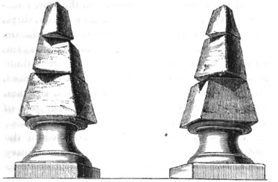
Shift in the stones of two obelisks in the Convent of S. Bruno.
which agitated the building is described as having been horizontal and vorticose. The pedestal of each obelisk remained in its original place; but the separate stones above were turned partially round, and removed sometimes nine inches from their position without falling.
Fissures.—It appears evident that a great part of the rending and fissuring of the ground was the effect of a violent motion from below upwards; and in a multitude of cases where the rents and chasms opened and closed alternately, we must suppose that the earth was by turns heaved up, and then let fall again. We may conceive the same effect to be produced on a small scale, if, by some mechanical force, a pavement composed of large flags of stone should be raised up, and then allowed to fall suddenly, so as to resume its original position. If any small pebbles happened to be lying on the line of contact of two flags, they would fall into the opening when the pavement rose, and be
VOL. II. N
swallowed up, so that no trace of them would appear after the subsidence of the stones. In the same manner, when the earth was upheaved, large houses, trees cattle, and men were engulphed in an instant in chasms and fissures; and when the ground sank down again the earth closed upon them, so that no vestige of then was discoverable on the surface. In many instance individuals were swallowed up by one shock, and the thrown out again alive, together with large jets water, by the shock which immediately succeeded.
At Jerocarne, a country which, according to the Academicians, was lacerated in a most extraordinar manner, the fissures ran in every direction "like cracks on a broken pane of glass" (see Fig. 34.); and as a great portion of them remained open after the shocks, it is very possible that this country was permanently upraised. It was usual, as we learn from Dolc
Fig. 34.
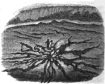
Fissures near Jerocarne, in Calabria, caused by the earthquake of 1783.
mieu, for the chasms and fissures throughout Calabria to run parallel to the course of some pre-existing gorges in their neighbourhood.
Houses engulphed.—In the vicinity of Oppido, the central point from which the earthquake diffused its violent movements, many houses were swallowed up by the yawning earth, which closed immediately over them. In the adjacent district, also, of Cannamaria four farm-houses, several oil-stores, and some spacious dwelling-houses were so completely engulphed in one chasm, that not a vestige of them was afterwards discernible. The same phenomenon occurred at Terranuova, S. Christina, and Sinopoli. The Academicians state particularly, that when deep abysses had opened in the argillaceous strata of Terranuova, and houses had sunk into them, the sides of the chasms closed with such violence, that, on excavating afterwards to recover articles of value, the workmen found the contents and detached parts of the buildings jammed together so as to become one compact mass. It is unnecessary to accumulate examples of similar occurrences; but so many are well authenticated during this earthquake in Calabria, that we may, without hesitation, yield assent to the accounts of catastrophes of the same kind repeated again and again in history, where whole towns are declared to have been engulphed, and nothing but a pool of water or tract of sand left in their place.
Chasm formed near Oppido.—On the sloping side of a hill near Oppido a great chasm opened; and, although a large quantity of soil was precipitated into the abyss, together with a considerable number of olive-trees and part of a vineyard, a great gulph remained after the shock, in the form of an amphi-
N 2
theatre, five hundred feet long and two hundred illeg deep. (See Fig. 35.)
Dimensions of new fissures and chasms.—According to Grimaldi, many fissures and chasms, formed the first shock of February 5th, were greatly wider lengthened, and deepened by the violent convulsion of March 28th. In the territory of San Fili this server found a new ravine, half a mile in length, feet and a half broad, and twenty-five feet deep; another of similar dimensions in the territory of Rosa A ravine nearly a mile long, 105 feet broad, and the feet deep, opened in the district of Plaisano, who also, two gulphs were caused—one in a place illeg Cerzulle, three quarters of a mile long, 150 feet illeg and above one hundred feet deep; and another ailleg Fortuna, nearly a quarter of a mile long, above illeg feet in breadth, and no less than 225 feet deep.
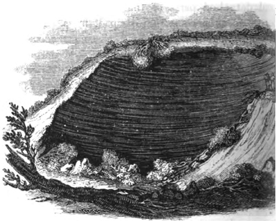
Chasm formed by the earthquake of 1783 near Oppido, in Calabria
In the district of Fosolano three gulphs opened: one of these measured 300 feet square, and above thirty feet deep; another was nearly half a mile long, fifteen feet broad, and above thirty feet deep; the third was 750 feet square. Lastly, a calcareous mountain, called Zefirio, at the southern extremity of the Italian peninsula, was cleft in two for the length of nearly half a mile, and an irregular breadth of many feet. Some of these chasms were in the form of a crescent. The annexed cut (Fig. 36.) represents one by no means remarkable for its dimensions, which remained open by the side of a small pass over the hill of St. Angelo, near Soriano. The small river Mesima is seen in the foreground.
Formation of new lakes.—In the vicinity of Seminara, a lake was suddenly formed by the opening of a great chasm, from the bottom of which water issued. This lake was called Lago del Tolfilo. It extended
Fig. 36.
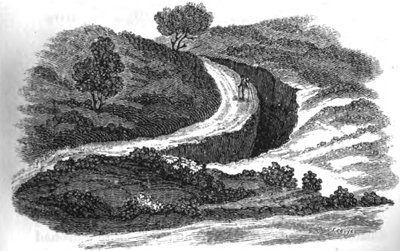
Chasm in the hill of St. Angelo, near Soriano, in Calabria, caused by the earthquake of 1783.
N 3
1785 feet in length, by 937 in breadth, and 52 in depth. The inhabitants, dreading the miasma of the stagnant pool, endeavoured, at great cost, to drain by canals, but without success, as it was fed by spring issuing from the bottom of the deep chasm. A sillegcircular subsidence occurred not far from Polistena which a representation is given in the annexed cut
Fig. 37.
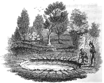
Circular pond near Polistena, in Calabria, caused by the earthquake is illeg
Gradual closing in of fissures.—Sir W. Hamilton was shown several deep fissures in the vicinity Mileto, which, although not one of them was above foot in breadth, had opened so wide during the earthquake as to swallow up an ox and nearly one hundred goats. The Academicians also found, on their retilleg through districts which they had passed at the commencement of their tour, that many rents had, in the short interval, gradually closed in, so that their widilleg had diminished several feet, and the opposite walls hilleg sometimes nearly met. It is natural that this should happen in argillaceous strata, while, in more soilleg
rocks, we may expect that fissures will remain open for ages. Should this be ascertained to be a general fact in countries convulsed by earthquakes, it may afford a satisfactory explanation of a common phenomenon in mineral veins. Such veins often retain their full size so long as the rocks consist of limestone, granite, or other indurated materials; but they contract their dimensions, become mere threads, or are even entirely cut off, where masses of an argillaceous nature are interposed. If we suppose the filling up of fissures with metallic and other ingredients to be a process requiring ages for its completion, it is obvious that the opposite walls of rents, where strata consist of yielding materials, must collapse or approach very near to each other before sufficient time is allowed for the accretion of a large quantity of veinstone.
Thermal waters augmented.—It is stated by Grimaldi, that the thermal waters of St. Euphemia, in Terra di Amato, which first burst out during the earthquake of 1638, acquired, in February, 1783, an augmentation both in quantity and degree of heat. This fact appears to indicate a connection between the heat of the interior and the fissures caused by the Calabrian earthquakes, notwithstanding the absence of volcanic rocks, either ancient or modern, in that district.
Bounding of detached masses into the air.—The violence of the movement of the ground upwards was singularly illustrated by what the Academicians call the "sbalzo," or bounding into the air, to the height of several yards, of masses slightly adhering to the surface. In some towns, a great part of the pavement stones were thrown up, and found lying with their lower sides uppermost. In these cases, we must suppose that they were propelled upwards by
N 4
the momentum which they had acquired; and that the adhesion of one end of the mass being greater than that of the other, a rotatory motion had been communicated to them. When the stone was projected to a sufficient height to perform somewhat more than a quarter of a revolution in the air, it pitched down on its edge, and fell with its lower side uppermost.
Effects of earthquakes on the excavation of valleys. — The next class of effects to be considered, are those more immediately connected with the formation of valleys, in which the action of water was often combined with that of the earthquake. The country agitated was composed, as before stated, chiefly of argillaceous strata, intersected by deep narrow valleys, sometimes from five to six hundred feet deep. As the boundary cliffs were in great part vertical, it will readily be conceived that, amidst the various movements of the earth, the precipices overhanging rivers, being without support on one side, were often thrown down. We find, indeed, that inundations produced by obstructions in river-courses are among the most disastrous consequences of great earthquakes in all parts of the world; for the alluvial plains in the bottoms of valleys are usually the most fertile and well-peopled parts of the whole country; and whether the site of a town is above or below a temporary barrier in the channel of a river, it is exposed to injury by the waters either of a lake or flood.
Landslips.—From each side of the deep valley or ravine of Terranuova, enormous masses of the adjoining flat country were detached, and cast down into the course of the river, so as to give rise to great lakes. Oaks, olive-trees, vineyards, and corn, were often seen growing at the bottom of the ravine, as little injured
as their former companions, which still continued to flourish in the plain above, at least five hundred feet higher, and at the distance of about three quarters of a mile. In one part of this ravine was an enormous mass, two hundred feet high, and about four hundred feet at its base, which had been detached by some former earthquake. It is well attested, that this mass travelled down the ravine nearly four miles, having been put in motion by the earthquake of the 5th of February. Hamilton, after examining the spot, declared that this phenomenon might be accounted for by the declivity of the valley, the great abundance of rain which fell, and the great weight of the alluvial matter which pressed behind it. Dolomieu also alludes to the fresh impulse derived from other masses falling, and pressing upon the rear of those first set in motion.
The first account sent to Naples of the two great slides or landslips above alluded to, which caused a great lake near Terranuova, was couched in these words:—"Two mountains on the opposite sides of a valley walked from their original position until they met in the middle of the plain, and there joining together, they intercepted the course of a river," &c. The expressions here used resemble singularly those applied to phenomena, probably very analogous, which are said to have occurred at Fez, during the great Lisbon earthquake, as also in Jamaica and Java at other periods.
Not far from Soriano, which was levelled to the ground by the great shock of February, a small valley, containing a beautiful olive-grove, called Fra Ramondo, underwent a most extraordinary revolution. Innumerable fissures first traversed the river-plain in
N 5
directions, and absorbed the water until the argillilleg ceous substratum became soaked, so that a great pilleg of it was reduced to a state of fluid paste. Strangely alterations in the outline of the ground were the cilleg sequence, as the soil to a great depth was eailleg moulded into any form. In addition to this change the ruins of the neighbouring hills were precipitailleg into the hollow; and while many olives were uprootilleg others remained growing on the fallen masses, and clined at various angles (see Fig. 38.). The small rilleg Caridi was entirely concealed for many days; illeg when at length it reappeared, it had shaped for its an entirely new channel.
Fig. 38.
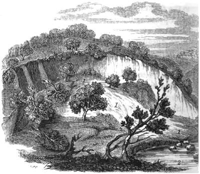
Changes of the surface at Fra Ramondo near Soriano, in Calabris-
1. Portion of a hill covered with olives thrown down.
2. New bed of the river Caridi.
3. Town of Soriano.
Buildings transported entire to great distances Near Seminara, an extensive olive-ground and orchard
were hurled to a distance of two hundred feet, into a valley sixty feet in depth. At the same time a deep chasm was riven in another part of the high platform from which the orchard had been detached, and the river immediately entered the fissure, leaving its former bed completely dry. A small inhabited house, standing on the mass of earth carried down into the valley, went along with it entire, and without injury to the inhabitants. The olive-trees, also, continued to grow on the land which had slid into the valley, and bore the same year an abundant crop of fruit.
Two tracts of land on which a great part of the town of Polistena stood, consisting of some hundreds of houses, were detached into a contiguous ravine, and nearly across it, about half a mile from their original site; and what is most extraordinary, several of the inhabitants were dug out from the ruins alive and unhurt.
Two tenements, near Mileto, called the Macini and Vaticano, about a mile long, and half a mile broad, were carried for a mile down a valley. A thatched cottage, together with large olive and mulberry trees, most of which remained erect, were carried uninjured to this extraordinary distance. According to Hamilton, the surface removed had been long undermined by rivulets, which were afterwards in full view on the bare spot deserted by the tenements. The earthquake seems to have opened a passage in the adjoining argillaceous hills, which admitted water charged with loose soil into the subterranean channels of the rivulets immediately under the tenements, so that the foundations of the ground set in motion by the earthquake were loosened. Another example of subsidence, where the edifices were not destroyed, is mentioned by Grimaldi,
N 6
as having taken place in the city of Catanzaro, the capital of the province of that name. The houses in the quarter called San Giuseppe subsided with the ground to various depths from two to four feet, but the buildings remained uninjured.
It would be tedious, and our space would not permit us, to follow the different authors through their local details of landslips produced in minor valleys; but they are highly interesting, as showing to how great an extent the power of rivers to widen valleys, and to carry away large portions of soil towards the sea, is increased where earthquakes are of periodical occurrence. Among other territories, that of Cinquefrondi was greatly convulsed, various portions of soil being raised or sunk, and innumerable fissures traversing the country in all directions (see Fig. 39.). Along the flanks of a small valley in this district there appears to have been an almost uninterrupted line of landslips.
Fig. 39.
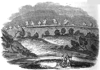
Landslips war Cinquefrondi, caused by the earthquake of 1783.
Number of new-formed lakes.—Vivenzio states, that near Sitizzano a valley was nearly filled up to a level with the high grounds on each side, by the enormous masses detached from the boundary hills, and cast down into the course of two streams. By this barrier a lake was formed of great depth, about two miles long and a mile broad. The same author mentions that, upon the whole, there were fifty lakes occasioned during the convulsions; and he assigns localities to all of these. The government surveyors enumerated 215 lakes, but they included in this number many small ponds.
Currents of mud.—Near S. Lucido, among other places, the soil is described as having been "dissolved," so that large torrents of mud inundated all the low grounds, like lava. Just emerging from this mud, the tops only of trees and of the ruins of farmhouses were seen. Two miles from Laureana, the swampy soil in two ravines became filled with calcareous matter, which oozed out from the ground immediately before the first great shock. This mud, rapidly accumulating, began, ere long, to roll onward, like a flood of lava, into the valley, where the two streams uniting, moved forward with increased impetus from east to west. It now presented a breadth of 225 feet by fifteen in depth, and, before it ceased to move, covered a surface equal in length to an Italian mile. In its progress it overwhelmed a flock of thirty goats, and tore up by the roots many olive and mulberry-trees, which floated like ships upon its surface. When this calcareous lava had ceased to move, it gradually became dry and hard, during which process the mass was lowered seven feet and a half. It contained
fragments of earth of a ferruginous colour, and emillegting a sulphureous smell.
Cones of sand thrown up.—Many of the appearance exhibited in the alluvial plains indicate clearly the ternate rising and sinking of the ground. The illeg effect of the more violent shocks was usually to up the rivers, but they immediately afterwards oilleg flowed their banks. Along the alluvial plains, an marshy places, an immense number of cones of illeg were thrown up. These appearances Hamilton plains, by supposing that the first movement railleg the fissured plain from below upwards, so that illeg rivers and stagnant waters in bogs sank down, cilleg least were not upraised with the soil. But when ground returned with violence to its former posiilleg the water was thrown up in jets through fissures.
Fig. 40.
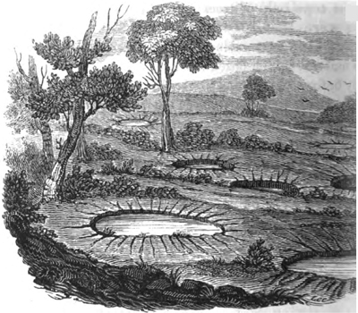
Circular hollows in the plain of Rosarno, formed by the earthquake of
* Phil. Trans., vol. lxxiii. p.180.
Formation of circular hollows.—In the report of the Academy, we find that some plains were covered with circular hollows, for the most part about the size of carriage-wheels, but often somewhat larger or smaller. When filled with water to within a foot or two of the surface, they appeared like wells; but, in general, they were filled with dry sand, sometimes with a concave surface, and at other times convex. (See fig. 40.). On digging down, they found them to be funnel-shaped, and the moist loose sand in the centre marked the tube up which the water spouted. The annexed cut represents a section of one of these inverted cones when the water had disappeared, and nothing but dry micaceous sand remained.
Fig. 41.
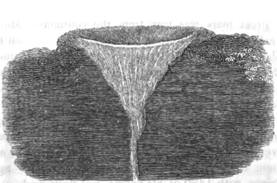
Section of one of the circular hollows formed in the plain of Rosarno.
Fall of the sea cliffs.—Along the sea-coast of the straits of Messina, near the celebrated rock of Scilla, the fall of huge masses detached from the bold and lofty cliffs overwhelmed many villas and gardens. At Gian Greco a continuous line of cliff, for a mile in length, was thrown down. Great agitation was frequently observed in the bed of the sea during the
shocks, and, on those parts of the coast where the movement was most violent all kinds of fish were taken in abundance, and with unusual facility. Some rare species, as that called Cicirelli, which usually lie buried in the sand, were taken on the surface of the waters in great quantity. The sea is said to have boiled up near Messina, and to have been agitated as if by a copious discharge of vapours from its bottom.
Shore near Scilla inundated.—The Prince of Scilla had persuaded a great part of his vassals to betake themselves to their fishing-boats for safety, and be himself had gone on board. On the night of the 5th of February, when some of the people were sleeping in the boats, and others on a level plain slightly elevated above the sea, the earth rocked, and suddenly a great mass was torn from the contiguous Mount Jaci, and thrown down with a dreadful crash upon the plain. Immediately afterwards, the sea, rising more than twenty feet above the level of this low tract, rolled foaming over it, and swept away the multitude. It then retreated, but soon rushed back again with greater violence, bringing with it some of the people and animals it had carried away. At the same time every boat was sunk or dashed against the beach, and some of them were swept far inland. The aged Prince, with 1430 of his people, was destroyed.
State of Stromboli and Etna during the shocks.— The inhabitants of Pizzo remarked that, on the 5th of February, 1783, when the first great shock afflicted Calabria, the volcano of Stromboli, which is in full view of that town, and at the distance of about fifty miles, smoked less, and threw up a less quantity of inflamed matter, than it had done for some years previously. On the other hand, the great crater of Etna
is said to have given out a considerable quantity of vapour towards the beginning, and Stromboli towards the close, of the commotions. But as no eruption happened from either of these great vents during the whole earthquake, the sources of the Calabrian convulsions, and of the volcanic fires of Etna and Stromboli, appear to be very independent of each other; unless, indeed, they have the same mutual relation as Vesuvius and the volcanos of the Phlegræan Fields and Ischia, a violent disturbance in one district serving as a safety-valve to the other, and both never being in full activity at once.
Excavation of valleys.—It is impossible for the geologist to consider attentively the effect of this single earthquake of 1783, and to look forward to the alterations in the physical condition of the country to which a continued series of such movements will here-after give rise, without perceiving that the formation of valleys by running water can never be understood, if we consider the question independently of the agency of earthquakes. Rivers do not begin to act, as some seem to imagine, when a country is already elevated far above the level of the sea, but while it is rising or sinking by successive movements. Whether Calabria is now undergoing any considerable change of relative level, in regard to the sea, or is, upon the whole, nearly stationary, is a question which our observations, confined almost entirely to the last half century, cannot possibly enable us to determine. But we know that strata, containing species of shells identical with those now living in the contiguous parts of the Mediterranean, have been raised in that country, as they have in Sicily, to the height of several thousand feet.
Now, those geologists who grant that the presilleg course of Nature in the inanimate world has been illeg changed since the existing species of animals were being, will not feel surprise that the Calabrian stresilleg and rivers have cut out of such comparatively modilleg strata a great system of valleys, varying in depth illeg fifty to six hundred feet, and often several miles illeg if they consider how numerous must have been earthquakes which lifted those recent marine illeg to so prodigious a height. Some speculators, indilleg who disregard the analogy of existing Nature, who are always ready to assume that her forces illeg more energetic in by-gone ages, may dispense illeg long series of movements, and suppose that illeg "rose like an exhalation" from the deep, after manner of Milton's Pandemonium. But sucilleg hypothesis would deprive them of that peculiilleg moving force required to form a regular system deep and wide valleys; for time, which they an unwilling to assume, is essential to the operilleg Time must be allowed in the intervals between tinct convulsions, for running water to clear away ruins caused by landslips, otherwise the fallen milleg will serve as buttresses, and prevent the succeilleg earthquake from exerting its full power. The siilleg the valley must be again cut away by the stream made to form precipices and overhanging cliffs, billeg the next shock can take effect in the same mannilleg
If a single violent convulsion agitate at onilleg entire hydrographical basin, or if the shocks illeg each other too rapidly, the previously existing illeg will be annihilated, instead of being modified an larged. Every stream will in that case be compilleg to begin its operations anew, and to open for its
passage through strata before undisturbed, instead of continuing to deepen and widen channels already in great part excavated. On the other hand, if, consistently with all that is known from observation of the laws which regulate subterranean movements, we consider their action to have been intermittent; if sufficient periods have always intervened between the severer shocks to allow the drainage of the country to be nearly restored to its original state, then both the illegind and degree of force are supplied which may enable running water to hollow out a valley of any depth and size consistent with the degree of elevation above the sea which the district in question may happen at any time to have attained during a succession of physical revolutions.
Notwithstanding the great derangement caused by violent earthquakes, there is an evident tendency in running water to remain constant to the same connected series of valleys. The softening of the soaked oil is invariably greatest in the channels of rivers and illeg alluvial plains. The water is absorbed in an infinite number of rents; and when the ground is swelled with water, it is reduced almost to a state of mud by the vehement agitation of the ground in every direction, and often for several years consecutively. The illegrosive and transporting action of running water is, therefore, facilitated in the tracts already excavated.
When we read of the drying up and desertion of the channels of rivers, the accounts most frequently illegfer to their deflection into some other part of the illegme alluvial plain, perhaps several miles distant. Under certain circumstances, a change of level may undoubtedly force the water to flow over into some
distinct hydrographical basin; but even then it will fall immediately into valleys already formed. Provided, therefore, we suppose the elevation and subsidence of mountain-chains to be a gradual process. there is no difficulty in explaining how the rivers draining large continents have converted ravines into valleys, and enlarged and deepened valleys to an enormous extent. On the contrary, the signs of slow and gradual action so manifest in the sinuosities and other characters of valleys, are admirably reconcileable with the great width and depth of the excavations, if we are content not only to suppose a great succession of ordinary earthquakes, but also the usual intervals of time between the shocks.
It may be observed, that earthquakes alone could never give rise to a regular system of valleys ramifying from a main trunk, like the small vessels from the great arteries of the human body. On the contrary, they would in the course of time destroy every system of valleys on the globe, were it not for the agency of aqueous causes. We learn from history that, ever since the first Greek colonists settled in Calabria, that region has been subject to devastation by earthquakes; and, for the last century and a half, ten years have seldom elapsed without a shock: but the severer convulsions have not only been separated by intervals of twenty, fifty, or one hundred years; but have not affected precisely the same points when they recurred. Thus the earthquake of 1783, although confined within the same geographical limits as that of 1638, and not very inferior in violence, visited, according to Grimaldi, very different districts. The points where the local intensity of the force is developed being thus
perpetually varied, more time is allowed for the removal of separate mountain masses thrown into river channels by each shock.
When chasms and deep hollows open at the bottom of valleys, they must often be filled with those "mud lavas" before described; and these must be extremely analogous to the enormous ancient deposits of mud which are seen in many countries, as in the basin of the Tay, Isla, and North Esk rivers, for example, in Scotland — alluvions hundreds of feet thick, which are neither stratified nor laminated like the ordinary sediment which subsides from water. Whenever a landslip blocks up a river, these currents of mud will be arrested, and accumulate to an enormous depth.
The portion of the Calabrian valleys formed within the last three thousand years may be inconsiderable in amount, compared to that previously formed, just as the lavas which have flowed from Etna since the historical era constitute but a small proportion of the whole cone. But as a continued series of such eruptions as man has witnessed would reproduce another cone like Etna, so a sufficient number of earthquakes like that of 1783 would enable torrents and rivers to re-excavate all the Calabrian valleys, if they were now to be entirely obliterated. It must be evident that more change is effected in two centuries in the width and depth of the valleys of that region, than in many thousand years in a country as undisturbed by earthquakes as Great Britain. For the same reason, therefore, that he who desires to comprehend the volcanic phenomena of Central France will repair to Vesuvius, Etna, or Hecla, so they who aspire to explain the mode in which valleys are formed, must
visit countries. where earthquakes are of frequent occurrence. For we may be assured, that the power which uplifted our more ancient tertiary strata of marine origin to more than a thousand feet above the level of the sea, co-operated at some former epoch with the force of rivers in the removal of large portions of rock and soil, just as the elevatory power which has upraised new strata to the height of several thousand feet in the south of Italy has caused those formations to be already intersected by deep valleys and ravines.
Number of persons who perished during the earthquake.—The number of persons who perished during the earthquake in the two Calabrias and Sicily is estimated by Hamilton at about forty thousand, and about twenty thousand more died by epidemics, which were caused by insufficient nourishment, exposure to the atmosphere, and malaria, arising from the new stagnant lakes and pools.
By far the greater number were buried under the ruins of their houses; but many were burnt to death in the conflagrations which almost invariably followed the shocks. These fires raged the more violently in some cities, such as Oppido, from the immense magazines of oil which were consumed.
Many persons were engulphed in deep fissures, especially the peasants, when flying across the open country, and their skeletons may perhaps be buried in the earth to this day, at the depth of several hundred feet.
When Dolomieu visited Messina after the shock of Feb. 5th, he describes the city as still presenting, at least at a distance, an imperfect image of its ancient splendour. Every house was injured, but the walls were standing: the whole population had taken refuge
in wooden huts in the neighbourhood, and all was solitude and silence in the streets: it seemed as if the city had been desolated by the plague, and the impression made upon his feelings was that of melancholy and sadness. "But when I passed over to Calabria, and first beheld Polistena, the scene of horror almost deprived me of my faculties; my mind was filled with mingled compassion and terror: nothing had escaped; all was levelled with the dust; not a single house or piece of wall remained; on all sides were heaps of stone so destitute of form, that they gave no conception of there ever having been a town on the spot. The stench of the dead bodies still rose from the ruins. I conversed with many persons who had been buried for three, four, and even for five days; I questioned them respecting their sensations in so dreadful a situation, and they agreed that, of all the physical evils they endured, thirst was the most intolerable; and that their mental agony was increased by the idea that they were abandoned by their friends, who might have rendered them assistance." *
It is supposed that about a fourth part of the inhabitants of Polistena, and of some other towns, were buried alive, and might have been saved had there been no want of hands; but in so general a calamity, where each was occupied with his own misfortunes, or those of his family, aid could rarely be obtained. Neither tears, nor supplications, nor promises of high rewards, were listened to. Many acts of self-devotion, prompted by parental and con-
* Dissertation on the Calabrian Earthquake, &c. translated in Pinkerton's Voyages and Travels, vol. v.
jugal tenderness, or by friendship, or the gratitude of faithful servants, are recorded; but individual exertions were, for the most part, ineffectual. It frequently happened, that persons in search of those most dear to them could hear their moans,— could recognize their voices,—were certain of the exact spot where they lay buried beneath their feet, yet could afford them no succour. The piled mass resisted all their strength, and rendered their efforts of no avail.
At Terranuova, four Augustin monks, who had taken refuge in a vaulted sacristy, the arch of which continued to support an immense pile of ruins, made their cries heard for the space of four days. One only of the brethren of the whole convent was saved, and "of what avail was his strength to remove the enormous weight of rubbish which had overwhelmed his companions?" He heard their voices die away gradually; and when afterwards their four corpses were disinterred, they were found clasped in each other's arms. Affecting narratives are preserved of mothers saved after the fifth, sixth, and even seventh day of their interment, when their infants or children had perished with hunger.
It might have been imagined that the sight of sufferings such as these would have been sufficient to awaken sentiments of humanity and pity in the most savage breasts, but nothing could exceed the atrocity of conduct and moral depravity displayed by the Calabrian peasants: they abandoned the farms, and flocked in great numbers into the towns—not to rescue their countrymen from a lingering death, but to plunder. They dashed through the streets, fearless of danger, amid tottering walls and clouds of dust, trampling
beneath their feet the bodies of the wounded and half buried, and often stripping them, while yet living, of their clothes.*
Concluding remarks. — But to enter more fully into these details would be foreign to the purpose of the present work, and several volumes would be required to give the reader a just idea of the sufferings which the inhabitants of many populous districts have undergone during the earthquakes of the last 140 years. A bare mention of the loss of life — as that fifty or a hundred thousand souls perished in one catastrophe — conveys to the reader no idea of the extent of misery inflicted: we must learn, from the narratives of eyewitnesses, the various forms in which death was encountered, the numbers who escaped with loss of limbs or serious bodily injuries, and the multitude who were suddenly reduced to penury and want. It has been often remarked, that the dread of earthquakes is strongest in the minds of those who have experienced them most frequently; whereas, in the case of almost every other danger, familiarity with peril renders men intrepid. The reason is obvious—scarcely any part of the mischief apprehended in this instance is imaginary; the first shock is often the most destructive; and, as it may occur in the dead of the night, or if by day, without giving the least warning of its approach, no forethought can guard against it; and when the convulsion has begun, no skill, or courage, or presence of mind, can point out the path of safety. During the intervals, of uncertain duration, between the more fatal shocks, slight tremors of the soil are not unfrequent; and as these sometimes precede more
* Dolomieu, ibid.
VOL. II. O
violent convulsions, they become a source of anxiety and alarm. The terror arising from this cause alone is of itself no inconsiderable evil.
Although sentiments of pure religion are frequently awakened by these awful visitations, yet we more commonly find that an habitual state of fear, a sense of helplessness, and a belief in the futility of all human exertions, prepare the minds of the vulgar for the influence of a demoralizing superstition.
Where earthquakes are frequent, there can never be perfect security of property under the best government; for industry cannot be assured of reaping the fruits of its labour; and the most daring acts of outrage may occasionally be perpetrated with impunity, when the arm of the law is paralysed by the general consternation. It is hardly necessary to add, that the progress of civilization and national wealth must be retarded by convulsions which level cities to the ground, destroy harbours, render roads impassable, and cause the most cultivated valley-plains to be covered with lakes, or the ruins of adjoining hills.
Those geologists who imagine that, at remote periods ere man became a sojourner on earth, the volcanic agency was more energetic than now, should be careful to found their opinion on strict geological evidence, and not permit themselves to be biassed, as they have often been, by a notion, that the disturbing force would probably be mitigated for the sake of man.
I shall endeavour to point out in the sequel, that the general tendency of subterranean movements, when their effects are considered for a sufficient lapse of ages, is eminently beneficial, and that they constitute an essential part of that mechanism by which the integrity of the habitable surface is preserved, and the
very existence and perpetuation of dry land secured. Why the working of this same machinery should be attended with so much evil, is a mystery far beyond the reach of our philosophy, and must probably remain so until we are permitted to investigate, not our planet alone and its inhabitants, but other parts of the moral and material universe with which they may be connected. Could our survey embrace other worlds, and the events, not of a few centuries only, but of periods as indefinite as those with which geology renders us familiar, some apparent contradictions might be reconciled, and some difficulties would doubtless be cleared up. But even then, as our capacities are finite, while the scheme of the universe may be infinite, both in time and space, it is presumptuous to suppose that all sources of doubt and perplexity would ever be removed. On the contrary, they might, perhaps, go on augmenting in number; for it has been justly said, that the greater the circle of light, the greater the boundary of darkness by which it is surrounded.*
* Sir H. Davy, Consolations in Travel, p.246.
O 2
CHAPTER XVI.
EARTHQUAKES OP THE EIGHTEENTH CENTURY — Continued.
Earthquake of Guatimala, 1773 — Java, 1772 — Truncation of a lofty cone — St. Domingo, 1770 — Colombia, 1766 — Lisbon 1755 — Shocks felt throughout Europe, Northern Africa, and the West Indies — Great wave (p. 298.) — Conception Bay, 1750 — Permanent elevation — Peru, 1746 — Kamtschatka, 1737 — Java, 1699 (p. 304.)— Rivers obstructed by landslips — Subsidence in Sicily, 1693 — Moluccas, 1693 — Jamaica, 1692 — Large tracts engulphed — Portion of Port Royal sunk — Amount of change in the last 140 years — Elevation and subsidence of land in Bay of Baiæ (p. 312.) — Evidence of the same afforded by the Temple of Serapis.
IN the preceding chapters we have considered a small part of those earthquakes only which have occurred during the last fifty years, of which accurate and authentic descriptions happen to have been recorded. We may next proceed to examine some of earlier date, respecting which information of geological interest has been obtained.
Mexico, June, 1773. — The town of Guatimala was founded, in 1742, on the side of a volcano, in a valley about three miles wide, opening to the South Sea; nine years afterwards it was destroyed by an earthquake, and again, in 1773, during an eruption of the volcano. The ground on which the town stood gaped open in deep fissures, until at length, after five days, an abyss opened, and the city, with all its riches, and
eight thousand families, was swallowed up. Every vestige of its former existence was entirely obliterated, and the spot is now indicated by a frightful desert, four leagues distant from the present town.*
Java, 1772— Truncation of a lofty cone. — In the year 1772, Papandayang, formerly one of the loftiest volcanos in the island of Java, was in eruption. Before all the inhabitants on the declivities of the mountain could save themselves by flight, the ground began to give way, and a great part of the volcano fell in and disappeared. It is estimated that an extent of ground of the mountain itself and its immediate environs, fifteen miles long and full six broad, was by this commotion swallowed up in the bowels of the earth. Forty villages were destroyed, some being engulphed and some covered by the substances thrown out on this occasion, and 2957 of the inhabitants perished. A proportionate number of cattle were also killed, and most of the plantations of cotton, indigo, and coffee in the adjacent districts were buried under the volcanic matter. This catastrophe appears to have resembled, although on a grander scale, that of the ancient Vesuvius in the year 79. The cone was reduced in height from nine thousand to about five thousand feet; and, as vapours still escape from the crater on its summit, a new cone may one day rise out of the ruins of the ancient mountain, as the modern Vesuvius has risen from the remains of Somma.†
* Von Hoff — Dodsley's Ann. Regist., vol. xvi. p. 149.
† Dr. Horsfield, Batav. Trans.; vol. viii. p. 26. Dr. H. informs me that he has seen this truncated mountain; and, though he did not ascend it, he has conversed with those who have examined it. Raffles's account (History of Java, vol. i.) is derived from Horsfield.
O 3
Caucasus, 1772.—About the year 1772, an earthquake convulsed the ground in the province at Beshtau, in the Caucasus, so that part of the hill Metshuka sunk into an abyss.*
St Domingo, 1770.—During a tremendous earthquake which destroyed a great part of St. Domingo, innumerable fissures were caused throughout the island, from which mephitic vapours emanated and produced an epidemic. Hot springs burst forth in many places where there had been no water before; but after a time they ceased to flow.†
Colombia, 1766—On the 21st of October, 1766, the ground was agitated at once at Cumana, at Caraccas, at Maracaybo, and on the banks of the rivers Casanare, the Meta, the Orinoco, and the Ventuario. These districts were much fissured, and great fallings in of the earth took place in the mountain Paurari: Trinidad was violently shaken. A small island in the Orinoco, near the rock Aravacoto, sunk down and disappeared.‡ At the same time the ground was raised in the sea near Cariaco, where the Point Del Gardo was enlarged. A rock also rose up in the river Guarapica, near the village of Maturin.§ The shocks continued in Colombia hourly for fourteen months.
Hindostan, 1762.— The town of Chittagong, in Bengal, was violently shaken by an earthquake, on the 2d of April 1762, the earth opening in many places, and throwing up water and mud of a sulphu-
* Pallas's Travels in Southern Russia.
† Essai sur l'Hist. Nat. de l'Isle de St.Domingue, Paris, 1776.
‡ Humboldt's Personal Narrative, vol. iv. p. 45.; and Saggio di Storia Americana, vol. ii. p. 6.
§ Humboldt, Voy. Relat. Hist, part i. p. 807.; and part ii. p. 23.
reous smell. At a place called Bardayan a large river was dried up; and at Bakar Churak, near the sea, a tract of ground sunk down, and 200 people with all their cattle were lost. Unfathomable chasms are described as remaining open in many places after the shocks, and towns which subsided several cubits were overflowed with water; among others, Deep Gong, which was submerged to the depth of seven cubits. Two volcanos are said to have opened in the Secta Cunda hills. The shock was also felt at Calcutta.*
Lisbon, 1755. — In no part of the volcanic region of southern Europe has so tremendous an earthquake occurred in modern times as that which began on the 1st of November, 1755, at Lisbon. A sound of thunder was heard underground, and immediately afterwards a violent shock threw down the greater part of that city. In the course of about six minutes, sixty thousand persons perished. The sea first retired and laid the bar dry; it then rolled in, rising fifty feet or more above its ordinary level. The mountains of Arrabida, Estrella, Julio, Marvan, and Cintra, being some of the largest in Portugal, were impetuously shaken, as it were, from their very foundations; and some of them opened at their summits, which were split and rent in a wonderful manner, huge masses of them being thrown down into the subjacent valleys.† Flames are related to have issued from these mountains, which are supposed to have been electric; they are also said to have smoked; but vast clouds of dust may have given rise to this appearance.
* Dodsley's Ann. Regist, 1763. For other particulars, see Phil. Trans., vol. Iiii.
† Hist, and Philos. of Earthquakes, p. 317.
O 4
Subsidence of the Quay. — The most extraordinary circumstance which occurred at Lisbon during the catastrophe was the subsidence of a new quay, built entirely of marble at an immense expense. A great concourse of people had collected there for safety, as a spot where they might be beyond the reach of falling ruins; but, suddenly, the quay sank down with all the people on it, and not one of the dead bodies ever floated to the surface. A great number of boats and small vessels anchored near it, all full of people, were swallowed up, as in a whirlpool.* No fragments of these wrecks ever rose again to the surface, and the water in the place where the quay had stood is stated, in many accounts, to be unfathomable; but Whitehurst says, he ascertained it to be one hundred fathoms.†
In this case, we must either suppose that a certain tract sank down into a subterranean hollow, which would cause a "fault" in the strata to the depth of six hundred feet, or we may infer, as some have done, from the entire disappearance of the substances engulphed, that a chasm opened and closed again. Yet, in adopting this latter hypothesis, we must suppose that the upper part of the chasm, to the depth of one hundred fathoms, remained open.
Area over which the earthquake extended. — The great area over which this Lisbon earthquake extended is very remarkable. The movement was most violent in Spain, Portugal, and the north of Africa; but nearly the whole of Europe, and even the West Indies,
* Rev. C. Davy's Letters, vol. ii. Letter ii. p. 12., who was at Lisbon at the time, and ascertained that the boats and vessels said to have been swallowed were missing.
† On the Formation of the Earth, p. 55.
felt the shock on the same day. A seaport, called St. Ubes, about twenty miles south of Lisbon, was engulphed. At Algiers and Fez, in Africa, the agitation of the earth was equally violent; and at the distance of eight leagues from Morocco, a village with the inhabitants to the number of about eight or ten thousand persons, together with all their cattle, were swallowed up. Soon after the earth closed again over them.
Shocks felt at sea. — The shock was felt at sea, on the deck of a ship to the west of Lisbon, and produced very much the same sensation as on dry land. Off St. Lucar, the captain of the ship Nancy felt his vessel so violently shaken, that he thought she had struck the ground; but, on heaving the lead, found a great depth of water. Captain Clark, from Denia, in latitude 36°24′ N., between nine and ten in the morning, had his ship shaken and strained as if she had struck upon a rock, so that the seams of the deck opened, and the compass was overturned in the binnacle. Another ship, forty leagues west of St. Vincent, experienced so violent a concussion, that the men were thrown a foot and a half perpendicularly up from the deck. In Antigua and Barbadoes, as also in Norway, Sweden, Germany, Holland, Corsica, Switzerland, and Italy, tremors and slight oscillations of the ground were felt.
Rate at which the movement travelled.—The agitation of lakes, rivers, and springs, in Great Britain, was remarkable. At Loch Lomond, in Scotland, for example, the water, without the least apparent cause, rose against its banks, and then subsided below its usual level. The greatest perpendicular height of this swell was two feet four inches. It is said that the movement of this earthquake was undulatory, and that it travelled at the rate of twenty miles a minute, its
O 5
velocity being calculated by the intervals between the time when the first shock was felt at Lisbon, and its time of occurrence at other distant places.*
Great wave and retreat of the sea. — A great wave swept over the coast of Spain, and is said to have been sixty feet high at Cadiz. At Tangier, in Africa, it rose and fell eighteen times on the coast At Funchal, in Madeira, it rose full fifteen feet perpendicular above high-water mark, although the tide, which ebbs and flows there seven feet, was then at half ebb. Besides entering the city, and committing great havoc, it overflowed other seaports in the island. At Kinsale, in Ireland, a body of water rushed into the harbour, whirled round several vessels, and poured into the market-place.
It was before stated that the sea first retired at Lisbon; and this retreat of the ocean from the shore, at the commencement of an earthquake and its subsequent return in a violent wave, is a common occurrence. In order to account for the phenomenon, Michell imagined a subsidence at the bottom of the sea, from the giving way of the roof of some cavity in consequence of a vacuum produced by the condensation of steam. Such condensation, he observes, might be the first effect of the introduction of a large body of water into fissures and cavities already filled with steam, before there has been sufficient time for the heat of the incandescent lava to turn so large a supply of water into steam, which being soon accomplished causes a greater explosion.
Another proposed explanation is, the sudden rise of
* Michell on the Cause and Phenomena of Earthquakes, Phil Trans., vol. li. p. 566. 1760.
the land which would cause the sea to abandon immediately the ancient line of coast; and if the shore, after being thus heaved up, should fall again to its original level, the ocean would return. This theory, however, will not account for the facts observed during the Lisbon earthquake; for the retreat preceded the wave, not only on the coast of Portugal, but also at the island of Madeira, and several other places. If the upheaving of the coast of Portugal had caused the retreat, the motion of the waters, when propagated to Madeira, would have produced a wave previous to the retreat. Nor could the motion of the waters at Madeira have been caused by a different local earthquake; for the shock travelled from Lisbon to Madeira in two hours, which agrees with the time which it required to reach other places equally distant.*
The following is, perhaps, the most probable solution of the problem which has yet been offered: — Suppose a portion of the bed of the sea to be suddenly upheaved, the first effect will be to raise over the elevated part a body of water, the momentum of which will carry it much above the level it will afterwards assume, causing a draught or receding of the water from the neighbouring coasts, followed immediately by the return of the displaced water, which will also be impelled by its momentum, much farther and higher on the coast than its former level.†
St Domingo, 1751. — On the 15th of September, 1751, an earthquake began in several of the West India Islands; and on the 21st of November, a violent shock destroyed the capital of St. Domingo, Port au
* Michell, Phil. Trans., vol. li. p.614.
† Quarterly Review, No. 86. p. 459.
O 6
Prince. Part of the coast, twenty leagues in length, sank down, and has ever since formed a bay of the sea.*
Chili, 1750. — On the 24th of May, 1750, the ancient town of Conception, otherwise called Penco, was totally destroyed by an earthquake, and the sea rolled over it. The ancient port was rendered entirely useless, and the inhabitants built another town ten miles from the sea-coast, in order to be beyond the reach of similar inundations.
Proofs of elevation of twenty-four feet—During a late survey of Conception Bay, Captains Beechey and Belcher discovered that the ancient harbour, which formerly admitted all large merchant vessels which went round the Cape, is now occupied by a reef of sandstone, certain points of which project above the sea at low water, the greater part being very shallow. A tract of a mile and a half in length, where, according to the report of the inhabitants, the water was formerly four or five fathoms deep, is now a shoal; consisting, as our hydrographers found, of hard sandstone, so that it cannot be supposed to have been formed by recent deposits of the river Biobio, an arm of which carries down loose micaceous sand into the same side of the bay. Besides, it is a well-known fact that ever since the shock of 1750, no vessels have been able to approach within a mile and a half of the ancient port of Penco. That shock, therefore, uplifted the bed of the sea to the height of twenty-four feet at the least, and, most probably, the adjoining coast shared in the elevation: for an enormous bed of shells of the same species as those now living in the
* Hist. de l'Acad. des Sciences. 1752. Paris.
bay, are seen raised above high-water mark along the beach, filled with micaceous sand like that which the Biobio now conveys to the bay. These shells, as well as others, which cover the adjoining hills of mica-schist to the height of from 1000 to 1500 feet, have lately been examined by experienced conchologists in London, and identified with those taken at the same time in a living state from the bay and its neighbourhood.*
Ulloa, therefore, was perfectly correct in his statement that, at various heights above the sea between Talcaguana and Conception, "mines were found of various sorts of shells used for lime of the very same kinds as those found in the adjoining sea." Among them he mentions the great mussel called Choros, and two others, which he describes. Some of these, he says, are entire, and others broken; they occur at the bottom of the sea, in four, six, ten, or twelve fathom water, where they adhere to a sea-plant called Cochayuyo. They are taken in dredges, and have no resemblance to those found on the shore or in shallow water; yet beds of them occur at various heights on the hills. "I was the more pleased with the sight," he adds, "as it appeared to me a convincing proof of the universality of the deluge, although I am not ignorant that some have attributed their position to other causes; but an unanswerable confutation of their subterfuge is, that the various sorts of shells which compose these strata, both in the plains and mountains, are the very same with those found in the bay."† Perhaps the diluvian theory of this distinguished navigator, the
* Captain Belcher has shown me these shells, and the collection has been examined by Mr. Broderip.
† Ulloa's Voyage to South America, vol. ii. book viii. ch. vi.
companion of Condamine, may account for his never having recorded even reports of changes in the relative level of land and sea on the shores of South America. He could not, however, have given us a relation of the rise of the reef above alluded to; for the destruction of Penco happened a few years after the publication of his Voyages.
If we duly consider these facts, so recently brought to light, as well as the elevation before mentioned of the coast at Valparaiso in 1822, we shall be less sceptical than Raspe, in regard to an event for which Hooke had cited Purchas's Travels. In that passage it was stated, that "a certain sea-coast in a province of South America, called Chili, was, during a violent earthquake, propelled upwards with such force and velocity, that some ships on the sea were grounded in it, and the sea receded to a distance." Raspe, being himself of opinion that all the continents had been upraised gradually by earthquakes from the sea, admitted that the circumstance was not impossible; but he complains that Purchas had interpolated the account of the earthquake (which happened, probably, at the close of the seventeenth century) into Da Costa's History of the West Indies.*
Peru, 1746.—Peru was visited, on the 28th of October, 1746, by an earthquake, which is declared to have been more tremendous and extensive than even that of Lisbon in 1755. In the first twenty-four hours, two hundred shocks were experienced. The ocean twice retired and returned impetuously upon the land: Lima was destroyed, and part of the coast near Callao was converted into a bay; four other harbours, among
* De Novis Insulis, p. 120. 1753.
which were Cavalla and Guanape, shared the same fate. There were twenty-three ships and vessels, great and small, in the harbour of Callao, of which nineteen were sunk; and the other four, among which was a frigate called St. Fermin, were carried by the force of the waves to a great distance up the country. The number of the inhabitants in this city amounted to four thousand. Two hundred only escaped, twenty-two of whom were saved on a small fragment of the fort of Vera Cruz, which remained as the only memorial of the site of the town after this dreadful inundation.
A volcano in Lucanas burst forth the same night, and such quantities of water descended from the cone that the whole country was overflowed; and in the mountain near Patao, called Conversiones de Caxamarquilla, three other volcanos burst out, and frightful torrents of water swept down their sides.*
In regard to changes of level, I have heard that the submerged arches of a church, and the position of several buildings, indicate a subsidence on the ancient site of Callao; but this report requires confirmation. Mr. Fryer states that the isle of San Lorenzo in the bay of Callao appears to have been raised up by volcanic action, and partially so at a comparatively recent period; for he found at considerable heights above the sea the shells of Concholepas, Pecten purpureus, Sigaretus concavus, and others, in great abundance, and retaining their colours almost as fresh as those now living in the Pacific.†
Kamtschatka, 1737.—The eastern side of the Peninsula of Kamtschatka, at Awatchka Bay, was shaken by
* Ulloa's Voyage, vol. ii. book vii. chap. vii.
† Letter read to Geol. Soc., March, 1835.
an earthquake on October the 6th, 1737. The sea was violently agitated, and overflowed the land to an immense height, and then withdrew so far as to lay bare its bottom between the first and second of the Kurile Isles. The shape of the ground was greatly changed. Several plains were uplifted and formed hills; and, on the other hand, many subsidences occasioned inland lakes and new bays on the coast.*
Martinique, 1727.—In the year 1727, a hill is said to have sunk down in Martinique during an earthquake.†
Iceland, 1725. — In Iceland during the eruption of the volcano Leirhnukur, in 1725-6, a tract of high land sank down, and formed a lake; and, half a mile from the same place, a hill rose and converted a lake into dry land.‡
Teneriffe, 1706.—May 5th, 1706, a lateral eruption of Teneriffe took place south of the harbour of Garachico, which was overwhelmed with lava. Many springs disappeared, and there were such changes of level as to alter the whole face of the country, hills having risen up where there were plains before.§
Java, 1699.—On the 5th of January, 1699, a terrible earthquake visited Java, and no less than 208 considerable shocks were reckoned. Many houses in Batavia were overturned, and the flame and noise of a volcanic eruption were seen and heard in that city, which were afterwards found to proceed from Mount Salak║, a volcano six days' journey distant. Next morning the Batavian river, which has its rise from
* Kracheninikon by Chappe d'Auteroche, p. 337.
† Geog. of America, Schlözer, part ii. p. 554.
‡ Dureau de la Malie, Géog. de la Mer Noire, p. 203.
§ Humboldt and Bonpland, Voy. Relat. Hist., part i. p. 177.
║ Misspelt Sales in Hooke's Account.
that mountain, became very high and muddy, and brought down abundance of bushes and trees, half burnt. The channel of the river being stopped up, the water overflowed the country round the gardens about the town, and some of the streets, so that fishes lay dead in them. All the fish in the river, except the carps, were killed by the mud and turbid water. A great number of drowned buffaloes, tigers, rhinoceroses, deer, apes, and other wild beasts, were brought down by the current; and, "notwithstanding," observes one of the writers, "that a crododile is amphibious, several of them were found dead among the rest." *
It is stated, that seven hills bounding the river sank down, by which is merely meant, as by similar expressions in the description of the Calabrian earthquakes, seven great landslips. These hills, descending some from one side of the valley and some from the other, filled the channel, and the waters then finding their way under the mass, flowed out thick and muddy. The Tangaran river was also dammed up by nine hills, and in its channel were large quantities of drift trees. Seven of its tributaries also are said to have been "covered up with earth." A high tract of forest land, between the two great rivers before mentioned, is described as having been changed into an open country, destitute of trees, the surface being spread over with a fine red clay. This part of the account may, perhaps, merely refer to the sliding down of woody tracts into the valleys, as happened to so many extensive vineyards and olive grounds in Calabria, in 1783. The close packing of large trees in the Batavian river is represented as very remarkable, and it attests in a striking
* Hooke's Posthumous Works, p. 437. 1705.
manner the destruction of soil bordering the valleys which had been caused by floods and landslips.*
Quito, 1698. — In Quito, on the 19th of July, 1698, during an earthquake, a great part of the crater and summit of the volcano Carguairazo fell in, and a stream of water and mud issued from the broken sides of the hill.†
Sicily, 1693. — Shocks of earthquakes spread over all Sicily in 1693, and on the 11th of January the city of Catania and forty-nine other places were levelled to the ground, and about one hundred thousand people killed. The bottom of the sea, says Vicentino Bonajutus, sank down considerably, both in ports, inclosed bays, and open parts of the coast, and water bubbled up along the shores. Numerous long fissures of various breadths were caused, which threw out sulphureous water; and one of them, in the plain of Catania (the delta of the Simeto), at the distance of four miles from the sea, sent forth water as salt as the sea. The stone buildings of a street in the city of Noto, for the length of half a mile, sank into the ground, and remained hanging on one side. In another street, an opening large enough to swallow a man and horse appeared.‡
Moluccas, 1693. — The small isle of Sorea, which consists of one great volcano, was in eruption in the year 1693. Different parts of the cone fell, one after the other, into a deep crater, until almost half the space of the island was converted into a fiery lake. Most of the inhabitants fled to Banda; but great pieces of the mountain continued to fall down, so that the lake of lava became wider; and finally the whole popu-
* Phil. Trans. 1700.
† Humboldt, Atl. Pit, p. 106.
‡ Phil. Trans. 1693-4.
lation was compelled to emigrate. It is stated that, in proportion as the burning lake increased in size, the earthquakes were less vehement.*
Jamaica, 1692.—In the year 1692, the island of Jamaica was visited by a violent earthquake; the ground swelled and heaved like a rolling sea, and was traversed by numerous cracks, two or three hundred of which were often seen at a time opening and then closing rapidly again. Many people were swallowed up in these rents; some the earth caught by the middle, and squeezed to death; the heads of others only appeared above ground; and some were first engulphed, and then cast up again with great quantities of water. Such was the devastation, that even at Port Royal, then the capital, where more houses are said to have been left standing than in the whole island beside, three quarters of the buildings, together with the ground they stood on, sank down with their inhabitants entirely under water.
Subsidence in the harbour. — The large store-houses on the harbour side subsided, so as to be twenty-four, thirty-six, and forty-eight feet under water; yet many of them appear to have remained standing, for it is stated that, after the earthquake, the mast-heads of several ships wrecked in the harbour, together with the chimney-tops of houses, were just seen projecting above the waves. A tract of land round the town, about a thousand acres in extent, sank down in less than one minute, during the first shock, and the sea immediately rolled in. The Swan frigate, which was repairing in the wharf, was driven over the tops of many buildings, and then thrown upon one of the roofs,
* Phil. Trans. 1693.
through which it broke. The breadth of one of the streets is said to have been doubled by the earthquake.
According to Mr. De la Beche, the part of Port Royal described as having sunk was built upon newly formed land, consisting of sand in which piles had been driven; and the settlement of this loose sand, charged with the weight of heavy houses, may have given rise to the subsidences alluded to.* There can be no doubt that a waving motion of the earth, accompanied by an inroad of the sea, might affect loose sand, while solid rock might remain unmoved; but, after attentively considering the original documents, and conversing with persons who, ninety years after, saw some of the submerged houses, I am inclined to believe that there were various and unequal subsidences of the land at Port Royal, independently of any sliding and undermining of the sands.
At several thousand places in Jamaica, the earth is related to have opened. On the north of the island, several plantations, with their inhabitants, were swallowed up, and a lake appeared in their place, covering above a thousand acres, which afterwards dried up, leaving nothing but sand and gravel, without the least sign that there had ever been a house or a tree there. Several tenements at Yallowes were buried under landslips; and one plantation was removed half a mile from its place, the crops continuing to grow upon it uninjured. Between Spanish Town and Sixteen-mile Walk, the high and perpendicular cliffs bounding the river fell in, stopped the passage of the river, and flooded the latter place for nine days, so that the
* Manual of Geol., p. 133, second edition.
people "concluded it had been sunk as Port Royal was." But the flood at length subsided, for the river had found some new passage at a great distance.
Mountains shattered. — The Blue and other of the highest mountains are declared to have been strangely torn and rent. They appeared shattered, and half-naked, no longer affording a fine green prospect, as before, but stripped of their woods and natural verdure. The rivers on these mountains first ceased to flow for about twenty-four hours, and then brought down into the sea, at Port Royal and other places, several hundred thousand tons of timber, which looked like floating islands on the ocean. The trees were in general barked, most of their branches having been torn off in the descent. It is particularly remarked in this, as in the narratives of so many earthquakes, that fish were taken in great numbers on the coast during the shocks. The correspondents of Sir Hans Sloane, who collected with care the accounts of eye-witnesses of the catastrophe, refer constantly to subsidences, and some supposed the whole of Jamaica to have sunk down.*
Reflections on the amount of change in the last one hundred and forty years. — I have now only enumerated the earthquakes of the last 140 years, respecting which facts illustrative of geological inquiries are on record. Even if my limits permitted, it would be a tedious and unprofitable task to examine all the obscure and ambiguous narratives of similar events of earlier epochs; although, if the places were now examined by geologists well practised in the art of interpreting the monuments of physical changes, many events which have happened within the historical era might
* Phil. Trans. 1694.
still be determined with precision. It must not be imagined that, in the above sketch of the occurrences of a short period, I have given an account of all, or even the greater part, of the mutations which the earth has undergone by the agency of subterranean movements. Thus, for example, the earthquake of Aleppo, in the present century, and of Syria, in the middle of the eighteenth, would doubtless have afforded numerous phenomena, of great geological importance, had those catastrophes been described by scientific observers. The shocks in Syria, in 1759, were protracted for three months, throughout a space of ten thousand square leagues; an area compared to which that of the Calabrian earthquake of 1783 was insignificant. Accon, Saphat, Balbeck, Damascus, Sidon, Tripoli, and many other places, were almost entirely levelled to the ground. Many thousands of the inhabitants perished in each; and, in the valley of Balbeck alone, twenty thousand men are said to have been victims to the convulsion. In the absence of scientific accounts, it would be as irrelevant to our present purpose to enter into a detailed account of such calamities, as to follow the track of an invading army, to enumerate the cities burnt or rased to the ground, and reckon the number of individuals who perished by famine or the sword.
Deficiency of historical records.—If such, then, be the amount of ascertained changes in the last 140 years, notwithstanding the extreme deficiency of our records during that brief period, how important must we presume the physical revolutions to have been in the course of thirty or forty centuries, during which some countries habitually convulsed by earthquakes have been peopled by civilized nations! Towns en-
gulphed during one earthquake may, by repeated shocks, have sunk to enormous depths beneath the surface, while the ruins remain as imperishable as the hardest rocks in which they are enclosed. Buildings and cities, submerged, for a time, beneath seas or lakes, and covered with sedimentary deposits, must, in some places, have been re-elevated to considerable heights above the level of the ocean. The signs of these events have, probably, been rendered visible by subsequent mutations, as by the encroachments of the sea upon the coast, by deep excavations made by torrents and rivers, by the opening of new ravines, and chasms, and other effects of natural agents, so active in districts agitated by subterranean movements.
If it be asked why, if such wonderful monuments exist, so few have hitherto been brought to light, we reply — because they have not been searched for. In order to rescue from oblivion the memorials of former Occurrences, the inquirer must know what he may reasonably expect to discover; and under what peculiar local circumstances. He must be acquainted with the action and effect of physical causes, in order to recognize, explain, and describe correctly the phenomena when they present themselves.
The best known of the great volcanic regions, of which the boundaries were sketched in the ninth chapter, is that which includes Southern Europe, Northern Africa, and Central Asia; yet nearly the whole, even of this region, must be laid down in a geological map, as "Terra Incognita." Even Calabria may be regarded as unexplored, as also Spain, Portugal, the Barbary States, the Ionian Isles, the Morea, Asia Minor, Cyprus, Syria, and the countries between the Caspian and Black Seas. We are, in truth, beginning to ob-
tain some insight into one small spot of that great zone of volcanic disturbance, the district around Naples; a tract by no means remarkable for the violence of the earthquakes which have convulsed it.
If, in this part of Campania, we are enabled to establish, that considerable changes in the relative level of land and sea have taken place since the Christian era, it is all that we could have expected; and it is to recent antiquarian and geological research, not to history, that we are principally indebted for the information. I shall now proceed to lay before the reader some of the results of modern investigations in the Bay of Baiæ and the adjoining coast.
PROOFS OF ELEVATION AND SUBSIDENCE IN THE
BAY OF BALÆ.
Temple of Jupiter Serapis. —This celebrated monument of antiquity affords, in itself alone, unequivocal
Fig. 42.
Ground plan of the coast of the Boy of Baœ, in the environs of Puzzuoli.
evidence that the relative level of land and sea has changed twice at Puzzuoli since the Christian era; and each movement, both of elevation and subsidence, has exceeded twenty feet. Before examining these proofs, I may observe, that a geological examination of the coast of the Bay of Baiæ, both on the north and south of Puzzuoli, establishes, in the most satisfactory manner, an elevation, at no remote period, of more than twenty feet, and, at one point, of more than thirty feet; and the evidence of this change would have been complete, even if the temple had, to this day, remained undiscovered.
Coast south of Puzzuoli. — If we coast along the shore from Naples to Puzzuoli, we find, on approaching the latter place, that the lofty and precipitous cliffs of indurated tuff, resembling that of which Naples is built, retire slightly from the sea; and that a low level tract of fertile land, of a very different aspect, intervenes between the present sea-beach, and what was evidently the ancient line of coast.
The inland cliff may be seen opposite the small island of Nisida, about two miles and a half south-east of Puzzuoli,* where, at the height of thirty-two feet above the level of the sea, Mr. Babbage observed an ancient mark, such as might have been worn by the waves; and, upon further examination, discovered that, along that line, the face of the perpendicular rock, consisting of very hard tuff, was covered with barnacles (Balanus sulcatus Lamk.), and drilled by boring testacea. Some of the hollows of the Lithodomi contained the shells; while others were filled with
* See Map, Pl. IV. Fig. 2.
VOL. II. P
the valves of a species of Arca.* Nearer to Puzzuoli, the inland cliff is eighty feet high, and as perpendicular as if it was still undermined by the waves. At its
Fig. 43.
a. Antiquities on hill S.E. of Puzzuoli.
b. Ancient cliff now inland.
c. Terrace composed of recent submarine deposit.
base, a new deposit, constituting the fertile tract above alluded to, attains a height of about twenty feet above the sea; and, since it is composed of regular sedimentary deposits, containing marine shells, its position proves that, subsequently to its formation, there has been a change of more than twenty feet in the relative level of land and sea.
The sea encroaches on these new incoherent strata; and as the soil is valuable, a wall has been built for its protection: but when I visited the spot in 1828, the waves had swept away part of this rampart, and exposed to view a regular series of strata of tuff, more or less argillaceous, alternating with beds of pumice and lapilli, and containing great abundance of marine shells, of species now common on this coast, and amongst
* Mr. Babbage examined this spot in company with Mr. Head, in June, 1828, and has shown me numerous specimens of the shells collected here, and in the Temple of Serapis.
them Cardium rusticum, Ostrea edulis, Donax trunculus (Lamk.), and others. The strata vary from about a foot to a foot and a half in thickness, and one of them contains abundantly remains of works of art, tiles, squares of mosaic pavement of different colours, and small sculptured ornaments, perfectly uninjured. Intermixed with these I collected some teeth of the pig and ox. These fragments of building occur below as well as above strata containing marine shells. Puzzuoli itself stands chiefly on a promontory of the older tufaceous formation, which cuts off the new deposit, although I detected a small patch of the latter in a garden under the town.
From the town the ruins of a mole, called Caligula's Bridge, run out into the sea. This mole consists of a number of piers and arches; and Mr. Babbage found, on the sixth pier, perforations of lithodomi four feet above the level of the sea; and near the termination of the mole, on the last pier but one, marks of the same ten feet above the level of the sea, together with great numbers of balani and flustra.
Coast north of Puzzuoli. — If we then pass to the north of Puzzuoli, and examine the coast between that town and Monte Nuovo, we find a repetition of analogous phenomena. The sloping sides of Monte Barbaro slant down within a short distance of the coast, and terminate in an inland cliff of moderate elevation, to which the geologist perceives at once that the sea must, at some former period, have extended. Between this cliff and the sea is a low plain or terrace, called La Starza, corresponding to that before described on the south-east of the town; and, as the sea encroaches rapidly, fresh sections of the strata may readily be obtained, of which the annexed is an example.
P 2
Fig. 44.
a. Remains of Cicero's villa, N. side of Puzzuoli.*
b. Ancient cliff now inland.
c. Terrace composed of recent submarine deposits.
d. Temple of Serapis.
Section on the shore north of the town of Puzzuoli:—
| Ft. | In. | ||
| 1. | Vegetable soil | 1 | 0 |
| 2. | Horizontal beds of pumice and scoriæ, with broken fragments of unrolled bricks, bones of animals, and marine shells | 1 | 6 |
| 3. | Beds of lapilli, containing abundance of marine shells, principally Cardium rusticum, Donax trunculus, Lam., Ostrea edulis, Triton cutaceum, Lam., and Buccinum serratura, Brocchi, the beds varying in thickness from one to eighteen inches | 10 | 0 |
| 4. | Argillaceous tuff, containing bricks and fragments of buildings not rounded by attrition. | 1 | 6 |
The thickness of many of these beds varies greatly as we trace them along the shore, and sometimes the whole group rises to a greater height than at the point above described. The surface of the tract which they
* The spot here indicated on the summit of the cliff, is that from which Hamilton's view, plate 26, Campi Phlegræi, is taken, and on which, he observes, Cicero's villa, called the Academia, anciently stood.
compose appears to slope gently upwards towards the base of the old cliffs.
Now, if these appearances presented themselves on the eastern or southern coast of England, a geologist would naturally endeavour to seek an explanation in some local depression of high-water mark, in consequence of a change in the set of the tides and currents: for towns have been built, like ancient Brighton, on sandy tracts intervening between the old cliff and the sea, and, in some cases, they have been finally swept away by the return of the ocean. On the other hand, the inland cliff at Lowestoffe, in Suffolk, remains, as was before stated, at some distance from the shore, and the low green tract called the Ness may be compared to the low flat called La Starza, near Puzzuoli.* But there are scarce any tides in the Mediterranean; and, to suppose that sea to have sunk generally from twenty to twenty-five feet since the shores of Campania were covered with sumptuous buildings, is an hypothesis obviously untenable. The observations, indeed, made during modern surveys on the moles and cothons (docks) constructed by the ancients in various ports of the Mediterranean, have proved that there has been no sensible variation of level in that sea during the last two thousand years.†
Thus we arrive, without the aid of the celebrated temple, at the conclusion, that the recent marine deposit at Puzzuoli was upraised in modern times above the level of the sea, and that not only this change of position, but the accumulation of the modern strata, was posterior to the destruction of many edifices, of
* See p. 30.
† On the authority of Captain W. H. Smyth, R.N.
P 3
which they contain the imbedded remains. If we now examine the evidence afforded by the temple itself, it appears, from the most authentic accounts, that the three pillars now standing erect continued, down to the middle of the last century, half buried in the new marine strata before described. The upper part of the columns, being concealed by bushes, had not attracted, until the year 1749, the notice of antiquaries; but, when the soil was removed in 1750, they were seen to form part of the remains of a splendid edifice, the pavement of which was still preserved, and upon it lay a number of columns of African breccia and of granite. The original plan of the building could be traced distinctly; it was of a quadrangular form, seventy feet in diameter, and the roof had been supported by forty-six noble columns, twenty-four of granite, and the rest of marble. The large court was surrounded by apartments, supposed to have been used as bathing-rooms; for a thermal spring, still used for medicinal purposes, issues now just behind the building, and the water, it is said, of this spring was conveyed by marble ducts into the chambers.
Many antiquaries have entered into elaborate discussions as to the deity to which this edifice was consecrated; but Signor Carelli, who has written the last able treatise on the subject*, endeavours to show that all the religious edifices of Greece were of a form essentially different; that the building, therefore, could never have been a temple; that it corresponded to the public bathing-rooms at many of our watering-places; and, lastly, that if it had been a temple, it could not have been dedicated to Serapis, the worship of the
* Dissertazione esergetica sulla Sagra Architettura degli Antichi.
Egyptian god being strictly prohibited, at the time when this edifice was in use, by the senate of Rome.
Perforation of the columns by Lithodomous shells.— It is not for the geologist to offer an opinion on these topics; and I shall, therefore, designate this valuable relic of antiquity by its generally received name, and proceed to consider the memorials of physical changes inscribed on the three standing columns in most legible characters by the hand of nature. (See Plate of Temple.*) These pillars, which have been carved each out of a single block of marble, are forty-two feet in height. An horizontal fissure nearly intersects one of the columns; the other two are entire. They are all slightly out of the perpendicular, inclining somewhat to the south-west, that is, towards the sea.† Their surface is smooth and uninjured to the height of about twelve feet above their pedestals. Above this is a zone, about nine feet in height, where the marble has been pierced by a species of marine perforating bivalve — Lithodomus, Cuv.‡ The holes of these animals are pear-shaped, the external opening being minute, and gradually increasing downwards. At the bottom of the cavities, many shells are still found, notwithstanding the great numbers that
* The representation of the present state of the temple in this Plate has been carefully reduced from that given by the Canonico Andrea de Jorio, Ricerche sul Tempio di Serapide, in Puzzuoli. Napoli, 1820.
† This appears from the measurement of Captain Basil Hall, R.N., Proceedings of Geol. Soc, No. 38. p. 114. The fact of the three standing columns having been each formed out of a single stone, was first pointed out to me by Mr. James Hall, and is important, as helping to explain why they were not shaken down.
‡ Modiola lithophaga, Lam. Mytilus lithophagus, Linn.
P 4
have been taken out by visitors; in many the valves of a species of arca, an animal which conceals itself in small hollows, occur. The perforations are so considerable in depth and size, that; they manifest a long-continued abode of the lithodomi in the columns; for, as the inhabitant grows older and increases in size, it bores a larger cavity, to correspond with the increasing magnitude of its shell. We must, consequently, infer a long-continued immersion of the pillars in sea-water, at a time when the lower part was covered up and protected by strata of tuff and the rubbish of buildings; the highest part, at the same time, projecting above the waters, and being consequently weathered, but not materially injured.
On the pavement of the temple lie some columns of marble, which are perforated in the same manner in certain parts; one, for example, to the length of eight feet, while, for the length of four feet, it is uninjured. Several of these broken columns are eaten into, not only on the exterior, but on the cross fracture, and, on some of them, other marine animals have fixed themselves.* All the granite pillars are untouched by lithodomi. The platform of the temple, which is not perfectly even, is at present about one foot below high-water mark (for there are small tides in the Bay of Naples); and the sea, which is only one hundred feet distant, soaks through the intervening soil. The upper part of the perforations, then, are at least twenty-three feet above high-water mark; and it is clear, that the columns must have continued for a long time in an
* Serpula contortuplicata, Linn., and Vermilia triquetra, Lam. These species, as well as the Lithodomus, are now inhabitants of the neighbouring sea.
erect position, immersed in salt water. After remaining for many years submerged, they must have been upraised to the height of about twenty-three feet above the level of the sea.
Temples and Roman roads under water. — So far the information derived from the temple corroborates that before obtained from the new strata in the plain of La Starza, and proves nothing more. But, as the temple could not have been built originally at the bottom of the sea, it must have first sunk down below the waves, and afterwards have been elevated. Of such subsidences there are numerous independent proofs in the Bay of Baiæ. Not far from the shore, to the north-west of the Temple of Serapis, are the ruins of a Temple of Neptune, and a Temple of the Nymphs, now under water. The columns of the former edifice stand erect in five feet water, their upper portions just rising to the surface of the sea. The pedestals are doubtless buried in the mud; so that if this part of the bottom of the bay should hereafter be elevated, the exhumation of this temple might take place after the manner of that of Serapis. Both these buildings probably participated in the movement which raised the Starza; but, either they were deeper under water than the Temple of Serapis, or they were not raised up again to so great a height. There are also two Roman roads under water in the bay, one reaching from Puzzuoli towards the Lucrine Lake, which may still be seen, and the other near the Castle of Baiæ. The ancient mole, too, of Puzzuoli, before alluded to, has the water up to a considerable height of the arches; whereas Brieslak justly observes, it is next to certain that the piers must formerly have reached the surface
P 5
before the springing of the arches*; so that, although the phenomena before described prove that this mole has been uplifted ten feet above the level at which it once stood, it is still evident that it has not yet been restored to its original position.
A modern writer also reminds us, that these effects are not so local as some would have us believe; for on the opposite side of the Bay of Naples, on the Sorrentine coast, which, as well as Puzzuoli, is subject to earthquakes, a road, with some fragments of Roman buildings, is covered to some depth by the sea. In the island of Capri, also, which is situated some way at sea, in the opening of the Bay of Naples, one of the palaces of Tiberius is now covered with water.† They who have attentively considered the effects of earthquakes, before enumerated, as having occurred during the last 140 years, will not feel astonished at these signs of alternate elevation and depression of the bed of the sea and the adjoining coast during the course of eighteen centuries; but, on the contrary, they will be very much astonished if future researches fail to bring to light similar indications of change in almost all regions of volcanic disturbances.
That buildings should have been submerged, and afterwards upheaved, without being entirely reduced to a heap of ruins, will appear no anomaly, when we recollect that, in the year 1819, when the delta of the
* Voy. dans la Campanie, tome ii. p. 162.
† Mr. Forbes, Physical Notices of the Bay of Naples. Ed. Journ. of Sci., No. II., new series, p. 280. October 1829. When I visited Puzzuoli, and arrived at the above conclusions, I knew nothing of Mr. Forbes's observations, which I first saw on my return to England the year following.
Indus sank down, the houses within the fort of Sindree subsided beneath the waves, without being overthrown. In like manner, in the year 1692, the buildings around the harbour of Port Royal, in Jamaica, descended suddenly to the depth of between thirty and fifty feet under the sea, without falling. Even on small portions of land transported to a distance of a mile, down a declivity, tenements, like those near Mileto, in Calabria, were carried entire. At Valparaiso buildings were left standing, when their foundations, together with a long tract of the Chilian coast, were permanently upraised to the height of several feet in 1822. It is true that, in the year 1750, when the bottom of the sea in the harbour of Penco was suddenly uplifted to the extraordinary elevation of twenty-four feet above its former level, the buildings of that town were thrown down; but we might still suppose that a great portion of them would have escaped, had the walls been supported on the exterior and interior with a deposit, like that which surrounded and filled to the height of ten or twelve feet the Temple of Serapis at Puzzuoli.
Periods when the Temple of Serapis sank and rose.—The next subject of inquiry is the era when these remarkable changes took place in the Bay of Baiæ. It appears that, in the Atrium of the Temple of Serapis, inscriptions were found in which Septimius Severus and Marcus Aurelius record their labours in adorning it with precious marbles.* We may, therefore, conclude, that it existed at least down to the third century of our era in its original position; and it may have been built at the close of the second cen-
* Brieslak, Voy. dans la Campanie, tom. ii., p. 167.
P 6
tury. On the other hand, we have evidence that the marine deposit forming the flat land, called La Starza, was still covered by the sea in the year 1530, or just eight years anterior to the tremendous explosion of Monte Nuovo. Mr. Forbes, has lately pointed out the distinct testimony of an old Italian writer, Loffredo, in confirmation of this important point.* Writing in 1580, Loffredo declares that, fifty years previously the sea washed the base of the hills which rise from the flat land before alluded to; and at that time he expressly tells us, that a person might have fished from the site of those ruins which are now called the Stadium. (See Fig. 42.) Hence it follows, that the subsidence of the ground happened at some period between the third century, when the temple was still standing, and the beginning of the sixteenth century, when its site was still submerged.
Now, in this interval the only two events which are recorded in the imperfect annals of the dark ages are, the eruption of the Solfatara in 1198, and an earthquake in 1488, by which Puzzuoli was ruined. It is at least highly probable, that earthquakes, which preceded the eruption of the Solfatara, which is very near the temple (see Fig. 42.), caused a subsidence, and the pumice and other matters ejected from that volcano might have fallen in heavy showers into the sea, and would thus immediately have covered up the lower part of the columns, and preserved them from the action of the sea and from lithodomous perforations. The waves might afterwards have thrown down many pillars, and formed strata of broken fragments of buildings, intermixed with volcanic ejections,
* Ed. Journ. of Science, new series, No. II. p. 281.
and thus have caused those strata, containing works of art and shells, which extend for several miles along the coast. Mr. Babbage, after carefully examining several incrustations of carbonate of lime, such· as the waters of the hot spring might have deposited, adhering to the walls and columns of the temple at different heights, as also the distinct marks of ancient lines of water level, visible below the zone of lithophagous perforations, has come to the conclusion, and, I think, proved, that the subsidence of the building was not sudden, or at one period only, but gradual, and by successive movements.*
As to the re-elevation of the depressed tract, that may also have occurred at different periods, since earthquakes are not unfrequent in this country. Jorio cites two authentic documents in illustration of this point. The first, dated Oct. 1503, is a deed, written in Italian, by which Ferdinand and Isabella grant to the University of Puzzuoli a portion of land, "where the sea is drying up" (Che va seccando el mare); the second, a document in Latin, dated May 23, 1511, or nearly eight years after, by which Ferdinand grants to the city a certain territory around Puzzuoli, where the ground is dried up from the sea (desiccatum).†
It is perfectly evident, however, from Lofrredo's statement, that the principal elevation of the low tract called La Starza took place after the year 1530, and some time before the year 1580; and from this alone we might have suspected that the change happened in the year 1538, when Monte Nuovo was formed. But, fortunately, we are not left in the slightest doubt that such was the date of this re-
* Proceedings of Geol. Soc., No. 36. March 1834.
† Sul Tempio di Serap. chap. viii.
markable event. Sir William Hamilton has given us two original letters describing the eruption of 1538, the first of which, by Falconi, dated 1538, contains the following passages.* "It is now two years since there have been frequent earthquakes at Puzzuoli, Naples, and the neighbouring parts. On the day and in the night before the eruption (of Monte Nuovo), above twenty shocks, great and small, were felt. The eruption began on the 29th of September, 1538. It was on a Sunday, about one 0′clock in the night, when flames of fire were seen between the hot baths and Tripergola. In a short time the fire increased to such a degree, that it burst open the earth in this place, and threw up so great a quantity of ashes and pumice stones, mixed with water, as covered the whole country. The next morning (after the formation of Monte Nuovo) the poor inhabitants of Puzzuoli quitted their habitations in terror, covered with the muddy and black shower which continued the whole day in that country — flying from death, but with death painted in their countenances. Some with their children in their arms, some with sacks full of their goods; others leading an ass, loaded with their frighttened family, towards Naples; others carrying quantities of birds of various sorts, that had fallen dead at the beginning of the eruption; others, again, with fish which they had found, and which were to be met with in plenty on the shore, the sea having left them dry for a considerable time. I accompanied Signor Moramaldo to behold the wonderful effects of the eruption. The sea had retired on the side of Baiæ, abandoning a considerable tract, and the shore appeared almost entirely dry, from the quantity of ashes and broken
* Campi Phlegræi, p. 70.
pumice-stones thrown up by the eruption. I saw two springs in the newly discovered ruins: one before the house that was the queen's, of hot and salt water," &c.
So far Falconi; the other account is by Pietro Giacomo di Toledo, which begins thus It is now two years since this province of Campagna has been afflicted with earthquakes, the country about Puzzuoli much more so than any other parts: but the 27th and the 28th of the month of September last, the earthquakes did not cease day or night in the town of Puzzuoli: that plain which lies between Lake Avernus, the Monte Barbaro, and the sea, was raised a little, and many cracks were made in it, from Some of which issued water; at the same time the sea immediately adjoining the plain dried up about two hundred paces, so that the fish were left on the sand a prey to the inhabitants of Puzzuoli. At last, on the 29th of the same month, about two o'clock in the night, the earth opened," &c. Now, both these accounts, written immediately after the birth of Monte Nuovo, agree in expressly stating that the sea retired, and one mentions that its bottom was upraised. To this elevation we have already seen that Hooke, writing at the close of the seventeenth century, alludes as to a well-known fact.* The preposterous theories, therefore, that have been advanced in order to dispense with the elevation of the land, in the face of all this historical and physical evidence, are not entitled to a serious refutation.
Encroachments of the sea in the Bay of Baiœ.—The
* Vol. i. p. 50.
flat land, when first upraised, must have been more extensive than now, for the sea encroaehes somewhat rapidly, both to the north and south-east of Puzzuoli. The coast has, of late years, given way more than a foot in a twelvemonth; and I was assured, by fishermen in the bay, that it has lost ground near Puzzuoli, to the extent of thirty feet, within their, memory. It is, probably, this gradual encroachment, which has led many authors to imagine that the level of the sea is slowly rising in the Bay of Baiæ; an opinion by no means warranted by such circumstances. In the course of time, the whole of the low land will, perhaps, be carried away, unless some earthquake shall remodify the surface of the country, before the waves reach the ancient coast-line; but the removal of this narrow tract will by no means restore the country to its former state, for the old tufaceous hills, and the interstratified current of trachytic lava which has flowed from the Solfatara, must have participated in the movement of 1538; and these will remain upraised, even though the sea may regain its ancient limits.
In 1828, excavations were made below the marble pavement of the Temple of Serapis, and another costly pavement of mosaic was found, at the depth of five feet or more below the other. The existence of these two pavements, at different levels, seems clearly to imply some subsidence previously to all the changes already alluded to, which had rendered it necessary to construct a new floor, at a higher level. But to these and other circumstances bearing on the history of the Temple antecedently to the revolutions already explained, I shall not refer at present, trusting that future investigations will set them in a clearer light.
Permanence of the ocean's level.—In concluding this subject, I may observe, that the interminable controversies to which the phenomena of the Bay of Baiæ gave rise, have sprung from an extreme reluctance to admit that the land, rather than the sea, is subject alternately to rise and fall. Had it been assumed that the level of the ocean was invariable, on the ground that no fluctuations have as yet been clearly established, and that, on the other hand, the continents are inconstant in their level, as has been demonstrated by the most unequivocal proofs again and again, from the time of Strabo to our own times, the appearances of the Temple at Puzzuoli could never have been regarded as enigmatical. Even if contemporary accounts had not distinctly attested the upraising of the coast, this explanation should have been proposed in the first instance as the most natural, instead of being now adopted unwillingly when all others have failed.
To the strong prejudices still existing in regard to the mobility of the land, we may attribute the rarity of such discoveries as have been recently brought to light in the Bay of Baiæ and the Bay of Conception. A false theory, it is well known, may render us blind to facts which are opposed to our prepossessions, or may conceal from us their true import when we behold them. But it is time that the geologist should, in some degree, overcome those first and natural impressions which induced the poets of old to select the rock as the emblem of firmness—the sea as the image of inconstancy. Our modern poet, in a more philosophical spirit, saw in the sea "The image of Eternity," and has finely contrasted the fleeting existence of the
successive empires which have flourished and fallen on the borders of the ocean with its own unchanged stability.
——Their decay
Has dried up realms to deserts: —not so thou,
Unchangeable, save to thy wild waves' play:
Time writes no wrinkle on thine azure brow;
Such as creation's dawn beheld, thou rollest now.
CHILDE HAROLD, Canto iv.
CHAPTER XVII.
ELEVATION AND SUBSIDENCE OF LAND WITHOUT
EARTHQUAKES.
Changes in the relative level of land and sea in regions not volcanic Opinion of Celsius that the waters of the Baltic Sea and Northern Ocean were sinking — Objections raised to his opinion — Proofs of the stability of the sea level in the Baltic — Playfair's hypothesis that the land was rising in Sweden — Opinion of Vori Bueh (p. 336.) — Marks cut on the rocks—Survey of these in 1820 — Facility of detecting slight alterations in level of sea on coast of Sweden — Shores of the ocean also rising — Area upheaved (p. 341.) — Shelly deposits of Uddevalla — Of Stockbolm, containing fossil shells characteristic of the Baltic — Whether subsidence in Sweden — Fishing-hut buried under marine strata (p. 347.) — Sinking of land in Greenland — Bearing of these facts on geological phenomena.
WE have now considered the phenomena of volcanos and earthquakes according to the division of the subject before proposed (p. 92.), and have next to turn our attention to those slow and insensible changes in the relative level of land and sea which take place in countries remote from volcanos, and where no violent earthquakes have occurred within the period of human observation. Early in the last century the Swedish naturalist, Celsius, expressed his opinion that the waters, both of the Baltic and Northern Ocean, were gradually subsiding. From numerous observations he
inferred, that the rate of depression was about forty Swedish inches in a century.* In support of this position, he alleged that there were many rocks both on the shores of the Baltic and the ocean known to have been once sunken reefs, and dangerous to navigators, but which were in his time above water — that the waters of the Gulf of Bothnia had been gradually converted into land, several ancient ports having been changed into inland cities, small islands joined to the continent, and old fishing grounds deserted as being too shallow, or entirely dried up. Celsius also maintained, that the evidence of the change rested not only on modern observations, but on the authority of the ancient geographers, who had stated that Scandinavia was formerly an island. This island, he argued, must in the course of centuries by the gradual retreat of the sea have become connected with the continent; an event which he supposed to have happened after the time of Pliny, and before the ninth century of our era.
To this argument it was objected that the ancients were so ignorant of the geography of the most northern parts of Europe, that their authority was entitled to no weight; and that their representation of Scandinavia as an island, might with, more propriety be adduced to prove the scantiness of their information, than to confirm so bold an, hypothesis. It was also remarked, that if the land which connected Scandinavia with the main continent was laid dry between the time of Pliny and the ninth century, to the extent to which it is known to have risen above the sea at the latter pe-
* The Swedish measure, scarcely differs from ours; the foot being divided into twelve inches, and being less than ours by three-eighths of an inch only.
riod, the rate of depression could not have been uniform, as was pretended; for it ought to have fallen much more rapidly between the ninth and eighteenth centuries.
Many of the proofs relied on by Celsius and his followers were immediately controverted by several philosophers, who saw clearly that a fall of the sea in any one region could not take place without a general sinking of the waters over the whole globe; they denied that this was the fact, or that the depression was universal, even in the Baltic. In proof of the stability of the level of that sea, they appealed to the position of the island of Saltholm, not far from Copenhagen. This island is so low that, in autumn and winter, it is permanently overflowed; and it is only dry in summer, when it serves for pasturing cattle. It appears from documents of the year 1280, that Saltholm was then also in the same state, and exactly on a level with the mean height of the sea, instead of having been about twenty feet under water, as it ought to have been, according to the computation of Celsius. Several towns, also, on the shores of the Baltic, as Lubeck, Wismar, Rostock, Stralsund, and others, after six and even eight hundred years, are as little elevated above the sea as at the era of their foundation, being now close to the water's edge. The lowest part of Dantzic was no higher than the mean level of the sea in the year 1000; and after eight centuries its relative position remains exactly the same.*
Several of the examples of the gain of land and shallowing of the sea pointed out by Celsius, and afterwards by Linnæus, who embraced the same opinions, were ascribed by others to the deposition of
* For a full account of the Celsian controversy, we may refer our readers to Von Hoff, Geschichte, &c. vol. i. p. 439.
sediment at points where rivers entered: and, undoubtedly, Celsius had not sufficiently distinguished between changes due to these causes, and such, as would arise if the waters of the ocean itself were diminishing. Many large rivers descending from a mountainous country, at the head of the Gulf of Bothnia, enter the sea charged with sand, mud, and pebbles, and it was said that in these places the low land had advanced rapidly, especially near Torneo. At Piteo also half a mile had been gained in forty-five years; at Luleo *, no less than a mile in twenty-eight years; facts which might all be admitted consistently with the assumption that the level of the Baltic has remained unchanged, like that of the Adriatic, during a period when the plains of the Po and the Adige have greatly extended their area.
It was also alleged that certain insular rocks, once entirely covered with water, had at length protruded themselves above the waves, and grown, in the course of a century and a half, to be eight feet high; The following attempt was made to explain away this phenomenon:— In the Baltic, large erratic blocks, as well as sand and smaller stones which lie on shoals, are liable every year to be frozen into the ice, where the sea freezes to the depth of five or six feet. On the melting of the snow in spring, when the sea rises about half a fathom, numerous ice-islands float away, bearing up these rocky fragments so as to convey them to a distance; and if they are driven by the waves upon shoals, they may convert them into islands by depositing the blocks; if stranded upon low islands, they may considerably augment their height.
* Piteo, Luleo, and Obo are spelt, in many English maps, Pitea, Lules, Abo; but the a is not sounded in the Swedish diphthong a0 or å.
Browallius, also, and some other Swedish naturalists, affirmed that some islands were lower than formerly; and that, by reference to this kind of evidence, there was equally good reason for contending that the level of the Baltic was gradually rising. They also added another curious proof of the permanency of the water-level, at some points at least, for many centuries. On the Finland coast were some large pines, growing close to the water's edge; these were cut down, and, by counting the concentric rings of annual growth, as seen in a transverse section of the trunk, it was demonstrated that they had stood there for four hundred years. Now, according to the Celsian hypothesis, the sea had sunk about fifteen feet during that period, in which case the germination and early growth of these pines must have been, for many seasons, below the level of the water. In like manner it was asserted, that the lower walls of many ancient castles, such as those of Sonderburg and Åbo, reached then to the water's edge, and must, therefore, according to the theory of Celsius, have been originally constructed below the level of the sea.
In reply to this last argument, Colonel Hllstrom, a Swedish engineer, well acquainted with the Finland coast, assured me, that the base of the walls of the castle of Åbo is now ten feet above the water, so that there may have been a considerable rise of the land at that point since the building was erected.
Playfair, in his "Illustrations of the Huttonian Theory," in 1802, admitted the sufficiency of the proofs adduced by Celsius, but attributed the change of level to the movement of the land, rather than to a diminution of the waters. He observed, "that in order to depress or elevate the absolute level of the sea, by a
given quantity, in any one place, we must depress or elevate it by the same quantity over the whole surface of the earth; whereas no such necessity exists with respect to the elevation or depression of the land."* The hypothesis of the rising of the land, he adds, "agrees well with the Huttonian theory, which holds that our continents are subject to be acted upon by the expansive forces of the mineral regions; that by these forces they have been actually raised up, and are sustained by them in their present situation."†
In the year 1807, Von Buch, after returning from a tour in Scandinavia, announced his conviction, "that the whole country, from Frederickshall in Sweden to Åbo in Finland, and perhaps as far as St. Petersburgh, was slowly and insensibly rising"—a conclusion to which he appears to have been led principally by information obtained from the inhabitants, and in part by the occurrence of marine shells of recent species, which he had found at several points on the coast of Norway above the level of the sea.
The attention excited by this subject in the early part of the last century, induced many philosophers in Sweden to endeavour to determine, by accurate observations, whether the standard level of the Baltic was really subject to periodical variations; and under their direction, lines or grooves, indicating the ordinary level of the water on a calm day, together with the date of the year, were chiselled out upon the rocks. In 1820-21, all the marks made before those years were examined by the officers of the pilotage establishment of Sweden; and in their report to the Royal Academy of Stockholm they declared, that on comparing the level of the sea at the time of their
* Sect. 393.
† Sect. 398.
observations with that indicated by the ancient marks, they found that the Baltic was lower relatively to the land in certain places, but the amount of change during equal periods of time had not been every where the same. During their survey, they cut new marks for the guidance of future observers, several of which I had an opportunity of examining fourteen years after (in the summer of 1834), and in that interval the land appeared to me to have risen at certain places north of Stockholm four or five inches. I also convinced myself, during my visit to Sweden, after conversing with many civil engineers, pilots, and fishermen, and after examining some of the ancient marks, that the evidence formerly adduced in favour of the change of level, both on the coasts of Sweden and Finland, was full and satisfactory.* The alteration of level evidently diminishes as we proceed from the northern parts of the Gulf of Bothnia towards the south, being slight around Stockholm, and not in the least degree perceptible in Scania, the southernmost province of Sweden. Some writers have indeed represented the rate of depression of the waters at Stockholm as very considerable, because certain houses in that city which are built on piles have sunk down within the memory of persons still living, so as to be out of the perpendicular; and this in consequence of the tops of the piles giving way, and decaying, owing to a fall of the waters which has exposed them to be alternately wet and dry. The houses alluded to are situated on the
* In former editions I expressed many doubts as to the validity of the proofs of a gradual rise of land in Sweden. A detailed statement of the observations which I made in 1834, and which led me to change my opinion, will be found in the Philosophical Transactions for 1835, part i.
VOL. II. Q
borders of Lake Maeler, a large lake, the outlet of which joins the Baltic in the middle of Stockholm. This lake is certainly lower than formerly; but the principal cause of the change is not the elevation of the land, but the removal of two old bridges built on piles, which formerly obstructed the discharge of the freshwater into the sea. Another cause is the opening, in the year 1819, of a new canal at Södertelje, a place south of Stockholm, by means of which a new line of communication was formed between Lake Maeler and the Baltic.*
It will naturally be asked, whether the mean level of a sea like the Baltic can ever be determined so exactly as to permit us to appreciate a variation of level, amounting only to one or two feet. In reply, I may observe, that, except near the Cattegat, there are no tides in the Baltic; and it is only when particular winds have prevailed for several days in succession, or at certain seasons when there has been an unusually abundant influx of river water, or when these causes have combined, that this sea is made to rise two or three feet above its standard level. The fluctuations due to these causes are nearly the same from year to year; so that the pilots and fishermen believe, and apparently with reason, that they can mark a deviation, even of a few inches, from the ordinary or mean height of the waters.
There are, moreover, peculiarities in the configuration of the shores of Norway and Sweden, which facilitate, in a remarkable degree, the appreciation of slight changes in the relative level of land and water.
* See Professor Johnston's Paper, Ed. New Phil. Journ., No. XXIX., July 1833, and my remarks, Phil. Trans., 1835, p. 12.
It has often been said, that there are two coasts, an inner and an outer one; the inner being the shore of the mainland; the outer one, a fringe of countless rocky islands of all dimensions, called the skär (shair). Boats and small vessels make their coasting voyages within this skär; for here they may sail in smooth water, even when the sea without is strongly agitated. But the navigation is very intricate, and the pilot must possess a perfect acquaintance with the breadth and depth of every narrow channel, and the position of innumerable sunken rocks. If on such a coast the land rises one or two feet in the course of half a century, the minute topography of the skär is entirely altered. To a stranger, indeed, who revisits it after an interval of many years, its general aspect remains the same; but the inhabitant finds that he can no longer penetrate with his boat through channels where he formerly passed; and he can tell of countless other changes in the height and breadth of isolated rocks, now exposed, but once only seen through the clear water.
The rocks of gneiss, mica-schist, and quartz, are usually very hard on this coast, slow to decompose, and, when protected from the breakers, remaining for ages unaltered in their form. Hence it is easy to mark the stages of their progressive emergence by the aid of natural and artificial marks imprinted on them. Besides the summits of fixed rocks, there are numerous erratic blocks of vast size strewed over the shoals and islands in the skär, which have been probably drifted by ice in the manner before suggested.* All these are observed to have increased in height and dimen-
* See p. 334.; also Vol. I. p. 267.
Q 2
sions within the last half century. Some, which were formerly known as dangerous sunken rocks, are now only hidden at high water. On their first appearance, they usually present a smooth, bare, rounded protuberance, a few feet or yards in diameter; and a single sea-gull often appropriates to itself this resting-place, resorting there to devour its prey. Similar points, in the mean time, have grown to long reefs, and are constantly whitened by a multitude of sea fowl; while others have been changed from a reef, annually submerged, to a small islet, on which a few lichens, a firseedling, and a few blades of grass, attest that the shoal has at length been fairly changed into dry land, Thousands of wooded islands around show the greater alterations which time can work. In the course of centuries also, the spaces intervening between the existing islands may be laid dry, and become grassy plains encircled by heights well clothed with lofty firs. This last step of the process, by which long fiords and narrow channels, once separating wooded islands, are deserted by the sea, has been exemplified within the memory of living witnesses on several parts of the coast.
Had the apparent fall of the waters been observed in the Baltic only, we might have endeavoured to explain the phenomenon by local causes affecting that sea alone. For instance, the channel by which the Baltic discharges its surplus waters into the Atlantic, might be supposed to have been gradually widened and deepened by the waves and currents, in which case a fall of the water, like that before alluded to in Lake Maeler, might have occurred. But the lowering of level would in that case have been uniform and universal, and the waters could not have sunk at Torneo, while they retained their former level at
Copenhagen. Such an explanation is also untenable on other grounds; for it is a fact, as Celsius long ago affirmed, that the alteration of level extends to the western shores of Sweden, bordering the ocean. The signs of elevation observed between Uddevalla and Gothenburg are as well established as those on the shores of the Bothnian Gulf. Among the places where they may be studied, are the islands of Marstrand and Gulholmen, the last-mentioned locality being one of those particularly pointed out by Celsius.
The inhabitants there and elsewhere affirm, that the rate of the sinking of the sea (or elevation of land) varies in different and adjoining districts, being greatest at points where the coast is low. But in this they are deceived; for they measure the amount of rise by the area gained, which is most considerable where the land descends with a gentle slope into the sea. In the same manner, some advocates of the Celsian theory formerly appealed to the increase of lands near the mouths of rivers, not sufficiently adverting to the fact, that if the bed of the sea is rising, the change will always be most sensible where the bottom has been previously rendered shallow; whereas, at a distance from these points, where the scarped granitic cliffs plunge at once into deep water, a much greater amount of elevation is necessary to produce an equally conspicuous change.
As to the area in northern Europe which is subject to this slow upheaving movement, we have not as yet sufficient data for estimating it correctly. It seems probable, however, that it reaches from Gothenburg to Torneo, and from thence to the North Cape, the rate of elevation increasing always as we proceed farther northwards. The two extremities of this line are
Q 3
more than a thousand geographical miles distant from each other; and as both terminate in the ocean, we know not how much farther the motion may be prolonged under water. As to the breadth of the tract, its limits are equally uncertain, though it evidently extends across the widest parts of the Gulf of Bothnia, and may probably stretch far into the interior, both of Sweden and Finland. Now, if the elevation continue, a larger part of the Gulf of Bothnia will be turned into land, as also more of the ocean off the west coast of Sweden between Gothenburg and Uddevalla; and, on the other hand, if the change has been going on for thousands of years at the rate of several feet in a century, large tracts of what is now land must have been submarine at periods comparatively modern. It is natural therefore to inquire whether there are any signs of the recent sojourn of the sea on districts now inland? The answer is most satisfactory. — Near Uddevalla and the neighbouring coastland, we find upraised deposits of shells belonging to species such as now live in the ocean; while on the opposite or eastern side of Sweden, near Stockholm, Gefle, and other places bordering the Bothnian Gulf, there are analogous beds containing shells of species characteristic of the Baltic.
Von Buch announced, in 1807, that he had discovered in Norway and at Uddevalla in Sweden, beds of shells of existing species, at considerable heights above the sea. Since that time, other naturalists have confirmed his observation; and, according to Ström, deposits occur at an elevation of more than 400 feet above the sea in the northern part of Norway. M. Alex. Brongniart, when he visited Uddevalla, ascertained that one of the principal masses of shells, that of Capellbacken, is
raised more than 200 feet above the sea, resting on rocks of gneiss, all the species being identical with those now inhabiting the contiguous ocean. The same naturalist also stated that on examining with care the surface of the gneiss, immediately above the ancient shelly deposit, he found barnacles (balani) adhering to the rocks, showing that the sea had remained there for a long time. I was fortunate enough to be able to verify this observation by finding, in the summer of 1834, at Kured, about two miles north of Uddevalla, and at the height of more than 100 feet above the sea, a surface of gneiss newly laid open by the partial removal of a mass of shells used largely in the district for making lime and repairing the roads. So firmly did these barnacles adhere to the gneiss that I broke off portions of the rock with the shells attached. The face of the gneiss was also encrusted with small zoophytes (Cellepora? Lam.), but had these or the barnacles been exposed in the atmosphere ever since the elevation of the rocks above the sea, they would probably have decomposed and been obliterated.
The town of Uddevalla stands at the head of a narrow creek overhung by steep and barren rocks of gneiss, of which all the adjacent country is composed, except in the low grounds and bottoms of valleys where strata of sand, clay, and marl frequently hide the fundamental rocks. To these newer and horizontal deposits the fossil shells above mentioned belong, and similar marine remains are found at various heights above the sea on the opposite island of Orust. The extreme distance from the sea to which such fossils extend is as yet unknown, but they have been already found at Trollhättan in digging the canal there, and still farther inland on the northern borders of Lake
Q 4
Wener fifty miles from the sea, at an elevation of 200 feet, near Lake Rogvarpen.
To pass to the Baltic: I observed near its shores at Södertelje, sixteen miles S. W. of Stockholm, strata of sand, clay, and marl, more than 100 feet high, and containing shells of species now inhabiting the Bothnian Gulf. These consist partly of marine and partly of freshwater species; but they are few in number, the brackishness of the water appearing to be very unfavourable to the development of testacea. The most abundant species are the common cockle, and the common mussel and periwinkle of our shores (Cardium edule, Mytilus edulis, and Littorina littorea), together with a small tellina (T. Baltica), and a few minute univalves allied to Paludina ulva. These live in the same waters as a Lymneus, a Neritina (N. fluviatilis), and some other freshwater shells.
But the marine molluscs of the Baltic above mentioned, although very numerous in individuals, are dwarfish in size, scarcely ever attaining a third of the average dimensions which they acquire in the salter waters of the ocean. By this character alone a geologist would generally be able to recognize an assemblage of Baltic fossils as distinguished from those derived from a deposit in the ocean. The absence also of oysters, barnacles, whelks, scallops, limpets (ostrea, balanus, buccinum, pecten, patella), and many other forms abounding alike in the sea near Uddevalla, and in the fossiliferous deposits of modern date on that coast, supplies an additional negative character of the greatest value, distinguishing assemblages of Baltic from those of oceanic shells. Now the strata containing Baltic shells are found in many localities near Stockholm, Upsala, and Gefle, and will probably be discovered every where
around the borders of the Bothnian Gulf; for I have seen similar remains brought from Finland, in marl resembling that found near Stockholm. The utmost distance to which these deposits have yet been traced inland, is on the southern shores of Lake Maeler, at a place seventy miles from the sea.*
As no accurate observations on the rise of the Swedish coast refer to periods more remote than a century and a half from the present time, and as traditional information, and that derived from ancient buildings on the coast, do not enable the antiquary to trace back any monuments of change for more than five or six centuries, we cannot declare whether the rate of the upheaving force is uniform during very long periods. In those districts where the fossil shells are found at the height of more than 200 feet above the ocean, as at Uddevalla, Orust, and Lake Rogvarpen, the present rate of rise seems less than four feet in a century. Even at that rate it would have required five thousand years to lift up those deposits. But as the movement is now very different in different places, it may also have varied much in intensity at different periods.
Whether any of the land in Norway is now rising must be determined by future investigations. Marine fossil shells, of recent species, have been collected from inland places near Drontheim; but Mr. Everest, in his "Travels through Norway," informs us that the small island of Munkholm, which is an insulated rock in the harbour of Dronthcim, affords conclusive evidence of the land having in that region remained stationary for the last eight centuries. The area of this isle does not exceed that of a small village,
* Phil. Trans., 1835, part i.
Q 5
and by an official survey, its highest point has been determined to be twenty-three feet above the mean high water mark, that is, the mean between neap and spring tides. Now, a monastery was founded there by Canute the Great, A.D. 1028, and thirty-three years before that time it was in use as a common place of execution. According to the assumed average rate of rise in Sweden (about forty inches in a century), we should be obliged to suppose that this island had been three feet eight inches below high water mark when it was originally chosen as the site of the monastery.
But we have not only to learn whether the motion proceeds always at the same rate, but also whether it has been uniformly in one direction. The level of the land may oscillate; and for centuries there may be a depression, and afterwards a re-elevation, of the same district. This idea is rendered the more probable by the observations of MM. Pingel and Graah, Danish travellers, who visited Greenland in 1830-32; for they are convinced that part of the coast of Greenland has been sinking down during the last four centuries, throughout a space extending for about four hundred geographical miles in length; and in consequence of this subsidence the habitations of the Esquimaux, and of the early Danish colonists, are now submerged at high water.*
Some phenomena in the neighbourhood of Stockholm, appear to me only explicable on the supposition of the alternate rising and sinking of the ground since the country was inhabited by man. In digging a canal,
* A detailed account of these researches will shortly be published. The information was communicated to me at Copenhagen by M. Pingel, in 1834.
in 1819, at Södertelje, about sixteen miles to the south of Stockholm, to unite Lake Maeler with the Baltic, marine strata, containing fossil shells of Baltic species, were passed through. At a depth of about sixty feet, they came down upon what seems to have been a buried fishing-hut, constructed of wood, in a state of decomposition, which soon crumbled away on exposure to the air. The lowest part, however, which had stood on a level with the sea, was in a more perfect state of preservation. On the floor of this hut was a rude fireplace, consisting of a ring of stones, and within this were cinders and charred wood. On the outside lay boughs of the fir, cut as with an axe, with the leaves or needles still attached. It seems impossible to explain the position of this buried hut, without imagining, as in the case of the Temple of Serapis (see p. 312.), first, a subsidence to the depth of more than sixty feet, then a re-elevation. During the period of submergence, the hut must have become covered over with gravel and shelly marl, under which not only the hut, but several vessels also were found, of a very antique form, and having their timbers fastened together by wooden pegs instead of nails.*
The probable cause of these movements, whether of elevation or depression, will be more appropriately discussed in the following chapters, when the origin of subterranean heat is considered. But I may remark here, that the rise of Scandinavia has naturally been regarded as a very singular and scarcely credible phenomenon, because no region on the globe has been more free within the times of authentic history from violent earthquakes. In common, indeed, with our
* See the paper before referred to, Phil. Trans., 1835, pt. i.
Q 6
own island, and with almost every spot on the globe, some movements have been, at different periods, experienced, both in Norway and Sweden, as during the earthquake of Lisbon, and on a few other occasions. There have also been some recent shocks in Sweden, as in England, sufficiently local to indicate a source of disturbance immediately under the country itself, and not merely a tremor produced by the lateral prolongation of movements from great distances. Notwithstanding these shocks Scandinavia has, upon the whole, been as tranquil in modern times, and as free from subterranean convulsions, as any region of equal extent on the globe. There is also another circumstance, which has made the change of level in Sweden appear anomalous, and has for a long time caused the proofs of the fact to be received with reluctance. Volcanic action, as we have seen, is usually intermittent; and the variations of level to which it has given rise have taken place by starts, not by a prolonged and insensible movement similar to that experienced in Sweden.
Yet, when we are once assured of the reality of the gradual rise of a large region, it enables us to account for many geological appearances otherwise very difficult of explanation. There are large continental tracts and high table lands where the strata are nearly horizontal, bearing no marks of having been thrown up by violent convulsions, nor by a series of movements, such as those which occur in the Andes, and cause the earth to be rent open, and raised or depressed from time to time, while masses are engulphed in subterranean cavities. The result of a series of such earthquakes might be to produce in a great lapse of ages a country of shattered, inclined, and perhaps vertical strata. But a movement like that of Scandinavia would cause the
bed of the sea, and all the strata recently formed in it, to be upheaved so gradually, that it would merely seem as if the ocean had formerly stood at a higher level, and had slowly and tranquilly sunk down into its present bed.
The fact also of a very gradual and insensible elevation of land may explain many geological monuments of denudation, on a grand scale. If, for example, instead of the hard granitic rocks of Norway and Sweden, a large part of the bed of the Atlantic, consisting chiefly of soft strata, should rise up, century after century, at the rate of about half an inch, or an inch, in a year, how easily might oceanic currents, such as those described in the sixth chapter, sweep away the thin film of matter thus brought up annually within the sphere of aqueous denudation! The tract, when it finally emerged, might present table lands and ridges of horizontal strata, with intervening valleys and vast plains, where originally, and during its period of submergence, the surface may have been level and nearly uniform.
These speculations relate to superficial changes; but others must be continually in progress in the subterranean regions. The foundations of the country, thus gradually uplifted in Sweden, must be undergoing important modifications. Whether we ascribe these to the expansion of solid matter by continually increasing heat, or to the liquefaction of rock, or to the crystallization of a dense fluid, or the accumulation of pent-up gases, in whatever conjectures we indulge, we can never doubt for a moment, that at some unknown depth the structure of the globe is in our own times becoming changed from day to day, throughout a space probably more than a thousand miles in length, and several hundred in breadth.
CHAPTER XVIII.
CAUSES OP EARTHQUAKES AND VOLCANOS.
Intimate connexion between the causes of volcanos and earthquakes — Supposed original state of fusion of the planet — Universal fluidity not proved by spheroidal figure of the earth — Heat in mines increasing with the depth (p. 356.) — Objections to the supposed intense heat of a central fluid — Whether chemical changes may produce volcanic heat (p. 363.) — Currents of electricity circulating in the earth's crust — Theory of an unoxidated metallic nucleus (p. 370.) — The metallic oxides when heated may be deoxidated by hydrogen.
IT will hardly be questioned, after the description before given of the phenomena of earthquakes and volcanos, that both of these agents have, to a certain extent, a common origin; and I may now, therefore, proceed to inquire into their probable causes. But first, it may be well to recapitulate some of those points of relation and analogy which lead naturally to the conclusion, that they spring from a common source.
The regions convulsed by violent earthquakes include within them the site of all the active volcanos. Earthquakes, sometimes local, sometimes extending over vast areas, often precede volcanic eruptions. The subterranean movement and the eruption return again and again, at irregular intervals of time, and with unequal degrees of force, to the same spots. The
action of either may continue for a few hours, or for several consecutive years. Paroxysmal convulsions are usually followed, in both cases, by long periods of tranquillity. Thermal and mineral springs are abundant in countries of earthquakes and active volcanos. Lastly, hot springs situated in districts considerably distant from volcanic vents have been observed to have their temperature suddenly raised, and the volume of their water augmented, by subterranean movements.
All these appearances are evidently more or less connected with the passage of heat from the interior of the earth to the surface; and where there are active volcanos, there must exist, at some unknown depth below, enormous masses of matter intensely heated, and, in many instances, in a constant state of fusion. We have first, then, to inquire, whence is this heat derived?
It has long been a favourite conjecture, that the whole of our planet was originally in a state of igneous fusion, and that the central parts still retain a great portion of their primitive heat. Some have imagined, with the late Sir W. Herschel, that the elementary matter of the earth may have been first in a gaseous state, resembling those nebulae which we behold in the heavens, and which are of dimensions so vast, that some of them would fill the orbits of the remotest planets of our system. It is conjectured that such aëriform matter (for in many cases the nebulous appearance cannot be referred to clusters of very distant stars), if concentrated, might form solid spheres; and others have imagined that the evolution of heat, attendant on condensation, might retain the materials of the new globes in a state of igneous fusion.
Without dwelling on such speculations, which can never have any direct bearing on geology, we may consider how far the spheroidal form of the earth affords sufficient ground for presuming that its primitive condition was one of universal fluidity. The discussion of this question would be superfluous, were the doctrine of original fluidity less popular; for it may well be asked, why the globe should be supposed to have had a pristine shape different from the present one? — why the terrestrial materials, when first called into existence, or assembled together in one place, should not have been subject to rotation, so as to assume at once that form which alone could retain their several parts in a state of equilibrium?
Let us, however, concede that the statical figure may be a modification of some other pre-existing form, and suppose the globe to have been at first a perfect and quiescent sphere, covered with an uniform ocean — what would happen when it was made to turn round on its axis with its present velocity? "A centrifugal force," says Sir J. Herschel, "would in that case be generated, whose general tendency would be to urge the water at every point of the surface to recede from the axis. A rotation might indeed be conceived so swift as to flirt the whole ocean from the surface, like water from a mop. But this would require a far greater velocity than what we now speak of. In the case supposed, the weight of the water would still keep it on the earth; and the tendency to recede from the axis could only be satisfied, therefore, by the water leaving the poles, and flowing towards the equator; there heaping itself up in a ridge, and being retained in opposition to its weight or natural tendency towards the centre by the pressure thus caused. This, how-
ever, could not take place without laying dry the polar regions, so that protuberant land would appear at the poles, and a zone of ocean be disposed around the equator. This would be the first or immediate effect. Let us now See what would afterwards happen if things were allowed to take their natural course.
"The sea is constantly beating on the land, grinding it down, and scattering its worn-off particles and fragments, in the state of sand and pebbles, over its bed. Geological facts afford abundant proof that the existing continents have all of them undergone this process, even more than once, and been entirely torn in fragments, or reduced to powder, and submerged and reconstructed. Land, in this view of the subject, loses its attribute of fixity. As a mass it might hold together in opposition to forces which the water freely obeys; but in its state of successive or simultaneous degradation, when disseminated through the water, in the state of sand or mud, it is subject to all the impulses of that fluid. In the lapse of time, then, the protuberant land would be destroyed, and spread over the bottom of the ocean, filling up the lower parts, and tending continually to re-model the surface of the solid nucleus, in correspondence with the form of equilibrium. Thus after a sufficient lapse of time, in the case of an earth in rotation the polar protuberances would gradually be cut down and disappear, being transferred to the equator (as being then the deepest sea), till the earth would assume by degrees the form we observe it to have — that of a flattened or oblate ellipsoid.
"We are far from meaning here to trace the process by which the earth really assumed its actual form; all
we intend is to show that this is the form to which, under a condition of a rotation on its axis, it must tend, and which it would attain even if originally and (so to speak) perversely constituted otherwise." *
In this passage, the author of the "Discourse on the Study of Natural Philosophy" has contemplated the superficial effects of aqueous causes only; he might have added that every stream of lava which flowed out of a volcano would be impelled, in a slight degree, towards the equatorial regions, in obedience to the same power; and if the volcanic action should extend to great depths, so as to melt, one after another, different parts of the earth, the whole interior might at length be remodelled under the influence of similar changes, due to causes which may all be operating at this moment. The statical figure, therefore, of the terrestrial spheriod (of which the longest diameter exceeds the shortest by about twenty-five miles), may have been the result of gradual and even of existing causes, and not of a primitive, universal, and simultaneous fluidity.
Experiments made with the pendulum, and observations on the manner in which the earth attracts the moon, have shewn that our planet is not an empty sphere, but that it must rather increase in density from the surface towards the centre; and it has also been inferred that the equatorial protuberance is continued inwards, that is to say, that layers of equal density are arranged elliptically, and symmetrically, from the exterior to the centre. The inequalities, however, in the moon's motion, on which this opinion
* Herschel's Astronomy, chap. iii.
is founded, are so extremely slight, that it can be regarded as little more than a probable conjecture.
The mean density of the earth has been computed by Laplace to be about 5½, or more than five times that of water. Now the specific gravity of many of our rocks is from 2½ to 3, and the greater part of the metals range between that density and 21. Hence some have imagined that the terrestrial nucleus may be metallic — that it may correspond, for example, with the specific gravity of iron, which is about 7. But here a curious question arises in regard to the form which materials, whether fluid or solid, might assume, if subjected to the enormous pressure which must obtain at the earth's centre. Water, if it continued to decrease in volume according to the rate of compressibility deduced from experiment, would have its density doubled at the depth of ninety-three miles, and be as heavy as mercury at the depth of 362 miles. Dr. Young computed that, at the earth's centre, steel would be compressed into one-fourth, and stone into one-eighth of its bulk.* It is more than probable, however, that after a certain degree of condensation, the compressibility of bodies may be governed by laws altogether different from those which we can put to the test of experiment; but the limit is still undetermined, and the subject is involved in such obscurity, that we cannot wonder at the variety of notions which have been entertained respecting the nature and conditions of the central nucleus. Some have conceived it to be fluid, others solid; some have imagined it to have a cavernous structure, and have even endea-
* Young's Lectures, and Mrs. Somerville's Connexion of the Physical Sciences, p. 90.
voured to confirm this opinion by appealing to observed irregularities in the vibrations of the pendulum in certain countries.
Central Heat. — The hypothesis of internal fluidity calls for the more attentive consideration, as it has been found that the heat in mines augments in proportion as we descend. Observations have been made, not only on the temperature of the air in mines, but on that of the rocks, and on the water issuing from them. The mean rate of increase, calculated from results obtained in six of the deepest coal mines in Durham and Northumberland, is 1° Fahr. for a descent of forty-four English feet.* A series of observations, made in several of the principal lead and silver mines in Saxony, gave 1° Fahr. for every sixty-five feet. In this case, the bulb of the thermometer was introduced into cavities purposely cut in the solid rock at depths varying from two hundred to above nine hundred feet But in other mines of the same country, it was necessary to descend thrice as far for each degree of temperature.†
A thermometer was fixed in the rock of the Dolcoath mine, in Cornwall, by Mr. Fox, at the great depth of 1380 feet, and frequently observed during eighteen months; the mean temperature was 68° Fahr., that of the surface being 50°, which gives 1° for every seventy-five feet.
Kupffer, after an extensive comparison of the results in different countries, makes the increase 1° F. for about every thirty-seven English feet ‡; and Cordier considers that it would not be overstated at 1°
* Ed. Journal of Sci., April 1832.
† Cordier, Mém. de I'Instit., tom. vii.
‡ Pog. Ann. tom. xv. p. 159.
Cent. for every twenty-five metres, or about 1° F. for every forty-five feet.*
Some writers have endeavoured to refer these phenomena (which, however discordant as to the ratio of increasing heat, appear all to point one way), to the condensation of air constantly descending from the surface into the mines. For the air under pressure would give out latent heat, on the same principle as it becomes colder when rarified in the higher regions of the atmosphere. But, besides that the quantity of heat is greater than could be supposed to flow from this source, the argument has been answered in a satisfactory manner by Mr. Fox, who has shown, that in the mines of Cornwall the ascending have generally a higher temperature than the descending aërial currents. The difference between them was found to vary from 9° to 17° F.: a proof, that instead of imparting heat, these currents actually carry off a large quantity from the mines.†
If we adopt M. Cordier's estimate of 1° F. for every 45 feet of depth as the mean result, and assume, with the advocates of central fluidity, that the increasing temperature is continued downwards, we should reach the ordinary boiling point of water at about two miles below the surface, and at the depth of about twenty-four miles should arrive at the melting point of iron, a heat sufficient to fuse almost every known substance. The temperature of melted iron was estimated at 21,000° F., by Wedgwood; but his pyrometer gives, as is now demonstrated, very erroneous results. It
* Cordier, Mém. de l'Instit. tom. vii.
† Phil. Mag. and Ann., Feb. 1830.
has been ascertained by Professor Daniell, that the point of fusion is 2786° F.*
By adopting the least correct of these two results, the melting point of our ordinary rocks would be farther removed from the surface; but this difference does not affect the probability of the theory now under consideration. According to Mr. Daniell's scale, we ought to encounter the internal melted matter before penetrating through a thickness represented by that of the outer circle in the annexed diagram; whereas, if the other scale be correct, we should meet with it at some point between the two circles; the space between them, together with the lines themselves, representing a crust of two hundred miles in depth. In either case, we must be prepared to maintain, that a temperature many times greater than that sufficient to melt the most refractory substances known to us, is sustained at the centre of the globe; while a comparatively thin crust, resting upon the fluid, remains unmelted; or is even, according to M. Cordier, increasing in thickness, by the continual addition of new internal layers solidified during the process of refrigeration.
* The heat was measured in Wedgwood's pyrometer by the contraction of pure clay, which is reduced in volume when heated, first by the loss of its water of combination, and afterwards on the application of more intense heat, by incipient vitrification. The expansion of platina is the test employed by Mr. Daniell, in his pyrometer, and this has been found to yield uniform and consistent results, such as are in perfect harmony with conclusions drawn from various other independent sources. The instrument for which the author received the Rumford Medal from the Royal Society in 1833, is described in the Phil. Trans. 1830, part ii., and 1831, part ii.
Fig. 45.
Section of the earth in which the breadth of the outer boundary line represents a thickness of 25 miles; the space between the circles including the breadth of the lines, 200 miles
The mathematical calculations of Fourier, on the passage of heat through conducting bodies, have been since appealed to in support of these views; for he has shown that it is compatible with theory that the present temperature of the surface might coexist with an intense heat, at a certain depth below. But his reasoning seems to be confined to the conduction of heat through solid bodies; and the conditions of the problem are wholly altered when we reason about a fluid nucleus, as we must do, if it be assumed that the heat augments from the surface to the interior, according to the rate observed in mines. For when
the heat of the lower portion of a fluid is increased, a circulation begins throughout the mass, by the ascent of hotter, and the descent of colder currents. And this circulation, which is quite distinct from the mode in which heat is propagated through solid bodies, must evidently occur in the supposed central ocean, if the laws of fluids and of heat are the same there as upon the surface.
In Mr. Daniell's recent experiments for obtaining a measure of the heat of bodies, at their point of fusion, he invariably found that it was impossible to raise the heat of a large crucible of melted iron, gold, or silver, a single degree beyond the melting point, so long as a bar of the respective metals was kept immersed in the fluid portions. So in regard to other substances, however great the quantities fused, their temperature could not be raised while any solid pieces immersed in them remained unmelted; every accession of heat being instantly absorbed during their liquefaction. These results are, in fact, no more than the extension of a principle previously established, that so long as a fragment of ice remains in water, we cannot raise the temperature of the water above 32° F.
If, then, the heat of the earth's centre amount to 450,000° F., as M. Cordier deems highly probable, that is to say, about twenty times the heat of melted iron, even according to Wedgwood's scale, and upwards of 160 times according to the improved pyrometer, it is clear that the upper parts of the fluid mass could not long have a temperature only just sufficient to melt rocks. There must be a continual tendency towards a uniform heat; and until this were accomplished, by the interchange of portions of fluid of different densities, the surface could not begin to
consolidate. Nor, on the hypothesis of primitive fluidity, can we conceive any crust to have been formed until the whole planet had cooled down to about the temperature of incipient fusion.
It cannot be objected that hydrostatic pressure would prevent a tendency to equalization of temperature; for, as far as observations have yet been made, it is found that the waters of deep lakes and seas are governed by the same laws as a shallow pool; and no experiments indicate that solids resist fusion under high pressure. The arguments, indeed, now controverted, always proceed on the admission that the internal nucleus is in a state of fusion.
It may be said that we may stand upon the hardened surface of a lava current while it is still in motion,— nay, may descend into the crater of Vesuvius after an eruption, and stand on the scoriæ while every crevice shows that the rock is red-hot two or three feet below us; and at a somewhat greater depth, all is, perhaps, in a state of fusion. May not, then, a much more intense heat be expected at the depth of several hundred yards, or miles? The answer is,—that, until a great quantity of heat has been given off, either by the emission of lava, or in a latent form by the evolution of steam and gas, the melted matter continues to boil in the crater of a volcano. But ebullition ceases when there is no longer a sufficient supply of heat from below, and then a crust of lava may form on the top, and showers of scoriae may then descend upon the surface, and remain unmelted. If the internal heat be raised again, ebullition will recommence, and soon fuse the superficial crust. So in the case of the moving current, we may safely assume that no part of the
VOL. II. R
liquid beneath the hardened surface is much above the temperature sufficient to retain it in a state of fluidity.
It may assist us in forming a clearer view of the doctrine now controverted, if we consider what would happen were a globe of homogeneous composition placed under circumstances analogous, in regard to the distribution of heat, to those above stated. If the whole planet, for example, were composed of water covered with a spheroidal crust of ice fifty miles thick, and with an interior ocean having a central heat about two hundred times that of the melting point of ice, or 6400° and if, between the surface and the centre, there was every intermediate degree of temperature between that of melting ice and that of the central nucleus;—could such a state of things last for a moment? If it must be conceded, in this case, that the whole spheroid would be instantly in a state of violent ebullition, that the ice (instead of being strengthened annually by new internal layers) would soon melt, and form part of an atmosphere of steam— on what principle can it be maintained that analogous effects would not follow, in regard to the earth, under the conditions assumed in the theory of central heat?
M. Cordier admits that there must be tides in the internal melted ocean; but their effect, he says, has become feeble, although originally, when the fluidity of the globe was perfect, the rise and fall of these ancient land tides could not have been less than from thirteen to sixteen feet. Now granting, for a moment, that these tides have become so feeble as to be incapable of lifting up every six hours the fissured shell of the earth, may we not ask whether, during eruptions, jets of lava ought not to be thrown up from the craters
of volcanos, when the tides rise? — and whether the same phenomena would not be conspicuous in Stromboli, where there is always lava boiling in the crater? Ought not the fluid, if connected with the interior ocean, to disappear entirely on the ebbing of its tides?
Whether chemical changes may produce volcanic heat. — Having now explained the reasons which have induced me to reject the hypothesis of central heat as the primary source of volcanic action, it remains to consider what has been termed the chemical theory of volcanos. It is well known that many, perhaps all, of the substances of which the earth is composed are continually undergoing chemical changes. To what depth these processes may be continued downwards must, in a great degree, be matter of conjecture; but there is no reason to suspect that, if we could descend to a great distance from the surface, we should find elementary substances differing essentially from those with which we are acquainted.
Playfair has, indeed, attempted to deduce, from an observation of Pallas, that we can, by the aid of geology, see, as it were, into the interior thirty miles or more; for Pallas had described, in the peninsula of Tauris, a series of parallel strata as regular as the leaves of a book, inclined at an angle of 45° to the horizon, and exposed in a continuous section eighty-six English miles long. The height of the range of hills composed of these strata does not exceed twelve hundred feet; but if we measure the thickness of the stratified mass by a line perpendicular to its stratification, the height of the uppermost bed above the undermost must have been originally more than sixty miles; and, even allowing, says Playfair, that the strata had shifted during their elevation, we may still suppose
R 2
a thickness of thirty miles. But, if a deception to the extent of one half is allowed for, on the score of shifting, it may well be asked why the same cause might not have produced a much greater amount of error? I shall point out, in another place, that, besides the probability of a shifting of the beds during elevation, there may also have been an original deviation from horizontality in the strata, which might cause them to assume the appearance of having been deposited in an ocean many leagues in depth, when, in fact, they may have been accumulated in a sea only a few hundred fathoms deep.*
Nevertheless, since we discover in mountain chains strata thousands of feet thick, which must have been formed at the bottom of the sea, but are now raised to the height of four or five miles above it, we may fairly speculate on the probability of rocks, such as are now on the surface, existing at the depth of several leagues below.
We may next recall to mind that all the solid, fluid, and gaseous bodies which enter into the composition of the earth, consist of a very small number of elementary substances variously combined: the total number of elements at present known is less than sixty; and not half of these enter into the composition of the more abundant inorganic productions.
Some portions of the compounds above alluded to are daily resolved into their elements; and these, on being set free, are always passing into new combinations. These processes are by no means confined to the surface, and are almost always accompanied by the evolution of heat, which is intense in proportion to the
* Book iv. chap. xii.
rapidity of the combinations. At the same time, there is a development of electricity.
It is well known that mixtures of sulphur and iron, sunk in the ground, and exposed to moisture, give out sufficient heat to pass gradually into a state of combustion, and to set fire to any bodies that are near. The following experiment was first made by Lemery:—Let a large quantity of clean iron filings be mixed with a still larger proportion of sulphur, and as much water as is necessary to make them into a firm paste. Let the mixture be then buried in the earth, and the soil pressed down firmly upon it. In a few hours it will grow warm, and swell so as to raise the ground; sulphureous vapours will make their way through the crevices, and sometimes flames appear. There is rarely an explosion; but, when this happens, the fire is vivid, and, if the quantity of materials is considerable, the heat and fire both continue for a long time.*
The spontaneous combustion of beds of bituminous shale, and of refuse coal thrown out of mines, is also generally due to the decomposition of pyrites; and it is the contact of water, not of air, which brings about the change. A smouldering heat results from the various new combinations, which immediately take place when the sulphur and other substances are set free. Similar effects are often produced in mines where no coaly matter is present, where substances capable of being decomposed by water are heaped together.
On what principle heat is generated, when two or more bodies having a strong affinity for each other unite suddenly, is wholly unexplained; but it is a singular fact that, while chemical combination causes
* Daubeny's Volcanos, p. 356.
R 3
heat, the disunion of elements does not produce the opposite effect, or a corresponding degree of cold. It may be said that decomposition is usually brought about by the combination of one or more of the elements with a new substance, and this concomitant agency might be supposed to neutralize or counterbalance any frigorific effects which might otherwise be sensible. But this explanation is, in many cases, wholly inapplicable; as, for example, when the voltaic pile is used for decomposition, or in the more striking instance of the well-known detonating powder, the iodine of nitrogen, which explodes with violence in the open air, the instant it is touched by a cold substance. The two elements into which this binary compound is resolved fly off in a gaseous form, and do not unite with any other body, the iodine rising in a purple vapour, while the nitrogen may be collected separately. Yet sudden as is the process by which their union is broken, we find that heat and light, instead of cold, are generated.
Electricity a source of volcanic heat.—It has already been stated, that chemical changes develope electricity; which, in its turn, becomes a powerful disturbing cause. As a chemical agent, says Davy, its silent and slow operation in the economy of nature is much more important than its grand and impressive operation in lightning and thunder. It may be considered, not only as directly producing an infinite variety of changes, but as influencing almost all which take place; it would seem, indeed, that chemical attraction itself is only a peculiar form of the exhibition of electrical attraction.*
* Consolations in Travel, p. 271.
Now that it has been demonstrated that magnetism and electricity are always associated, and are perhaps only different conditions of the same power, the phenomena of terrestrial magnetism have become of no ordinary interest to the geologist. Soon after the first great discoveries of Oersted in electro-magnetism, Ampere suggested that all the phenomena of the magnetic needle might be explained by supposing currents of electricity to circulate constantly in the shell of the globe in directions parallel to the magnetic equator. This theory has acquired additional consistency the farther we have advanced in science; and according to the experiments of Mr. Fox, on the electro-magnetic properties of metalliferous veins, some trace of electric currents seems to have been detected in the interior of the earth.*
Some philosophers ascribe these currents to the chemical action going on in the superficial parts of the globe to which air and water have the readiest access; while others refer them, in part at least, to thermo-electricity excited by the solar rays on the surface of the earth during its rotation; successive parts of the land and sea being exposed to the influence of the sun, and then cooled again in the night. That this idea is not a mere speculation, is proved by the correspondence of the diurnal variations of the magnet with the apparent motion of the sun; and by the greater amount of variation in summer than in winter, and during the day than in the night. M. de la Rive, although conceding that such minor variations of the needle may be due to thermo-electricity, contends that the general phenomena of terrestrial mag-
* Phil. Trans. 1830, p. 399.
R 4
netism must be attributed to currents far more intense; which, though liable to secular fluctuations, act with much greater constancy and regularity than the causes which produce the diurnal variations.* The remark seems just; yet it is difficult to assign limits to the accumulated influence even of a very feeble force constantly acting on the whole surface of the earth. This subject, however, must evidently remain obscure, until we become acquainted with the causes which give a determinate direction to the supposed electric currents. Already the experiments of Faraday on the rotation of magnets have led him to speculate on the manner in which the earth, when once it had become magnetic, might produce electric currents within itself, in consequence of its diurnal rotation.†
Before leaving the consideration of thermo-electricity, I may remark, that it may be generated by great inequalities of temperature, arising from a partial distribution of volcanic heat. Wherever, for example, masses of rock occur of great horizontal extent, and of considerable depth, which are, at one point in a state of fusion (as beneath some active volcano); at another, red hot; and at a third, comparatively cold — strong thermo-electric action may be excited.
Some, perhaps, may object, that this is reasoning in a circle; first to introduce electricity as one of the primary causes of volcanic heat, and then to derive the same heat from thermo-electric currents. But there must, in truth, be much reciprocal action between the agents now under consideration; and it is very difficult to decide which should be regarded as the
* Biblioth. Univers., 1833, Electricité.
† Phil. Trans., 1832, p. 176.; also pp. 172, 173, &c.
prime mover, or to see where the train of changes, once begun, would terminate.
In the ordinary operations of nature, it is in the atmosphere alone that we observe the action of electricity; and it is probable that a moment never passes without a flash of lightning striking some part of the earth. The electric fluid shatters rocks, and instantaneously melts substances which are commonly regarded as infusible. The air is supposed to derive a great part of this electricity directly from the earth*; and M. Necker seems to have succeeded in establishing that there is a connection between the direction of the curves of equal magnetic intensity and the strike of the principal mountain chains.† Some, also, attribute the electricity of the air to the evaporation of sea-water by the sun: for it can be shown, by experiment, that the conversion of salt water into vapour is accompanied by the excitement of electricity; and the process alluded to takes place on so vast a scale,—the measure of the quantity of evaporation being the constant flow of all the rivers of the earth, exclusive of the rain which falls directly into the ocean, — that a feeble action of this kind may become very powerful by accumulation.
During volcanic eruptions, vivid lightnings are almost invariably seen in the clouds of vapour which ascend from the crater; and, as there are always one or more eruptions going on in some part of the globe, we are here presented with another perpetual source of derangement. How far subterranean electric currents may possess the decomposing power of the voltaic pile,
* Faraday, Phil. Trans., 1832, p. 177.
† Bibliot. Univers., tom. xliii. p. 166.
R 5
is a question for those alone are who are farthest ad vanced in the career of discovery in a rapidly progressive science; but such a power would at once supply us with a never-failing source of chemical action, from which volcanic heat might be derived.
Theory of an unoxidated metallic nucleus. — When Sir H. Davy first discovered the metallic bases of the earths and alkalies, he threw out the idea that those metals might abound in an unoxidized state in the subterranean regions to which water must occasionally penetrate. Whenever this happened, gaseous matter would be set free, the metals would combine with the oxygen of the water, and sufficient heat might be evolved to melt the surrounding rocks. This hypothesis was at first very favourably received, both by the chemist and the geologist; for silica, alumina, lime, soda, and oxide of iron, — substances of which lavas are principally composed, — would all result from the contact of the inflammable metals alluded to with water. But whence this abundant store of unsaturated metals in the interior? It was assumed that, in the beginning of things, the nucleus of the earth was mainly composed of inflammable metals, and that oxidation went on with intense energy at first; till, at length, when a superficial crust of oxides had been formed, the chemical action became more and more languid.
It must be confessed, that this assumption was not less arbitrary than that first suggested by Leibnitz, of an original igneous fluid; for a particular mineral condition of a primitive solid nucleus is, to say the least, as bold a speculation as a newly created mass of incandescent matter. It would, perhaps, be more philosophical to begin by inquiring, whether any existing
causes may have the power of deoxidating the earthy and alkaline compounds formed from time to time by the action of water upon the metallic bases; so that the previous state of things might, under favourable circumstances, be restored, a permament chemical action sustained, and a continual circle of operation kept up. It has been suggested to me, by Mr. Daniell, that we have, in hydrogen, precisely such a deoxidating agent as would be required. It is well known to chemists, that the metallization of the most difficultly reduced oxides may be effected by hydrogen brought into contact with them at a red heat; and it is more than probable that the production of potassium itself, in the common gun-barrel process, is due to the power of nascent hydrogen derived from the water which the hydrated oxide contains. According to the recent experiments, also, of Faraday, it would appear that every case of metallic reduction by voltaic agency, from saline solutions, in which water is present, is due to the secondary action of hydrogen upon the oxide; both of these being determined to the negative pole, and then reacting upon one another.
It has never been disputed that intense heat might be produced by the occasional contact of water with the metallic bases; and it is quite certain that, during the process of saturation, vast volumes of hydrogen must be evolved. The hydrogen, thus generated, might permeate the crust of the earth in different directions, and be stored up for ages in fissures and caverns, sometimes in a liquid form, under the necessary pressure. Whenever, at any subsequent period, in consequence of the changes effected by earthquakes in the shell of the earth, this gas happened to come in contact
R 6
with metallic oxides at a high temperature, the reduction of these oxides would be the necessary result.
Recapitulation.—In the next chapter I shall inquire more particularly into the manner in which the phenomena of earthquakes and volcanos accord with the hypothesis of a continued generation of heat by chemical action. But, first, it may be desirable to recapitulate, in a few words, the conclusions already obtained.
1st. The primary causes of the volcano and the earthquake are, to a great extent, the same, and must be connected with the passage of heat from the interior to the surface.
2ndly. This heat has been referred, by many, to a supposed state of igneous fusion of the central parts of the planet when it was first created, of which a part still remains in the interior, but is always diminishing in intensity.
3dly. The spheroidal figure of the earth, adduced in support of this theory, does not of necessity imply an universal and simultaneous fluidity in the beginning; for supposing the original figure of our planet had been strictly spherical — which, however, is a gratuitous assumption, resting on no established analogy — still the statical figure must have been assumed, if sufficient time be allowed, by the gradual operation of the centrifugal force, acting on the materials brought successively within its action by aqueous and igneous causes.
4thly. It appears, from experiment, that the heat in mines increases progressively with their depth; and if the ratio of increase be continued uniformly from the surface to the interior, the whole globe, with the
exception of a small external shell, must be fluid, and the central parts must have a temperature many times higher than that of melted iron.
5thly. But the theory adopted by M. Cordier and others, which maintains the actual existence of such a state of things, seems wholly inconsistent with the laws which regulate the circulation of heat through fluid bodies. For, if the central heat were as intense as is represented, there must be a circulation of currents, tending to equalize the temperature of the resulting fluid, and the solid crust itself would be melted.
6thly. Instead of an original central heat, we may, perhaps, refer the heat of the interior to chemical changes constantly going on in the earth's crust; for the general effect of chemical combination is the evolution of heat and electricity, which, in their turn, become sources of new chemical changes.
7thly. The existence of currents of electricity in the shell of the earth has been deduced from the phenomena of terrestrial magnetism; from the connection between the diurnal variations of the magnet and the apparent motion of the sun; from observations on the electro-magnetic properties of metalliferous veins; and, lastly, from atmospheric electricity, which is continually passing between the air and the earth.
8thly. Subterranean electric currents may exert a slow decomposing power like that of the voltaic pile, and thus become a constant source of chemical action, and, consequently, of volcanic heat.
9thly. It has been suggested, that the metals of the earths and alkalies may exist in an unoxidized state in the subterranean regions, and that the occasional con-
tact of water with these metals must produce intense heat. The hydrogen, evolved during the process of saturation, may, on coming afterwards in contact with the heated metallic oxides, reduce them again to metals; and this circle of action may be one of the principal means by which internal heat, and the stability of the volcanic energy, are preserved.
CHAPTER XIX.
CAUSES OF EARTHQUAKES AND VOLOANOS —continued.
Heat of the interior of the earth — Causes of earthquakes — Expansive power of condensed gases — How land may be permanently elevated—Expansion of rocks by heat (p. 383.)—Subsidence of land — Volcanic eruptions — Geysers of Iceland— Whether decomposition of water a source of volcanic heat — Almost all volcanos near the sea (p. 391.)—Many subterranean changes now unseen; therefore many geological phenomena obscure — Average annual number of earthquakes — Elevatory movements alone not opposed to the levelling force of running water— The sinking in of the earth's crust must exceed the forcing out of the same by earthquakes (p. 398.)— Whether earthquakes have diminished in energy — Conservative influence of volcanic action.
WHEN we reflect that the largest mountains are but insignificant protuberances upon the surface of the earth, and that these mountains are nevertheless composed of different parts which have been formed in succession, we may well feel surprise that the central fluidity of the planet should have been called in to account for volcanic phenomena. To suppose the entire globe to be in a state of igneous fusion, with the exception of a solid shell, not more than from thirty to one hundred miles thick, and to imagine that the central heat of this fluid spheroid exceeds by more than two hundred times that of liquid lava, is to intro duce a force altogether disproportionate to the effects which it is required to explain.
The ordinary repose of the surface implies, on the contrary, an inertness in the internal mass which is truly wonderful. When we consider the combustible nature of the elements of the earth, so far as they are known to us, — the facility with which their compounds may be decomposed, and made to enter into new combinations, — the quantity of heat which they evolve during these processes; when we recollect the expansive power of steam, and that water itself is composed of two gases which, by their union produce intense heat; when we call to mind the number of explosive and detonating compounds which have been already discovered, we may be allowed to share the astonishment of Pliny, that a single day should pass without a general conflagration:— "Excedit profectò omnia miracula, ullum diem fuisse quo non cuncta conflagrarent."*
The signs of internal heat observable on the surface of the earth do not necessarily indicate the permanent existence of subterranean heated masses, whether fluid or solid, by any means so vast as our continents and seas; yet how insignificant would these appear if distributed through an external shell of the globe one or two hundred miles in depth! The principal facts in proof of the accumulation of heat below the surface may be summed up in a few words. Several volcanos are constantly in eruption, as Stromboli and Nicaragua; others are known to have been active for periods of 60, or even 150 years, as those of Sangay in Quito, Popocatepetl in Mexico, and the volcano of the Isle of Bourbon. Many craters emit hot vapours in the intervals between eruptions, and solfataras evolve inces-
* Hist. Mundi, lib. ii. c. 107.
Fig. 46.
Centre of the Earth.
santly the same gases as volcanos. Steam of high temperature has continued for more than twenty centuries to issue from the "stufas," as the Italians call them,—thermal springs abound not only in regions of earthquakes, but are found in almost all countries, however distant from active vents; and, lastly, the temperature in the mines of various parts of the world is found to increase in proportion as we descend.
It is probably to this unceasing discharge of subterranean heat that we owe the general tranquillity of the globe; and the occasional convulsions which occur may arise from the temporary stoppage of the channels by which heat is transmitted to the surface; for the passage of caloric from below upwards may be compared to the descent of water from the continents to the sea; and as a partial interruption of the drainage of a country causes a flood, so any obstruction to the discharge of volcanic heat may give rise to an earthquake or eruption.
The annexed diagram* may convey some idea of the proportion which our continents and the ocean bear to the radius of the earth. If all the land were about as high as the Himalaya mountains, and the ocean every where as deep as the Pacific, the whole of both might be contained within a space expressed by the thickness of the line a b; and masses of nearly equal volume might be placed in the space marked by the line c d, in the interior. Seas of lava, therefore, of the size of the Mediterranean, or even of the Atlantic, would be as nothing if distributed through such an outer shell of the globe as is represented by
* Reduced, by permission, from a figure in plate 40. of Mr. De la Beche's Geological Sections and Views.
the shaded portion of the figure a b c d. If throughout that space we imagine electro-chemical causes to be continually in operation, even of very feeble power, they might give rise to heat which, if accumulated at certain points, might melt or render red-hot entire mountains, or sustain the temperature of stufas and hot springs for ages.
Causes of earthquakes — wave-like motion. — I shall now proceed to examine the manner in which the heat of the interior may give rise to earthquakes; and shall then pass on to the probable causes of eruptions. One of the most common phenomena attending subterranean movements, is the undulatory motion of the ground. And this, says Michell, will seem less extra ordinary, if we call to mind the extreme elasticity of the earth, and the compressibility of even the most solid materials. Large districts, he suggests, may rest on fluid lava; and, when this is disturbed, its motions may be propagated through the incumbent rocks. He also adds the following ingenious speculation:—"As a small quantity of vapour almost instantly generated at some considerable depth below the surface of the earth will produce a vibratory motion, so a very large quantity (whether it be generated almost instantly, or. in any small portion of time) will produce a wave-like motion. The manner in which this wave-like motion will be propagated may, in some measure, be represented by the following experiment: —Suppose a large cloth, or carpet (spread upon a floor), to be raised at one edge, and then suddenly brought down again to the floor; the air under it, being by this means propelled, will pass along, till it escapes at the opposite side, raising the cloth in a wave all the way as it goes. In like manner, a large quantity of
vapour may be conceived to raise the earth in a wave, as it passes along between the strata, which it may easily separate in a horizontal direction, there being little or no cohesion between one stratum and another. The part of the earth that is first raised, being bent from its natural form, will endeavour to restore itself by its elasticity; and the parts next to it being to have their weight supported by the vapour, which will insinuate itself under them, will be raised in their turn, till it either finds some vent, or is again condensed by the cold into water, and by that means prevented from proceeding any farther."*
To this hypothesis of Michell it has been objected, with some reason, that the wave-like movements of the surface of the land during earthquakes, though violent, are on a very minute scale; as appears from the account of tall trees touching the ground with their tops, and then resuming their erect position, the sea-sickness experienced by spectators, and other phenomena, clearly indicating that the radius of each superficial curvature is very small. On the other hand, the sudden fracture, it is said, of solid strata, might produce a vibratory jar; which, being propagated in undulations through a mass of rock several thousand feet thick, would give rise to superficial waves, even though the subjacent crust of the globe were entirely solid, and not reposing either on fluid or gaseous matter.†
The facility with which all the particles of a solid mass can be made to vibrate, may be illustrated, says
* On the Cause and Phenomena of Earthquakes, Phil. Trans., vol. li. sect. 58. 1760.
† Quarterly Review, No. lxxxvi. p. 463.
Gay-Lussac, by many familiar examples. If we apply the ear to one end of a long wooden beam, and listen attentively when the other end is struck by a pin's head, we hear the shock distinctly; which shows that every fibre throughout the whole length has been made to vibrate. The rattling of carriages on the pavement shakes the largest edifices; and in the quarries underneath some quarters in Paris, it is found that the movement is communicated through a considerable thickness of rock.*
The rending and upheaving of continental masses are operations which are not difficult to explain, when we are once convinced that heat, of sufficient power not only to melt, but to reduce to a gaseous form a great variety of substances, is accumulated in certain parts of the interior. We see that elastic fluids are capable of projecting solid masses to immense heights in the air; and the volcano of Cotopaxi has been known to throw out, to the distance of eight or nine miles, a mass of rock about one hundred cubic yards in volume. When we observe these aëriform fluids rushing out from particular vents for months, or even years, continuously, what power may we not expect them to exert in other places, where they happen to be confined under an enormous weight of rock?
Liquid gases. — The experiments of Faraday and others have shown, within the last twelve years, that many of the gases, including all those which are most copiously disengaged from volcanic vents, as the carbonic, sulphurous, and muriatic acids, may be condensed into liquids by pressure. At temperatures of from 30° to 50° F., the pressure required for this purpose varies from fifteen to fifty atmospheres; and this
* Ann. de Ch. et de Ph., tom. xxii. p. 428.
amount of pressure we may regard as very insignificant in the operations of nature. A column of Vesuvian lava that would reach from the lip of the crater to the level of the sea, must be equal to about three hundred atmospheres; so that, at depths which may be termed moderate in the interior of the crust of the earth, the gases may be condensed into liquids, even at very high temperatures. The method employed to reduce some of these gases to a liquid state is, to confine the materials, from the mutual action of which they are evolved, in tubes hermetically sealed, so that the accumulated pressure of the vapour, as it rises and expands, may force some part of it to assume the liquid state. A similar process may, and indeed must, frequently take place in subterranean caverns and fissures, or even in the pores and cells of many rocks; by which means, a much greater store of expansive power may be packed into a small space than could happen if these vapours had not the property of becoming liquid. For, although the gas occupies much less room in a liquid state, yet it exerts exactly the same pressure upon the sides of the containing cavity as if it remained in the form of vapour.
If a tube, whether of glass or other materials, filled with condensed gas, have its temperature slightly raised, it will often burst; for a slight increment of heat causes the elasticity of the gas to increase in a very high ratio. We have only to suppose certain rocks permeated by these liquid gases (as porous strata are sometimes filled with water), to have their temperature raised some hundred degrees; and we obtain a power capable of lifting superincumbent masses of almost any conceivable thickness; while, if the depth at which the gas is confined be great,
there is no reason to suppose that any other appearances would be witnessed by the inhabitants of the surface than vibratory movements and rents, from which no vapour might escape. In making their way through fissures a very few miles only in length, or in forcing a passage through soft yielding strata, the vapours may be cooled and absorbed by water. For water has a strong affinity to several of the gases; and will absorb large quantities, with a very slight increase of volume. In this manner, the heat or the volume of springs may be augmented, and their mineral properties made to vary.
Permanent elevation and subsidence. — It is easy to conceive that the shattered rocks may assume an arched form during a convulsion, so that the country above may remain permanently upheaved. In other cases, gas may drive before it masses of liquid lava, which may thus be injected into newly opened fissures. The gas having then obtained more room, by the forcing up of the incumbent rocks, may remain at rest; while the lava, congealing in the rents, may afford a solid foundation for the newly raised district.
Experiments have recently been made in America, by Colonel Totten, to ascertain the ratio according to which some of the stones commonly used in architecture expand with given increments of heat.* It was found impossible, in a country where the annual variation of temperature was more than 90° F., to make a coping of stones, five feet in length, in which the joints should fit so tightly as not to admit water between the stone and the cement; the annual contraction and
* Silliman's American Journ., vol. xxii. p. 136. The application of these results to the theory of earthquakes, was first suggested to me by Mr. Babbage.
expansion of the stones causing, at the junctions, small crevices, the width of which varied with the nature of the rock. it was ascertained that fine-grained granite expanded with 1° F. at the rate of ·000004825; white crystalline marble ·000005668; and red sandstone ·000009532, or about twice as much as granite.
Now, according to this law of expansion, a mass of sandstone, a mile in thickness, which should have its temperature raised 200° F., would lift a superimposed layer of rock to the height of ten feet above its former level. But, suppose a part of the earth's crust, one hundred miles in thickness and equally expansible, to have its temperature raised 600° or 800°, this might produce an elevation of between two and three thousand feet. The cooling of the same mass might afterwards cause the overlying rocks to sink down again and resume their original position. By such agency we might explain the gradual rise of Scandinavia or the subsidence of Greenland, if this last phenomenon should also be established as a fact on further inquiry.
It is also possible that as the clay in Wedgwood's pyrometer contracts, by giving off its water, and then, by incipient vitrification; so, large masses of argillaceous strata in the earth's interior may shrink, when subjected to heat and chemical changes, and allow the incumbent rocks to subside gradually. It may frequently happen that fissures of great extent may be formed in rocks simply by the unequal expansion of a continuous mass, heated in one part, while in another it remains at a comparatively low temperature. The sudden subsidence of land may also be occasioned by subterranean caverns giving way, when gases are condensed, or when they escape through newly-formed
crevices. The subtraction, moreover, of matter from certain parts of the interior, by the flowing of lava, and of mineral springs, must, in the course of ages, cause vacuities below, so that the undermined surface may at length fall in.
Cause of volcanic eruptions.—The most probable causes of a volcanic outburst at the surface have been in a great degree anticipated in the preceding speculations on the liquefaction of rocks and the generation of gases. When a minute hole is bored in a tube filled with gas condensed into a liquid, the whole becomes instantly aëriform, or, as some writers have expressed it, "flashes into vapour," and often bursts the tube. Such an experiment may represent the mode in which gaseous matter may rush through a rent in the rocks, and continue to escape for days or weeks through a small, orifice, with an explosive power sufficient to reduce every substance which opposes its passage into small fragments, or even dust. Lava may be propelled upwards at the same time, and ejected in the form of scoriæ. In some places, where the fluid lava lies in a space intervening between a fissure, communicating with the surface, and a cavern in which a considerable body of vapour has been formed, there will be an efflux of lava, followed by the escape of gas. Eruptions often commence and close with the discharge of vapour; and, when this is the case, the next outburst may be expected to take place by the same vent, for the concluding evolution of elastic fluids will open the duct, and leave it unobstructed.
The breaking out of lava from the side or base of a lofty cone, rather than from the summit, may be attributed to the hydrostatic pressure to which the flanks of the mountain are exposed, when the column
VOL. II. S
of lava has risen to a great height. If, before it has reached the top, there should happen to be a stoppage of the main duct, the upward pressure of the ascending column of gas and lava may be sufficient to burst a lateral opening.
Geysers of Iceland.—As aqueous vapour constitutes the most abundant of the aëriform products of volcanos in eruption, it may be well to consider attentively a case in which steam is exclusively the moving power—that of the Geysers of Iceland. These intermittent hot springs occur in a district situated in the south-western division of Iceland, where nearly one hundred of them are said to break out within a circle of two miles. They rise through a thick current of lava, which may perhaps have flowed from Mount Hecla, the summit of that volcano being seen from the spot at the distance of more than thirty miles In this district, the rushing of water is sometimes heard in chasms beneath the surface; for here, as on Etna, rivers flow in subterranean channels through the porous and cavernous lavas. It has more than once happened, after earthquakes, that some of the boiling fountains have increased or diminished in violence and volume, or entirely ceased, or that new ones have made their appearance—changes which may be explained by the opening of new rents and the closing of pre-existing fissures. It has often been reported that the powers of the Geysers are, upon the whole, on the decline; but the description given by Mr. Barrow, Jun. of the eruptions in 1834, agrees very closely with that of Sir J. Banks, written more than 60 years before.*
Few of the Geysers play longer than five or six
* See Barrow's visit to Iceland, ch. vi. 1834.
minutes at a time, and the intervals between their eruptions are for the most part very irregular. The Great Geyser rises out of a spacious basin at the summit of a circular mound composed of siliceous incrustations deposited from the spray of its waters. The diameter of this basin, in one direction, is fifty-six set, and forty-six in another.
Fig. 47.
View of the Crater of the great Geyser in Iceland.
the centre is a pipe seventy-eight feet in perpendicular depth, and from eight to ten feet in diameter, illegt gradually widening, as it rises into the basin. illege inside of the basin is whitish, consisting of a siliillegus crust, and perfectly smooth, as are likewise two illegll channels on the sides of the mound, down which illeg water escapes when the bowl is filled to the margin. illege circular basin is sometimes empty, as represented
illegReduced from a sketch given by W. J. Hooker, M.D., in Tour in Iceland, vol. i. p. 149.
S 2
in the above sketch; but is usually filled with beautifully transparent water in a state of ebullition. During the rise of the boiling water in the pipe, especially when the ebullition is most violent, and when the water is thrown up in jets, subterranean noises are heard, like the distant firing of cannon, and the earth is slightly shaken. The sound then increases and the motion becomes more violent, till at length a column of water is thrown up, with loud explosions, to the height of one or two hundred feet. After playing for a time like an artificial fountain, and giving off great clouds of vapour, the pipe or tube is emptied; and a column of steam rushing up with amazing force and a thundering noise, terminates the eruption.
If stones are thrown into the crater, they are instantly ejected; and such is the explosive force, that very hard rocks are sometimes shivered by it into small pieces. Henderson found that by throwing a great quantity of large stones into the pipe of Strockr, one of the Geysers, he could bring on an eruption in a few minutes.* The fragments of stone, as well as the boiling water, were thrown in that case to a much greater height than usual. After the water had been ejected, a column of steam continued to rush up with a deafening roar for nearly an hour; but the Geyser, as if exhausted by this effort, did not send out a fresh eruption when its usual interval of rest had elapsed.
Among the different theories proposed to account for these phenomena, I shall first mention one suggested by Sir J. Herschel. An imitation of these jets, he says, may be produced on a small scale, by heating red hot the stem of a tobacco pipe, filling the bowl with water, and so inclining the pipe as to let the
* Journal of a Residence in Iceland, p. 74.
water run through the stem. Its escape, instead of taking place in a continued stream, is then performed by a succession of violent explosions, at first of steam alone, then of water mixed with steam; and, as the pipe cools, almost wholly of water. At every such paroxysmal escape of the water a portion is driven back, accompanied with steam, into the bowl. The intervals between the explosions depend on the heat, length, and inclination of the pipe; their continuance, on its thickness and conducting power.* The application of this experiment to the Geysers merely requires that a subterranean stream, flowing through the pores and crevices of lava, should suddenly reach a fissure, in which the rock is red hot, or nearly so. Steam would immediately be formed, which, rushing up the fissure, might force up water along with it to the surface, while, at the same time, part of the steam might drive back the water of the supply for a certain distance towards its source. And when, after the space of some minutes, the steam was all condensed, the water would return, and a repetition of the phenomena take place.
There is, however, another mode of explaining the action of the Geyser perhaps more probable than that above described. Suppose water percolating from the surface of the earth to penetrate into the subterranean cavity AD by the fissures F F, while, at the same time, steam, at an extremely high temperature, such as is commonly given out from the rents of lava currents during congelation, emanates from the fissures C. A portion of the steam is at first condensed into water, while the temperature of the water is raised
* MS. read to Geol. Soc. of London, Feb. 29. 1882.
S 3
by the latent heat thus evolved, till, at last, the lower part of the cavity is filled with boiling water and the upper with steam under high pressure. The expansive force of the steam becomes, at length, so great, that the water is forced up the fissure or pipe E B, and runs over the rim of the basin. When the pressure is thus diminished, the steam in the upper part of the cavity A expands, until all the water D is driven into the pipe: and when this happens, the steam, being the lighter of the two fluids, rushes up through the
Fig. 48.
Supposed reservoir and pipe of a Geyser in Iceland,*
water with great velocity. If the pipe be choked up artificially, even for a few minutes, a great increase of heat must take place; for it is prevented from escaping
* From Sir George Mackenzie's Iceland.
in a latent form in steam; so that the water is made to boil more violently, and this brings on an eruption.
If we suppose that large subterranean cavities exist at the depth of some miles below the surface of the earth, in which melted lava accumulates, and that water penetrates into these, the steam thus generated may press upon lava and force it up the duct of a volcano, in the same manner as a column of water is driven up the pipe of a Geyser.
Agency of water in volcanos.—No theory seems at first more improbable, than that which represents water as affording an inexhaustible supply of fuel to the volcanic fires; yet, if subterraneous heat be derived from chemical action, as before hinted, and if electric currents in the crust of the earth may exert a slow decomposing power, the hypothesis is far from visionary.
It is a fact that must never be overlooked, when we are speculating on the probable causes of volcanos, that, while a great number are entirely submarine, the remainder are for the most part in islands or maritime tracts. There are a few exceptions, but some of these, as Dr. Daubeny observes, are near inland salt lakes, as in Central Tartary; while others form part of a train of volcanos the extremities of which are near the sea. Thus Jorullo, in Mexico, though itself not less than forty leagues from the nearest ocean, appears to be connected with the volcano of Tuxtla on the one hand, and that of Colima on the other; the first bordering on the Atlantic, the latter on the Pacific Ocean. This communication is rendered more probable by the parallelism that exists between these and several intermediate volcanic hills.*
* See Daubeny's remarks—"Volcanos," p. 368.
S 4
Sir H. Davy supposes that, when the sea is distant, as in the case of some of the South American volcanos, they may still be supplied with water from subterranean lakes; since, according to Humboldt, large quantities of fish are often thrown out during eruptions.*
It has been already stated, that the gases exhaled from volcanos, together with steam, are such as would result from the decomposition of salt water, and the fumes which escape from the Vesuvian lava have been observed to deposit common salt.† The emission of free muriatic acid gas in great quantities favours the theory of the decomposition of the salt contained in sea water; but M. Boussingault did not meet with this gas in his late examination of the elastic fluids evolved from the volcanos of equatorial America. He informs us, that the same are given out by all the different vents, namely, aqueous vapour, in very large quantity, carbonic acid gas, sulphurous acid gas, and sometimes fumes of sulphur. The same naturalist found by analysis, that all the thermal waters of the Cordilleras were charged with sulphuretted hydrogen gas.‡
M. Gay Lussac, while he avows his opinion that the decomposition of water contributes largely to volcanic action, calls attention, nevertheless, to the fact, that hydrogen has not been detected in a separate form among the gaseous products of volcanos; nor can it, he says, be present; for, in that case, it would be inflamed in the air by the red-hot stones thrown out during an eruption. Dr. Davy, also, in his account
* Phil. Trans., 1828, p. 250.
† Davy, Phil. Trans., 1828, p. 244.
‡ Ann. de Chim. et de Phys., tom. lii. p. 181.
of Graham island, says, "I watched when the lightning was most vivid, and the eruption of the greatest degree of violence, to see if there was any inflammation occasioned by this natural electric spark—any indication of the presence of inflammable gas; but in vain." *
May not the hydrogen, Gay Lussac inquires, be combined with chlorine, and produce muriatic acid? for this gas has been observed to be evolved from Vesuvius—and the chlorine may have been derived from sea salt; which was, in fact, extracted by simple washing from the Vesuvian lava of 1822, in the proportion of nine per cent.† But it was answered, that Sir H. Davy's experiments had shown, that hydrogen is not combustible when mixed with muriatic acid gas; so that if muriatic gas was evolved in large quantities, the hydrogen might be present without inflammation.‡
M. Gay Lussac, in the memoir just alluded to, expresses doubt as to the presence of sulphurous acid; but the abundant disengagement of this gas during eruptions is now ascertained: and thus all difficulty in regard to the absence of hydrogen in an inflammable state is removed. For, as Dr. Daubeny supposes, the hydrogen of decomposed water may unite with sulphur to form sulphuretted hydrogen gas, and this gas will then be mingled with the sulphurous acid as it rises to the crater. It is shown by experiment, that these gases mutually decompose each other when mixed where steam is present; part of the hydrogen of the one immediately uniting with the oxygen of the other,
* Phil. Trans., 1832, p. 240.
† Ann. de Chim. et de Phys., tom. xxii.
‡ Quart. Journ. of Science, 1823, p. 132. note by editor.
S 5
to form water, while the excess of sulphurous acid alone escapes into the atmosphere. Sulphur is at the same precipitated.
This explanation is sufficient, but it may be asked, whether the flame of hydrogen would be visible during an eruption; as that gas, when inflamed in a pure state, burns with a very faint blue flame, which even in the night could hardly be perceptible by the side of red-hot and incandescent cinders. Its immediate conversion into water when inflamed in the atmosphere, might also account for its not appearing in a separate form.
When treating of springs and overflowing wells, I have stated that porous rocks are percolated by fresh water to great depths, and that sea-water probably penetrates in the same manner through the rocks which form the bed of the ocean. But, besides this universal circulation in regions not far from the surface, it must be supposed that, wherever earthquakes prevail, much larger bodies of water will be forced by the pressure of the ocean into fissures at greater depths, or swallowed up in chasms; in the same manner as, on the land, towns, houses, cattle, and trees are sometimes engulphed. It will be remembered, that these chasms often close again after houses have fallen into them: and, for the same reason, when water has penetrated to a mass of melted lava, the steam into which it is converted may often rush out at a different aperture from that by which the water entered. The frequent explosions caused by the generation of steam in the neighbourhood of the sea or of deep lakes, may shatter the solid crust of the earth, and allow the free escape of gases and lava which, but for this cause, might never have reached the surface, and might only have given rise to earthquakes.
Dr. Daubeny has suggested that water containing atmospheric air may descend from the surface of the earth to the volcanic foci, and that the same process of combustion by which water is decomposed may deprive such subterranean air of its oxygen. In this manner we might explain the great quantities of nitrogen evolved from volcanic vents, and thermal waters, and the fact that air disengaged from the earth in volcanic regions is either wholly or in part deprived of its oxygen.
Sir H. Davy, in his memoir on the "Phenomena of Volcanos," remarks, that there was every reason to suppose in Vesuvius the existence of a descending current of air; and he imagined that subterranean cavities which threw out large volumes of steam during the eruption, might afterwards, in the quiet state of the volcano, become filled with atmospheric air.* The presence of ammoniacal salts in volcanic emanations, and of ammonia in lava, favours greatly, says Dr. Daubeny, the notion of air as well as water being deoxidated in the interior of the earth.†
Such phenomena admit of a ready explanation on the principles of the chemical theory of volcanos, considered in the last chapter; but are left unexplained by the hypothesis of the gradual contraction of an external crust upon a fluid nucleus.
Importance of attending to the unseen volcanic phenomena.—In concluding these remarks on the causes of volcanos and earthquakes, I may observe, that speculations and conjectures on this obscure subject
* Phil. Trans. 1828.
† Ammonia is composed of hydrogen and nitrogen: or the elements of air without its oxygen. See Daubeny, Encyc. Metrop., Part 40.
S 6
should be encouraged; because a great step is gained, if geologists are rendered more conscious of the changes in the earth's crust now going on out of sight, and under circumstances widely different from any which can ever come within the sphere of human observation. In estimating the effects of existing causes, we are too apt to confine our views to operations such as we actually see in progress upon the habitable surface, regardless of those which must be going on at various depths below. But when we examine the geological structure of the earth, we behold the results of former processes both subterranean and superficial; and recognize at once the exact agreement of many of the superficial class with the effects of known causes. To what agency, then, ought we to refer the phenomena which still remain unexplained? Surely not to imaginary forces, which may by possibility have prevailed in the infancy of the planet; but rather to the unseen portion of that machinery which is still at work. Let it be supposed that a person has made such progress in a foreign language—German, for example—that, in perusing the works of living authors, he understands the meaning of about two thirds of what he reads. If, on taking up a book written two or three centuries ago, he finds that he is able to interpret about as much of that also, he might naturally conclude that the language had remained the same, or nearly the same, during the intervening time. Would he have any doubt respecting this identity, from being unable to comprehend all that is written in the older volume illegor would he not, on the contrary, think it unreasonable, while he remains ignorant of a great part of the living language, to expect to interpret every thing in the ancient book?
The balance of dry land, how preserved.—In the present state of our knowledge, we cannot pretend to estimate the average number of earthquakes which may happen in the course of a single year. As the area of the ocean is nearly three times that of the land, it is probable that about three submarine earthquakes may occur for one exclusively continental: and when we consider the great frequency of slight movements in certain districts, we can hardly suppose that a day ever passes without one or more shocks being experienced in some part of the globe. We have also seen that in Sweden, and other countries, changes in the relative level of sea and land may take place without commotion, and these perhaps produce the most important geographical and geological changes; for the position of land may be altered to a greater amount by an elevation or depression of one inch over a vast area, than by the sinking of a more limited tract, such as the forest of Aripao, to the depth of many fathoms at once.*
It must be evident, from the historical details above given, that the force of subterranean movement, whether intermittent or continuous, whether with or without disturbance, does not operate at random, but is developed in certain regions only; and although the alterations produced during the time required for the occurrence of a few volcanic eruptions may be inconsiderable, we can hardly doubt that, during the ages necessary for the formation of large volcanic cones, composed of thousands of lava currents, shoals might be converted into lofty mountains, and low lands into deep seas.
* See p. 251.
In a former chapter, I have stated that aqueous and igneous agents may be regarded as antagonist forces; the aqueous labouring incessantly to reduce the inequalities of the earth's surface to a level, while the igneous are equally active in renewing the unevenness of the surface.* By some geologists it has been thought that the levelling power of running water was opposed rather to the elevating force of earthquakes than to their action generally. This opinion is, however, untenable; for the sinking down of the bed of the ocean is one of the means by which the gradual submersion of land is prevented. The depth of the sea cannot be increased at any one point without a universal fall of the waters, nor can any partial deposition of sediment occur without the displacement of a quantity of water of equal volume, which will raise the sea, though in an imperceptible degree, even to the antipodes. The preservation, therefore, of the dry land may sometimes be effected by the subsidence of part of the earth's crust (that part, namely, which is covered by the ocean), and in like manner an upheaving movement must often tend to destroy land; for if it render the bed of the sea more shallow, it will displace a certain quantity of water, and thus tend to submerge low tracts.
Astronomers having proved that there has been no change in the diameter of the earth during the last two thousand years, we may assume it as probable, that the dimensions of the planet remain uniform.† If, then, we inquire in what manner the force of earthquakes must be regulated, in order to restore perpetually the inequalities of the surface which the levelling power of water tends to efface, it will be found,
* Book ii. chap. i.
† Vol. i. p. 217.
that the amount of depression must exceed that of elevation. It would be otherwise if the action of volcanos and mineral springs were suspended; for then the forcing outwards of the earth's envelope ought to be no more than equal to its sinking in.
To understand this proposition more clearly, it must be borne in mind, that the deposits of rivers and currents probably add as much to the height of lands which are rising, as they take from those which have risen. Suppose a large river to bring down sediment to a part of the ocean two thousand feet deep, and that the depth of this part is gradually reduced by the accumulation of sediment till only a shoal remains, covered by water at high tides; if now an upheaving force should uplift this shoal to the height of 2000 feet, the result would be a mountain 2000 feet high. But had the movement raised the same part of the bottom of the sea before the sediment of the river had filled it up; then, instead of changing a shoal into a mountain 2000 feet high, it would only have converted a deep sea into a shoal.
It appears, then, that the operations of the earthquake are often such as to cause the levelling power of water to counteract itself; and, although the idea may appear paradoxical, we may be sure, wherever we find hills and mountains composed of stratified deposits, that such inequalities of the surface would have had no existence if water, at some former period, had not been labouring to reduce the earth's surface to one level.
But, besides the transfer of matter by running water from the continents to the ocean, there is a constant transportation from below upwards, by mineral springs and volcanic vents. As mountain masses are, in the
course of ages, created by the pouring forth of successive streams of lava, so stratified rocks, of great extent, originate from the deposition of carbonate of lime, and other mineral ingredients, with which springs are impregnated. The surface of the land, and portions of the bottom of the sea, being thus raised, the external accessions due to these operations would cause the dimensions of the planet to enlarge continually, if the amount of depression of the earth's crust were no more than equal to the elevation. In order, therefore, that the mean diameter of the earth should remain uniform, and the unevenness of the surface be preserved, it is necessary that the amount of subsidence should be in excess. And such a predominance of depression is far from improbable, on mechanical principles, since every upheaving movement must be expected either to produce caverns in the mass below, or to cause some diminution of its density. Vacuities must, also, arise from the subtraction of the matter poured out from volcanos and mineral springs; and the foundations having been thus weakened, the earth's crust, shaken and rent by reiterated convulsions, must, in the course of time, fall in.
If we embrace these views, important geological consequences will follow; since, if there be, upon the whole, more subsidence than elevation, the average depth to which former surfaces have sunk beneath their original level must exceed the height which ancient marine strata have attained above the sea. If, for example, marine strata, about the age of our chalk and green-sand, have been lifted up in Europe to an extreme height of more than eleven thousand feet, and a mean elevation of some hundreds, we may conclude that certain parts of the surface, which existed when
those strata were deposited, have sunk to an extreme depth of more than eleven thousand feet below their original level, and to a mean depth of more than a few hundreds.
In regard to faults, also, we must infer, according to the hypothesis now proposed, that a greater number have arisen from the sinking down than from the elevation of rocks.
Mr. Conybeare, and some other writers, have contended, that the upheaving force of earthquakes was more energetic during remote geological epochs, and that it has since been gradually on the decline*; while M. Elie de Beaumont, on the contrary, maintains, that the most tremendous of known convulsions belong to times comparatively modern.† But in order to compare the relative amount of change produced, at different periods, by any given cause, we must obtain some standard for the measurement of time at both the periods compared.
I have shown that, during the last two thousand years, considerable tracts of land have been upheaved above, or depressed below their former level.‡ Now, they who contend that a greater or less amount of change was formerly accomplished in an equal number of years, must first explain the mode in which they mea sure the time referred to; for they cannot, in geology, avail themselves of the annual revolutions of our planet in its orbit. If they assume that the power of volcanos to emit lava, and of running water to transport sediment from one part of the globe to the other, has
* Phil. Mag., No. 48. Dec. 1830, p. 402.
† Ann. des Sci. Nat., 1829;—Phil. Mag., No. 58. Oct. 1831.
‡ See Chapters vi. vii. viii. and ix.
remained uniform from the earliest periods; they may then attempt to compare the effects of subterranean movements in ancient and modern times by reference to one common standard; and to show that, during the time required for the production of a certain number of lava currents, or of so many cubic yards of sediment, the elevation and depression of the earth's crust were once much greater than they are now. Or, if they premise that the progressive rate of change of species in the animal and vegetable kingdoms had been always uniform, they may then endeavour to prove the diminished energy of earthquakes, by showing that, in relation to the periods connected with the changes of organic species, earthquakes had become comparatively feeble.
But those who contend for the reduced activity of natural agents, have not attempted to support this line of argument; nor does our scanty acquaintance, both with the animate and inanimate world, warrant such generalizations. That it would be most premature, in the present state of natural history, to reason on the comparative rate of fluctuation in the species of organic beings in ancient and modern times, or at any two geological periods, will be more fully demonstrated when I come, in the next book, to consider the intimate connexion between Geology and the study of the present condition of the animal and vegetable kingdoms.
To conclude: it seems to be rendered probable, by the views above explained, that the constant repair of the land, and the subserviency of our planet to the support of terrestrial as well as aquatic species, are secured by the elevating and depressing power illeg
causes acting in the interior of the earth; which, although so often the source of death and terror to the inhabitants of the globe—visiting, in succession, every zone, and filling the earth with monuments of ruin and disorder—are, nevertheless, the agents of a conservative principle above all others essential to the stability of the system.
BOOK III.
CHAPTER I.
CHANGES OF THE ORGANIC WORLD NOW IN PROGRESS.
Division of the subject—Examination of the question, Whether species have a real existence in nature?—Importance of this question in geology—Sketch of Lamarck's arguments in favour of the transmutation of species, and his conjectures respecting the origin of existing animals and plants (p. 407.)—His theory of the transformation of the orang outang into the human species.
THE last book was occupied with the consideration of the changes brought about on the earth's surface, within the period of human observation, by inorganic agents; such, for example, as rivers, marine currents, volcanos, and earthquakes. But there is another class of phenomena relating to the organic world, which have an equal claim on our attention, if we desire to obtain possession of all the preparatory knowledge respecting the existing course of nature, which may be available in the interpretation of geological monuments. It appeared, from our preliminary sketch of the progress of the science, that the most lively interest was excited among its earlier cultivators, by the discovery of the remains of animals and plants in the interior of mountains frequently remote from the sea. Much controversy arose respecting the nature of these remains, the causes which may have brought them into so singular
a position, and the want of a specific agreement between them and known animals and plants. To qualify ourselves to form just views on these curious questions, we must first study the present condition of the animate creation on the globe.
This branch of our inquiry naturally divides itself into two parts: first, we may examine the vicissitudes to which species are subject; secondly, the processes by which certain individuals of these species occasionally become fossil. The first of these divisions will lead us, among other topics, to inquire, first, whether species have a real and permanent existence in nature? or whether they are capable, as some naturalists pretend, of being indefinitely modified in the course of a long series of generations? Secondly, whether, if species have a real existence, the individuals composing them have been derived originally from many similar stocks, or each from one only, the descendants of which have spread themselves gradually from a particular point over the habitable lands and waters? Thirdly, how far the duration of each species of animal and plant is limited by its dependence on certain fluctuating and temporary conditions in the state of the animate and inanimate world? Fourthly, whether there be proofs of the successive extermination of species in the ordinary course of nature, and whether there be any reason for conjecturing that new animals and plants are created from time to time, to supply their place?
Whether species have a real existence in nature.—Before we can advance a step in our proposed inquiry, we must be able to define precisely the meaning which we attach to the term species. This is even more
necessary in geology than in the ordinary studies of the naturalist; for they who deny that such a thing as a species exists, concede nevertheless that a botanist illeg zoologist may reason as if the specific character were constant, because they confine their observations to illeg brief period of time. Just as the geographer, in constructing his maps from century to century, may proceed as if the apparent places of the fixed stars remained absolutely the same, and as if no alteration were brought about by the precession of the equinoxesilleg so, it is said, in the organic world, the stability of a species may be taken as absolute, if we do not extend our views beyond the narrow period of human history; but let a sufficient number of centuries elapse, to allow of important revolutions in climate, physical geography and other circumstances, and the characters, say they of the descendants of common parents may devilleg indefinitely from their original type.
Now, if these doctrines be tenable, we are at once presented with a principle of incessant change in the organic world; and no degree of dissimilarity in the plants and animals which may formerly have existed and are found fossil, would entitle us to conclude that they may not have been the prototypes and progenitors of the species now living. Accordingly, M. Geoffroy St. Hilaire has declared his opinion, that there has been an uninterrupted succession in the animal kingdom, effected by means of generation, from the earliest ages of the world up to the present dayilleg and that the ancient animals whose remains have been preserved in the strata, however different, may nevertheless have been the ancestors of those now in being. This notion is not very generally received, but we are
not warranted in assuming the contrary, without fully explaing the data and reasoning by which it may be refuted.
I shall begin by stating as concisely as possible all the facts and ingenious arguments by which the theory has been supported; and for this purpose I cannot do better than offer the reader a rapid sketch of Lamarck's statement of the proofs which he regards as confirmatory of the doctrine, and which he has derived partly from the works of his predecessors, and in part from original investigations.
His proofs and inferences will be best considered in the order in which they appear to have influenced his mind, and I shall then point out some of the results to which he was led while boldly following out his principles to their legitimate consequences.
Lamarck's arguments in favour of the transmutation of species.—The name of species, observes Lamarck, has been usually applied to "every collection of similar individuals produced by other individuals like themselves." * This definition, he admits, is correct; because every living individual bears a very close resemblance to those from which it springs. But this is not all which is usually implied by the term species; for the majority of naturalists agree with Linnæus in supposing that all the individuals propagated from one stock have certain distinguishing characters in common, which will never vary, and which have remained the same since the creation of each species.
In order to shake this opinion, Lamarck enters upon the following line of argument:—The more we ad-
* Phil. Zool. tom. i. p. 54.
vance in the knowledge of the different organized bodies which cover the surface of the globe, the more our embarrassment increases, to determine what ought to be regarded as a species, and still more how to limit and distinguish genera. In proportion as our collections are enriched, we see almost every void filled up, and all our lines of separation effaced; we are reduced to arbitrary determinations, and are sometimes fain to seize upon the slight differences of mere varieties, in order to form characters for what we choose to call a species; and sometimes we are induced to pronounce individuals but slightly differing, and which others regard as true species, to be varieties.
The greater the abundance of natural objects assembled together, the more do we discover proofs that every thing passes by insensible shades into something else: that even the more remarkable differences are evanescent, and that nature has, for the most part, left us nothing at our disposal for establishing distinctions, save trifling and, in some respects, puerile particularities.
We find that many genera amongst animals and plants are of such an extent, in consequence of the number of species referred to them, that the study and determination of these last has become almost impracticable. When the species are arranged in a series, and placed near to each other, with due regard to their natural affinities, they each differ in so minute a degree from those next adjoining, that they almost melt into each other, and are in a manner confounded together. If we see isolated species, we may presume the absence of some more closely connected, and which have not yet been discovered. Already are there genera, and even entire orders—nay, whole
classes, which present an approximation to the state of things here indicated.
If, when species have been thus placed in a regular series, we select one, and then, making a leap over several intermediate ones, we take a second, at some distance from the first, these two will, on comparison, be seen to be very dissimilar; and it is in this manner that every naturalist begins to study the objects which are at his own door. He then finds it an easy task to establish generic and specific distinctions; and it is only when his experience is enlarged, and when he has made himself master of the intermediate links, that his difficulties and ambiguities begin. But while we are thus compelled to resort to trifling and minute characters in our attempt to separate species, we find a striking disparity between individuals which we know to have descended from a common stock; and these newly acquired peculiarities are regularly transmitted from one generation to another, constituting what are called races.
From a great number of facts, continues the author, we learn that in proportion as the individuals of one of our species change their situation, climate, and manner of living, they change also, by little and little, the consistence and proportions of their parts, their form, their faculties, and even their organization, in such a manner that every thing in them comes at last to participate in the mutations to which they have been exposed. Even in the same climate, a great difference of situation and exposure causes individuals to vary; but if these individuals continue to live and to be reproduced under the same difference of circumstances, distinctions are brought about in them which become in some degree essential to their existence. In a
VOL. II. T
word, at the end of many successive generations, these individuals, which originally belonged to another species, are transformed into a new and distinct species.*
Thus, for example, if the seeds of a grass, or any other plant which grows naturally in a moist meadow, be accidentally transported, first to the slope of some neighbouring hill, where the soil, although at a greater elevation, is damp enough to allow the plant to live; and if, after having lived there, and having been several times regenerated, it reaches by degrees the drier and almost arid soil of a mountain declivity, it will then, if it succeeds in growing, and perpetuates itself for a series of generations, be so changed that botanists who meet with it will regard it as a particular species.† The unfavourable climate in this case, deficiency of nourishment, exposure to the winds, and other causes, give rise to a stunted and dwarfish race, with some organ more developed than others, and having proportions often quite peculiar.
What nature brings about in a great lapse of time, we occasion suddenly by changing the circumstances in which a species has been accustomed to live. All are aware that vegetables taken from their birth-place, and cultivated in gardens, undergo changes which render them no longer recognizable as the same plants. Many which were naturally hairy become smooth, or nearly so; a great number of such as were creepers and trailed along the ground, rear their stalks and grow erect. Others lose their thorns or asperities; others, again, from the ligneous state which their stem possessed in hot climates, where they were indige-
* Phil. Zool., tom. i. p. 62.
† Ibid.
nous, pass to the herbaceous; and, among them, some which were perennials become mere annuals. So well do botanists know the effects of such changes of circumstances, that they are averse to describe species from garden specimens, unless they are sure that they have been cultivated for a very short period.
"Is not the cultivated wheat" (Triticum sativum), asks Lamarck, "a vegetable brought by man into the state in which we now see it? Let any one tell me in what country a similar plant grows wild, unless where it has escaped from cultivated fields? Where do we find in nature our cabbages, lettuces, and other culinary vegetables, in the state in which they appear in our gardens? Is it not the same in regard to a great quantity of animals which domesticity has changed or considerably modified?"* Our domestic fowls and pigeons are unlike any wild birds. Our domestic ducks and geese have lost the faculty of raising themselves into the higher regions of the air, and crossing extensive countries in their flight, like the wild ducks and wild geese from which they were originally derived. A bird which we breed in a cage cannot, when restored to liberty, fly like others of the same species which have been always free. This small alteration of circumstances, however, has only diminished the power of flight, without modifying the form of any part of the wings. But when individual of the same race are retained in captivity during a considerable length of time, the form even of their parts is gradually made to differ, especially if climate, nourishment, and other circumstances be also altered.
The numerous races of dogs which we have pro-
* Phil. Zool., tom, i. p. 227.
T 2
duced by domesticity are nowhere to be found in a wild state. In nature we should seek in vain for mastiffs, harriers, spaniels, greyhounds, and other races, between which the differences are sometimes so great, that they would be readily admitted as specific between wild animals; "yet all these have sprung originally from a single race, at first approaching very near to a wolf, if, indeed, the wolf be not the true type which at some period or other was domesticated by man."
Although important changes in the nature of the places which they inhabit modify the organization of animals as well as vegetables; yet the former, says Lamarck, require more time to complete a considerable degree of transmutation; and, consequently, we are less sensible of such occurrences. Next to a diversity of the medium in which animals or plants may live, the circumstances which have most influence in modifying their organs are differences in exposure, climate, the nature of the soil, and other local particulars. These circumstances are as varied as are the characters of the species, and, like them, pass by insensible shades into each other, there being every intermediate gradation between the opposite extremes. But each locality remains for a very long time the same, and is altered so slowly that we can only become conscious of the reality of the change by consulting geological monuments, by which we learn that the order of things which now reigns in each place has not always prevailed, and by inference anticipate that it will not always continue the same.*
Every considerable alteration in the local circum-
* Phil. Zool., tom. i. p. 232.
stances in which each race of animals exists causes a change in their wants, and these new wants excite them to new actions and habits. These actions require the more frequent employment of some parts before but slightly exercised, and then greater development follows as a consequence of their more frequent use. Other organs no longer in use are impoverished and diminished in size, nay, are sometimes entirely annihilated, while in their place new parts are insensibly produced for the discharge of new functions.*
I must here interrupt the author's argument, by observing, that no positive fact is cited to exemplify the substitution of some entirely new sense, faculty, or organ, in the room of some other suppressed as useless. All the instances adduced go only to prove that the dimensions and strength of members and the perfection of certain attributes may, in a long succession of generations, be lessened and enfeebled by disuse; or, on the contrary, be matured and augmented by active exertion; just as we know that the power of scent is feeble in the greyhound, while its swiftness of pace and its acuteness of sight are remarkable—that the harrier and stag-hound, on the contrary, are comparatively slow in their movements, but excel in the sense of smelling.
It was necessary to point out to the reader this important chasm in the chain of evidence, because he might otherwise imagine that I had merely omitted the illustrations for the sake of brevity, but the plain truth is, that there were no examples to be found; and when Lamarck talks "of the efforts of internal senti-
* Phil. Zool, tom. i. p. 234.
T 3
ment," "the influence of subtle fluids," and "acts of organization," as causes whereby animals and plants may acquire new organs, he substitutes names for things; and, with a disregard to the strict rules of induction, resorts to fictions, as ideal as the "plastic virtue," and other phantoms, of the geologists of the middle ages.
It is evident that, if some well-authenticated facts could have been adduced to establish one complete step in the process of transformation, such as the appearance, in individuals descending from a common stock, of a sense or organ entirely new, and a complete disappearance of some other enjoyed by their progenitors, time alone might then be supposed sufficient to bring about any amount of metamorphosis. The gratuitous assumption, therefore, of a point so vital to the theory of transmutation, was unpardonable on the part of its advocate.
But to proceed with the system: it being assumed as an undoubted fact, that a change of external circumstances may cause one organ to become entirely obsolete, and a new one to be developed, such as never before belonged to the species, the following proposition is announced, which, however staggering and absurd it may seem, is logically deduced from the assumed premises. It is not the organs, or, in other words, the nature and form of the parts of the body of an animal, which have given rise to its habits, and its particular faculties; but, on the contrary, its, habits, its manner of living, and those of its progenitors, have in the course of time determined the form of its body, the number and condition of its organs, in short, the faculties which it enjoys. Thus otters, beavers, waterfowl, turtles, and frogs, were not made web-footed in
order that they might swim; but their wants having attracted then to the water in search of prey, they stretched out the toes of their feet to strike the water and move rapidly along its surface. By the repeated stretching of their toes, the skin which united them at the base acquired a habit of extension, until, in the course of time, the broad membranes which now connect their extremities were formed.
In like manner, the antelope and the gazelle were not endowed with light agile forms, in order that they might escape by flight from carnivorous animals; but, having been exposed to the danger of being devoured by lions, tigers, and other beasts of prey, they were compelled to exert themselves in running with great celerity; a habit which, in the course of many generations, gave rise to the peculiar slenderness of their legs, and the agility and elegance of their forms.
The camelopard was not gifted with a long flexible neck because it was destined to live in the interior of Africa, where the soil was arid and devoid of herbage; but, being reduced by the nature of that country to support itself on the foliage of lofty trees, it contracted a habit of stretching itself up to reach the high boughs, until its fore legs became longer than the hinder, and its neck so elongated that it could raise its head to the height of twenty feet above the ground.
Another line of argument is then entered upon, in further corroboration of the instability of species. In order, it is said, that individuals should perpetuate themselves unaltered by generation, those belonging to one species ought never to ally themselves to those of another; but such sexual unions do take place, both among plants and animals; and although the offspring of such irregular connexions are usually sterile, yet
T 4
such is not always the case. Hybrids have some times proved prolific, where the disparity between the species was not too great; and by this means alone says Lamarck, varieties may gradually be created by near alliances, which would become races, and in the course of time would constitute what we term species.*
But if the soundness of all these arguments and inferences be admitted, we are next to inquire, what were the original types of form, organization, and instinct, from which the diversities of character, as now exhibited by animals and plants, have been derived illeg We know that individuals which are mere varieties illeg the same species would, if their pedigree could be traced back far enough, terminate in a single stock; so, according to the train of reasoning before described the species of a genus, and even the genera of a greilleg family, must have had a common point of departure What, then, was the single stem from which so many varieties of form have ramified? Were there many of these, or are we to refer the origin of the whole animate creation, as the Egyptian priests did that of the universe, to a single egg?
In the absence of any positive data for framing illeg theory on so obscure a subject, the following considerations were deemed of importance to guide conjecture.
In the first place, if we examine the whole series illeg known animals, from one extremity to the other, when they are arranged in the order of their natural relations, we find that we may pass progressively, or, illegleast, with very few interruptions, from beings more illeg simple to those of a more compound structure and, in proportion as the complexity of their organ-
* Pail. Zool., p. 64.
ization increases, the number and dignity of their faculties increase also. Among plants, a similar approximation to a graduated scale of being is apparent. Secondly, it appears, from geological observations, that plants and animals of more simple organization existed on the globe before the appearance of those of more compound structure, and the latter were successively formed at more modern periods: each new race being more fully developed than the most perfect of the preceding era.
Of the truth of the last-mentioned geological theory, Lamarck seems to have been fully persuaded; and he also shows that he was deeply impressed with a belief prevalent amongst the older naturalists, that the primeval ocean invested the whole planet long after it became the habitation of living beings; and thus he was inclined to assert the priority of the types of marine animals to those of the terrestrial, so as to fancy, for example, that the testacea of the ocean existed first, until some of them, by gradual evolution, were improved into those inhabiting the land.
These speculative views had already been, in a great degree, anticipated by Demaillet in his Telliamed, and by several modern writers; so that the tables were completely turned on the philosophers of antiquity, with whom it was a received maxim, that created things were always most perfect when they came first from the hands of their Maker; and that there was a tendency to progressive deterioration in sublunary things when left to themselves—
——omnia fatis
In pejus ruere, ac retrò sublapsa referri.
So deeply was the faith of the ancient schools of
T 5
philosophy imbued with this doctrine, that, to check this universal proneness to degeneracy, nothing less than the re-intervention of the Deity was thought adequate; and it was held, that thereby the order, excellence, and pristine energy of the moral and physical world had been repeatedly restored.
But when the possibility of the indefinite modification of individuals descending from common parents was once assumed, as also the geological inference respecting the progressive development of organic life, it was natural that the ancient dogma should be rejected, or rather reversed, and that the most simple and imperfect forms and faculties should be conceived to have been the originals whence all others were developed. Accordingly, in conformity to these views inert matter was supposed to have been first endowed with life; until, in the course of ages, sensation was superadded to mere vitality: sight, hearing, and the other senses were afterwards acquired; then instinct and the mental faculties; until, finally, by virtue of the tendency of things to progressive improvement, the irrational was developed into the rational.
The reader, however, will immediately perceive that when all the higher order of plants and animals were thus supposed to be comparatively modern, and have been derived in a long series of generation from those of more simple conformation, some further hypothesis became indispensable, in order to explain why, after an indefinite lapse of ages, there were silleg so many beings of the simplest structure. Why have the majority of existing creatures remained stationary throughout this long succession of epochs, while others have made such prodigious advances? Why are there such multitudes of infusoria and polyps, or of conferilleg
and other cryptogamie plants? Why, moreover, has the process of development acted with such unequal and irregular force on those classes of beings which have been greatly perfected, so that there are wide chasms in the series; gaps so enormous, that Lamarck fairly admits we can never expect to fill them up by future discoveries?
The following hypothesis was provided to meet these objections. Nature, we are told, is not an intelligence, nor the Deity; but a delegated power—a mere instrument—a piece of mechanism acting by necessity—an order of things constituted by the Supreme Being, and subject to laws which are the expressions of his will. This Nature is obliged to proceed gradually in all her operations; she cannot produce animals and plants of all classes at once, but must always begin by the formation of the most simple kinds, and out of them elaborate the more compound, adding to them, successively, different systems of organs, and multiplying more and more their number and energy.
This Nature is daily engaged in the formation of the elementary rudiments of animal and vegetable existence, which correspond to what the ancients termed spontaneous generation. She is always beginning anew, day by day, the work of creation, by forming monads, or "rough draughts" (ébauches), which are the only living things she gives birth to directly.
There are distinct primary rudiments of plants and animals, and probably of each of the great divisions of the animal and vegetable kingdoms.* These are gradually developed into the higher and more perfect classes by the slow but unceasing agency of two
* Animaux sans Vert. tom. i. p. 56. Introduction.
T 6
influential principles: first, the tendency to progressive advancement in organization, accompanied by greater dignity in instinct, intelligence, &c.; secondly, the force of external circumstances, or of variations in the physical condition of the earth, or the mutual relations of plants and animals. For, as species spread themselves gradually over the globe, they are exposed from time to time to variations in climate, and to changes in the quantity and quality of their food; they meet with new plants and animals which assist or retard their development, by supplying them with nutriment, or destroying their foes. The nature, also, of each locality, is in itself fluctuating; so that, even if the relation of other animals and plants were invariable, the habits and organization of species would be modified by the influence of local revolutions.
Now, if the first of these principles, the tendency to progressive development, were left to exert itself with perfect freedom, it would give rise, says Lamarck, in the course of ages, to a graduated scale of being, where the most insensible transition might be traced from the simplest to the most compound structure, from the humblest to the most exalted degree of intelligence. But, in consequence of the perpetual interference of the external causes before mentioned, this regular order is greatly interfered with, and an approximation only to such a state of things is exhibited by the animate creation, the progress of some races being retarded by unfavourable, and that of others accelerated by favourable, combinations of circumstances. Hence, all kinds of anomalies interrupt the continuity of the plan; and chasms, into which whole genera or families might be inserted, are seen to separate the nearest existing portions of the series.
Lamarck's theory of the transformation of the Orang- Outang into the human species.—Such is the machinery of the Lamarckian system; but the reader will hardly, perhaps, be able to form a perfect conception of so complicated a piece of mechanism, unless it is exhibited in motion, so that we may see in what manner it can work out, under the author's guidance, all the extraordinary effects which we behold in the present state of the animate creation. I have only space for exhibiting a small part of the entire process by which a complete metamorphosis is achieved, and shall, therefore, omit the mode by which, after a countless succession of generations, a small gelatinous body is transformed into an oak or an ape; passing on at once to the last grand step in the progressive scheme, by which the orang-outang, having been already evolved out of a monad, is made slowly to attain the attributes and dignity of man.
One of the races of quadrumanous animals which had reached the highest state of perfection, lost, by constraint of circumstances (concerning the exact nature of which tradition is unfortunately silent), the habit of climbing trees, and of hanging on by grasping the boughs with their feet as with hands. The individuals of this race being obliged, for a long series of generations, to use their feet exclusively for walking, and ceasing to employ their hands as feet, were transformed into bimanous animals; and what before were thumbs became mere toes, no separation being required when their feet were used solely for walking. Having acquired a habit of holding themselves upright, their legs and feet assumed, insensibly, a conformation fitted to support them in an erect attitude, till at last these
animals could no longer go on all-fours without much inconvenience.
The Angola orang (Simia troglodytes, Linn.) is the most perfect of animals; much more so than the Indian orang (Simia Satyrus), which has been called the orang-outang, although both are very inferior to man in corporeal powers and intelligence. These animals frequently hold themselves upright; but their organization has not yet been sufficiently modified to sustain them habitually in this attitude, so that the standing posture is very uneasy to them. When the Indian orang is compelled to take flight from pressing danger, he immediately falls down upon all-fours, showing clearly that this was the original position of the animal. Even in man, whose organization, in the course of a long series of generations, has advanced so much farther, the upright posture is fatiguing, and can be supported only for a limited time, and by aid of the contraction of many muscles. If the vertebral column formed the axis of the human body, and supported the head and all the other parts in equilibrium, then might the upright position be a state of repose: but, as the human head does not articulate in the centre of gravity, as the chest, belly, and other parts press almost entirely forward with their whole weight, and as the vertebral column reposes upon an oblique base, a watchful activity is required to prevent the body from falling. Children which have large heads and prominent bellies can hardly walk at the end even of two years; and their frequent tumbles indicate the natural tendency in man to resume the quadrupedal state.
Now, when so much progress had been made by the quadrumanous animals before mentioned, that they
could hold themselves habitually in an erect attitude, and were accustomed to a wide range of vision, and ceased to use their jaws, for fighting and tearing, or for clipping herbs for food, their snout became gradually shorter, their incisor teeth became vertical, and facial angle grew more open.
Among other ideas which the natural tendency to perfection, engendered, the desire of ruling suggested itself, and this race succeeded at length in getting the better of the other animals, and made themselves masters of all those spots on the surface of the globe which best suited them. They drove out the animals which approached nearest them in organization and intelligence, and which were in a condition to dispute with them the good things of this world, forcing them to take refuge in deserts, woods, and wildernesses, where their multiplication was checked, and the progressive development of their faculties retarded; while, in the mean time, the dominant race spread itself in every direction, and lived in large companies, where new wants were successively created, exciting them to industry, and gradually perfecting their means and faculties.
In the supremacy and increased intelligence acquired by the ruling race, we see an illustration of the natural tendency of the organic world to grow more perfect; and, in their influence in repressing the advance of others, an example of one of those disturbing causes before enumerated, that force of external circumstances, which causes such wide chasms in the regular series of animated being.
When the individuals of the dominant race became very numerous, their ideas greatly increased in number, and they felt the necessity of communicating them
to each other, and of augmenting and varying the signs proper for the communication of ideas. Meanwhile the inferior quadrumanous animals, although most of them were gregarious, acquired no new ideas, being persecuted and restless in the deserts, and obliged to fly and conceal themselves, so that they conceived no new wants. Such ideas as they already had remained unaltered, and they could dispense with the communication of the greater part of these. To make themselves, therefore, understood by their fellows, required merely a few movements of the body or limbs—whistling, and the uttering of certain cries varied by the inflexions of the voice.
On the contrary, the individuals of the ascendant race, animated with a desire of interchanging their ideas, which became more and more numerous, were prompted to multiply the means of communication, and were no longer satisfied with mere pantomimic signs, nor even with all the possible inflexions of the voice; but made continual efforts to acquire the power of uttering articulate sounds, employing a few at first, but afterwards varying and perfecting them according to the increase of their wants. The habitual exercise of their throat, tongue, and lips, insensibly modified the conformation of these organs, until they became fitted for the faculty of speech.*
In effecting this mighty change, "the exigencies of the individuals were the sole agents; they gave rise to efforts, and the organs proper for articulating sounds were developed by their habitual employment." Hence, in this peculiar race, the origin of the admirable faculty of speech; hence also the diversity of languages, since
* Lamarck's Phil. Zool., tom.i. p. 356.
the distance of places where the individuals composing the race established themselves soon favoured the corruption of conventional signs.*
In conclusion, it may be proper to observe that the above sketch of the Lamarckian theory is no exaggerated picture, and those passages which have probably excited the greatest surprise in the mind of the reader are literal translations from the original.
* Lamarck's Phil. Zool., tom. i. p. 357.
CHAPTER II.
TRANSMUTATION OP SPECIES—Continued.
Recapitulation of the arguments in favour of the theory of transmutation of species—Their insufficiency—Causes of difficulty in discriminating species—Some varieties possibly more distinct than certain individuals of distinct species (p.432.)—Variability in a species consistent with a belief that the limits of deviation are fixed—No facts of transmutation authenticated—Varieties of the Dog—The Dog and Wolf distinct species—Mummies of various animals from Egypt identical in character with living individuals (p.439.)—Seeds and plants from the Egyptian tombs—Modifications produced in plants by agriculture and gardening.
THE theory of the transmutation of species, considered in the last chapter, has met with some degree of favour from many naturalists, from their desire to dispense, as far as possible, with the repeated intervention of a First Cause, as often as geological monuments attest the successive appearance of new races of animals and plants, and the extinction of those pre-existing. But, independently of a predisposition to account, if possible, for a series of changes in the organic world by the regular action of secondary causes, we have seen that in truth many perplexing difficulties present themselves to one who attempts to establish the nature and reality of the specific character., And if once there appears ground of reasonable doubt, in regard to the
constancy of species, the amount of transformation which they are capable of undergoing may seem to resolve itself into a mere question of the quantity of time assigned to the past duration of animate existence.
Before entering upon the reasons which may be adduced for rejecting Lamarck's hypothesis, I shall recapitulate, in a few words, the phenomena, and the whole train of thought, by which I conceive it to have been suggested, and which have gained for this and analogous theories, both in ancient and modern times, a considerable number of votaries.
In the first place, the various groups into which plants and animals may be thrown seem almost invariably, to a beginner, to be so natural, that he is usually convinced at first, as was Linnæus to the last, "that genera are as much founded in nature as the species which compose them."* When, by examining the numerous intermediate gradations, the student finds all lines of demarcation to be in most instances obliterated, even where they at first appeared most distinct, he grows more and more sceptical as to the real existence of genera, and finally regards them as mere arbitrary and artificial signs, invented, like those which serve to distinguish the heavenly constellations, for the convenience of classification, and having as little pretensions to reality.
Doubts are then engendered in his mind as to whether species may not also be equally unreal. The student is probably first struck with the phenomenon, that some individuals are made to deviate widely from
* Genus omne est naturale, in primordio tale creatum, &c. Phil. Bot. § 159. See also ibid. § 162.
the ordinary type by the force of peculiar circumstances, and with the still more extraordinary fact, that the newly acquired peculiarities are faithfully transmitted to the offspring. How far, he asks, may such variations extend in the course of indefinite periods of time, and during great vicissitudes in the physical condition of the globe? His growing incertitude is at first checked by the reflection, that nature has forbidden the intermixture of the descendants of distinct original stocks, or has, at least, entailed sterility on their offspring, thereby preventing their being confounded together; and pointing out that a multitude of distinct types must have been created in the beginning, and must have remained pure and uncorrupted to this day.
Relying on this general law, he endeavours to solve each difficult problem by direct experiment, until he is again astounded by the phenomenon of a prolific hybrid, and still more by an example of a hybrid perpetuating itself throughout several generations in the vegetable world. He then feels himself reduced to the dilemma of choosing between two alternatives; either to reject the test, or to declare that the two species, from the union of which the fruitful progeny has sprung, were mere varieties. If he prefer the latter, he is compelled to question the reality of the distinctness of all other supposed species which differ no more than the parents of such prolific hybrids: for although he may not be enabled immediately to procure, in all such instances, a fruitful offspring; yet experiments show, that after repeated failures, the union of two recognized species may at last, under very favourable circumstances, give birth to a fertile
progeny. Such circumstances, therefore, the naturalist may conceive to have occurred again and again, in the course of a great lapse of ages.
His first opinions are now fairly unsettled, and every stay at which he has caught has given way one after another; he is in danger of falling into any new and visionary doctrine which may be presented to him; for he now regards every part of the animate creation as void of stability, and in a state of continual flux. In this mood he encounters the Geologist, who relates to him how there have been endless vicissitudes in the shape and structure of organic beings in former ages—how the approach to the present system of things has been gradual—that there has been a progressive development of organization subservient to the purposes of life, from the most simple to the most complex state—that the appearance of man is the last phenomenon in a long succession of events; and finally, that a series of physical revolutions can be traced in the inorganic world, coeval and coextensive with those of organic nature.
These views seem immediately to confirm all his preconceived doubts as to the stability of the specific character, and he begins to think there may exist an inseparable connexion between a series of changes in the inanimate world, and the capability of the species to be indefinitely modified by the influence of external circumstances. Henceforth his speculations know no definite bounds; he gives the rein to conjecture, and fancies that the outward form, internal structure, instinctive faculties, nay, that reason itself may have been gradually developed from some of the simplest states of existence—that all animals, that man himself, and the irrational beings, may have had one common
origin; that all may be parts of one continuous and progressive scheme of development, from the most imperfect to the more complex; in fine, he renounces his belief in the high genealogy of his species, and looks forward, as if in compensation, to the future perfectibility of man in his physical, intellectual, aid moral attributes.
Let us now proceed to consider what is defective in evidence, and what fallacious in reasoning, in the grounds of these strange conclusions. Blumenbach judiciously observes, that "no general rule can be laid down for determining the distinctness of species, as there is no particular class of characters which can serve as a criterion. In each case we must be guided by analogy and probability." The multitude, in fact, and complexity of the proofs to be weighed, is so great, that we can only hope to obtain presumptive evidence, and we must, therefore, be the more careful to derive our general views as much as possible from those observations where the chances of deception are least. We must be on our guard not to tread in the footsteps of the naturalists of the middle ages, who believed the doctrine of spontaneous generation to be applicable to all those parts of the animal and vegetable kingdoms which they least understood, in direct contradiction to the analogy of all the parts best known to them; and who, when at length they found that insects and cryptogamous plants were also propagated from eggs or seeds, still persisted in retaining their old prejudices respecting the infusory animalcules and other minute beings, the generation of which had not then been demonstrated by the microscope to be governed by the same laws.
Lamarck has, indeed, attempted to raise an argument
in favour of his system, out of the very confusion which has arisen in the study of some orders of animals and plants, in consequence of the slight shades of difference which separate the new species discovered within the last half century. That the embarrassment of those who attempt to classify and distinguish the new acquisitions, poured in such multitudes into our museums, should increase with the augmentation of their number, is quite natural; since to obviate this it is not enough that our powers of discrimination should keep pace with the increase of the objects, but we ought to possess greater opportunities of studying each animal and plant in all stages of its growth, and to know profoundly their history, their habits, and physiological characters, throughout several generations; for, in proportion as the series of known animals grows more complete, none can doubt that there is a nearer approximation to a graduated scale of being; and thus the most closely allied species will be found to possess a greater number of characters in common.
Causes of the difficulty of discriminating species.— But, in point of fact, our new acquisitions consist, more and more as we advance, of specimens brought from foreign and often very distant and barbarous countries. A large proportion have never even been seen alive by scientific inquirers. Instead of having specimens of the young, the adult, and the aged individuals of each sex, and possessing means of investigating the anatomical structure, the peculiar habits, and instincts of each, what is usually the state of our information? A single specimen, perhaps, of a dried plant, or a stuffed bird or quadruped; a shell, without the soft parts of the animal; an insect in one stage of its numerous transformations;—these are the scanty
and imperfect data which the naturalist possesses. Such information may enable us to separate species which stand at a considerable distance from each other; but we have no right to expect any thing but difficulty and ambiguity, if we attempt, from such imperfect opportunities, to obtain distinctive marks for defining the characters of species which are closely related.
If Lamarck could introduce so much certainty and precision into the classification of several thousand species of recent and fossil shells, notwithstanding the extreme remoteness of the organization of these animals from the type of those vertebrated species which are best known, and in the absence of so many of the living inhabitants of shells, we are led to form an exalted conception of the degree of exactness to which specific distinctions are capable of being carried, rather than to call in question their reality.
When our data are so defective, the most acute naturalist must expect to be sometimes at fault, and, like the novice, to overlook essential points of difference, passing unconsciously from one species to another, until, like one who is borne along in a current he is astonished, on looking back, at observing that he has reached a point so remote from that whence hilleg set out.
It is by no means improbable, that, when the serieilleg of species of certain genera is very full, they may be found to differ less widely from each other than do thilleg mere varieties or races of certain species. If such fact could be established, it would, undoubtedly, dimillegnish the chance of our obtaining certainty in oilleg results; but it would by no means overthrow our confidence in the reality of species.
Some mere varieties possibly more distinct than certailleg
individuals of distinct species.—It is almost necessary, indeed, to suppose that varieties will differ in some cases more decidedly than some species, if we admit that there is a graduated scale of being, and assume that the following laws prevail in the economy of the animate creation:—first, that the organization of individuals is capable of being modified to a limited extent by the force of external causes; secondly, that these modifications are, to a certain extent, transmissible to their offspring; thirdly, that there are fixed limits, beyond which the descendants from common parents can never deviate from a certain type; fourthly, that each species springs from one original stock, and can never be permanently confounded by intermixing with the progeny of any other stock; fifthly, that each species shall endure for a considerable period of time. Now, let us assume, for the present, these rules hypothetically, and see what consequences may naturally be expected to result from them.
We must suppose that, when the Author of Nature creates an animal or plant, all the possible circumstances in which its descendants are destined to live are foreseen, and that an organization is conferred upon it which will enable the species to perpetuate itself, and survive under all the varying circumstances to which it must be inevitably exposed. Now, the range of variation of circumstances will differ essentially in almost every case. Let us take, for example, any one of the most influential conditions of existence, such as temperature. In some extensive districts near the equator, the thermometer might never vary, throughout several thousand centuries, for more than 20° Fahrenheit; so that if a plant or animal be provided with an organization fitting it to endure such a
VOL. II. U
range, it may continue on the globe for that immense period, although every individual might be liable at once to be cut off by the least possible excess of heat or cold beyond the determinate degree. But if a species be placed in one of the temperate zones, and have a constitution conferred on it capable of supporting a similar range of temperature only, it will inevitably perish before a single year has passed away.
Humboldt has shown that, at Cumana, within the tropics, there is a difference of only four degrees (Fahr.) between the temperature of the warmest and coldest months; whereas at Quebec and Pekin, in the temperate zones, the annual variation amounts to about 60°.
The same remark might be applied to any other condition, as food, for example: it may be foreseen that the supply will be regular throughout indefinite periods in one part of the world, and in another very precarious and fluctuating both in kind and quantity. Different qualifications may be required for enabling species to live for a considerable time under circumstances so changeable. If, then, temperature and food be among those external causes which, according to certain laws of animal and vegetable physiology, modify the organization, form, or faculties of individuals, we instantly perceive that the degrees of variability from a common standard must differ widely illeg the two cases above supposed; since there is a necessity of accommodating a species in one case to a much greater latitude of circumstances than in the other.
If it be a law, for instance, that scanty sustenanilleg should check those individuals in their growth whiilleg are enabled to accommodate themselves to privatioilleg of this kind, and that a parent, prevented in tilleg
manner from attaining the size proper to its species, should produce a dwarfish offspring, a stunted race will arise, as is remarkably exemplified in some varieties of the horse and dog. The difference of stature in some races of dogs, when compared to others, is as one to five in linear dimensions, making a difference of a hundred-fold in volume.* Now, there is good reason to believe that species in general are by no means susceptible of existing under a diversity of circumstances, which may give rise to such a disparity in size, and, consequently, there will be a multitude of distinct species, of which no two adult individuals can ever depart so widely from a certain standard of dimensions as the mere varieties of certain other species—the dog, for instance. Now, we have only to suppose that what is true of size, may also hold in regard to colour and many other attributes; and it will at once follow, that the degree of possible discordance between varieties of the same species may, in certain cases, exceed the utmost disparity which can arise between two individuals of many distinct species.
The same remarks may hold true in regard to instincts; for, if it be foreseen that one species will have to encounter a great variety of foes, it may be necessary to arm it with great cunning and circumspection, or with courage or other qualities capable of developing themselves on certain occasions; such, for example, as those migratory instincts which are so remarkably exhibited at particular periods, after they have remained dormant for many generations. The history and habits of one variety of such a species may often differ more considerably from some other than
* Cuvier, Disc. Prélim., p. 128. sixth edition.
U 2
those of many distinct species which have no such latitude of accommodation to circumstances.
Extent of known variability in species.—Lamarck has somewhat misstated the idea commonly entertained of a species; for it is not true that naturalists in general assume that the organization of an animal or plant remains absolutely constant, and that it can never vary in any of its parts.* All must be aware that circumstances influence the habits, and that the habits may alter the state of the parts and organs; but the difference of opinion relates to the extent to which these modifications of the habits and organs of a particular species may be carried.
Now, let us first inquire what positive facts can be adduced in the history of known species, to establish a great and permanent amount of change in the form, structure, or instinct of individuals descending from some common stock. The best authenticated examples of the extent to which species can be made to vary may be looked for in the history of domesticated animals and cultivated plants. It usually happens, that those species, both of the animal and vegetable kingdom, which have the greatest pliability of organization those which are most capable of accommodating themselves to a great variety of new circumstances, are most serviceable to man. These only can be carried by him into different climates, and can have their properties or instincts variously diversified by differences of nourishment and habits. If the resources of a species be so limited, and its habits and faculties be of such a confined and local character, that it can only
* Phil. Zool., tom. i. p. 266.
flourish in a few particular spots, it can rarely be of great utility.
We may consider, therefore, that, in perfecting the arts of domesticating animals and cultivating plants, mankind have first selected those species which have the most flexible frames and constitutions, and have then been engaged for ages in conducting a series of experiments, with much patience and at great cost, to ascertain what may be the greatest possible deviation from a common type which can be elicited in these extreme cases.
Varieties of the dog—no transmutation.—The modifications produced in the different races of dogs exhibit the influence of man in the most striking point of view. These animals have been transported into every climate, and placed in every variety of circumstances; they have been made, as a modern naturalist observes, the servant, the companion, the guardian, and the intimate friend of man, and the power of a superior genius has had a wonderful influence, not only on their forms, but on their manners and intelligence.* Different races have undergone remarkable changes in the quantity and colour of their clothing: the dogs of Guinea are almost naked, while those of the arctic circle are covered with a warm coat both of hair and wool, which enables them to bear the most intense cold without inconvenience. There are differences also of another kind no less remarkable, as in size, the length of their muzzles, and the convexity of their foreheads.
But, if we look for some of those essential changes which would be required to lend even the semblance
* Dureau de la Malle, Ann, des Sci. Nat., tom. xxi. p. 63. Sept.1830.
U 3
of a foundation for tie theory of Lamarck, respecting the growth of new organs and the gradual obliteration of others, we find nothing of the kind. For, in all these varieties of the dog, says Cuvier, the relation of the bones with each other remains essentially the same; the form of the teeth never changes in any perceptible degree, except that, in some individuals, one additional false grinder occasionally appears, sometimes on the one side, and sometimes on the other.* The greatest departure from a common type—and it constitutes the maximum of variation as yet known in the animal kingdom—is exemplified in those races of dogs which have a supernumerary toe on the hind foot with the corresponding tarsal bones; a variety analogous to one presented by six-fingered families of the human race.†
Lamarck has thrown out as a conjecture, that the wolf may have been the original of the dog; but he has adduced no data to bear out such an hypothesis. "The wolf," observes Dr. Prichard, "and the dog differ, not only with respect to their habits and instincts, which in the brute creation are very uniform within the limits of one species; but some differences have also been pointed out in their internal organization, particularly in the structure of a part of the intestinal canal."‡
Domestic animals in South America have reverted to their original character.—It is well known that the horse, the ox, the boar, and other domestic animal which have been introduced into South America, and have run wild in many parts, have entirely lost all marks of domesticity, and have reverted to the original characters of their species. But dogs have also become
* Disc. Prél., p. 129. sixth edition.
† Ibid.
‡ Prichard, Phys. Hist. of Mankind, Vol. i. p. 96., who cites Professor Güldenstädt.
wild in Cuba, Hayti, and in all the Caribbean islands; In the course of the seventeenth century, they hunted in packs from twelve to fifty, or more, in number, and fearlessly attacked herds of wild boars and other animals. It is natural, therefore, to inquire to what form they reverted? Now, they are said by many travellers to have resembled very nearly the shepherd's dog; but it is certain that they were never turned into wolves. They were extremely savage, and their ravages appear to have been as much dreaded as those of wolves; but when any of their whelps were caught, and brought from the woods to the towns, they grew up in the most perfect submission to man.
Mummies of animals in Egyptian tombs identical with species still living.— As the advocates of the theory of transmutation trust much to the slow and insensible changes which time may work, they are accustomed to lament the absence of accurate descriptions, and figures of particular animals and plants, handed down from the earliest periods of history, such as might have afforded data for comparing the condition of species, at two periods considerably remote. But, fortunately, we are in some measure independent of such evidence; for, by a singular accident, the priests of Egypt have bequeathed to us, in their cemeteries, that information which the museums and works of the Greek philosophers have failed to transmit.
For the careful investigation of these documents, we are greatly indebted to the skill and diligence of those naturalists who accompanied the French armies during their brief occupation of Egypt: that conquest of four years, from which we may date the improvement of the modern Egyptians in the arts and sciences, and the rapid progress which has been made of late in our
U 4
knowledge of the arts and sciences of their remote predecessors. Instead of wasting their whole time, as so many preceding travellers had done, in exclusively collecting human mummies, M. Geoffroy and his associates examined diligently, and sent home great numbers of embalmed bodies of consecrated animals, such as the bull, the dog, the cat, the ape, the ichneumon, the crocodile, and the ibis.
To those who have never been accustomed to connect the facts of Natural History with philosophical speculations, who have never raised their conceptions of the end and import of such studies beyond the mere admiration of isolated and beautiful objects, or the exertion of skill in detecting specific differences, it will seem incredible that amidst the din of arms, and the stirring excitement of political movements, so much enthusiasm could have been felt in regard to these precious remains.
In the official report, drawn up by the Professors of the Museum at Paris, on the value of these objects, there are some eloquent passages, which may appear extravagant, unless we reflect how fully these naturalists could appreciate the bearing of the facts thus brought to light on the past history of the globe.
"It seems," say they, "as if the superstition of the ancient Egyptians had been inspired by Nature, with a view of transmitting to after ages a monument of her history. That extraordinary and whimsical people, by embalming with so much care the brutes which were the objects of their stupid adoration, have left us, in their sacred grottos, cabinets of zoology almost complete. The climate has conspired with the art of embalming to preserve the bodies from corruption, and we can now assure ourselves by our own eyes what
was the state of a great number of species three thousand years ago. We can scarcely restrain the transports of our imagination, on beholding thus preserved, with their minutest bones, with the smallest portions of their skin, and in every particular most perfectly recognizable, many an animal, which at Thebes or Memphis, two or three thousand years ago, had its own priests and altars.*
Among the Egyptian mummies thus procured were not only those of numerous wild quadrupeds, birds, and reptiles; but, what was perhaps of still higher importance in deciding the great question under discussion, there were the mummies of domestic animals, among which those above mentioned, the bull, the dog, and the cat, were frequent. Now, such was the conformity of the whole of these species to those now living, that there was no more difference, says Cuvier, between them than between the human mummies and the embalmed bodies of men of the present day. Yet some of these animals have since that period been transported by man to almost every climate, and forced to accommodate their habits to the greatest variety of circumstances. The cat, for example, has been carried over the whole earth, and, within the last three centuries, has been naturalized in every part of the new world,—from the cold regions of Canada to the tropical plains of Guiana; yet it has scarcely undergone any perceptible mutation, and is still the same animal which was held sacred by the Egyptians.
Of the ox, undoubtedly, there are many very distinct races: but the bull Apis, which was led in solemn
* Ann. du Muséum d'Hist. Nat., tom. i. p. 234. 1802. The reporters were MM. Cuvier, Lacépède, and Lamarck.
U 5
processions by the Egyptian priests, did not differ from some of those now living. The black cattle that have run wild in America, where there were many peculiarities in the climate not to be found, perhaps, in any part of the old world, and where scarcely a single plant on which they fed was of precisely the same species, instead of altering their form and habits, have actually reverted to the exact likeness of the aboriginal wild cattle of Europe.
In answer to the arguments drawn from the Egyptian mummies, Lamarck said that they were identical with their living descendants in the same country, because the climate and physical geography of the banks of the Nile have remained unaltered for the last thirty centuries. But why, it may be asked, have other individuals of these species retained the same characters in so many different quarters of the globe, where the climate and many other conditions are so varied?
Seeds and plants from the Egyptian tombs.—The evidence derived from the Egyptian monuments was not confined to the animal kingdom; the fruits, seeds, and other portions of twenty different plants, were faithfully preserved in the same manner; and among these the common wheat was procured by Delille, from closed vessels in the sepulchres of the kings, the grains of which retained not only their form, but even their colour; so effectual has proved the process of embalming with bitumen in a dry and equable climate. No difference could be detected between this wheat and that which now grows in the East and elsewhere, and similar identifications were made in regard to all the other plants.
Native country of the common wheat.—And here I may observe, that there is an obvious answer to La-
marck's objection, that the botanist cannot point out a country where the common wheat grows wild, unless in places where it may have been derived from neighbouring cultivation.* All naturalists are well aware that the geographical distribution of a great number of species is extremely limited; that it was to be expected that every useful plant should first be cultivated successfully in the country where it was indigenous; and that, probably, every station which it partially occupied, when growing wild, would be selected by the agriculturist as best suited to it when artificially increased. Palestine has been conjectured, by a late writer on the Cerealia, to have been the original habitation of wheat and barley; a supposition which appears confirmed by Hebrew and Egyptian traditions, and by tracing the migrations of the worship of Ceres, as indicative of the migrations of the plant.†
If we are to infer that some one of the wild grasses has been transformed into the common wheat, and that some animal of the genus canis, still unreclaimed, has been metamorphosed into the dog, merely because we cannot find the domestic dog, or the cultivated wheat, in a state of nature, we may be next called upon to make similar admissions in regard to the camel; for it seems very doubtful whether any race of this species of quadruped is now wild.
Changes in plants produced by cultivation.—But if agriculture, it will be said, does not supply examples of extraordinary changes of form and organization, the horticulturist can, at least, appeal to facts which may
* Phil. Zool. tom. i. p. 227.
† L'Origine et la Patrie des Céréales, &c., Ann. des Sci. Nat, tom. ix. p. 61.
U 6
confound the preceding train of reasoning. The crab has been transformed into the apple; the sloe into the plum: flowers have changed their colour, and become double; and these new characters can be perpetuated by seed: a bitter plant, with wavy sea-green leaves, has been taken from the sea-side, where it grew like wild charlock; has been transplanted into the garden, lost its saltness, and has been metamorphosed into two distinct vegetables, as unlike each other as is each to the parent plant—the red cabbage and the cauliflower. These, and a multitude of analogous facts, are undoubtedly among the wonders of nature, and attest more strongly, perhaps, the extent to which species may be modified, than any examples derived from the animal kingdom. But in these cases we find that we soon reach certain limits, beyond which we are unable to cause the individuals descending from the same stock to vary; while, on the other hand, it is easy to show that these extraordinary varieties could seldom arise, and could never be perpetuated in a wild state for many generations, under any imaginable combination of accidents. They may be regarded as extreme cases, brought about by human interference, and not as phenomena which indicate a capability of indefinite modification in the natural world.
The propagation of a plant by buds or grafts, and by cuttings, is obviously a mode which nature does not employ; and this multiplication, as well as that produced by roots and layers, seems merely to operate as an extension of the life of an individual, and not as a reproduction of the species such as happens by seed. All plants increased by grafts or layers retain precisely the peculiar qualities of the individual to which they owe their origin, and, like an individual, they
have only a determinate existence; in some cases longer, and in others shorter.* It seems now admitted by horticulturists, that none of our garden varieties of fruit are entitled to be considered strictly permanent, but that they wear out after a time†; and we are thus compelled to resort again to seeds: in which case there is so decided a tendency in the seedings to revert to the original type, that our utmost skill is sometimes baffled in attempting to recover the desired variety.
Varieties of the cabbage.—The different races of cabbages afford, as was admitted, an astonishing example of deviation from a common type; but we can scarcely conceive them to have originated, much less to have lasted for several generations, without the intervention of man. It is only by strong manures that these varieties have been obtained, and in poorer soils they instantly degenerate. If, therefore, we suppose in a state of nature the seed of the wild Brassica oleracea to have been wafted from the sea-side to some spot enriched by the dung of animals, and to have there become a cauliflower, it would soon diffuse its seed to some comparatively sterile soils around, and the offspring would relapse to the likeness of the parent stock, like some individuals which were seen growing, in 1831, on the cornice of old London Bridge.
But if we go so far as to imagine the soil, in the spot first occupied, to be constantly manured by herds of wild animals, so as to continue as rich as that of a garden, still the variety could not be maintained; because we know that each of these races is prone to
* Smith's Introduction to Botany, p. 138. Edit. 1807.
† See Mr. Knight's Observations, Hort. Trans., vol. ii. p. 160.
fecundate others, and gardeners are compelled to exert the utmost diligence to prevent cross-breeds. The intermixture of the pollen of varieties growing in the poorer soil around would soon destroy the peculiar characters of the race which occupied the highly manured tract; for, if these accidents so continually happen, in spite of our care, among the culinary varieties, it is easy to see how soon this cause might obliterate every marked singularity in a wild state.
Besides, it is well known that, although the pampered races which we rear in our gardens for use or ornament may often be perpetuated by seed, yet they rarely produce seed in such abundance, or so prolific in quality, as wild individuals; so that if the care of man were withdrawn, the most fertile variety would always, in the end, prevail over the more sterile.
Similar remarks may be applied to the double flowers, which present such strange anomalies to the botanist The ovarium, in such cases, is frequently abortive; and the seeds, when prolific, are generally much fewer than where the flowers are single.
Changes caused by soil.—Some curious experiments, recently made on the production of blue instead of red flowers in the Hydrangea hortensis, illustrate the immediate effect of certain soils on the colours of the calyx and petals. In garden-mould or compost, the flowers are invariably red; in some kinds of bog-earth they are blue; and the same change is always produced by a particular sort of yellow loam.
Varieties of the primrose.—Linnæus was of opinion that the primrose, oxlip, cowslip, and polyanthus, were only varieties of the same species. The majority of modern botanists, on the contrary, consider them to be distinct, although some conceived that the oxlip
might be a cross between the cowslip and the primrose. Mr. Herbert has lately recorded the following experiment:—"I raised from the natural seed of one umbel of a highly manured red cowslip a primrose, a cowslip, oxlips of the usual and other colours, a black polyanthus, a hose-in-hose cowslip, and a natural primrose bearing its flower on a polyanthus stalk. From the seed of that very hose-in-hose cowslip, I have since raised a hose-in-hose primrose. I therefore consider all these to be only local varieties, depending upon soil and situation."* Professor Henslow, of Cambridge, has since confirmed this experiment of Mr. Herbert; so that we have an example, not only of the remarkable varieties which the florist can obtain from a common stock, but of the distinctness of analogous races found in a wild state.†
On what particular ingredient, or quality in the earth, these changes depend, has not yet been ascertained.‡ But gardeners are well aware that particular plants, when placed under the influence of certain circumstances, are changed in various ways, according to the species; and as often as the experiments are repeated, similar results are obtained. The nature of these results, however, depends upon the species, and they are, therefore, part of the specific character: they exhibit the same phenomena again and again, and indicate certain fixed and invariable relations between the physiological peculiarities of the plant, and the influence of certain external agents. They afford no ground for questioning the instability of species, but
* Hort. Trans., vol. iv. p. 19.
† Loudon's Mag. of Nat. Hist., Sept. 1830, vol. iii. p. 408.
‡ Hort. Trans. vol. iii. p. 173.
rather the contrary: they present us with a class of phenomena which, when they are more thoroughly understood, may afford some of the best tests for identifying species, and proving that the attributes originally conferred endure so long as any issue of the original stock remains upon the earth.
CHAPTER III.
WHETHER SPECIES HAVE A REAL EXISTENCE IN NATURE—continued.
Variability of a species compared to that of an individual—Species susceptible of modification may be altered greatly in a short time, and in a few generations; after which they remain stationary—The animals now subject to man had originally an aptitude to domesticity—Acquired peculiarities which become hereditary have a close connexion with the habits or instincts of the species in a wild state (p. 453.)—Some qualities in certain animals have been conferred with a view of their relation to man—Wild elephant domesticated in a few years, but its faculties incapable of further development (p. 461.).
Variability of a species compared to that of an individual.—I ENDEAVOURED, in the last chapter, to show, that a belief in the reality of species is not inconsistent with the idea of a considerable degree of variability in the specific character. This opinion, indeed, is little more than an extension of the idea which we must entertain of the identity of an individual, throughout the changes which it is capable of undergoing.
If a quadruped, inhabiting a cold northern latitude, and covered with a warm coat of hair or wool, be transported to a southern climate, it will often, in the course of a few years, shed a considerable portion of its coat, which it gradually recovers on being again
restored to its native country. Even there the same changes are, perhaps, superinduced to a certain extent by the return of winter and summer. We know that the Alpine hare, (Lepus variabilis, Pal.,) and the ermine, or stoat, (Mustela erminea, Linn.,) become white during winter, and again obtain their full colour during the warmer season; that the plumage of the ptarmigan undergoes a like metamorphosis in colour and quantity, and that the change is equally temporary. We are aware that, if we reclaim some wild animal, and modify its habits and instincts by domestication, it may, if it escapes, become in a few years nearly as wild and untractable as ever; and if the same individual be again retaken, it may be reduced to its former tame state. A plant is placed in a prepared soil, in order that the petals of its flowers may multiply, and their colour be heightened or changed; if we then withhold our care, the flowers of this same individual become again single. In these, and innumerable other instances, we must suppose that the individual was produced with a certain number of qualities; and, in the case of animals, with a variety of instincts, some of which may or may not be developed according to circumstances, or which, after having been called forth, may again become latent when the exciting causes are removed.
Now, the formation of races seems the necessary consequence of such a capability in individuals to vary, if it be a general law that the offspring should very closely resemble the parent. But, before we can infer that there are no limits to the deviation from an original type which may be brought about in the course of an indefinite number of generations, we ought to have some proof that, in each successive generation,
individuals may go on acquiring an equal amount of new peculiarities, under the influence of equal changes of circumstances. The balance of evidence, however, inclines most decidedly on the opposite side; for in al cases we find that the quantity of divergence diminishes from the first in a very rapid ratio.
Species susceptible of modification may be greatly altered in a few generations.—It cannot be objected, that it is out of our power to go on varying the circumstances in the same manner as might happen in the natural course of events during some great geological cycle. For in the first place, where a capacity is given to individuals to adapt themselves to new circumstances, it does not generally require a very long period for its development; if, indeed, such were the case, it is not easy to see how the modification would answer the ends proposed, for all the individuals would die before new qualities, habits, or instincts were conferred.
When we have succeeded in naturalizing some tropical plant in a temperate climate, nothing prevents us from attempting gradually to extend its distribution to higher latitudes, or to greater elevations above the level of the sea, allowing equal quantities of time, or an equal number of generations, for habituating the species to successive increments of cold. But every husbandman and gardener is aware that such experiments will fail; and we are more likely to succeed in making some plants, in the course of the first two generations, support a considerable degree of difference of temperature than a very small difference afterwards, though we persevere for many centuries.
It is the same if we take any other cause instead of temperature; such as the quality of the food, or the
kind of dangers to which an animal is exposed, or the soil in which m plant lives. The alteration in habits, form, or organization, is often rapid during a short period; but when the circumstances are made to vary further, though in ever so slight a degree, all modification ceases, and the individual perishes. Thus some herbivorous quadrupeds may be made to feed partially on fish or flesh; but even these can never be taught to live on some herbs which they reject, and which would even poison them, although the same may be very nutritious to other species of the same natural order. So, when man, uses force or stratagem against wild animals, the persecuted race soon becomes more cautious, watchful, and cunning; new instincts seem often to be developed, and to become hereditary in the first two or three generations: but let the skill and address of man increase, however gradually, no further variation can take place, no new qualities are elicited by the increasing dangers. The alteration of the habits of the species has reached a point beyond which no ulterior modification is possible, howeser indefinite the lapse of ages during which the new circumstances operate. Extirpation then follows, rather than such a transformation as could alone enable the species to perpetuate itself under the new state of things.
Animals now subject to man had originally an aptitude to domesticity.—It has been well observed by M. F. Cuvier and M. Dureau de la Malle, that, unless some animals had manifested in a wild state an aptitude to second the efforts of man, their domestication would never have been attempted. If they had all resembled the wolf, the fox, and the hyæna, the patience of the experimentalist would have been exhausted by innumerable failures before he at last succeeded in obtain-
ing some imperfect results; so, if the first advantages derived from the cultivation of plants had been elicited by as tedious and costly a process as that by which we now make some slight additional improvement in certain races, we should have remained to this day in ignorance of the greater number of their useful qualities.
Acquired instincts of some animals become hereditary.—It is undoubtedly true, that many new habits and qualities have not only been acquired in recent times by certain races of dogs, but have been transmitted to their offspring. But in these cases it will be observed, that the new peculiarities have an intimate relation to the habits of the animal in a wild state, and therefore do not attest any tendency to departure to an indefinite extent from the original type of the species. A race of dogs employed for hunting deer in the platform of Santa Fé, in Mexico, affords a beautiful illustration of a new hereditary instinct. The mode of attack, observes M. Roulin, which they employ, consists in seizing the animal by the belly and overturning it by a sudden effort, taking advantage of the moment when the body of the deer rests only upon the forelegs. The weight of the animal thus thrown over is often six times that of its antagonist The dog of pure breed inherits a disposition to this kind of chase, and never attacks a deer from before while running. Even should the deer, not perceiving him, come directly upon him, the dog steps aside and makes his assault on the flank; whereas other hunting-dogs, though of superior strength and general sagacity, which are brought from Europe, are destitute of this instinct. For want of similar precautions, they are
often killed by the deer on the spot, the vertebræ of their neck being dislocated by the violence of the shock.*
A new instinct has also become hereditary in a mongrel race of dogs employed by the inhabitants of the banks of the Magdalena almost exclusively in hunting the white-lipped pecari. The address of these dogs consists in restraining their ardour, and attaching themselves to no animal in particular, but keeping the whole herd in check. Now, among these dogs some are found, which, the very first time they are taken to the woods, are acquainted with this mode of attack; whereas, a dog of another breed starts forward at once is surrounded by the pecari, and whatever may be his strength is destroyed in a moment.
Some of our countrymen, engaged of late in conducting one of the principal mining associations in Mexico, that of Real del Monte, carried out with them some English greyhounds of the best breed to hunt the hares which abound in that country. The great platform which is the scene of sport is at an elevation of about nine thousand feet above the level of the sea, and the mercury in the barometer stands habitually at the height of about nineteen inches. It was found that the greyhounds could not support the fatigues of a long chase in this attenuated atmosphere, and before they could come up with their prey, they lay down gasping for breath; but these same animals have produced whelps which have grown up, and are not in the least degree incommoded by the want of density in the air, but run down
* M. Roulin, Ann. des Sci. Nat., tom. xvi. p.16. 1829.
the hares with as much ease as the fleetest of their race in this country.
The fixed and deliberate stand of the pointer has with propriety been regarded as a mere modification of a habit, which may have been useful to a wild race accustomed to wind game, and steal upon it by surprise, first pausing for an instant, in order to spring with unerring aim. The faculty of the Retriever, however, may justly be regarded as more inexplicable and less easily referrible to the instinctive passions of the species. M. Majendie, says a French writer in a recently published memoir, having learnt that there was a race of dogs in England, which stopped and brought back game of their own accord, procured a pair, and, having obtained a whelp from them, kept it constantly under his eyes, until he had an opportunity of assuring himself that, without having received any instruction, and on the very first day that it was carried to the chase, it brought back game with as much steadiness as dogs which had been schooled into the same manœuvre by means of the whip and collar.
Such attainments, as well as the habits and dispositions which the shepherd's dog and many others inherit, seem to be of a nature and extent which we can hardly explain by supposing them to be modifications of instincts necessary for the preservation of the species in a wild state. When such remarkable habits appear in races of this species, we may reasonably conjecture that they were given with no other view than for the use of man and the preservation of the dog, which thus obtains protection.
Attributes of animals in their relation to man.— As a general rule, I fully agree with M. F. Cuvier, that, in studying the habits of animals, we must
attempt, as far as possible, to refer their domestic qualities to modifications of instincts which are implanted in them in a state of nature; and that writer has successfully pointed out, in an admirable essay on the domestication of the mammalia, the true origin of many dispositions which are vulgarly attributed to the influence of education alone.* But we should go too far if we did not admit that some of the qualities of particular animals and plants may have been given solely with a view to the connexion which it was foreseen would exist between them and man—especially when we see that connexion to be in many cases so intimate, that the greater number, and sometimes all the individuals of the species which exist on the earth, are in subjection to the human race.
We can perceive in a multitude of animals, especially in some of the parasitic tribes, that certain instincts and organs are conferred for the purpose of defence or attack against some other species. Now, if we are reluctant to suppose the existence of similar relations between man and the instincts of many of the inferior animals, we adopt an hypothesis no less violent, though in the opposite extreme to that which has led some to imagine the whole animate and inanimate creation to have been made solely for the support, gratification, and instruction of mankind.
Many species, most hostile to our persons or property, multiply, in spite of our efforts to repress them; others, on the contrary, are intentionally augmented many hundred-fold in number by our exertions. In such instances, we must imagine the relative resources
* Mém. du Mus. d'Hist Nat.—Jameson, Ed. New Phil. Journ., Nos. 6, 7, 8.
of man and of species, friendly or inimical to him, to have been prospectively calculated and adjusted. To withhold assent to this supposition, would be to refuse what we must grant in respect to the economy of Nature in every other part of the organic creation; for the various species of contemporary plants and animals have obviously their relative forces nicely balanced, and their respective tastes, passions, and instincts so contrived, that they are all in perfect harmony with each other. In no other manner could it happen that each species, surrounded, as it is, by countless dangers, should be enabled to maintain its ground for periods of considerable duration.
The docility of the individuals of some of our domestic species, extending, as it does, to attainments foreign to their natural habits and faculties, may, perhaps, have been conferred with a view to their association with man. But, lest species should be thereby made to vary indefinitely, we find that such habits are never transmissible by generation.
A pig has been trained to hunt and point game with great activity and steadiness *; and other learned individuals, of the same species, have been taught to spell; but such fortuitous acquirements never become hereditary, for they have no relation whatever to the exigencies of the animal in a wild state, and cannot, therefore, be developments of any instinctive propensities.
Influence of domestication.—An animal in domes-
* In the New Forest, near Ringwood, Hants, by Mr. Toomer, keeper off Broomy Lodge. I have conversed with witnesses of the fact.
VOL. II. X
ticity, says M. F. Cuvier, is not essentially in a different situation, in regard to the feeling of restraint, from one left to itself. It lives in society without constraint, because, without doubt, it was a social animal; and it conforms itself to the will of man, because it had a chief, to which, in a wild state, it would have yielded obedience. There is nothing in its new situation that is not conformable to its propensities; it is satisfying its wants by submission to a master, and makes sacrifice of its natural inclinations. All the social animals, when left to themselves, form herds more or less numerous; and all the individuals of the same herd know each other, are mutually attached, and will not allow a strange individual to join them. In a wild state, moreover, they obey some individual, which, by its superiority, has become the chief of the herd. Our domestic species had, originally, this sociability of disposition; and no solitary species, however easy it may be to tame it, has yet afforded true domestic races. We merely, therefore, develope, to our own advantage propensities which propel the individuals of certain species to draw near to their fellows.
The sheep which we have reared is induced to follow us, as it would be led to follow the flock among which it was brought up; and, when individuals of gregarious species have been accustomed to one master, it is he alone whom they acknowledge as their chief—he only whom they obey. "The elephant allows himself to be directed only by the carnac whom he has adopted; the dog itself, reared in solitude with its master, manifests a hostile disposition towards all others; and every body knows how dangerous it is to be in the midst of a herd of cows, in pasturages thilleg
are little frequented, when they have not at their head the keeper who takes care of them."
"Every thing, therefore, tends to convince us, that formerly men were only, with regard to the domestic animals, what those who are particularly charged with the care of them still are—namely, members of the society which these animals form among themselves; and that they are only distinguished, in the general mass by the authority which they have been enabled to assume from their superiority of intellect. Thus, every social animal which recognizes man as a member, and as the chief of its herd, is a domestic animal. It might even be said, that, from the moment when such an animal admits man as a member of its society, it is domesticated, as man could not enter into such a society without becoming the chief of it."*
But the ingenious author whose observations I have here cited, admits that the obedience which the individuals of many domestic species yield indifferently to every person, is without analogy in any state of things which could exist previously to their subjugation by man. Each troop of wild horses, it is true, has some stallion for its chief, who draws after him all the individuals of which the herd is composed; but, when a domesticated horse has passed from hand to hand, and has served several masters, he becomes equally docile towards any person, and is subjected to the whole human race. It seems fair to presume, that the capability in the instinct of the horse to be thus modified, was given to enable the species to render greater services to man; and, perhaps, the facility with which many other acquired characters become here-
* Mém. du Mus. d'Hist. Nat
X 2
ditary in various races of the horse, may be explicable only on a like supposition. The amble, for example, a pace to which the domestic races in Spanish America are exclusively trained, has, in the course of several generations, become hereditary, and is assumed by all the young colts before they are broken in.*
It seems, also, reasonable to conclude, that the power bestowed on the horse, the dog, the ox, the sheep, the cat, and many species of domestic fowls, of supporting almost every climate, was given expressly to enable them to follow man throughout all parts of the globe, in order that we might obtain their services, and they our protection. If it be objected that the elephant, which, by the union of strength, intelligence and docility, can render the greatest services to mankind, is incapable of living in any but the warmest latitudes, we may observe, that the quantity of vegetable food required by this quadruped would render its maintenance in the temperate zone too costly, and in the arctic impossible.
Among the changes superinduced by man, none appear, at first sight, more remarkable than the perfect tameness of certain domestic races. It is well knows that, at however early an age we obtain possession of the young of many unreclaimed races, they will retain throughout life, a considerable timidity and apprehensiveness of danger; whereas, after one or two generations, the descendants of the same stock will habitually place the most implicit confidence in mailleg There is good reason, however, to suspect that such changes are not without analogy in a state of nature
* Dureau de Ia Malle, Ann. des Sci. Nat., tom. xxi. p. 58.
or, to speak more correctly, in situations where man has lot interfered.
Thus, Dr. Richardson informs us in his able history of the habits of North American animals, that, "in the retired parts of the mountains, where the hunters had seldom penetrated, there is no difficulty in approaching the Rooky Mountain sheep, which there exhibit the simplicity of character so remarkable in the domestic species: but where they have been often fired at, they are exceedingly wild, alarm their companions, on the approach of danger, by a hissing noise, and scale the rocks with a speed and agility that baffles pursuit." *
It is probable, therefore, that as man, in diffusing himself over the globe, has tamed many wild races, so, also he has made many tame races wild. Had some of the larger carnivorous beasts, capable of scaling the rocks, made their way into the North American mountains before our hunters, a similar alteration in the instincts of the sheep would doubtless have been brought about.
wild elephants domesticated in a few years.—No animal affords a more striking illustration of the principal points which I have been endeavouring to establish, than the elephant; for, in the first place, the wonderful sagacity with which he accommodates himself to the society of man, and the new habits which he contracts are not the result of time, nor of modifications produced in the course of many generations. These animals will breed in captivity, as is now ascertained, in opposition to the vulgar opinion of many modern naturalists, and in conformity to that of the
* Fauna Boreali- Americana, p. 273.
X 3
ancients Ælian and Columella*: yet it has always been the custom, as the least expensive mode of obtaining them, to capture wild individuals in the forests, usually when full grown; and, in a few years after they are taken—sometimes, it is said, in the space of a few months—their education is completed.
Had the whole species been domesticated from an early period in the history of man, like the camel, their superior intelligence would, doubtless, have been attributed to their long and familiar intercourse with the lord of the creation; but we know that a few years is sufficient to bring about this wonderful change of habits; and, although the same individual may continue to receive tuition for a century afterwards, yet it makes no further progress in the general development of its faculties. Were it otherwise, indeed, the animal would soon deserve more than the poet's epithet of "half-reasoning."
From the authority of our countrymen employed in the late Burmese war, it appears, in corroboration of older accounts, that, when elephants are required to execute extraordinary tasks, they may be made to understand that they will receive unusual rewards. Some favourite dainty is shown to them, in the hope of acquiring which the work is done; and so perfectly does the nature of the contract appear to be understood, that the breach of it, on the part of the master, is often attended with danger. In this case, a power has been given to the species to adapt their social instincts to new circumstances with surprising rapidity; but the extent of this change is defined by strict and
* Mr. Corse on the Habits, &c. of the Elephant, Phil. Trans. 1799.
arbitrary limits. There is no indication of a tendency to continued divergence from certain attributes with which the elephant was originally endued—no ground whatever for anticipating that, in thousands of centuries, any material alteration could ever be effected. All that we can infer from analogy is, that some more useful and peculiar races might probably be formed, if the experiment were fairly tried; and that some individual characteristic, now only casual and temporary, might be perpetuated by generation.
In all cases, therefore, where the domestic qualities exist in animals, they seem to require no lengthened process for their development; and they appear to have been wholly denied to some classes, which, from their strength and social disposition, might have rendered great services to man; as, for example, the greater part of the quadrumana. The orang-outang, indeed, which, for its resemblance in form to man, and apparently for no other good reason, has been assumed by Lamarck to be the most perfect of the inferior animals, has been tamed by the savages of Borneo, and made to climb lofty trees, and to bring down the fruit. But he is said to yield to his masters an unwilling obedience, and to be held in subjection only by severe discipline. We know nothing of the faculties of this animal which can suggest the idea that it rivals the elephant in intelligence; much less any thing which can countenance the dreams of those who have fancied that it might have been transmuted into "the dominant race." One of the baboons of Sumatra (Simia carpolegus) appears to be more docile, and is frequently trained by the inhabitants to ascend trees, for the purpose of gathering cocoa-nuts; a service in which the animal is very expert. He
X 4
selects, says Sir Stamford Raffles, the ripe nuts, with great judgment, and pulls no more than he is ordered.* The capuchin and cacajao monkeys are, according to Humboldt, taught to ascend trees in the same manner, and to throw down fruit on the banks of the lower Orinoco.†
It is for the Lamarckians to explain how it happens that those same savages of Borneo have not themselves acquired, by dint of longing, for many generations, for the power of climbing trees, the elongated arms of the orang, or even the prehensile tails of some American monkeys. Instead of being reduced to the necessity of subjugating stubborn and untractable brutes, we should naturally have anticipated "that their wants would have excited them to efforts, and that continued efforts would have given rise to new organs;" or, rather, to the re-acquisition of organs which, in a manner irreconcileable with the principle of the progressive system, have grown obsolete in tribes of men which have such constant need of them.
Recapitulation.—It follows, then, from the different facts which have been considered in this chapter, that a short period of time is generally sufficient to effect nearly the whole change which an alteration of external circumstances can bring about in the habits of a species, and that such capacity of accommodation to now circumstances is enjoyed, in very different degrees, by different species.
Certain qualities appear to be bestowed exclusively with a view to the relations which are destined to
* Linn. Trans. vol. xiii. p. 244.
† Pers. Narr. of Travels to the Equinoctial Regions of the New Continent, in the years 1799—1804.
exist between different species and, among others, between certain species and man; but these latter are always so nearly connected with the original habits and propensities of each species in a wild state, that they imply no indefinite capacity of varying from the original type. The acquired habits derived from human tuition are rarely transmitted to the offspring; and when this happens, it is almost universally the case with those merely which have some obvious connexion with the attributes of the species when in a state of independence.
END OF THE SECOND VOLUME.
LONDON:
Printed by SPOTTISWOODE,
New-Street-Square.
Albemarle Street, July, 1835.
NEW BOOKS AND NEW EDITIONS
PUBLISHED BY MR. MURRAY.
I.
BOSWELL'S LIFE OF JOHNSON;
A NEW EDITION, HAVING FOR ITS GROUNDWORK
Mr. Croker's Edition of Boswell's Johnson,
With all his Elucidations and Improvements, calculated to throw light upon obsolete facts and allusions hitherto obscure, to supply omissions, and to render BOSWELL perfectly intelligible to readers of the present day. Containing also all the BEST NOTES of other EDITORS, &c. With an original whole-length Portrait, and Views illustrative of the actual localities of DR. JOHNSON'S LIFE, from Drawings made by C. STANFIELD, R. A. Published in Monthly Volumes,
Price 5s. each, bound.
II.
A JOURNAL.
By FRANCIS ANNE BUTLER (Fanny Kemble).
2 Vols. post 8vo, 18s.
III.
A TOUR on the PRAIRIES.
By the Author of "The Sketch-Book."
Post 8vo, 9s. 6d.
IV.
ABBOTSFORD and NEWSTEAD.
By the Author of "The Sketch-Book."
Post 8vo, 9s. 6d.
V.
MAJOR DOWNING'S LETTERS, Second English
Edition, with Three additional Letters. 18mo, 3s.
VI.
COLERIDGE'S TABLE TALK.
2 Vols. Foolscap 8vo, with Portrait, &c., 15s.
VII.
A RESIDENCE and TOUR in the UNITED
STATES, with particular Observations on the CONDITION
of the BLACKS in that Country.
By E. S. ABDY, A.M. 3 Vols. post 8vo, 30s.
VIII.
MATTHEWS' DIARY of an INVALID.
Fifth Edition, in one Pocket Vol., Foolscap, 7s. 6d.
IX.
FORSYTH'S ARTS, ANTIQUITIES, and LITE
RATURE of ITALY. Fourth Edition, one Pocket Vol.,
7s. 6d.
X.
ANDERSON'S NEWEST GUIDE to the HIGH
LANDS and ISLANDS of SCOTLAND. One Pocket
Vol. of 760 Pages, with a travelling Map, Foolscap 8vo, 16s.
XI.
HOPE'S ESSAY on ARCHITECTURE. A New Edition, carefully revised, with nearly One Hundred
Plates. Royal 8vo, 2.
XII.
EGYPT, and THEBES; From Observations made during a Residence of more than
Twelve Years. With View and other Illustrations. 8vo, 30s.
By J. G. WILKINSON, Esq.
XIII.
EXCURSIONS in the NORTH of EUROPE, through Parts of RUSSIA, FINLAND, SWEDEN, DENMARK, and NORWAY, in the Years 1830 and 1833.
By JOHN BARROW, Jun.
A New Edition. Post 8vo, 12s.
With a few characteristic Sketches, and 2 Maps.
XIV.
A VISIT to ICELAND in the SUMMER of 1834.
With Thirty-three Wood Engravings. Post 8vo, 12s.
By JOHN BARROW, Jun., Author of "Excursions in the North of Europe."
XV.
THE SACRED SCRIPTURES, ILLUSTRATED from the CUSTOMS, MANNERS, SUPERSTITIONS, TRADITIONS, &c. of the EAST. 8vo, 18s.
By the Rev. JOSEPH ROBERTS.
XVI.
On the CONNEXION of the PHYSICAL SCIENCES. A New Edition, most carefully revised, particularly with a view of simplifying the Work, and rendering it intelligible to unscientific Readers, with numerous Illustrative Woodcuts, foolscap 8vo, 10s. 6d.
By MARY SOMERVILLE.
XVII.
PRINCIPLES OF GEOLOGY; with a GLOSSARY, containing an Explanation of Scientific Terms, and a copious INDEX.
By CHARLES LYELL, F.R.S., President of the Geological Society. A Fourth Edition, illustrated with 147 Woodcuts, and 13 Plates and Maps. 4 Vols. 12mo, price only 24s.
XVIII.
STATE PAPERS RELATING TO IRELAND. Published by the Authority of His MAJESTY'S GOVERNMENT. Vols. II. and III. 4to, 3l. 3s. Large Paper, 5l. 5s.
XIX.
The DUKE OF WELLINGTON'S DESPATCHES during his various CAMPAIGNS. Compiled from Authentic Documents, by Lieut.-Col. GURWOOD. Vols. I. II. and III. 8vo, 20s. each.
XX.
VON RAUMER'S ILLUSTRATIONS of the HISTORY of the SIXTEENTH and SEVENTEENTH CENTURIES. Translated from the German,
By Lord FRANCIS EGERTON, M.P.
2 Vols. Post 8vo, 21s.
XXI.
The ACHARNENSES of ARISTOPHANES. Edited, and adapted to the use of Schools and Colleges, by THOMAS MITCHELL, A.M. 2 Vols. Post 8vo, 10s. 6d.
XXII.
INTRODUCTION TO THE STUDY OF THE GREEK CLASSIC POETS. Designed for Young Persons at School or College. By HENRY NELSON COLERIDGE, A. M. A New and Improved Edition. Foolscap 8vo, 7s. 6d.
XXIII.
BROCKEDON'S ILLUSTRATED ROAD-BOOK of the ROUTE from LONDON to NAPLES. Complete in Five Parts, with 25 Plates. 1 Vol. 8vo, 24s. The last three Parts may be bad separately, price 12s.
XXIV.
THE SONNETS OF DANTE. Translated by CHARLES LYELL, Esq. of Kinnordy. Post 8vo, 12s.
JOURNAL of the ROYAL GEOGRAPHICAL SOCIETY OF LONDON. Vol. V. Part I. 8vo, 2s. 6d.
FOREST SCENES and INCIDENTS in the WILDS of NORTH AMERICA. By GEORGE HEAD, Esq. Post 8vo, 8s. 6d.
TRAVELS to BOKHARA, and VOYAGE up the INDUS. By LIEUTENANT BURNES. A New Edition, 3 Vols. Foolscap 8vo. with Map and Plates, 18s.
GUIDE BOOK FOR THE CONTINENT.
1. MRS. STARKE's DIRECTIONS for TRAVELLERS in ITALY. Eighth Edit. Post 8vo, 15s.
2. BUBBLES from the BRUNNENS of NASSAU. Third Edit. 12s.
3. BELGIUM and WESTERN GERMANY. By Mrs. TROLLOPE. Second Edit. 2 Vols. 18s.
4. AUTUMN NEAR THE RHINE. Second Edit. 8vo, 14s.
5. SIMONDS' SWITZERLAND. A New Edition. 2 Vols. 8vo, 24s.
6. DATES and DISTANCES; showing what may be done in a Tour of Sixteen Months. Post 8vo, 8s. 6d.
7. MATTHEWS' DIARY of an INVALID. Fifth Edit. Foolscap, 7s. 6d.
8. FORSYTH's ANTIQUITIES, ARTS, and LITERATURE of ITALY. Seventh Edit. Foolscap, 7s. 6d.
9. ROME in the NINETEENTH CENTURY. Second Edit. 3 Vols. small 8vo, 1l. 11s. 6d.
10. BARROW's EXCURSIONS in the NORTH of EUROPE. A New Edition, Post 8vo, 12s.
11. VISIT to ICELAND and NORWAY in 1834. By JOHN BARROW. Post 8vo, 12s.
12. A YEAR in SPAIN. By a Young American. 2 Vols. Post 8vo, 16s.
13. DR. JAMES CLARKE's MEDICAL ADVICE on CLIMATE for TRAVELLING INVALIDS. 8vo, 12s.
14. A HANDBOOK for TRAVELLERS upon the CONTINENT. Post 8vo. In the press
PEN and PENCIL SKETCHES of INDIA. Being a Journal of a Tour in that Country. With numerous Engravings by LANDSEER, and Woodcuts, chiefly illustrative of the FIELD SPORTS of INDIA, from the Author's own Sketches. By CAPTAIN MUNDY, late Aide-de-Camp to Lord Comber-mere. A New Edition. In 2 Vols. 8vo, 30s.
STATISTICAL ACCOUNT of UPPER CANADA, for the Use of EMIGRANTS. By A BACKWOODSMAN Third Edition. In Foolscap 8vo. 1s. 6d.
Contents:—1. Capitalists.—2. Provisions.—3. Forwarding of Settlers.—4. Purchase of Land—Climate.—5. Field Sports.—6. Travelling.—7. Soil.—8. Lumber Trade.—9. Religious Sects.—10. Odds and Ends.
A YEAR in SPAIN. By a YOUNG AMERICAN. 2 Vols. Post 8vo, 16s.
BUBBLES from the BRUNNENS of NASSAU. Third Edition, with Eleven Plates. Foolscap 8vo, 7s. 6d.
ROUGH NOTES taken during some rapid Journeys across the PAMPAS and among the ANDES. By Major Sir F. BOND HEAD, author of "Bubbles from the Brunnens." Third Edition. In Post 8vo, 9s. 6d.
JOURNAL of a WEST-INDIA PROPRIETOR. By the late M. G. LEWIS, Author of "The Monk," &c. 8vo, 10s. 6d.
CONSOLATIONS in TRAVEL; or, the LAST DAYS of a PHILOSOPHER. By Sir HUMPHRY DAVY, late President of the Royal Society. Printed uniformly with "Salmonia." New Edition. 8vo, 6s.
SALMONIA; or, DAYS of FLY-FISHING. Third Edition, with Plates and Woodcuts. Foolscap 8vo, 12s.
GLEANINGS IN NATURAL HISTORY. With LOCAL RECOLLECTIONS. By EDWARD JESSE, Esq., Surveyor of His Majesty's Parks and Palaces. Being a Companion to the "Journal of a Naturalist." A New Edition. First and Second Series. 2 Vols. Post 8vo, 10s. 6d. each.
The Third and last Volume is in the Press.